Publications Release Notices (Archived)
The following publications are available now for free download from GeologyOntario, or by following the links provided in this release notice.
Maps and reports in hard-copy (paper) format and digital data sets available on physical media (CD or DVD) can be purchased from the Publication Sales office.
In cases where the file size is prohibitive for downloading, please contact the Publication Sales office to obtain the data on physical media (CD for $25.00; DVD for $25.00).
The digital data provided with maps as downloadable zip files from GeologyOntario contain additional information that supplements the cartographic information, and is provided at the discretion of the author(s).
Prices listed in this Release Notice apply to hard-copy versions only and are subject to change without notice. The prices given in a particular release notice are guaranteed only for a period of 1 month following the date of the release.
To automatically receive the Publications Release Notice by email, subscribe to the distribution list by contacting Publication Sales.
Errors may occur in some publications. A list of publications containing errors can be viewed on the Errata web page.
We are committed to providing accessible customer service. If you need accessible formats or communications supports, please contact us.
2020 Publications
Earth Resources and Geoscience Mapping Section
Precambrian Geology — Northeastern Ontario
Preliminary Map P.3842
Precambrian Geology of Penhorwood Township, Northern Swayze Area, Abitibi Greenstone Belt, Northeastern Ontario; by P.J. MacDonald, L.E.D. Vice and J.M. Bisaillon, scale 1:20 000, colour. Geological, geochemical and geophysical data available as Miscellaneous Release—Data 378 (see below). $13.75
Miscellaneous Release—Data 378
Geological, Geochemical and Geophysical Data Related to Penhorwood and Kenogaming Townships, Northern Swayze Area, Abitibi Greenstone Belt, Northeastern Ontario; by L.E.D. Vice and P.J. MacDonald. This digital data release contains field data, field photographs, whole-rock geochemical data, geochronology information, and magnetic susceptibility data related to 1:20 000 scale mapping of Penhorwood and Kenogaming townships, along with parts of Pharand and Regan townships, northeastern Swayze area collected during the summer of 2018. Also included are previously published Summary of Field Work and Other Activities articles related to the project. This release comprises 192 photographs (as .jpg files), 8 Microsoft® Excel® for Office 365 (.xlsx) workbook files and 7 documents in portable document format (.pdf). These data augment Preliminary Maps P.3842, Precambrian Geology of Penhorwood Township, Northern Swayze Area, Abitibi Greenstone Belt, Northeastern Ontario, and P.3841, Precambrian Geology of Kenogaming Township, Northern Swayze Area, Abitibi Greenstone Belt, Northeastern Ontario; the geological legend for the maps is also provided. The data are available on 1 CD. $20.00
Precambrian Geology — Northwestern Ontario
Miscellaneous Release—Data 387
Compilation of Soil, Rock and Lake Sediment Sampling Data from the Red Lake Area, Northwestern Ontario; compiled by S.O. Lewis. This digital data release includes all of the soil, rock and lake sediment geochemical data collected by Laurentian Goldfields Ltd. (now PureGold Mining Inc.), from 2011 to 2012, at their Goldpines North and Goldpines South properties. The 4287 soil samples, 214 whole-rock samples, and 144 lake sediment samples were collected from an approximately 163 km2 area in the Ear Falls area southeast of Red Lake, Ontario. These data were compiled from assessment files AFRI# 20000007485, 20000007991 and 2000008062. The analytical, quality assurance and quality control details can be found in the respective assessment file. All sample locations are provided using North American Datum 1983 (NAD83) in Zone 15. This release comprises 3 Microsoft® Excel® for Office 365 (.xlsx) workbook files and 1 document in portable document format (.pdf). The data are available on 1 CD. $20.00
Surficial Mapping and Sampling
Miscellaneous Release—Data 383
Results of the 2014–2017 Drilling Programs on the Niagara Peninsula: Graphic Logs, Descriptions and Analytical Data; by A.K. Burt. This release contains graphic logs, sediment descriptions, interpretations, analytical data, a subsurface database and photographs resulting from 99 continuously cored boreholes drilled as part of the multiyear, Niagara Peninsula three-dimensional (3-D) sediment mapping project. The data in this release can be used as a geologic framework for interpreting lower quality data (i.e., water well records) surrounding each borehole and to calculate the hydraulic conductivity of borehole sediments. The goal of the multiyear mapping project is to build a regional-scale 3-D model of Quaternary deposits that form both regional and local aquifers and aquitards in a region encompassing approximately 5000 km2 of the Niagara Peninsula in southern Ontario. The model will be used for land-use planning purposes and to generate groundwater flow models. This release comprises 18 590 photographs (as .jpg files), 6 Microsoft® Excel® for Office 365 (.xlsx) workbook files, 99 graphic logs (.png), 9 reference maps (.tif), a shapefile of borehole locations and 3 documents in portable document format (.pdf). The data are available on 1 DVD. $25.00
Paleozoic Geology and Energy Studies
Open File Report 6362
Application of Subsurface Mapping to the Interpretation of Paleozoic Structures from Lineament Analysis of High-Resolution Aeromagnetic Data in the Chatham Sag, Southwestern Ontario; by C. Béland Otis, 171p. $15.35
Miscellaneous
Open File Report 6370
Summary of Field Work and Other Activities, 2020; by Ontario Geological Survey, 182p. $11.70
The Contents may be viewed on the Summary of Field Work and Other Activities, 2020 Web page.
Amendments
Preliminary Map P.3841, Precambrian Geology of Kenogaming Township, Northern Swayze Area, Abitibi Greenstone Belt, Northeastern Ontario (released December 2019), has been updated to correct a geochronology age associated with the Matachewan Dike Swarm (unit 28). It should be 2460 Ma. A new geochronology sample (18LV190) has been added to the map and Table 1. Additionally, the location map, and text in the legend footnotes and in “Sources of Information” have been updated to align with those in adjacent map P.3842, published December 2020, and maps P.3847 and P.3848, to be published in 2021. The grey colour of unit 7 (chemical metasedimentary rocks) was also darkened to align with that used on the abovementioned maps.
A new version of this map is available. If you purchased a copy of this map and wish to receive a replacement copy, please contact Publication Sales, and the new version will be shipped to you free of charge. Alternatively, the new version of Preliminary Map P.3841 is available for free downloading on GeologyOntario.
We regret any inconvenience these errors may have caused.
Location Map (PDF)
Earth Resources and Geoscience Mapping Section
Groundwater Studies
Groundwater Resources Study 13
Early Silurian Sequence Stratigraphy and Geological Controls on Karstic Bedrock Groundwater-Flow Zones, Niagara Escarpment Region and the Subsurface of Southwestern Ontario; by F.R. Brunton and C. Brintnell. This digital product comprises a regional outcrop and subsurface study of the early Silurian Lockport Group in southwestern Ontario, western New York State and Michigan, covering an area of 170 000 km2. The study involved the development of protocols for investigating groundwater-flow zones in Silurian sedimentary dolostone caprocks that make up the Niagara Escarpment and cuesta. A key element of the borehole investigations within the potable ground water region of the Niagara Escarpment and cuesta was the integration of optical and acoustic televiewer logs with gamma-ray logs to 1) improve regional stratigraphic pick criteria at formational rank; 2) improve subsurface karst identification; and 3) provide gamma-ray log profiles that highlight the stratigraphic complexity of the Lockport Group for comparison with deeper subsurface oil and gas well data. The study includes data compiled by Candace Brintnell for her Honours BSc and MSc theses at Western University, London, Ontario. The study addresses the historical challenges of the varied nomenclature applied to these early Silurian stack dolostones in Ontario and neighbouring USA states surrounding the Great Lakes region. Type sections are selected and described for the Eramosa and Guelph formations in the City of Guelph. The models for subsurface pinnacle structures are critically assessed relative to the updated stratigraphic nomenclature of the Lockport Group. The report summarizing the results of the study is provided as a portable document format (.pdf) file and is accompanied by 7 appendixes that include stratigraphic sections (.tif) for 346 boreholes and select carbon and oxygen isotopic geochemical profiles. Microsoft® Excel® for Office 365 (.xlsx) tables provide information on the locations of boreholes used in the study. A keyhole markup language zipped file (.kmz) is included that depicts the borehole and outcrop locations used for the creation of the conceptual block models as well as the relative stratigraphic positions of the key karstic bedrock flow zones. The file provides hyperlinks to all borehole logs provided in this study. The data are available on 1 DVD. $25.00
Geophysics
Airborne Geophysical Survey
Biscotasing Area
1:20 000 Scale Map Sheets
Map 83 000, Map 83 001, Map 83 002, Map 83 003, Map 83 004, Map 83 005
Airborne Magnetic and Electromagnetic Surveys, Residual Magnetic Field Contours with Electromagnetic Anomalies and Keating Correlation Coefficients, Biscotasing Area; by Ontario Geological Survey, scale 1:20 000, colour. Map prices range from $13.15 to $15.70.
1:50 000 Scale Map Sheets
Map 83 006, Map 83 007
Airborne Magnetic and Electromagnetic Surveys, Colour-filled Contours of the Residual Magnetic Field and Electromagnetic Anomalies, Biscotasing Area; by Ontario Geological Survey, scale 1:50 000, colour. Map prices range from $13.45 and $12.25.
Map 83 008, Map 83 009
Airborne Magnetic and Electromagnetic Surveys, Shaded Colour Image of the Second Vertical Derivative of the Residual Magnetic Field and Keating Correlation Coefficients, Biscotasing Area; by Ontario Geological Survey, scale 1:50 000, colour. Map prices range from $13.45 and $12.35.
Map 83 010, Map 83 011
Airborne Magnetic and Electromagnetic Surveys, Colour-filled Contours of the EM Decay Constant and Electromagnetic Anomalies, Biscotasing Area; by Ontario Geological Survey, scale 1:50 000, colour. Map prices range from $17.80 and $12.10.
Map 83 012, Map 83 013
Airborne Magnetic and Electromagnetic Surveys, Colour-Filled Contours of the Apparent Conductivity and Electromagnetic Anomalies, Biscotasing Area; by Ontario Geological Survey, scale 1:50 000, colour. Map prices range from $13.20 and $12.10.
Geophysical Data Set
Geophysical Data Set 1087
Ontario Airborne Geophysical Surveys, Magnetic and Electromagnetic Data, Grid and Profile Data (ASCII and Geosoft® Formats) and Vector Data, Biscotasing Area; by Ontario Geological Survey. The data are available on 1 DVD. $25.00
Location Map (PDF)
Earth Resources and Geoscience Mapping Section
Precambrian Geology — Northeastern Ontario
Miscellaneous Release—Data 377
Geological, Geochemical, Geophysical and Geochronological Data Related to Marion and Mallard Townships and Part of Genoa Township, Swayze Area, Southern Abitibi Greenstone Belt; by T.P. Gemmell and N. Szumylo. This digital data release contains field data, field photographs, whole-rock geochemical data, geochronological information, and magnetic susceptibility data related to 1:20 000 scale mapping of the Mallard and Marion townships and part of Genoa Township area in the southeastern Swayze area during the summer of 2018. This release comprises 131 photographs (as .jpg files), 7 Microsoft® Excel® for Office 365 (.xlsx) workbook files and 4 documents in portable document format (.pdf). Also included, in portable document format (.pdf), are 2 previously published Summary of Field Work articles and 1 poster presentation to the public related to the project. These data augment Preliminary Map P.3827, Precambrian Geology of Marion and Mallard Townships and Part of Genoa Township, Southeastern Swayze Area, Abitibi Greenstone Belt, Northeastern Ontario; the geological legend for the map is also provided. The data are available on 1 CD. $20.00
Precambrian Geology — Proterozoic and Grenville Province
Miscellaneous Release—Data 386
Geochemical and Geochronological Data from the Elliot Lake Group and Hough Lake Group of the Huronian Supergroup, Southern Province, Northeastern Ontario; by J.A. Ménard. This digital data release consists of geochronology data, field photographs, scanning electron microscope (SEM) images and whole-rock geochemistry data collected as part of a Huronian Supergroup provenance study of the Sudbury area. This work supports 1:20 000 scale bedrock geological mapping conducted in Denison and Drury townships by the Ontario Geological Survey. This release comprises 51 photographs (as .jpg files), 215 backscattered scanning electron microscope images (as .jpg files), 2 Microsoft® Excel® for Office 365 (.xlsx) files and 7 documents, including 2 presentations, in portable document format (.pdf). The data are available on 1 CD. $20.00
Geophysics
Airborne Geophysical Survey
Sturgeon River Area
1:50 000 Scale Map Sheets
Map 83 014, Map 83 015, Map 83 016, Map 83 017, Map 83 018, Map 83 019
Airborne Magnetic Gradiometer Survey, Colour-Filled Contours of the Residual Magnetic Field, Sturgeon River Area; by Ontario Geological Survey, scale 1:50 000, colour. Map prices range from $12.80 to $13.50.
Map 83 020, Map 83 021, Map 83 022, Map 83 023, Map 83 024, Map 83 025
Airborne Magnetic Gradiometer Survey, Shaded Colour Image of the Second Vertical Derivative of the Residual Magnetic Field and Keating Correlation Coefficients, Sturgeon River Area; by Ontario Geological Survey, scale 1:50 000, colour. Map prices range from $13.30 to $14.20.
Geophysical Data Sets
Geophysical Data Set 1088
Ontario Airborne Geophysical Surveys, Magnetic Gradiometer Data, Grid and Profile Data (ASCII and Geosoft® Formats) and Vector Data, Sturgeon River Area; by Ontario Geological Survey. The data are available on 1 DVD. $25.00
Location Map (PDF)
Earth Resources and Geoscience Mapping Section
Precambrian Geology – Far North
Preliminary Map P.3829
Precambrian Geology of the Wabassi River Area, Fort Hope–Miminiska Greenstone Belt, Northwestern Ontario; by B. Azar, M.N. Hakimian and K. Zammit, scale 1:100 000, colour. Geochemical, geophysical and geological data available as Miscellaneous Release—Data 389 (see below). $14.05
Preliminary Map P.3843
Precambrian Geology of the Makokibatan Lake Area, Fort Hope–Miminiska Greenstone Belt, Northwestern Ontario–West Sheet; by B. Azar and J.R. Bellrose, scale 1:50 000, colour. Geological, geochemical and geophysical data available as Miscellaneous Release—Data 380 (see below). $14.85
Preliminary Map P.3844
Precambrian Geology of the Makokibatan Lake Area, Fort Hope–Miminiska Greenstone Belt, Northwestern Ontario–East Sheet; by B. Azar and J.R. Bellrose, scale 1:50 000, colour. Geological, geochemical and geophysical data available as Miscellaneous Release—Data 380 (see below). $17.25
Miscellaneous Release—Data 380
Geological, Geochemical and Geophysical Data Related to the Makokibatan Lake Area, Fort Hope–Miminiska Greenstone Belt, Northwestern Ontario; by B. Azar. This digital data release consists of geochemical data, magnetic susceptibility data, geological information, structural data and selected field photographs for the Makokibatan Lake area of the Fort Hope–Miminiska greenstone belt, which were collected during the 2016 field season and a three-week period in 2017. This release contains whole-rock geochemistry (major element, trace element, rare earth element), assay data and quality control information, magnetic susceptibility data, drill hole data and field notes. These data augment the associated Preliminary Maps P.3843, Precambrian Geology of the Makokibatan Lake Area, Fort Hope–Miminiska Greenstone Belt, Northwestern Ontario–West Sheet; and P.3844, Precambrian Geology of the Makokibatan Lake Area, Fort Hope–Miminiska Greenstone Belt, Northwestern Ontario–East Sheet. The shared marginal notes and geological legend from these Preliminary Maps are also provided and are available as 2 separate portable document format (.pdf) files. Additional information includes the associated Summary of Field Work and Other Activities article from 2016; and a poster and presentation that were presented at the 2017 Ontario Prospectors Exploration Showcase (OPES) in Thunder Bay, Ontario, available as portable document format (.pdf) files. Location data are provided in the Universal Transverse Mercator (UTM) projection and grid system, North American Datum 1983 (NAD83), Zone 16. This release consists of 5 Microsoft® Excel® for Office 365 (.xlsx) format files, 190 photographs (.jpg format files) and 8 portable document format (.pdf) files. The data are available on 1 CD. $20.00
Miscellaneous Release—Data 389
Geochemical, Geophysical and Geological Data Related to the Wabassi River Area, Fort Hope–Miminiska Greenstone Belt, Northwestern Ontario; by B. Azar. This digital data release consists of geochemical data, magnetic susceptibility data, geological information, structural data and selected field photographs for the Fort Hope–Miminiska greenstone belt in the Peninsular Lake area, which were collected during the 2017 field season. This release contains whole-rock geochemistry (major element, trace element, rare earth element), quality control information, magnetic susceptibility data, drill hole data and field notes. These data are associated with Preliminary Map P.3849, Precambrian Geology of the Peninsular Lake Area, Fort Hope–Miminiska Greenstone Belt, Northwestern Ontario; the marginal notes and the geological legend (as 2 portable document format (.pdf) files) from the Preliminary Map are also provided. Additional information includes the associated Summary of Field Work and Other Activities article from 2017. Location data are provided in the Universal Transverse Mercator (UTM) projection and grid system, Zone 16, North American Datum 1983 (NAD83). This release consists of 5 Microsoft® Excel® for Office 365 (.xlsx) format files; 103 photographs (.jpg format files) and 5 portable document format (.pdf) files. The data are available on 1 CD. $20.00
Aggregate Resources and Industrial Minerals
Aggregate Resources of Ontario ARO—2020
The Ontario Geological Survey (OGS) is releasing a GIS-based compilation of the aggregate resources of Ontario. This compilation, updated in June 2021, is based on data compiled from aggregate resources inventory mapping conducted by the OGS from 1980 to 2020. It is intended that this compilation will be updated annually. This compilation includes data updated from the previously published information and may include newer geological data and/or mapping, where the latter are available.
It is important to note that this compilation is not intended to be used as a standalone product and the referenced original reports should always be consulted in conjunction with this compilation. Information contained within the referenced original reports (i.e., test results, resource properties and potential) is still highly relevant. However, it is possible that resource estimates provided in the referenced original reports may no longer be accurate, and may not reflect the data contained in this compilation. It must also be noted that, although the data represented in this compilation have been modified and updated since the release of the previously published information, the referenced original publications have not been revised to incorporate these changes.
The Aggregate Resources of Ontario—2020 (or ARO–2020) is available as a direct download from OGSEarth. The compressed (.zip) download file provides ARO–2020 data in geodatabase format using ESRI® ArcGIS® 9.3.1 with a completed project file (.mxd). Geospatial data are provided in North American Datum 1983 (NAD83) geographic co-ordinate system using decimal degrees. A user document and readme file that explains the GIS content is provided.
Groundwater Studies
Miscellaneous Release—Data 390
Groundwater Hydrochemistry, Water Isotope and Manual Water-Level Data for the Early Silurian Carbonates of the Niagara Escarpment Cuesta; by E.H. Priebe. This digital data release presents the results of groundwater sampling conducted in the summer of 2016, during which 69 groundwater samples were collected from 12 multidepth monitoring wells, 5 provincial groundwater monitoring network wells and 19 domestic wells. All sampled wells are installed in the bedrock aquifers of the Early Silurian carbonates of the Niagara Escarpment cuesta of southern Ontario. This digital data release includes the raw hydrochemistry and isotope geochemistry data, as well as a description of sampling locations, sampling and analysis methods, and quality-control measures. Accuracy and precision plots and the data used to create them are provided in a supporting portable document format (.pdf) document and a Microsoft® Excel® for Office 365 (.xlsx) file, respectively. The data are available on 1 CD. $20.00
Location Map (PDF)
Earth Resources and Geoscience Mapping Section
Precambrian Geology — Northwestern Ontario
Miscellaneous Release—Data 379
Geological and Geochemical Data from the Terrace Bay Pluton, Western Schreiber–Hemlo Greenstone Belt, Wawa–Abitibi Terrane, Northwestern Ontario; by K.A. Arnold, P. Hollings and S.J. Magnus. This digital data release includes field notes and whole rock geochemical data collected as part of the Terrace Bay pluton mapping project. The Terrace Bay pluton, also known as the Terrace Bay batholith, is located in Syine, Strey and Priske townships, within the western portion of the Schreiber–Hemlo greenstone belt, in the Wawa–Abitibi Terrane of the Superior Province. The Terrace Bay pluton mapping project was supported by an Ontario Geological Survey–Lakehead University Mapping School agreement; these data are part of an unpublished Master of Science (MSc) thesis by the lead author. This release comprises 2 Microsoft® Excel® for Office 365 (.xlsx) workbook files and 3 documents in portable document format (.pdf). The data are available on 1 CD. $20.00.
Precambrian Geology — Far North
Open File Report 6359
Precambrian Geology of the McFaulds Lake “Ring of Fire” Region, Northern Ontario; by R.T. Metsaranta and M.G. Houlé. Accompanied by Preliminary Maps P.3804, P.3805 and P.3806, 260p. $65.45.
Errata
In Open File Report 6367, Report of Activities 2019, Resident Geologist Program, Kirkland Lake Regional Resident Geologist Report: Kirkland Lake and Sudbury Districts (released April 28, 2020), a few errors and inconsistencies were noted in both reports and have been addressed. Please note the following changes.
Kirkland Lake District Report
The cumulative gold production value in the Kirkland Lake District report is corrected in the text and in Table 1 (bold text below indicates the corrections).
- On page 3, paragraph 1, line 2, the correction is as follows: “Cumulative gold production (excluding re-treated tailings) to the end of 2019 in the District, stands at 46 639 363 ounces (Table 1).”
- The corrections to Table 1 (referring to entries on page 5) are as follows:
Sudbury District Report
An inconsistency in the use of “sample” number or numbers was noted in the Sudbury District report and is replaced by the word “station” in 3 specific sentences (bold text below indicates the corrections).
- On page 55, paragraph 4, line 4
“The apatite and allanite portion of the eastern margin of the pegmatite is locally radiogenic, as summarized in Table 32 (station numbers 19RME-3001).” - On page 55, paragraph 5, line 4
“This pegmatite is nonradiogenic (station number 19RME-3003, Table 32). It is hosted in a migmatitic mafic gneiss.” - On page 56, paragraph 1, line 3
“This pegmatite is also nonradiogenic (station numbers 19RME-3002, Table 32). It is hosted in a variably migmatitic, texturally varied, mafic gneiss.”
We regret any inconvenience these errors may have caused.
Amendment
Preliminary Map P.3838, Quaternary Geology of the Cochrane Area, Northeastern Ontario, Map P.3839, Quaternary Geology of the Abitibi Area, Northeastern Ontario, and Map P.3840, Quaternary Geology of the Iroquois Falls Area, Northeastern Ontario (all released June 11, 2019), have been updated to include information to indicate these maps are associated with Preliminary Map P.3836, Quaternary Geology of the Kapuskasing Area, Northeastern Ontario, and Map P.3837, Quaternary Geology of the Smooth Rock Falls Area, Northeastern Ontario (both released May 20, 2020). Maps P.3838, P.3839 and P.3840 have a new appearance, but the technical information provided in these maps has not changed. The updates are the following: 1) footnotes indicating that all 5 maps have a common legend were added to i) “Legend” and ii) “Symbols”; 2) Figure 1, the outline of the Cochrane extent of lidar digital terrain model data, was modified to include the lidar extents for all 5 map areas; and 3) the location map was modified to include the locations of all 5 maps.
If you have purchased a copy of P.3838, P.3839 and/or P.3840 and wish to receive replacement copies, please contact Publication Sales and the new version will be sent to you free of charge. Alternatively, the new versions of Preliminary Map P.3838, Preliminary Map P.3839 and Preliminary Map P.3840 are available for downloading free of charge on GeologyOntario.
Location Map (PDF)
Earth Resources and Geoscience Mapping Section
Surficial Mapping and Sampling
Preliminary Map P.3836
Quaternary Geology of the Kapuskasing Area, Northeastern Ontario; by A.S. Marich, scale 1:50 000, colour. $11.45
Preliminary Map P.3837
Quaternary Geology of the Smooth Rock Falls Area, Northeastern Ontario; by A.S. Marich, scale 1:50 000, colour. $11.45
Location Map (PDF)
Resident Geologist Program
Open File Report 6363
Report of Activities 2019, Resident Geologist Program, Red Lake Regional Resident Geologist Report: Red Lake and Kenora Districts; by W.P.E. Paterson, C. Ravnaas, S.O. Lewis, G.F. Paju, S.P. Fudge, C.M. Daniels and T.K. Pettigrew, 112p. $11.05
Open File Report 6364
Report of Activities 2019, Resident Geologist Program, Thunder Bay North Regional Resident Geologist Report: Thunder Bay North District; by R.M. Cundari, G.F. Paju, M. Dorado-Troughton, C.M. Daniels, S.P. Fudge, T.K. Pettigrew and G. Dorland, 79p. $10.20.
Open File Report 6365
Report of Activities 2019, Resident Geologist Program, Thunder Bay South Regional Resident Geologist Report: Thunder Bay South District; by M.A. Puumala, D.A. Campbell, G.F. Paju, C.M. Daniels, S.P. Fudge, T.K. Pettigrew and M. Dorado-Troughton, 105p. $10.90
Open File Report 6366
Report of Activities 2019, Resident Geologist Program, Timmins Regional Resident Geologist Report: Timmins and Sault Ste. Marie Districts; by E.H. van Hees, P. Bousquet, J. Suma-Momoh, C.M. Daniels, S.L.K. Hinz, C. Boucher, P. Sword, L. Wang, S.P. Fudge, A. Millette and C. Patterson, 160p. $10.40
Open File Report 6367
Report of Activities 2019, Resident Geologist Program, Kirkland Lake Regional Resident Geologist Report: Kirkland Lake and Sudbury Districts; by P.J. Chadwick, A.S. Péloquin, J. Suma-Momoh, C.M. Daniels, S.L.K. Hinz, C.A. Kennedy, L. Streit and R.M. Todd, 143p. $12.10.
Open File Report 6368
Report of Activities 2019, Resident Geologist Program, Southern Ontario Regional Resident Geologist Report: Southeastern and Southwestern Ontario Districts and Petroleum Operations; by P.S. LeBaron, N. Sabiri, D.A. Laidlaw, S.L.K. Hinz and L. Fortner, 72p. $9.50
Earth Resources and Geoscience Mapping Section
Aggregate Resources and Industrial Minerals
Aggregate Resources of Ontario—2019 (ARO—2019)
The Ontario Geological Survey (OGS) is releasing a GIS-based compilation of the aggregate resources of Ontario. This compilation is based on data compiled from aggregate resources inventory mapping conducted by the OGS from 1980 to 2019. It is intended that this compilation will be updated annually. This compilation includes data updated from the previously published information and may include newer geological data and/or mapping, where the latter are available.
It is important to note that this compilation is not intended to be used as a standalone product and the referenced original reports should always be consulted in conjunction with this compilation. Information contained within the referenced original reports (i.e., test results, resource properties and potential) is still highly relevant. However, it is possible that resource estimates provided in the referenced original reports may no longer be accurate, and may not reflect the data contained in this compilation. It must also be noted that, although the data represented in this compilation have been modified and updated since the release of the previously published information, the referenced original publications have not been revised to incorporate these changes.
The Aggregate Resources of Ontario—2019 (or ARO—2019) is available as a direct download from OGSEarth. The compressed (.zip) download file provides ARO—2019 data in geodatabase format using ESRI® ArcGIS® 9.3.1 with a completed project file (.mxd). Geospatial data are provided in North American Datum 1983 (NAD83) geographic co-ordinate system using decimal degrees. A user document and readme file that explains the GIS content is provided.
Surficial Geochemistry
Lake Geochemistry of Ontario (LakeGeochemON—2019)
The Ontario Geological Survey (OGS) is releasing a compilation of lake geochemical data for Ontario. The Lake Geochemistry of Ontario (LakeGeochemON—2019) compilation contains information for over 65 000 sample locations and 5.7 million geochemical analytical values and includes quality control (QC) data for blind duplicates and certified reference materials (CRMs). It is based on data compiled from 45 digital data releases (Miscellaneous Release—Data (MRDs)) published by the OGS between 1995 and 2018. It is intended that this compilation will be updated annually. This compilation augments a previous OGS digital compilation (MRD 153: Ontario Geochemistry and Indicator Mineral Database) published in 2005.
It is important to note that this compilation is not intended to be used as a standalone product and the referenced original reports should always be consulted in conjunction with this compilation in order to assist in understanding the significance of the geochemical data and relevance to mineral exploration.
The Lake Geochemistry of Ontario (LakeGeochemON—2019) compilation is available as a direct download from OGSEarth. The compressed (LakeGeochemON—2019.zip) download file provides 1) Lake Geochemistry data as a relational database (Microsoft® Access® 2016 (.accdb) file); 2) geospatial data (ESRI® shape file) providing the outline of each survey area; and 3) for user convenience, examples of several Ontario-wide data queries (exported as Microsoft® Excel® (.xlsx) files). Geospatial data are provided in North American Datum 1983 (NAD83) geographic co-ordinate system using decimal degrees.
Note: This is the first release in this configuration and it should be considered to be a “beta” version. We welcome comments and suggestions from users regarding changes to the query criteria, report form, etc. Any errors or omissions should be brought to the attention of the Ontario Geological Survey so that they can be corrected, and included in future updates of this compilation. Contact information is provided in the readme document.
Miscellaneous
The Ministry of Energy, Northern Development and Mines has prepared supplements for Miscellaneous Papers (MP) 177 and 178 to include publications released in 2019. Also, the Bedrock Geology Index to Maps and Surficial Geology Index to Maps are updated to include all maps released in 2019. Miscellaneous Paper 177 (Supplement 2011–2019), MP 178 (Supplement 2011–2019) and the maps are available as free downloads or can be purchased in hard-copy format from Publication Sales.
Miscellaneous Paper (MP) 177 (Supplement 2011–2019)
Index to Published Reports, Maps and Digital Data, 2011–2019
This report provides a listing of all publications released since the publication of MP 177 (Supplement 1993–2010), Index to Published Reports, Maps and Digital Data, 1993–2010. Publications are listed by series only.
Miscellaneous Paper (MP) 178 (Supplement 2011–2019)
Geographic Index to Published Reports, Maps and Digital Data, 2011–2019
This report provides a listing of all publications released since the publication of MP 178 (Supplement 1994–2010), Geographic Index to Published Reports, Maps and Digital Data, 1994–2010. Publications are indexed by geographic areas, which include National Topographic System (NTS) areas, geographic townships and Ministry of Natural Resources (MNR) “areas”. Publications are listed under the main geographic areas where they are located.
Index to Maps, Bedrock Geology, 1991–2019; produced by the Publication Services Unit, scale 1:1 000 000, colour. Available as a set of 4 maps. $12.00
Index to Maps, Surficial Geology, 1991–2019; produced by the Publication Services Unit, scale 1:1 000 000, colour. Available as a set of 4 maps. $12.00
Location Map (PDF)
Earth Resources and Geoscience Mapping Section
Groundwater Studies
Open File Report 6361
Regional-Scale Groundwater Geoscience in Southern Ontario: An Ontario Geological Survey, Geological Survey of Canada, and Conservation Ontario Geoscientists Open House; by E.H. Priebe, S. Holysh, D. Ford, H.A.J., Russell and J.E. Nadeau, compilers. 46p. $8.85
Location Map (PDF)
2019 Publications
Earth Resources and Geoscience Mapping Section
Geophysics
Geophysical Data Set 1111—Revised
Ontario Airborne Geophysical Surveys, Magnetic and Electromagnetic Surveys, Reid–Mahaffy Airborne Geophysical Test Site (1999–2017); by Ontario Geological Survey. This digital release updates previously published airborne magnetic and electromagnetic (EM) surveys flown over the Reid–Mahaffy geophysical test site near Timmins using various fixed-wing and helicopter-borne EM systems. The tests were flown in order to verify system performance and to provide publicly available data that may be used to compare the performance of different electromagnetic systems. This release supersedes previously published Reid–Mahaffy test data (Miscellaneous Release Data 55, released June 2000; Geophysical Data Set 1045, released April 2003; and Geophysical Data Set 1111, released June 2004) which are incorporated in this compilation with updates, along with 5 unpublished test surveys. The data are presented along with geology, drilling information, and ground and borehole geophysical data. The data are available on 1 DVD. $25.00
Miscellaneous
Open File Report 6360
Summary of Field Work and Other Activities, 2019; by Ontario Geological Survey, 428p. $16.75.
The Contents may be viewed on the Summary of Field Work and Other Activities, 2019 page.
Location Map (PDF)
Earth Resources and Geoscience Mapping Section
Precambrian Geology – Northeastern Ontario
Preliminary Map P.3841
Precambrian Geology of Kenogaming Township, Northern Swayze Area, Abitibi Greenstone Belt, Northeastern Ontario; by L.E.D. Vice and P.J. MacDonald, scale 1:20 000, colour. $12.65
Groundwater Studies
Ontario Geological Survey Groundwater Resources Study 19
Geological Survey of Canada Open File 8618
A Three-Dimensional Geological Model of the Paleozoic Bedrock of Southern Ontario; by T.R. Carter, F.R. Brunton, J.K. Clark, L. Fortner, C. Freckelton, C.E. Logan, H.A.J. Russell, M. Somers, L. Sutherland and K.H. Yeung. This digital product comprises a regional three-dimensional (3-D) lithostratigraphic model of the Paleozoic bedrock of southwestern and southcentral Ontario, covering an area of 110 000 km2. The model, which was constructed over a five-year period (2015 to 2019), encompasses the entire Phanerozoic succession, comprising 54 Paleozoic bedrock layers representing 70 formations plus a Precambrian layer and Quaternary sedimentary layer. It was compiled at a spatial resolution of 400 m. The model was constructed using Leapfrog® Works, an implicit modelling software application, that enables support of numeric groundwater flow modelling. Included in this release are 1) a summary report, in portable document format (.pdf), outlining methodologies and scientific approach to formation picks and types of regional data sets used to create the model; 2) Leapfrog® Works model layers (.lfview), which can be viewed on the viewer provided; and the individual formation layers of the model in 2 formats (.csv, .dxf); and 3) a library of Leapfrog® scenes (.pdf) depicting the 3-D bedrock geology of southern Ontario, prepared using the viewer tool. The data are available on 1 DVD. $25.00.
Location Map (PDF)
Earth Resources and Geoscience Mapping Section
Precambrian Geology – Northeastern Ontario
Preliminary Map P.3827
Precambrian Geology of Marion and Mallard Townships and Part of Genoa Township, Southeastern Swayze Area, Abitibi Greenstone Belt, Northeastern Ontario; by T.P. Gemmell, N. Szumylo and A.B. Mowbray, scale 1:20 000, colour. $15.30
Groundwater Studies
Groundwater Resources Study 18
Three-Dimensional Mapping of Surficial Deposits in the Southern Part of the County of Simcoe, South-Central Ontario; by A.F. Bajc, R.P.M. Mulligan and J.E.P. Dodge. This digital data release contains information regarding the three-dimensional distribution and character of surficial materials that may form groundwater aquifers and aquitards within the southern part of the County of Simcoe, south-central Ontario. Data include 1) a summary report (.pdf); 2) ESRI® ArcInfo® grids and comma-delimited (.csv) files of modelled surfaces; 3) Google Earth™ mapping service (.kml, .kmz) files depicting borehole location and stratigraphic information as well as isopach and structural contour maps of modelled units; 4) high-resolution plates (.pdf) depicting north-south and east-west cross sections and aquifer recharge and vulnerability maps; and 5) an abbreviated version of the subsurface data (.mdb) used for the construction of the three-dimensional block model, which includes borehole collar and stratigraphic information, picks data, and screen depth and water level information. This study is available on 1 DVD. $25.00.
Geophysics
Miscellaneous Release—Data 273–Revision 2
Ontario Precambrian Bedrock Magnetic Susceptibility Geodatabase for 2001 to 2017; compiled by S. Biswas. This digital release updates previously published data, MRD 273—Revised (in 2013), with the addition of 21 420 magnetic susceptibility measurements acquired in 18 new geological mapping projects conducted between 2013 and 2017 (inclusive) by the Earth Resources and Geoscience Mapping Section of the Ontario Geological Survey. The merged data set now contains 50 225 sets of outcrop readings obtained between 2001 and 2017 from 64 projects and which are presented in ESRI® ArcMap™ document (.mxd), geodatabase (.gdb) and shapefile (.shp) formats and a comma delimited (.csv) file. Provincial-scale base (map) data for the province boundary (.gdb), drainage (.gdb) and township or area outlines (.shp) are also included. A report describing the instrumentation, data acquisition, processing and sources, and data usage is included as a portable document format (.pdf) file. A template for field data collection, as a macro-enabled spreadsheet, Microsoft® Excel® 2016 (.xlsm), is also provided. The data are available on 1 CD. $20.00
Miscellaneous
Geochronology Inventory of Ontario—2019 (GeochrON–2019)
The Geochronology Inventory of Ontario—2019 (or GeochrON—2019) is a compilation of the geochronology information for Ontario and for adjacent jurisdictions with similar geology. The Geochronology Inventory (GeochrON) provides an overview of isotopic ages obtained from rock samples from the province of Ontario and contains information on age, error, methods, rock type, sample number, location, geological environment, and the source of the information. It is based on data acquired by the Ontario Geological Survey (OGS) as part of its geological mapping program, data from Geological Survey of Canada publications, and data compiled from the scientific literature from 1932 to 2019. It is intended that this compilation will be updated annually.
The Geochronology Inventory of Ontario—2019 (or GeochrON—2019) is available as a direct download from OGSEarth. The compressed (GeochrON-2019.zip) download file provides Geochronology Inventory data in 2 formats: 1) a relational database (Microsoft® Access® 2016 (.accdb) file) and 2) geospatial (ESRI® shape file) provincial coverage. Geospatial data are provided in North American Datum 1983 (NAD83) geographic co-ordinate system using decimal degrees. A user document, a bibliography, and a readme file (that explains the content) are provided. It is important to note that this compilation is not intended to be used as a standalone product and the source reference(s) should always be consulted in conjunction with this compilation.
Note: This is the first release in this configuration and it should be considered to be a “beta” version. We welcome comments and suggestions from users regarding changes to the query criteria, report form, etc. Any errors or omissions should be brought to the attention of the Ontario Geological Survey so that they can be corrected, and included in future updates of this compilation. Contact information is provided in the readme document.
Errata
Maps 60 417 and 60 419
Geophysical Map 60 417, Airborne Magnetic Survey, Colour-Filled Contours of the Gradient-Enhanced Residual Magnetic Field, Latchford Area—Purchased Data, and Geophysical Map 60 419, Airborne Magnetic Survey, Shaded Colour Image of the Second Vertical Derivative of the Gradient-Enhanced Residual Magnetic Field and Keating Coefficients, Latchford Area—Purchased Data, (each map released on December 3, 2013), were published with an incorrect latitudinal measurement plotted at 1 corner of the map sheet: the northeastern extent is 47°12′48″N, 79°29′23″W (not 48°11′48″N, 79°29′23″W); all other measurements are correct.
These errors have been corrected and replacement maps are available. If you purchased a copy of either map and wish to receive a replacement copy, please contact Publication Sales and a replacement map will be sent to you free of charge. Alternatively, and for clients who downloaded the map from GeologyOntario, the corrected versions are available for downloading at Geophysical Map 60 417 and Geophysical Map 60 419.
We regret any inconvenience this error may have caused.
Location Map (PDF)
Earth Resources and Geoscience Mapping Section
Groundwater Studies
Open File Report 6358
Geological Survey of Canada Open File 8561
High-Resolution Seismic Reflection Profiles for Groundwater Studies in the Niagara Peninsula Region, Ontario; by B. Dietiker, A.J.-M. Pugin, A.K. Burt, H.L. Crow, T. Cartwright and K. Brewer. 50p. $9.65.
Location Map (PDF)
Earth Resources and Geoscience Mapping Section
Precambrian Geology – Northeastern Ontario
Preliminary Map P.3828
Precambrian Geology of Stover Township, Michipicoten Greenstone Belt, Northeastern Ontario; by L. Robichaud and J. Walker, scale 1:20 000, colour. $11.85
Precambrian Geology – Proterozoic and Grenville Province
Miscellaneous Release—Data 351
Geological, Geochemical, Geophysical and Petrographic Data from the Perth Area, Grenville Province, Southeastern Ontario; by R.M. Easton. This digital data release consists of geological information (field notes, outcrop photographs), whole-rock geochemical data, magnetic susceptibility data, scintillometer data, and photomicrographs and petrographic data types obtained between June 2015 and November 2016, as part of a 1:50 000 scale bedrock geological mapping project in the Perth area of southeastern Ontario. This release comprises 482 photographs and 8 thin section images (as .jpg files), 172 backscattered scanning electron microscope images (as .tif files), 6 Microsoft® Excel® 365 (.xlsx) files and 9 documents in portable document format (.pdf). The data are available on 1 CD. $20.00
Aggregate Resources and Industrial Minerals
Aggregate Resources Inventory Paper 105
Aggregate Resources Inventory of the County of Peterborough, Southern Ontario; by K.E. Hahn and L.A. Handley, 139p. $34.20
Surficial Mapping and Sampling
Preliminary Map P.3838
Quaternary Geology of the Cochrane Area, Northeastern Ontario; by A.S. Marich, scale 1:50 000, colour. $11.45
Preliminary Map P.3839
Quaternary Geology of the Abitibi Area, Northeastern Ontario; by A.S. Marich, scale 1:50 000, colour. $11.45
Preliminary Map P.3840
Quaternary Geology of the Iroquois Falls Area, Northeastern Ontario; by A.S. Marich, scale 1:50 000, colour. $11.45
Location Map (PDF)
Earth Resources and Geoscience Mapping Section
Precambrian Geology – Northeastern Ontario
Miscellaneous Release—Data 363
GIS Compilation of Geological, Geochemical and Geochronological Data from the Bartlett and Halliday Domes, Abitibi Greenstone Belt, Northeastern Ontario; by S. Préfontaine, M.G. Houlé, M. Duguet and J.E. Chartrand. This GIS compilation is designed to provide the general user with a complete library of work conducted in the Bartlett and Halliday domes area from 2005 to 2014. The compilation is a synthesis of the geology, tectonostratigraphic assemblages and formations from 10 Preliminary Maps (P.3786, P.3583, P.3612, P.3617, P.3618, P.3621, P.3576, P.3771, P.3765 and P.3772) and surrounding areas. It contains all data collected during the multiple field seasons, including station data and structural data. In addition, this MRD also includes geochemistry data (.xls and .pdf), geochronology data (.xlsx), field photos (.jpg), descriptions of thin sections and associated microphotographs (.jpg), as well as 12 Summary of Field Work and Other Activities articles, one poster and 3 presentations (.pdf, .ppt and .pptx). The compilation project file (.mxd) and file geodatabase (.gdb) were produced using ESRI® ArcGIS® 10.3. The data are available on 1 DVD. $25.00
Precambrian Geology – Northwestern Ontario
Open File Report 6357
Geology of the Western Schreiber–Hemlo Greenstone Belt: A Geological Guidebook; by S.J. Magnus, 41p. $9.15
Miscellaneous Release—Data 375
Geological, Geochemical and Petrographic Data from Syine Township, Western Schreiber–Hemlo Greenstone Belt, Wawa–Abitibi Terrane, Superior Province, Northwestern Ontario; by S.J. Magnus. This release contains field notes and outcrop photographs collected during the summer field seasons of 2015, 2016 and 2017 as part of 1:20 000 scale bedrock geology mapping in Syine Township. Whole-rock geochemical data and petrographic data are provided for collected samples. These data augment OGS Preliminary Map P.3826, Precambrian Geology of Syine Township, Northwestern Ontario (released April 2, 2019); the legend and marginal notes for this map are also provided. This release comprises 43 photographs (as .jpg files), 4 Microsoft® Excel® for Office 365 (.xlsx) workbook files and 6 documents in portable document format (.pdf). The data are available on 1 CD. $20.00
Erratum
In the online version of Open File Report 6345, Geological Compilation of the Bartlett and Halliday Domes Area, Abitibi Greenstone Belt: Marginal Notes to Accompany OGS Preliminary Map P.3822 (released April 2, 2019), Map P.3830 was inadvertently added to the back of the report. The correct map should have been Map P.3822, Geological Compilation of the Bartlett and Halliday Domes Area, Abitibi Greenstone Belt, Northeastern Ontario. This error has been corrected. You may download the corrected version of Open File Report 6345 from our GeologyOntario Web site.
We regret any inconvenience this error may have caused.
Location Map (PDF)
Earth Resources and Geoscience Mapping Section
Precambrian Geology – Northeastern Ontario
Open File Report 6345
Geological Compilation of the Bartlett and Halliday Domes Area, Abitibi Greenstone Belt: Marginal Notes to Accompany OGS Preliminary Map P.3822; by S. Préfontaine, M.G. Houlé and M. Duguet, 25p. Accompanied by Preliminary Map P.3822. $28.95
Preliminary Map P.3822
Geological Compilation of the Bartlett and Halliday Domes Area, Abitibi Greenstone Belt, Northeastern Ontario; by S. Préfontaine, M.G. Houlé and M. Duguet, scale 1:50 000, colour. $20.15
Precambrian Geology – Northwestern Ontario
Preliminary Map P.3826
Precambrian Geology of Syine Township, Northwestern Ontario; by S.J. Magnus, scale 1:20 000, colour. $13.70
Preliminary Map P.3830
Precambrian Geology of Marks Township, Shebandowan Greenstone Belt, Wawa–Abitibi Terrane, Northwestern Ontario; by L.M. Ratcliffe, scale 1:20 000, colour. Geological and geochemical data available as Miscellaneous Release—Data 376 (see below). $14.25
Miscellaneous Release—Data 376
Geological and Geochemical Data from Marks Township, Shebandowan Greenstone Belt, Wawa–Abitibi Terrane, Northwestern Ontario; by L.M. Ratcliffe. This digital data release consists of field data (station data, lithological data, structural data), sample data (whole-rock geochemical data and petrographic data) and field photographs (main rock types and geological relationships) obtained during bedrock geological mapping in 2016 and 2017, at a scale of 1:20 000, in Marks Township within the Shebandowan greenstone belt, northwestern Ontario. This release comprises 48 photographs (as .jpg files), 3 Microsoft® Excel® 365 (.xlsx) files and 4 documents in portable document format (.pdf). These data augment Preliminary Map P.3830, Precambrian Geology of Marks Township, Shebandowan Greenstone Belt, Wawa–Abitibi Terrane, Northwestern Ontario; the marginal notes and the geological legend for this map are also included in this release. The data are available on 1 CD. $20.00
Resident Geologist Program
Open File Report 6351
Report of Activities 2018, Resident Geologist Program, Red Lake Regional Resident Geologist Report: Red Lake and Kenora Districts; by W.P.E. Paterson, A.F. Lichtblau, C. Ravnaas, S.O. Lewis, R.D. Tuomi, S.P. Fudge, T.K. Pettigrew and K. Wiebe, 127p. $10.65
Open File Report 6352
Report of Activities 2018, Resident Geologist Program, Thunder Bay North Regional Resident Geologist Report: Thunder Bay North District; by R.M. Cundari, G.F. Paju, S.L.K. Hinz, R.D. Tuomi, S.P. Fudge and T.K. Pettigrew, 93p. $10.50
Open File Report 6353
Report of Activities 2018, Resident Geologist Program, Thunder Bay South Regional Resident Geologist Report: Thunder Bay South District; by M.A. Puumala, D.A. Campbell, R.D. Tuomi, S.P. Fudge, T.K. Pettigrew and S.L.K. Hinz, 109p. $10.65
Open File Report 6354
Report of Activities 2018, Resident Geologist Program, Timmins Regional Resident Geologist Report: Timmins and Sault Ste. Marie Districts; by E.H. van Hees, P. Bousquet, A. Bustard, R.E. Pressacco, C.M. Daniels, S.P. Fudge, J. Walker, L. Streit, L. Wang, P. Sword and C. Patterson, 162p. $10.65
Open File Report 6355
Report of Activities 2018, Resident Geologist Program, Kirkland Lake Regional Resident Geologist Report: Kirkland Lake and Sudbury Districts; by P.J. Chadwick, A.S. Péloquin, J. Suma-Momoh, C.M. Daniels, P. Bousquet, C.A. Kennedy and N. Sabiri, 140p. $11.30
Open File Report 6356
Report of Activities 2018, Resident Geologist Program, Southern Ontario Regional Resident Geologist Report: Southeastern and Southwestern Ontario Districts and Petroleum Operations; by A.C. Tessier, P.S. LeBaron, A.C. Smith, D.A. Laidlaw, P. Bousquet and L. Fortner, 94p. $10.10
Announcements
2019 Ontario Prospectors Exploration Showcase
April 2–3
Here we GOLD again?
Valhalla Inn, Thunder Bay
Staff of the Mines and Minerals Division, Ministry of Energy, Northern Development and Mines, will be participating in the 2019 Ontario Prospectors Exploration Showcase in Thunder Bay. This year’s theme, Here we GOLD again?, is about the exciting discoveries that continue to make Ontario one of the most attractive places in the world to explore. Ministry staff will be presenting posters and talks on recent field work, geoscience projects and initiatives, and summaries of current exploration activities in Ontario. The showcase provides an excellent forum for members of Ontario’s prospector, mining and exploration community to gather for the exchange of geoscience and exploration information. For registration and other information about the showcase, please visit the Ontario Prospectors Association Web site.
Erratum
Preliminary Map P.3823, Precambrian Geology of Drury Township, Southwest Sudbury Structure (released December 19, 2018), was published with an error in the geological legend. The description for unit 4 should read “Mafic Intrusive Rocks (likely correlative to the Matachewan dike swarm) (2480 to 2446 Ma)i ”, where the footnote “i” indicates that the age range is based on rock unit ages from Heaman (1997) and Bleeker et al. (2012). The descriptions of subunits 4a, 4b and 4c are correct.
This error has been corrected and a replacement map is available. If you purchased a copy of this map, please contact Publication Sales and a replacement map will be sent to you free of charge. Alternatively, and for clients who downloaded the map from GeologyOntario, the corrected version of Preliminary Map P.3823 is available to download.
We regret any inconvenience this error may have caused.
Location Map (PDF)
Earth Resources and Geoscience Mapping Section
Precambrian Geology – Northeastern Ontario
Miscellaneous Release—Data 362
Geological, Geochemical, Geophysical and Geochronological Data Related to the Osway and Huffman Townships Area, Opeepeesway Basin, Southern Abitibi Greenstone Belt; by P.J. MacDonald and T.P. Gemmell. This digital data release contains field data, field photographs, whole-rock geochemical, geochronological data and magnetic susceptibility data collected as part of 1:20 000 scale bedrock geology mapping of the Opeepeesway Basin in the southeastern Swayze area during the summers of 2016 and 2017. Also included are 1 previously published article and 1 poster presentation to the public related to the project. This release comprises 175 photographs (as .jpg files), 8 Microsoft® Excel® 2016 (.xlsx) workbook files and 5 documents in portable document format (.pdf). These data augment Preliminary Map P.3819, Precambrian Geology of the Osway and Huffman Townships Area, Opeepeesway Basin, Southern Abitibi Greenstone Belt; a modified version of the geological legend for the map is also provided. The data are available on 1 CD. $20.00
Geophysics
Airborne Geophysical Survey
Ramsey–Algoma Area
1:50 000 Scale Map Sheets
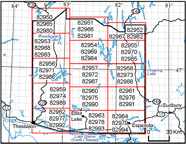
Map 82 950, Map 82 951, Map 82 952, Map 82 953,
Map 82 954, Map 82 955, Map 82 956, Map 82 957,
Map 82 958, Map 82 959, Map 82 960, Map 82 961,
Map 82 962, Map 82 963, Map 82 964
Airborne Magnetic Gradiometer and Gamma-Ray Spectrometric Surveys, Colour-Filled Contours of the Residual Magnetic Field, Ramsey–Algoma Area; by Ontario Geological Survey, scale 1:50 000, colour. Map prices range from $12.75 to $14.05.
Map 82 965, Map 82 966, Map 82 967, Map 82 968,
Map 82 969, Map 82 970, Map 82 971, Map 82 972,
Map 82 973, Map 82 974, Map 82 975, Map 82 976,
Map 82 977, Map 82 978, Map 82 979
Airborne Magnetic Gradiometer and Gamma-Ray Spectrometric Surveys, Shaded Colour Image of the Second Vertical Derivative of the Residual Magnetic Field and Keating Coefficients, Ramsey–Algoma Area; by Ontario Geological Survey, scale 1:50 000, colour. Map prices range from $12.75 to $14.05.
Map 82 980, Map 82 981, Map 82 982, Map 82 983,
Map 82 984, Map 82 985, Map 82 986, Map 82 987,
Map 82 988, Map 82 989, Map 82 990, Map 82 991,
Map 82 992, Map 82 993, Map 82 994
Airborne Magnetic Gradiometer and Gamma-Ray Spectrometric Surveys, Ternary Radioelement Image, Ramsey–Algoma Area; by Ontario Geological Survey, scale 1:50 000, colour. Map prices range from $13.10 to $14.65.
Geophysical Data Sets
Geophysical Data Set 1086a
Ontario Airborne Geophysical Surveys, Magnetic Gradiometer and Gamma-Ray Spectrometric Data, Grid and Profile Data (ASCII Format) and Vector Data, Ramsey–Algoma Area; by Ontario Geological Survey. The data are available on 1 DVD. $25.00
Geophysical Data Set 1086b
Ontario Airborne Geophysical Surveys, Magnetic Gradiometer and Gamma-Ray Spectrometric Data, Grid and Profile Data (Geosoft® Format) and Vector Data, Ramsey–Algoma Area; by Ontario Geological Survey. The data are available on 1 DVD. $25.00
Miscellaneous
The Ministry of Energy, Northern Development and Mines has prepared supplements for Miscellaneous Papers (MP) 177 and 178 to include publications released in 2018. Also, the Bedrock Geology Index to Maps and Surficial Geology Index to Maps are updated to include all maps released in 2018. Miscellaneous Paper 177 (Supplement 2011–2018), Miscellaneous Paper 178 (Supplement 2011–2018) and the maps are available as free downloads or can be purchased in hard-copy format from Publication Sales.
Miscellaneous Paper (MP) 177 (Supplement 2011–2018)
Index to Published Reports, Maps and Digital Data, 2011–2018
This report provides a listing of all publications released since the publication of MP 177 (Supplement 1993–2010), Index to Published Reports, Maps and Digital Data, 1993–2010. Publications are listed by series only. 144p. $11.85
Miscellaneous Paper (MP) 178 (Supplement 2011–2018)
Geographic Index to Published Reports, Maps and Digital Data, 2011–2018
This report provides a listing of all publications released since the publication of MP 178 (Supplement 1994–2010), Geographic Index to Published Reports, Maps and Digital Data, 1994–2010. Publications are indexed by geographic areas, which include National Topographic System (NTS) areas, geographic townships, and Ministry of Natural Resources and Forestry (MNRF) “areas”. Publications are listed under the main geographic areas where they are located. 403p. $13.70
Index to Maps, Bedrock Geology, 1991–2018; produced by the Publication Services Unit, scale 1:1 000 000, colour. Available as a set of 4 maps. $12.00
Index to Maps, Surficial Geology, 1991–2018; produced by the Publication Services Unit, scale 1:1 000 000, colour. Available as a set of 4 maps. $12.00
Location Map (PDF)
Earth Resources and Geoscience Mapping Section
Precambrian Geology – Northwestern Ontario
Miscellaneous Release—Data 374
Geochemical Data for Ultramafic Metavolcanic Rocks in the Eastern Portion of the Shebandowan Greenstone Belt, Northwestern Ontario; by S.L.K. Hinz, P. Hollings and R.W.D. Lodge. This digital data release consists of whole-rock geochemical data, sample descriptions, location data and petrographic descriptions for rocks collected from the eastern portion of the Shebandowan greenstone belt, west of Thunder Bay, in northwestern Ontario. These rock samples were utilized in the MSc thesis by the senior author, completed at Lakehead University in 2018. A summary of the results, accompanied by petrographic descriptions of selected samples, is provided in the readme file. Location data are provided in the Universal Transverse Mercator (UTM) projection and grid system, Zone 16, North American Datum 1983 (NAD83). This release consists of 1 Microsoft® Excel® 2016 (.xlsx) file and 1 portable document format (.pdf) file. The data are available on 1 CD. $20.00.
Aggregate Resources and Industrial Minerals
Aggregate Resources of Ontario—2018 (ARO—2018)
The Ontario Geological Survey (OGS) is releasing a GIS-based compilation of the aggregate resources of Ontario. This compilation is based on data compiled from aggregate resources inventory mapping conducted by the OGS from 1980 to 2018. It is intended that this compilation will be updated annually. This compilation includes data updated from the previously published information and may include newer geological data and/or mapping, where the latter are available.
It is important to note that this compilation is not intended to be used as a standalone product and the referenced original reports should always be consulted in conjunction with this compilation. Information contained within the referenced original reports (i.e., test results, resource properties and potential) is still highly relevant. However, it is possible that resource estimates provided in the referenced original reports may no longer be accurate, and may not reflect the data contained in this compilation. It must also be noted that, although the data represented in this compilation have been modified and updated since the release of the previously published information, the referenced original publications have not been revised to incorporate these changes.
The Aggregate Resources of Ontario—2018 (or ARO—2018) is available as a direct download from OGSEarth. The compressed (.zip) download file provides ARO—2018 data in geodatabase format using ESRI® ArcGIS® 9.3.1 with a completed project file (.mxd). Geospatial data are provided in North American Datum 1983 (NAD83) geographic co-ordinate system using decimal degrees. A user document and readme file that explains the GIS content is provided.
Surficial Mapping and Sampling
Open File Report 6348
Geological Survey of Canada Open File 8481
Subglacial Bedforms in Southern Ontario: From Flood Paths to Flow Sets; by N. Eyles, R.P.M. Mulligan, R.C. Paulen and S.S. Sookhan. 63p. $10.55.
Groundwater Studies
Ontario Geological Survey Open File Report 6349
Geological Survey of Canada Open File 8528
Regional-scale Groundwater Geoscience in Southern Ontario: An Ontario Geological Survey, Geological Survey of Canada, and Conservation Ontario Geoscientists Open House; compiled by H.A.J. Russell, D. Ford, S. Holysh and E.H. Priebe. 32p. $8.85.
Miscellaneous
Annual Statistical Report (ASR) 10
Ontario Mineral and Exploration Statistics 2015 / Statistiques de 2015 sur l’exploitation minière et l’exploration des minéraux en Ontario; by S. Jessome and B. Greenwell. This release provides a statistical profile of the exploration and mining industries in Ontario. It includes the most recent data on all of the minerals produced in Ontario; volume and value of production is provided for metals and non-metals, including fuels, sand/gravel and stone production. Statistics on mining claims, prospector’s licenses, assessment work recorded, exploration and deposit appraisal, and mine complex development are also provided. This report is provided in English and French. 151p. $12.70.
Annual Statistical Report (ASR) 11
Ontario Mineral and Exploration Statistics 2016 / Statistiques de 2016 sur l’exploitation minière et l’exploration des minéraux en Ontario; by S. Jessome, B. Greenwell and S. Colton. This release provides a statistical profile of the exploration and mining industries in Ontario. It includes the most recent data on all of the minerals produced in Ontario; volume and value of production is provided for metals and non-metals, including fuels, sand/gravel and stone production. Statistics on mining claims, prospector’s licenses, assessment work recorded, exploration and deposit appraisal, and mine complex development are also provided. This report is provided in English and French. 151p. $12.70.
Location Map (PDF)
2018 Publications
Earth Resources and Geoscience Mapping Section
Precambrian Geology — Northeastern Ontario
Open File Report 6346
Precambrian Geology of Drury Township, Southwest Sudbury Structure: Explanatory Notes for Preliminary Map P.3823; by C.A. Gordon, R-L. Simard and C-A. Généreux, 49p. Accompanied by Preliminary Map P.3823. Geological, geochemical and geophysical data available as Miscellaneous Release—Data 369 (see below). $23.35.
Preliminary Map P.3819
Precambrian Geology of the Osway and Huffman Townships Area, Opeepeesway Basin, Southern Abitibi Greenstone Belt; by P.J. MacDonald, J.M. Bisaillon and T.P. Gemmell, scale 1:20 000, colour. $16.00.
Preliminary Map P.3823
Precambrian Geology of Drury Township, Southwest Sudbury Structure; by C.A. Gordon, R-L. Simard and C-A. Généreux, scale 1:15 000, colour. Geological, geochemical and geophysical data available as Miscellaneous Release—Data 369 (see below). $14.15.
Miscellaneous Release—Data 369
Geological, Geochemical and Geophysical Data for Drury Township, Southwest Sudbury Structure; by C.A. Gordon, R-L. Simard and C-A. Généreux. This digital data release contains whole-rock geochemical and assay data, outcrop photographs, magnetic susceptibility and scintillometer geophysical data, as well as Summary of Field Work and Other Activities articles, conference abstracts and a poster related to the 1:15 000 scale bedrock mapping of Drury Township, part of the Southwest Sudbury Structure bedrock mapping project. Data were collected during the summer field seasons of 2015 and 2016. These data complement OGS Preliminary Map P.3823, Precambrian Geology of Drury Township, Southwest Sudbury Structure, and OGS Open File Report 6346, Precambrian Geology of Drury Township, Southwest Sudbury Structure: Explanatory Notes for Preliminary Map P.3823. This release includes 175 images (as .jpg files), 3 Microsoft® Excel® (.xlsx) workbook files and 10 documents in portable document format (.pdf). The data are available on 1 CD. $20.00.
Precambrian Geology – Far North
Preliminary Map P.3824
Precambrian Geology of the Eabamet Lake Area, Fort Hope–Miminiska Greenstone Belt—North Sheet; by B. Azar and N. Rudolph, scale 1:50 000, colour. Geological and geochemical data available as Miscellaneous Release—Data 372 (see below). $15.70.
Preliminary Map P.3825
Precambrian Geology of the Eabamet Lake Area, Fort Hope–Miminiska Greenstone Belt—South Sheet; by B. Azar and N. Rudolph, scale 1:50 000, colour. Geological and geochemical data available as Miscellaneous Release—Data 372 (see below). $15.50.
Miscellaneous Release—Data 372
Geological, Geochemical and Geophysical Data Related to the Eabamet Lake Area, Fort Hope–Miminiska Greenstone Belt, Northwestern Ontario; by B. Azar. This digital data release consists of geochemical data, magnetic susceptibility data, geological information, structural data and selected field photographs for the Fort Hope greenstone belt in the Eabamet Lake area, collected during the 2015 and 2016 field seasons. It includes whole-rock geochemistry (major element, trace element, rare earth element) and assay data, quality control data and field notes. These data are associated with Preliminary Maps P.3824 and P.3825, Precambrian Geology of the Eabamet Lake Area, Fort Hope–Miminiska Greenstone Belt (North and South sheets, respectively). The marginal notes and the geological legend (as 2 portable document format (.pdf) files) for these Preliminary Maps are also provided, as well as other documents related to the project. Location data are provided in the Universal Transverse Mercator (UTM) projection and grid system, Zone 16, North American Datum 1983 (NAD83). This release consists of 4 Microsoft® Excel® 2016 (.xlsx) files, 147 photographs (.jpg format files), and 6 portable document format (.pdf) files. The data are available on 1 CD. $20.00.
Surficial Geochemistry
Miscellaneous Release—Data 373
McFaulds Lake (“Ring of Fire”) Area Lake Sediment and Water Geochemistry, Northern Ontario; by L.A. Handley and R.D. Dyer. This digital data release provides deep and shallow lake sediment geochemical data and lake water geochemical data, including quality control data, collected from a total of 1323 sites in the McFaulds Lake area in northern Ontario, during the summers of 2011, 2012 and 2013. The sediment samples were analyzed for loss on ignition (LOI); and by inductively coupled plasma optical emission spectrometry (ICP–OES), inductively coupled plasma mass spectrometry (ICP-MS); and by instrumental neutron activation analysis (INAA, for deep sediments only). Lake water samples were analyzed by ICP–OES, ICP–OES and ion chromatography (IC). Quality control data consist of the results from the analysis of duplicate pairs and certified reference materials and are included in this release. Lake water measurements of temperature, pH and conductivity were determined in situ. All location information is presented as Universal Transverse Mercator (UTM) co-ordinates using North American Datum 1983 (NAD83) in Zone 16. Data are available as 24 Microsoft® Excel® 2016 (.xlsx) files and are accompanied by supporting documentation in portable document format (.pdf). The data are available on 1 CD. $20.00.
Miscellaneous
Open File Report 6350
Summary of Field Work and Other Activities, 2018; by Ontario Geological Survey, 426p. $16.80.
The Contents may be viewed on the Summary of Field Work and Other Activities, 2018 page.
Miscellaneous Release—Data 371
Ontario Specific Gravity Data for Bedrock Samples Acquired from 1970 to 2014; by D.R.B. Rainsford, A. Carter-McAuslan and L.C. Ashick-Stinson. This digital data release contains specific gravity data for rock samples collected by Ontario Geological Survey staff from across Ontario between 1970 and 2014. The majority of the more than 26 000 geolocated data records were obtained from specific gravity measurements of Archean rocks, with smaller populations of data from Proterozoic and Paleozoic eras. The data are provided as 1 Microsoft® Excel® 2013 (.xlsx) workbook file, 1 generic comma-separated values (.csv) file and a set of GIS-compatible shape files. Explanatory notes, describing specific gravity measurements, and the data compilation, processing and sources, are provided as a portable document format (.pdf) file. The data are available on 1 CD. $20.00.
Location Map (PDF)
Earth Resources and Geoscience Mapping Section
Precambrian Geology – Northeastern Ontario
Preliminary Map P.3821
Precambrian Geology of Cochrane and Borden Townships, Kapuskasing Structural Zone, Wawa–Abitibi Terrane; by M. Duguet and N. Szumylo, scale 1:20 000, colour. Geological, geochemical and geophysical data available as Miscellaneous Release—Data 365 (see below). $17.85.
Miscellaneous Release—Data 365
Geological, Geochemical, Geophysical and Petrographic Data Related to the Cochrane and Borden Townships Area, Kapuskasing Structural Zone, Wawa–Abitibi Terrane; by M. Duguet. This digital data release contains field photographs and petrographic images, and whole-rock geochemical, petrographic, magnetic susceptibility and scintillometer data collected as part of 1:20 000 scale bedrock geology mapping of Cochrane and Borden townships (Borden Lake area) during the summer of 2016. Also included are presentations and a previously published article related to the project. This release comprises 141 field photographs (as .jpg files), 13 thin section scans (as .jpg files), 98 scanning electron microscope (SEM) (.bmp) images and 43 associated thermobarometric (.txt) program files, 3 Microsoft® Excel® 2013 (.xlsx) workbook files and 8 documents in portable document format (.pdf). These data augment Preliminary Map P.3821, Precambrian Geology of Cochrane and Borden Townships, Kapuskasing Structural Zone, Wawa–Abitibi Terrane; the geological legend for the map is also provided. The data are available on 1 DVD. $25.00.
Precambrian Geology – Northwestern Ontario
Miscellaneous Release—Data 370
Geochemical Analyses of Rocks in the Central Wabigoon Superterrane, Northwestern Ontario; by K.E. Bjorkman and P. Hollings. This digital data release consists of brief sample descriptions, location data and whole rock analytical data for 282 rock samples collected as part of the PhD thesis by the senior author (K.E. Bjorkman) at the University of Western Australia in 2017. The descriptions and data are provided as 1 Microsoft® Excel® 2013 (.xlsx) workbook (with 4 worksheets for sample descriptions and locations; major element data; trace element data; and abbreviations), and 2 portable document format (.pdf) files (analytical quality-control data; and readme with a summary of results). The data are available on 1 CD. $20.00.
Groundwater Studies
Groundwater Resources Study 17
Geospatial Distribution of Selected Chemical, Bacteriological and Gas Parameters Related to Groundwater in Southern Ontario; by L.M. Colgrove and S.M. Hamilton. This digital data release comprises a report describing a study that uses select chemical, bacteriological and gas parameters from the Ontario Geological Survey Ambient Groundwater Geochemistry database to spatially map discrete areas of southern Ontario where groundwater has a natural tendency toward elevated concentrations of specific geochemical and bacteriological constituents. The chemical parameters included are arsenic, barium, boron, fluoride, nuisance gases (methane, hydrogen sulphide, hypoxic gas), iodide, nitrate, chloride, selenium and uranium. The report also includes a set of bacteriological maps. For each parameter, individual maps convey 1) geological associations, 2) chemical concentration distribution and 3) a simplified map showing discreet regions with elevated concentrations. Geological features and geochemical mechanisms controlling regional hydrochemical trends are briefly discussed. The report is provided as 1 portable document format (.pdf) file. Available on 1 CD. $20.00.
Geophysics
Airborne Geophysical Survey
Sandy Lake–Favourable Lake Area
1:20 000 Scale Map Sheets
Map 82 919, Map 82 920, Map 82 921, Map 82 922,
Map 82 923, Map 82 924, Map 82 925, Map 82 926,
Map 82 927, Map 82 928, Map 82 929, Map 82 930,
Map 82 931, Map 82 932, Map 82 933
Airborne Magnetic and Electromagnetic Surveys, Residual Magnetic Field Contours with Electromagnetic Anomalies and Keating Coefficients, Sandy Lake–Favourable Lake Area; by Ontario Geological Survey, scale 1:20 000, colour. Map prices range from $13.15 to $17.35.
1:50 000 Scale Map Sheets
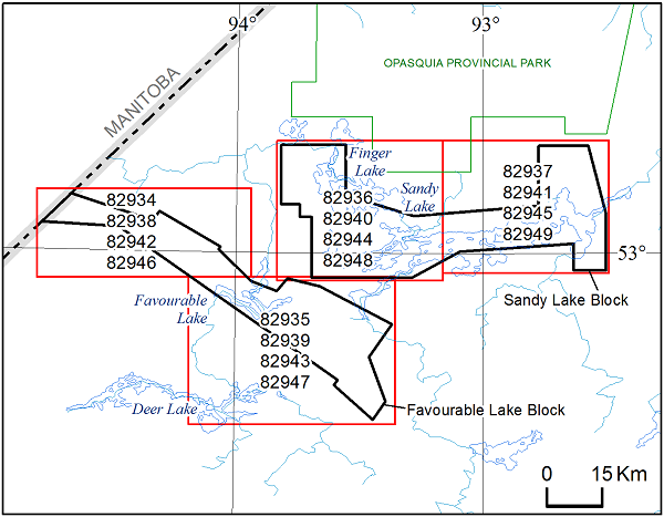
Map 82 934, Map 82 935, Map 82 936, Map 82 937
Airborne Magnetic and Electromagnetic Surveys, Colour-Filled Contours of the Residual Magnetic Field and Electromagnetic Anomalies, Sandy Lake–Favourable Lake Area; by Ontario Geological Survey, scale 1:50 000, colour. Map prices range from $13.20 to $15.25.
Map 82 938, Map 82 939, Map 82 940, Map 82 941
Airborne Magnetic and Electromagnetic Surveys, Shaded Colour Image of the Second Vertical Derivative of the Residual Magnetic Field and Keating Coefficients, Sandy Lake–Favourable Lake Area; by Ontario Geological Survey, scale 1:50 000, colour. Map prices range from $13.75 to $14.95.
Map 82 942, Map 82 943, Map 82 944, Map 82 945
Airborne Magnetic and Electromagnetic Surveys, Colour-Filled Contours of the EM Decay Constant and Electromagnetic Anomalies, Sandy Lake–Favourable Lake Area; by Ontario Geological Survey, scale 1:50 000, colour. Map prices range from $12.85 to $15.00.
Map 82 946, Map 82 947, Map 82 948, Map 82 949
Airborne Magnetic and Electromagnetic Surveys, Colour-Filled Contours of the Apparent Conductivity and Electromagnetic Anomalies, Sandy Lake–Favourable Lake Area; by Ontario Geological Survey, scale 1:50 000, colour. Map prices range from $13.05 to $15.00.
Geophysical Data Sets
Geophysical Data Set 1085a
Ontario Airborne Geophysical Surveys, Magnetic and Electromagnetic Data, Grid and Profile Data (ASCII Format) and Vector Data, Sandy Lake–Favourable Lake Area; by Ontario Geological Survey. The data are available on 3 DVDs. $75.00.
Geophysical Data Set 1085b
Ontario Airborne Geophysical Surveys, Magnetic and Electromagnetic Data, Grid and Profile Data (Geosoft® Format) and Vector Data, Sandy Lake–Favourable Lake Area; by Ontario Geological Survey. The data are available on 3 DVDs. $75.00.
Location Map (PDF)
Earth Resources and Geoscience Mapping Section
Precambrian Geology — Proterozoic and Grenville Province
Preliminary Map P.3807
Precambrian Geology of the Centennial Lake Area, Grenville Province; by M. Duguet, Q. Duparc and C. Mayer, scale 1:20 000, colour. Geological, geochemical and geophysical data available as Miscellaneous Release—Data 356 (see below). $17.70.
Miscellaneous Release—Data 356
Geological, Geochemical and Geophysical Data Related to the Centennial Lake Area, Grenville Province; by M. Duguet. This digital data release contains field photographs, and whole-rock geochemistry and magnetic susceptibility data collected as part of the Centennial Lake area 1:20 000 scale bedrock geology mapping project during the summer of 2015. Also included is a previously published article related to the project. This release comprises 202 images (as .jpg files), 2 Microsoft® Excel® 2013 (.xlsx) workbook files and 3 documents in portable document format (.pdf). These data augment Preliminary Map P.3807, Precambrian Geology of the Centennial Lake Area, Grenville Province; the geological legend for the map is also provided. Available on 1 CD. $20.00.
Surficial Mapping and Sampling
Miscellaneous Release—Data 364
Lake Sediment and Water Geochemical Data from the Nakina–Marshall Lake Area, Northwestern Ontario; by L.A. Handley and R.D. Dyer. This digital data release provides deep and shallow lake sediment geochemical data and lake water geochemical data, including quality control data, for samples collected from a total of 1638 sites. The survey was conducted during the summers of 2014 and 2015 in the area between Nakina and Marshall Lake in northwestern Ontario. Deep and shallow lake sediment were analyzed for loss on ignition (LOI); and by instrumental neutron activation analysis (INAA, for deep sediment only), inductively coupled plasma atomic emission spectroscopy (ICP-AES) and inductively coupled plasma mass spectrometry (ICP-MS). Lake water samples were analyzed by inductively coupled plasma atomic emission spectroscopy (ICP-AES), inductively coupled plasma mass spectrometry (ICP-MS) and ion chromatography (IC). Quality control data consisting of the results from the analysis of duplicate pairs and certified reference materials are included in this release. The ICP–OES, ICP–OES, IC and LOI analyses were completed by Geoscience Laboratories and INAA analysis by Becquerel Laboratories. All location information is presented as Universal Transverse Mercator (UTM) co-ordinates using North American Datum 1983 (NAD83) in Zone 16. The data are available as 21 Microsoft® Excel® 2013 (.xlsx) format files. Available on 1 CD. $20.00.
Groundwater Studies
Open File Report 6347
High Resolution Seismic Reflection Profiles for Groundwater Studies in Simcoe County, Southern Ontario; by A.J.-M. Pugin, B. Dietiker, R.P.M. Mulligan, H.L. Crow, K. Brewer, T. Cartwright, D.R.B. Rainsford, A.F. Bajc, D.R. Sharpe, and H.A.J. Russell. Also released as Geological Survey of Canada, Open File 8383, 23p. $9.00.
Location Map (PDF)
Earth Resources and Geoscience Mapping Section
Precambrian Geology – Northeastern Ontario
Preliminary Map P.3820
Precambrian Geology of Bruyere Township, Michipicoten Greenstone Belt; by J. Walker, scale 1:20 000, colour. Geological and geochemical data available as Miscellaneous Release—Data 360 (see below). $11.40.
Miscellaneous Release—Data 360
Geological and Geochemical Data from Bruyere Township, Michipictoten Greenstone Belt; by J. Walker. This digital data release contains field photographs, and whole-rock geochemical and assay data from samples collected during the summer of 2017 as part of a multi-year bedrock geology mapping project to update the geological knowledge of the Wawa Subprovince in the Michipicoten greenstone belt. This release comprises 35 images (as .jpg files), 1 Microsoft® Excel® 2013 (.xlsx) workbook file and 3 documents in portable document format (.pdf). These data augment Preliminary Map P.3820, Precambrian Geology of Bruyere Township, Michipicoten Greenstone Belt; the geological legend for the map is also provided. The data are available on 1 CD. $20.00.
Precambrian Geology — Northwestern Ontario
Miscellaneous Release—Data 368
Geology of the Mount Mollie Dike, Midcontinent Rift, Northwestern Ontario; by S. O’Brien, P. Hollings and J. Miller. This digital data release includes lithogeochemical data from 101 field and drill-core samples of the Mount Mollie dike. The Mount Mollie dike is an arcuate, 60 to 350 m wide dike that extends for 35 km, mainly as a series of islands along the northwestern shore of Lake Superior. The dike is part of the Midcontinent Rift (1.1 Ga) and was emplaced into the Paleoproterozoic Rove Formation, approximately 50 km south of Thunder Bay. A general description of the units sampled and their geochemistry, as well as a brief interpretation of the data are provided. This publication is a summary of part of a two-year study to petrogenetically characterize the Mount Mollie dike both on surface and at depth and represents part of an unpublished MSc thesis by the lead author at Lakehead University, Thunder Bay. This release consists of 1 Microsoft® Excel® 2013 (.xlsx) file and 3 supporting documents as portable document format (.pdf) files. The data are available on 1 CD. $20.00.
Surficial Mapping and Sampling
Open File Report 6342
Quaternary Geology and Surficial Media Sampling in Drury and Denison Townships, City of Greater Sudbury; by S. Hashmi, 133p. Bedrock and till geochemistry and heavy mineral concentrate data available as Miscellaneous Release—Data 359 (see below). $22.30.
Miscellaneous Release—Data 359
Till Geochemical and Mineralogical Data for Drury and Denison Townships, City of Greater Sudbury; by S. Hashmi. This digital data release comprises the results of a regional till sampling and surficial mapping project conducted in 2015 and 2016 in Drury and Denison townships. It is part of a multi-disciplinary research program on low-sulphide, PGE-rich footwall mineralization, being conducted by the Mineral Exploration Research Centre of the Harquail School of Earth Sciences at Laurentian University in collaboration with the Ontario Geological Survey, and the results form part of the requirements of the author’s PhD thesis, supervised by Dr. Matthew Leybourne at the Department of Geological Sciences and Geological Engineering at Queen’s University. The data are released in conjunction with Open File Report 6342, Quaternary Geology and Surficial Media Sampling in Drury and Denison Townships, City of Greater Sudbury, and augments Preliminary Map P.3801, Quaternary Geology, Drury and Denison Townships, which was released August 9, 2016. The results of geochemical and mineralogical analyses are provided for 12 whole rock, 113 humus, 112 B-horizon and 126 C-horizon till samples and 115 C-horizon till heavy mineral concentrates; and includes loss on ignition. The data consists of heavy mineral grain counts that include kimberlite indicator minerals, chromite, metamorphic/magmatic massive sulphide indicator minerals, and gold grains; and pebble lithology data. All sample location information is presented as Universal Transverse Mercator co-ordinates using North American Datum 1983 (NAD83) in Zone 17 and is accompanied by site descriptions. The data files are provided as 53 Microsoft® Excel® 2013 (.xlsx) files along with 5 supporting documents in portable document format (.pdf). The data are available on 1 CD. $20.00.
Location Map (PDF)
Earth Resources and Geoscience Mapping Section
Precambrian Geology – Northeastern Ontario
Miscellaneous Release—Data 355
Geological, Geochemical and Geophysical Data Related to the Yeo and Chester Townships Area, Chester Intrusive Complex, Southern Abitibi Greenstone Belt; by T.P. Gemmell and P.J. MacDonald. This digital data release contains field photographs, and whole-rock geochemical and magnetic susceptibility data collected as part of 1:20 000 scale mapping of the Chester intrusive complex in the southeastern Swayze area during the summers of 2015 and 2016. Also included are 2 previously published articles and 2 presentations to the public related to the project. This release comprises 151 images (as .jpg files), 7 Microsoft® Excel® 2013 (.xlsx) workbook files and 7 documents in portable document format (.pdf). These data augment Preliminary Map P.3817, Precambrian Geology of the Yeo and Chester Townships Area, Chester Intrusive Complex, Southern Abitibi Greenstone Belt; the geological legend for the map is also provided. The data are available on 1 CD. $20.00.
Precambrian Geology – Northwestern Ontario
Miscellaneous Release—Data 361
Geological, Geochemical, Geophysical and Petrographic Data from Tuuri and Walsh Townships, Schreiber–Hemlo–Greenstone Belt, Wawa–Abitibi Terrane, Superior Province; by S.J. Magnus. This release contains field notes, outcrop photographs and magnetic susceptibility data collected during the summer field seasons in 2015 and 2016 as part of 1:20 000 scale bedrock geology mapping in Tuuri and Walsh townships. Whole-rock geochemical data and petrographic data are provided for collected samples. Also included is a presentation to the public related to the project. These data augment Preliminary Map P.3812, Precambrian Geology of Tuuri and Walsh Townships, Northwestern Ontario, which was released in April 2017; the legend and marginal notes for this map are also provided. This release comprises 91 images (as .jpg files), 9 Microsoft® Excel® 2013 (.xlsx) workbook files and 6 supporting documents in portable document format (.pdf). Available on 1 CD. $20.00.
Precambrian Geology – Proterozoic and Grenville Province
Miscellaneous Release—Data 350
Geological, Geochemical and Geophysical Data Related to the Black Donald Lake Area, Grenville Province; by M. Duguet. This digital data release contains field photographs, and whole-rock geochemical, magnetic susceptibility and scintillometer data collected as part of 1:20 000 scale in the Black Donald Lake area during the summer of 2014. Also included is a previously published article related to the project. This release comprises 176 images (as .jpg files), 2 Microsoft® Excel® 2013 (.xlsx) workbook files and 3 documents in portable document format (.pdf). These data augment Preliminary Map P.3808, Precambrian Geology of the Black Donald Lake Area, Grenville Province; the geological legend for the map is also provided. Available on 1 CD. $20.00.
Surficial Mapping and Sampling
Preliminary Map P.3699
Surficial Geology of the Missisa Lake Area Northeast, Northern Ontario; by C. Gao and K.H. Yeung, scale 1:100 000, colour. $11.55.
Preliminary Map P.3700
Surficial Geology of the Kapiskau River Area Northwest, Northern Ontario; by C. Gao and K.H. Yeung, scale 1:100 000, colour. $11.55.
Preliminary Map P.3712
Surficial Geology of the Missisa Lake Area Southeast, Northern Ontario; by C. Gao and K.H. Yeung, scale 1:100 000, colour. $11.55.
Preliminary Map P.3713
Surficial Geology of the Kapiskau River Area Southwest, Northern Ontario; by C. Gao and K.H. Yeung, scale 1:100 000, colour. $11.60.
Preliminary Map P.3726
Surficial Geology of the Ogoki Area Northeast, Northern Ontario; by C. Gao and K.H. Yeung, scale 1:100 000, colour. $11.60.
Paleozoic Geology and Energy Studies
Preliminary Map P.3810
Paleozoic Geology of the Dunnville Area, Southern Ontario; by D.K. Armstrong, scale 1:50 000, colour. $14.30.
Location Map (PDF)
Earth Resources and Geoscience Mapping Section
Precambrian Geology — Northeastern Ontario
Preliminary Map P.3814
Precambrian Geology of Copenace Township, Michipicoten Greenstone Belt; by J. Walker and L. Robichaud, scale 1:20 000, colour. Geological and geochemical data available as Miscellaneous Release—Data 348 (see below). $12.15.
Miscellaneous Release—Data 348
Geological and Geochemical Data from Copenace Township, Michipicoten Greenstone Belt; by J. Walker. This digital data release contains field photographs, electron microprobe data, whole-rock geochemical data and assay data from samples collected during the summer of 2016 as part of a multi-year bedrock mapping project to update the geological knowledge of the Wawa Subprovince in the Michipicoten greenstone belt. This release comprises 36 images (as .jpg files), 2 Microsoft® Excel® 2013 (.xlsx) workbook files and 5 supporting documents in portable document format (.pdf). The data are available on 1 CD. $20.00.
Precambrian Geology — Northwestern Ontario
Miscellaneous Release—Data 357
Geochemistry of the Balmer and Confederation Assemblages at the Laird Lake Property and Associated Gold Mineralization, Red Lake Greenstone Belt, Northwestern Ontario; by B.R. Gélinas and P. Hollings. This digital data release contains whole-rock chemistry data from 161 field and drill-core samples that were collected during the mapping of the Laird Lake property in Killala and Mulcahy townships, and the Medicine Stone Lake area of the Red Lake greenstone belt, northwestern Ontario. A general description of the units sampled and their geochemistry, as well as a brief interpretation of the data, are provided. The data and interpretation presented in this publication represent part of an unpublished Master of Science (MSc) thesis by the lead author at Lakehead University, Thunder Bay. This release consists of 1 Microsoft® Excel® 2013 (.xlsx) file and 3 supporting documents as portable document format (.pdf) files. Available on 1 CD. $20.00
Surficial Mapping and Sampling
Preliminary Map P.3698
Surficial Geology of the Missisa Lake Area Northwest, Northern Ontario; by C. Gao and K.H. Yeung, scale 1:100 000, colour. $11.55.
Preliminary Map P.3711
Surficial Geology of the Missisa Lake Area Southwest, Northern Ontario; by C. Gao and K.H. Yeung, scale 1:100 000, colour. $11.55.
Preliminary Map P.3725
Surficial Geology of the Ogoki Area Northwest, Northern Ontario; by C. Gao and K.H. Yeung, scale 1:100 000, colour. $11.55.
Preliminary Map P.3737
Surficial Geology of the Ogoki Area Southwest, Northern Ontario; by C. Gao and K.H. Yeung, scale 1:100 000, colour. $11.65.
Preliminary Map P.3745
Surficial Geology of the Kenogami River Area Northwest, Northern Ontario; by C. Gao and K.H. Yeung, scale 1:100 000, colour. $11.65.
Preliminary Map P.3752
Surficial Geology of the Kenogami River Area Southwest, Northern Ontario; by C. Gao and K.H. Yeung, scale 1:100 000, colour. $11.65.
Surficial Geochemistry
Miscellaneous Release—Data 358
Lake Sediment and Water Geochemical Data from the Greenstone Area, Northwestern Ontario; by L.A. Handley and R.D. Dyer. This digital data release provides deep and shallow lake sediment geochemical data and lake water geochemical data, including quality control data, for samples collected from a total of 2229 sites in the Greenstone area in northwestern Ontario, during the 2011 and 2012 field seasons. Deep and shallow lake sediment were analyzed for loss on ignition (LOI); and by instrumental neutron activation analysis (INAA, for deep sediment only), inductively coupled plasma atomic emission spectroscopy (ICP—AES) and inductively coupled plasma mass spectrometry (ICP—MS) for more than 50 elements. Lake water samples were analyzed for more than 50 elements by inductively coupled plasma atomic emission spectroscopy (ICP—AES), inductively coupled plasma mass spectrometry (ICP—MS) and ion chromatography (IC). Temperature, pH and conductivity were determined in the field. All location information is presented as Universal Transverse Mercator (UTM) co-ordinates using North American Datum 1983 (NAD83) in Zone 16. Data are available as 22 Microsoft® Excel® 2013 (.xlsx) format files and are accompanied by supporting documentation in portable document format (.pdf). The data are available on 1 CD. $20.00.
Resident Geologist Program
Open File Report 6336
Report of Activities 2017, Resident Geologist Program, Red Lake Regional Resident Geologist Report: Red Lake and Kenora Districts; by A.F. Lichtblau, W. Paterson, C. Ravnaas, R.D. Tuomi, T.K. Pettigrew, S. Lewis and K. Wiebe, 100p. $11.85.
Open File Report 6337
Report of Activities 2017, Resident Geologist Program, Thunder Bay North Regional Resident Geologist Report: Thunder Bay North District; by R.M. Cundari, G.F. Paju, S.L.K. Hinz, R.D. Tuomi and T.K. Pettigrew, 79p. $11.00.
Open File Report 6338
Report of Activities 2017, Resident Geologist Program, Thunder Bay South Regional Resident Geologist Report: Thunder Bay South District; by M.A. Puumala, D.A. Campbell, R.D. Tuomi, T.K. Pettigrew and S.L.K. Hinz, 101p. $11.90.
Open File Report 6339
Report of Activities 2017, Resident Geologist Program, Timmins Regional Resident Geologist Report: Timmins and Sault Ste. Marie Districts; by E.H. van Hees, A. Pace, A. Bustard, T.S. Gomwe, P. Bousquet, C.M. Daniels, A.C. Wilson, L. Streit, P. Sword, C. Patterson and S.P. Fudge, 117p. $11.60.
Open File Report 6340
Report of Activities 2017, Resident Geologist Program, Kirkland Lake Regional Resident Geologist Report: Kirkland Lake and Sudbury Districts; by P.J. Chadwick, A.S. Péloquin, J. Suma-Momoh, C.M. Daniels, P. Bousquet, A.C. Wilson, N. Sabiri and N. Szumylo, 138p. $12.40.
Open File Report 6341
Report of Activities 2017, Resident Geologist Program, Southern Ontario Regional Resident Geologist Report: Southeastern Ontario and Southwestern Ontario Districts, and Petroleum Operations; by A.C. Tessier, P.S. LeBaron, S.J. Charbonneau, D.A. Laidlaw, A.C. Wilson and L. Fortner, 93p. $11.15.
Announcement
2018 Ontario Prospectors Exploration Showcase
April 3–5
Grassroots Prospects lead to New Mines!
Valhalla Inn, Thunder Bay
Staff of the Mines and Minerals Division, Ministry of Northern Development and Mines, will be participating in the 2018 Ontario Prospectors Exploration Showcase in Thunder Bay. This year’s theme, Grassroots Prospects lead to New Mines!, is about the exciting discoveries that continue to make Ontario one of the most attractive places in the world to explore. Ministry staff will be presenting posters and talks on recent field work, geoscience projects and initiatives, and summaries of current exploration activities in Ontario. The showcase provides an excellent forum for members of Ontario’s prospector, mining and exploration community to gather for the exchange of geoscience and exploration information. For registration and other information about the showcase, please visit the Ontario Prospectors Association Web site.
Location Map (PDF)
Earth Resources and Geoscience Mapping Section
Precambrian Geology – Northwestern Ontario
Miscellaneous Release—Data 352
Petrology and Geochemistry of the Copper Bar Cu-Ni-PGE Prospect, Northwestern Ontario; by M. Melchiorre, P. Hollings and M.A. Puumala. This digital data release includes whole-rock and trace element analyses for 22 surface samples from the Copper Bar copper-nickel-platinum group element (Cu-Ni-PGE) prospect within rocks of the Midcontinent Rift, northwestern Ontario. A general description of the units sampled is also provided. These results form part of an HBSc thesis study by the first author that was a collaborative project between Lakehead University and the Ontario Geological Survey. The data are available as 1 Microsoft® Excel® 2010 (.xlsx) file and 3 portable document format (.pdf) files on 1 CD. $20.00.
Miscellaneous
The Ministry of Northern Development and Mines has prepared supplements for Miscellaneous Papers (MP) 177 and 178 to include publications released in 2017. Also, the Bedrock Geology Index to Maps and Surficial Geology Index to Maps are updated to include all maps released in 2017. Miscellaneous Paper 177 (Supplement 2011–2017), MP 178 (Supplement 2011–2017) and the maps are available as free downloads or can be purchased in hard-copy format from Publication Sales.
Miscellaneous Paper (MP) 177 (Supplement 2011–2017)
Index to Published Reports, Maps and Digital Data, 2011–2017
This report provides a listing of all publications released since the publication of MP 177 (Supplement 1993–2010), Index to Published Reports, Maps and Digital Data, 1993–2010. Publications are listed by series only. 134p. $10.15.
Miscellaneous Paper (MP) 178 (Supplement 2011–2017)
Geographic Index to Published Reports, Maps and Digital Data, 2011–2017
This report provides a listing of all publications released since the publication of MP 178 (Supplement 1994–2010), Geographic Index to Published Reports, Maps and Digital Data, 1994–2010. Publications are indexed by geographic areas, which include National Topographic System (NTS) areas, geographic townships and Ministry of Natural Resources (MNR) “areas”. Publications are listed under the main geographic areas where they are located. 375p. $12.05.
Index to Maps, Bedrock Geology, 1991–2017; produced by the Publication Services Unit, scale 1:1 000 000, colour. Available as a set of 4 maps. $12.00.
Index to Maps, Surficial Geology, 1991–2017; produced by the Publication Services Unit, scale 1:1 000 000, colour. Available as a set of 4 maps. $12.00.
Location Map (PDF)
2017 Publications
Earth Resources and Geoscience Mapping Section
Precambrian Geology – Northeastern Ontario
Open File Report 6334
Gold Metallogeny of the Southern Swayze Area, Abitibi Greenstone Belt: A Field Trip Guidebook; by E.C.G. Hastie, 19p. $8.95.
Surficial Mapping and Sampling
Preliminary Map P.3701
Surficial Geology of the Kapiskau River Area Northeast and Fort Albany Area Northwest, Northern Ontario; by A.F. Bajc and K.H. Yeung, scale 1:100 000, colour. $12.65.
Preliminary Map P.3714
Surficial Geology of the Kapiskau River Area Southeast, Northern Ontario; by A.F. Bajc and K.H. Yeung, scale 1:100 000, colour. $11.55.
Preliminary Map P.3715
Surficial Geology of the Fort Albany Area South, Northern Ontario; by A.F. Bajc and K.H. Yeung, scale 1:100 000, colour. $12.15.
Preliminary Map P.3727
Surficial Geology of the Ghost River Area Northwest, Northern Ontario; by A.F. Bajc and K.H. Yeung, scale 1:100 000, colour. $11.55.
Preliminary Map P.3728
Surficial Geology of the Ghost River Area Northeast, Northern Ontario; by A.F. Bajc and K.H. Yeung, scale 1:100 000, colour. $11.55.
Preliminary Map P.3729
Surficial Geology of the Moosonee Area Northwest, Northern Ontario; by A.F. Bajc and K.H. Yeung, scale 1:100 000, colour. $11.60.
Preliminary Map P.3738
Surficial Geology of the Ogoki Area Southeast, Northern Ontario; by A.F. Bajc and K.H. Yeung, scale 1:100 000, colour. $11.60.
Preliminary Map P.3739
Surficial Geology of the Ghost River Area Southwest, Northern Ontario; by A.F. Bajc and K.H. Yeung, scale 1:100 000, colour. $11.60.
Preliminary Map P.3746
Surficial Geology of the Kenogami River Area Northeast, Northern Ontario; by A.F. Bajc and K.H. Yeung, scale 1:100 000, colour. $11.60.
Preliminary Map P.3747
Surficial Geology of the Smoky Falls Area Northwest, Northern Ontario; by A.F. Bajc and K.H. Yeung, scale 1:100 000, colour. $11.60.
Preliminary Map P.3753
Surficial Geology of the Kenogami River Area Southeast, Northern Ontario; by A.F. Bajc and K.H. Yeung, scale 1:100 000, colour. $11.60.
Preliminary Map P.3754
Surficial Geology of the Smoky Falls Area Southwest, Northern Ontario; by A.F. Bajc and K.H. Yeung, scale 1:100 000, colour. $11.65.
Miscellaneous
Open File Report 6333
Summary of Field Work and Other Activities, 2017; by Ontario Geological Survey, 408p. $15.80.
The Contents may be viewed on the Summary of Field Work and Other Activities, 2017 page.
Location Map (PDF)
Earth Resources and Geoscience Mapping Section
Surficial Geochemistry
Open File Report 6335
Southern Ontario Stream Sediment Project (SOSSP) Summary Report—Organic Contaminants; by S.R. Chaudhuri, R.D. Dyer, R. Fletcher, P. Helm, M. Millar, E.J. Reiner and P.G. Welsh, 43p. $9.60.
Location Map (PDF)
NOTICE TO OGS PUBLICATIONS SUBSCRIBERS
You may have noticed that the GeologyOntario Web site has undergone a significant change. Redesigning the site was necessary to complete important hardware upgrades and meet the requirements of The Accessibility for Ontarians with Disabilities Act (AODA).
The site’s search functionality has been simplified and features different search functions and capabilities. All the information, data, reports and maps previously archived on GeologyOntario are still available to our clients. A help page is featured on the new site to help clients use the new search functions.
Redesigning the GeologyOntario platform is part of our commitment to ensure that Ontario Geological Survey information and services are accessible for all Ontarians. This includes providing services and programs that people with disabilities can use and benefit from equally and in a manner that respects their dignity and independence. The OGS will continue to strive to be a global leader in the development of geoscience data through the publication of maps, reports and digital data on Ontario's geology.
If you require more information or assistance on navigating the new GeologyOntario site, please contact Digital Data Specialist Alphons Evers at (705) 670-5740.
Earth Resources and Geoscience Mapping Section
Precambrian Geology — Northeastern Ontario
Preliminary Map P.3817
Precambrian Geology of the Yeo and Chester Townships Area, Chester Intrusive Complex, Southern Abitibi Greenstone Belt; by T.P. Gemmell and P.J. MacDonald, scale 1:20 000, colour. $18.50.
Precambrian Geology — Northwestern Ontario
Miscellaneous Release—Data 346
Geological, Geochemical and Geophysical Data from Adrian Township, Shebandowan Greenstone Belt, Wawa–Abitibi Terrane; by L.M. Ratcliffe. This digital data release consists of geological information (field descriptions and field photographs), whole-rock geochemical data, petrographic data and magnetic susceptibility data, derived from bedrock geological mapping in 2015 and 2016, at a scale of 1:20 000, in Adrian Township within the Shebandowan greenstone belt. This release comprises 56 photographs (as .jpg files), 4 Microsoft® Excel® 2010 (.xlsx) files and 4 documents in portable document format (.pdf). These data augment Preliminary Map P.3813, Precambrian Geology of Adrian Township, Shebandowan Greenstone Belt, Wawa–Abitibi Terrane; the marginal notes and the geological legend for this map are also provided. The data are available on 1 CD. $20.00.
Precambrian Geology — Proterozoic and Grenville Province
Open File Report 6331
Tectonic and Metamorphic Architecture of the Northeastern Composite Arc Belt and the Central Metasedimentary Belt Boundary Tectonic Zone, Grenville Orogen: A Geological Guidebook; by M. Duguet and R.M. Easton. 115p. $26.80.
Surficial Mapping and Sampling
Preliminary Map P.3815
Quaternary Geology of the Collingwood Area; by R.P.M. Mulligan, scale 1:50 000, colour. $12.30.
Preliminary Map P.3816
Quaternary Geology of the Western Half of the Barrie and Elmvale Areas; by R.P.M. Mulligan, scale 1:50 000, colour. $13.30.
Paleozoic Geology and Energy Studies
Preliminary Map P.3811
Paleozoic Geology of the Welland–Fort Erie Area; by D.K. Armstrong, scale 1:50 000, colour. $13.85.
Geophysics
Geophysical Data Set 1037—Revised
Ontario Airborne Geophysical Surveys, Magnetic Data, Grid Data (ASCII and Geosoft® Formats), Magnetic Supergrids; by Ontario Geological Survey. The data are available on 1 DVD. $25.00.
Amendments
Preliminary Map P.3812, Precambrian Geology of Tuuri and Walsh Townships, Northern Ontario (released April 4, 2017), has been updated to include geochronology data not available at the time of the original release. Information on the 8 new ages has been added to the map face and also in Table 1; additionally, 2 new references have been added to the "Sources of Information".
A new version of this map is available. If you have purchased a copy of this map and wish to receive a replacement copy, please return the map to Publication Sales and a new plot of this map will be sent to you free of charge. Alternatively, the new version of Preliminary Map P.3812 is available for downloading free of charge on GeologyOntario.
Preliminary Map P.3813, Precambrian Geology of Adrian Township, Shebandowan Greenstone Belt, Wawa–Abitibi Terrane (released April 4, 2017), has been updated to include geochronology data not available at the time of the original release. Information on the 3 previously pending ages has been added to the map face and also in Table 2. Please note, information regarding these ages also resulted in changes to the “Legend” and the “Marginal Notes” accompanying the map.
A new version of this map is available. If you have purchased a copy of this map and wish to receive a replacement copy, please return the map to Publication Sales and new plot of this map will be sent to you free of charge. Alternatively, the new version is available for downloading at Preliminary Map P.3813.
Location Map (PDF)
NOTICE TO OGS PUBLICATIONS SUBSCRIBERS
You may have noticed that the GeologyOntario Web site has undergone a significant change. Redesigning the site was necessary to complete important hardware upgrades and meet the requirements of the Accessibility for Ontarians with Disabilities Act (AODA).
The site’s search functionality has been simplified and features different search functions and capabilities. All the information, data, reports and maps previously archived on GeologyOntario is still available to our clients. A help page is featured on the new site to help clients use the new search functions. Redesigning the GeologyOntario platform is part of our commitment to ensure that Ontario Geological Survey information and services are accessible for all Ontarians. This includes providing services and programs that people with disabilities can use and benefit from equally and in a manner that respects their dignity and independence. The OGS will continue to strive to be a global leader in the development of geoscience data through the publication of maps, reports and digital data on Ontario's geology.
If you require more information or assistance on navigating the new GeologyOntario site, please contact Digital Data Specialist Alphons Evers at (705) 670-5740.
Earth Resources and Geoscience Mapping Section
Precambrian Geology – Northwestern Ontario
Miscellaneous Release—Data 349
Petrology and Geochemistry of the Neoarchean McKenzie Granite, Northwestern Ontario; by A. Hughes, P. Hollings, M.C. Smyk, M.A. Puumala and D.A. Campbell. This digital data release includes whole-rock and trace element analyses for 16 samples of felsic igneous rocks from the Neoarchean McKenzie granite, located near Thunder Bay in northwestern Ontario. The geochemical data are provided in a Microsoft® Excel® 2010 (.xlsx) workbook file. A general description of the units sampled, and their petrography, are provided in the readme file. These results form part of an Honours BSc thesis study that was a collaborative project between Lakehead University and the Ontario Geological Survey. This data release consists of 1 Microsoft® Excel® 2010 (.xlsx) and 2 portable document format (.pdf) files on 1 CD. $20.00.
Precambrian Geology – Far North
Miscellaneous Release—Data 347
Lithogeochemical Data, Magnetic Susceptibility Data and Outcrop Photographs from the Winiskisis Channel, McFaulds Lake and Highbank Lake Areas, “Ring of Fire” Region, Northern Ontario; by R.T. Metsaranta. This data release provides lithogeochemical data, magnetic susceptibility data and outcrop photographs collected and compiled as part of a multi-year (2010 to 2014) compilation and bedrock geology mapping project designed to better understand the geological context of various new metal discoveries in the “Ring of Fire” region of the James Bay Lowland. The data are associated with, and complement, OGS Preliminary Maps P.3804, P.3805 and P.3806 and also MRD 343. The data are provided as 3 Microsoft® Excel® (.xlsx), 1447 photographs as .jpeg, and 2 documents as portable document format (.pdf) files. Available on 1 DVD. $25.00.
Precambrian Geology – Proterozoic and Grenville Province
Open File Report 6330
Insights into the Tectonic and Metamorphic Architecture of the Composite Arc Belt and the Frontenac–Adirondack Belt near Perth, Ontario, Grenville Orogen: A Geological Guidebook; by R.M. Easton, 54p. $9.55.
Groundwater Studies
Groundwater Resources Study 16
Discrete, High-Quality Hydraulic Conductivity Estimates for the Early Sllurian Carbonates of the Guelph Region; by E.H. Priebe, C.J. Neville and F.R. Brunton. This Groundwater Resources Study—as a digital data release—provides a large, high-quality set of hydraulic conductivity (“K”) estimates, with values tied to stratigraphy, for the Guelph region. The 72 hydraulic conductivity values represent a summary of the best discrete single-hole hydraulic testing conducted for the City of Guelph over the past 2 decades. This study was conducted in collaboration with the City of Guelph. The accompanying report provides detailed descriptions of how the hydraulic test analyses were conducted, a summary table of the best K estimate for each test and the borehole logs for each well. Associated hydraulic test analyses for each hydraulic conductivity value are also provided as graphic plots, which are hyperlinked from the report. Data files are provided as 1 portable document format (.pdf) file, 53 plots (as .tif files) and 1 Microsoft® Excel® 2010 workbook (.xlsx). Available on 1 CD. $20.00.
Miscellaneous Release—Data 353
Graphic Logs with Analytical and Geochronological Data from Hand Auger, Probe and Section Sites in the Niagara Peninsula; by A.K. Burt. This release consists of data from reconnaissance field operations conducted in 2013 for the Niagara Peninsula three-dimensional (3-D) Quaternary geology mapping project. A total of 130 sites were investigated, including 5 surface observation sites, 3 shallow test pits, 24 soil probe sites, 64 hand auger sites and 34 sections. This release provides analytical data (carbonate, grain size, pebble and radiocarbon analyses), field data (glacial feature observations), subsurface data (geological descriptions and interpretations; hydrostratigraphic units), 6 location maps and 75 selected field photographs. These data are summarized visually as graphic logs for each of the 130 sites. The data are available as 9 Microsoft® Excel® (.xlsx) files, 211 image (.tif or .png) files and 1 portable document format (.pdf) file on 1 CD. $20.00.
Announcement
OGS 2017 Project Areas Are Now Viewable Using OGSEarth
The geoscientists of the Earth Resources and Geoscience Mapping Section of the OGS are out again this summer collecting new geoscientific information right across the province. Descriptions of the 23 active projects and their locations can be viewed using OGSEarth, an OGS application that allows geoscience data to be viewed using the map-based program Google Earth™ mapping service. Also provided for each project is a list of related publications.
If you’re new to OGSEarth, it’s a valuable application for discovering and viewing not only OGS geological data, but also information on mining claims, index maps, administrative boundaries and abandoned mines.
Location Map (PDF)
Earth Resources and Geoscience Mapping Section
Precambrian Geology – Proterozoic and Grenville Province
Preliminary Map P.3808
Precambrian Geology of the Black Donald Lake Area, Grenville Province; by M. Duguet, S. Ma and K. Whitney, scale 1:20 000, colour. $16.80.
Miscellaneous Release—Data 323
Geological, Geochemical, Geochronological and Geophysical Data from the Cobden Area, Grenville Province; by R.M. Easton and B. Azar. This digital release contains field notes, outcrop photographs, photomicrographs and petrographic data, whole-rock geochemical data, Nd/Sm isotopic and U/Pb geochronologic data, and magnetic susceptibility and scintillometer data that were collected between June 2013 and September 2015 as part of the Cobden 1:50 000 scale bedrock mapping project. Also included are related presentations and preliminary reports by the authors. These data augment Preliminary Map P.3780, Precambrian Geology of the Cobden area, Grenville Province, Preliminary Map P.3781, Precambrian Geology of the Chenaux Gabbro, Grenville Province, and Open File Report 6299, Geology, Geochemistry and Mineral Potential of the Chenaux Gabbro, Northeastern Central Metasedimentary Belt, Grenville Province. This release comprises 1058 photographs and images (as .jpg and .tif files), 9 Microsoft® Excel® 2010 (.xlsx) files and 13 documents in portable document format (.pdf). The data are available on 1 CD. $20.00.
Resident Geologist Program
Open File Report 6327
Report of Activities 2016, Resident Geologist Program, Timmins Regional Resident Geologist Report: Timmins and Sault Ste. Marie Districts; by E.H. van Hees, P. Bousquet, A. Pace, C.M. Daniels, A.C. Wilson, A. Samuel and J. Walmsley, 109p. $10.20.
Open File Report 6328
Report of Activities 2016, Resident Geologist Program, Kirkland Lake Regional Resident Geologist Report: Kirkland Lake and Sudbury Districts; by P.J. Chadwick, D.L. Guindon, D.G. Farrow, A.S. Péloquin, J. Suma-Momoh, C.M. Daniels, A. Wilson, L.A. Bardeggia, F. Belley-Biswas, and N. Sabiri, 117p. $10.40.
Open File Report 6329
Report of Activities 2016, Resident Geologist Program, Southern Ontario Regional Resident Geologist Report: Southeastern Ontario and Southwestern Ontario Districts, and Petroleum Operations; by A.C. Tessier, P.S. LeBaron, S.J. Charbonneau, D.A. Laidlaw, A.C. Wilson and L. Fortner. 73p. $9.45.
Announcement
2017 Northeastern Ontario Mines and Minerals Symposium
April 18–19
Exploration in the Shadow of Many Headframes
McIntyre Arena, Timmins
Staff of the Mines and Minerals Division, Ministry of Northern Development and Mines, will be participating in the 2017 Northeastern Ontario Mines and Minerals Symposium in Timmins. Ministry staff will be presenting posters and talks on recent field work, geoscience projects and initiatives, and summaries of current exploration activities in Ontario. The symposium provides an excellent forum for members of Ontario’s prospector, mining and exploration community to gather for the exchange of geoscience and exploration information. For registration and other information about the showcase, please visit the Porcupine Prospectors and Developers Association Web site at http://www.porcupineprospectors.com/events/2017-northeastern-ontario-mines-minerals-symposium/.
Location Map (PDF)
Earth Resources and Geoscience Mapping Section
Precambrian Geology — Northwestern Ontario
Preliminary Map P.3812
Precambrian Geology of Tuuri and Walsh Townships, Northwestern Ontario; by S.J. Magnus, scale 1:20 000, colour. $15.00.
Preliminary Map P.3813
Precambrian Geology of Adrian Township, Shebandowan Greenstone Belt, Wawa–Abitibi Terrane; by L.M. Ratcliffe, scale 1:20 000, colour. $13.25.
Miscellaneous Release—Data 345
Geochemistry of the Mesoproterozoic Wolfcamp Lake Basalts, Northwestern Ontario; by S. Davis, P. Hollings and R.M. Cundari. This digital data release includes whole-rock and trace element analyses for 34 samples from the Mesoproterozoic Wolfcamp Lake basalts of the Midcontinent Rift, northwestern Ontario. The geochemical data are provided in a Microsoft® Excel® 2010 (.xlsx) workbook file. A general description of the units sampled is also provided. These results form part of an Honours BSc thesis study that was a collaborative project between Lakehead University and the Ontario Geological Survey. The data release consists of 1 Microsoft® Excel® 2010 (.xlsx) and 2 portable document format files on 1 CD. $20.00.
Geophysics
Airborne Geophysical Survey
Separation Lake Area
1:50 000 Scale Map Sheets
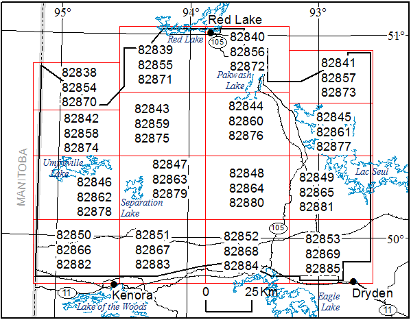
Map 82 838, Map 82 839, Map 82 840, Map 82 841,
Map 82 842, Map 82 843, Map 82 844, Map 82 845,
Map 82 846, Map 82 847, Map 82 848, Map 82 849,
Map 82 850, Map 82 851, Map 82 852, Map 82 853
Airborne Magnetic Gradiometer and Gamma-Ray Spectrometric Surveys, Colour-Filled Contours of the Residual Magnetic Field, Separation Lake Area; by Ontario Geological Survey, scale 1:50 000, colour. Map prices range from $11.85 to $13.25.
Map 82 854, Map 82 855, Map 82 856, Map 82 857,
Map 82 858, Map 82 859, Map 82 860, Map 82 861,
Map 82 862, Map 82 863, Map 82 864, Map 82 865,
Map 82 866, Map 82 867, Map 82 868, Map 82 869
Airborne Magnetic Gradiometer and Gamma-Ray Spectrometric Surveys, Shaded Colour Image of the Second Vertical Derivative of the Residual Magnetic Field and Keating Coefficients, Separation Lake Area; by Ontario Geological Survey, scale 1:50 000, colour. Map prices range from $12.05 to $13.25.
Map 82 870, Map 82 871, Map 82 872, Map 82 873,
Map 82 874, Map 82 875, Map 82 876, Map 82 877,
Map 82 878, Map 82 879, Map 82 880, Map 82 881,
Map 82 882, Map 82 883, Map 82 884, Map 82 885
Airborne Magnetic Gradiometer and Gamma-Ray Spectrometric Surveys, Ternary Radioelement Image, Separation Lake Area; by Ontario Geological Survey, scale 1:50 000, colour. Map prices range from $12.30 to $14.05.
Geophysical Data Sets
Geophysical Data Set 1083a
Ontario Airborne Geophysical Surveys, Magnetic Gradiometer and Gamma-Ray Spectrometric Data, Grid and Profile Data (ASCII Format) and Vector Data, Separation Lake Area; by Ontario Geological Survey. The data are available on 1 DVD. $25.00.
Geophysical Data Set 1083b
Ontario Airborne Geophysical Surveys, Magnetic Gradiometer and Gamma-Ray Spectrometric Data, Grid and Profile Data (Geosoft® Format) and Vector Data, Separation Lake Area; by Ontario Geological Survey. The data are available on 1 DVD. $25.00.
Airborne Geophysical Survey
Lac Seul East Area
1:50 000 Scale Map Sheets
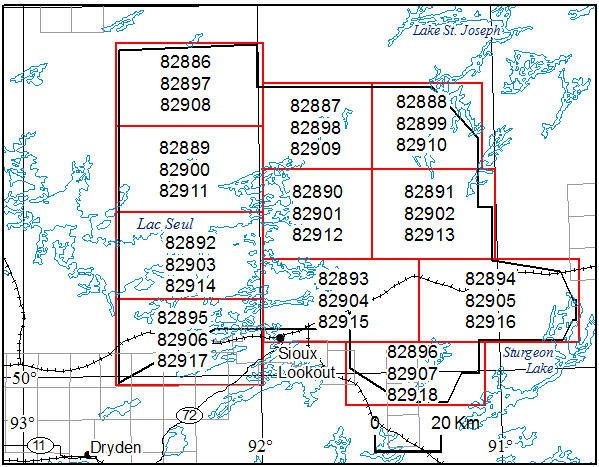
Map 82 886, Map 82 887, Map 82 888,
Map 82 889, Map 82 890, Map 82 891,
Map 82 892, Map 82 893, Map 82 894,
Map 82 895, Map 82 896
Airborne Magnetic Gradiometer and Gamma-Ray Spectrometric Surveys, Colour-Filled Contours of the Residual Magnetic Field, Lac Seul East Area; by Ontario Geological Survey, scale 1:50 000, colour. Map prices range from $11.10 to $12.10.
Map 82 897, Map 82 898, Map 82 899,
Map 82 900, Map 82 901, Map 82 902,
Map 82 903, Map 82 904, Map 82 905,
Map 82 906, Map 82 907
Airborne Magnetic Gradiometer and Gamma-Ray Spectrometric Surveys, Shaded Colour Image of the Second Vertical Derivative of the Residual Magnetic Field and Keating Coefficients, Lac Seul East Area; by Ontario Geological Survey, scale 1:50 000, colour. Map prices range from $11.30 to $12.15.
Map 82 908, Map 82 909, Map 82 910,
Map 82 911, Map 82 912, Map 82 913,
Map 82 914, Map 82 915, Map 82 916,
Map 82 917, Map 82 918
Airborne Magnetic Gradiometer and Gamma-Ray Spectrometric Surveys, Ternary Radioelement Image, Lac Seul East Area; by Ontario Geological Survey, scale 1:50 000, colour. Map prices range from $11.35 to $12.35.
Geophysical Data Sets
Geophysical Data Set 1084a
Ontario Airborne Geophysical Surveys, Magnetic Gradiometer and Gamma-Ray Spectrometric Data, Grid and Profile Data (ASCII Format) and Vector Data, Lac Seul East Area; by Ontario Geological Survey. The data are available on 1 DVD. $25.00.
Geophysical Data Set 1084b
Ontario Airborne Geophysical Surveys, Magnetic Gradiometer and Gamma-Ray Spectrometric Data, Grid and Profile Data (Geosoft® Format) and Vector Data, Lac Seul East Area; by Ontario Geological Survey. The data are available on 1 DVD. $25.00.
Miscellaneous
Resident Geologist Program
Open File Report 6324
Report of Activities 2016, Resident Geologist Program, Red Lake Regional Resident Geologist Report: Red Lake and Kenora Districts; by A.F. Lichtblau, G.F. Paju, C. Ravnaas, R.D. Tuomi, A. Tims and K. Wiebe, 107p. $10.70.
Open File Report 6325
Report of Activities 2016, Resident Geologist Program, Thunder Bay North Regional Resident Geologist Report: Thunder Bay North District; by R.M. Cundari, M.R. Brunelle, G.D. White, R.D. Tuomi and A. Tims, 66p. $9.75.
Open File Report 6326
Report of Activities 2016, Resident Geologist Program, Thunder Bay South Regional Resident Geologist Report: Thunder Bay South District; by M.A. Puumala, D.A. Campbell, R.D. Tuomi, A. Tims and M.R. Brunelle, 96p. $10.30.
Announcement
2017 Ontario Prospectors Exploration Showcase
April 4—6
Prospecting: Where it all Begins
Valhalla Inn, Thunder Bay
Staff of the Mines and Minerals Division, Ministry of Northern Development and Mines, will be participating in the 2017 Ontario Prospectors Exploration Showcase in Thunder Bay. This year’s theme, Prospecting: Where it all Begins, is about the exciting discoveries that continue to make Ontario one of the most attractive places in the world to explore. Ministry staff will be presenting posters and talks on recent field work, geoscience projects and initiatives, and summaries of current exploration activities in Ontario. The showcase provides an excellent forum for members of Ontario’s prospector, mining and exploration community to gather for the exchange of geoscience and exploration information. For registration and other information about the showcase, please visit the Ontario Prospectors Association Web site.
Location Map (PDF)
Targeted Geoscience Initiative (TGI)
Ontario Geological Survey Preliminary Map P.3804
Geological Survey of Canada Open File 8200
Precambrian Geology of the Winiskisis Channel Area, “Ring of Fire” Region, Ontario–Northern Sheet; by R.T. Metsaranta and M.G. Houlé, scale 1:100 000, colour. $15.25. Geochronology, mineral deposit, drill-core data available as Miscellaneous Release—Data 343 (see below).
Ontario Geological Survey Preliminary Map P.3805
Geological Survey of Canada Open File 8201
Precambrian Geology of the McFaulds Lake Area, “Ring of Fire” Region, Ontario–Central Sheet; by R.T. Metsaranta and M.G. Houlé, scale 1:100 000, colour. $18.40. Geochronology, mineral deposit, drill-core data available as Miscellaneous Release—Data 343 (see below).
Ontario Geological Survey Preliminary Map P.3806
Geological Survey of Canada Open File 8202
Precambrian Geology of the Highbank Lake Area, “Ring of Fire” Region, Ontario–Southern Sheet; by R.T. Metsaranta and M.G. Houlé, scale 1:100 000, colour. $15.50. Geochronology, mineral deposit, drill-core data available as Miscellaneous Release—Data 343 (see below).
Earth Resources and Geoscience Mapping Section
Precambrian Geology – Far North
Miscellaneous Release—Data 343
Geochronology, Mineral Deposit, Drill-Core Relogging and Drill-Core Compilation Data from the Winiskisis Channel, McFaulds Lake and Highbank Lake Areas, “Ring of Fire” Region, Northern Ontario; by R.T. Metsaranta and M.G. Houlé. This digital release contains compiled drill-hole data from the “Ring of Fire” region of northern Ontario and complements the information displayed on Ontario Geological Survey maps P.3804, P.3805 and P.3806. The data were compiled as part of the McFaulds Lake area mapping project between June 2010 and September 2016. This release comprises 10 Microsoft® Excel® 2010 (.xlsx) workbook files. The data are available on 1 CD. $20.00.
Precambrian Geology – Northeastern Ontario
Preliminary Map P.3803
Precambrian Geology of Rennie and Leeson Townships, Michipicoten Greenstone Belt; by L. Robichaud, J.A. McDivitt and B.E. Trevisan, scale 1:20 000, colour. $15.50.
Precambrian Geology – Northwestern Ontario
Miscellaneous Release—Data 342
Geological, Geochemical, Geochronological and Geophysical Data from Sackville Township, Shebandowan Greenstone Belt, Wawa–Abitibi Terrane; by L.M. Ratcliffe. This digital data release consists of geological information (field descriptions, field photographs and slab sample photographs), whole-rock geochemical data, U/Pb geochronological data, magnetic susceptibility data and petrographic data, derived from bedrock geological mapping in 2014, at a scale of 1:20 000, in Sackville Township within the Shebandowan greenstone belt. This release comprises 129 photographs (as .jpg files), 5 Microsoft® Excel® 2010 (.xlsx) files and 5 documents in portable document format (.pdf). These data augment Preliminary Map P.3802, Precambrian Geology of Sackville Township, Shebandowan Greenstone Belt, Wawa–Abitibi Terrane; the marginal notes and the geological legend for this map are also provided. The data are available on 1 CD. $20.00.
Miscellaneous
The Ministry of Northern Development and Mines has prepared supplements for Miscellaneous Papers (MP) 177 and 178 to include publications released in 2016. Also, the Bedrock Geology Index to Maps and Surficial Geology Index to Maps are updated to include all maps released in 2016. Miscellaneous Paper 177 (Supplement 2011–2016), MP 178 (Supplement 2011–2016) and the maps are available as free downloads or can be purchased in hard-copy format from Publication Sales.
Miscellaneous Paper (MP) 177 (Supplement 2011–2016)
Index to Published Reports, Maps and Digital Data, 2011–2016
This report provides a listing of all publications released since the publication of MP 177 (Supplement 1993–2010), Index to Published Reports, Maps and Digital Data, 1993–2010. Publications are listed by series only. 112p. $9.10.
Miscellaneous Paper (MP) 178 (Supplement 2011–2016)
Geographic Index to Published Reports, Maps and Digital Data, 2011–2016
This report provides a listing of all publications released since the publication of MP 178 (Supplement 1994–2010), Geographic Index to Published Reports, Maps and Digital Data, 1994–2010. Publications are indexed by geographic areas, which include National Topographic System (NTS) areas, geographic townships and Ministry of Natural Resources (MNR) “areas”. Publications are listed under the main geographic areas where they are located. 327p. $10.60.
Index to Maps, Bedrock Geology, 1991–2016; produced by the Publication Services Unit, scale 1:1 000 000, colour. Available as a set of 4 maps. $12.00.
Index to Maps, Surficial Geology, 1991–2016; produced by the Publication Services Unit, scale 1:1 000 000, colour. Available as a set of 4 maps. $12.00.
Errata
Geophysical Data Set 1079b Ontario Airborne Geophysical Surveys, Magnetic and Electromagnetic Data, Grid and Profile Data (Geosoft® Format) and Vector Data, Kabinakagami Lake Area
Original Release Date: April 14, 2015
Notification Date of Data Errata: February 27, 2017
An error has been identified in the embedded zone for the UTM co-ordinates in the EM anomaly database (Geosoft® profile .gdb format), specifically in Geophysical Data Set 1079b volume 3. The UTM co-ordinates (x_NAD83 and y_NAD83) in profile database file KL2MAGEM.gdb are correct, but the embedded UTM zone was incorrectly assigned to Zone 16N instead of Zone 17N. The embedded zone information has been corrected.
Corrected File
| File Name | File Size | Date Stamp | Time Stamp |
|---|---|---|---|
| KL2MAGEM.gdb | 3823809 Kb | 01/09/2017 | 4:08pm |
Please note, because of the large size of this data set, it is not available for download. If you purchased a copy of this data set where your file does not match the file attributes shown above, please return the original DVD of Geophysical Data Set 1079b volume 3 to Publication Sales, and a replacement copy will be sent to you free of charge.
We regret any inconvenience these errors may have caused.
Announcement
Ontario Pavilion—PDAC 2017
Plans are underway for the “Ontario Pavilion” at the 2017 Prospectors and Developers Association of Canada’s (PDAC) convention in Toronto, Ontario, Canada. The event will take place March 5–8, 2017, at the Metro Toronto Convention Centre. The Ministry of Northern Development and Mines (MNDM) Ontario Pavilion will be located on the main trade show floor in the South building of the convention centre. The Ontario Pavilion will continue to highlight the advantages of conducting mining and exploration in the province. It also provides an excellent forum for networking with companies, investors and MNDM staff. MNDM staff will be available to discuss any projects and concepts you might have in Ontario and to answer delegate’s questions.
If you would like further information on this event, please contact Sean MacLean:
Ministry of Northern Development and Mines
933 Ramsey Lake Road
Sudbury, Ontario P3E 6B5
Tel: (705) 670-5369
Fax: (705) 670-5770
E-mail: sean.maclean@ontario.ca
Location Map (PDF)
2016 Publications
Earth Resources and Geoscience Mapping Section
Surficial Geochemistry
Open File Report 6320
Results of Regional Till Sampling in the Chapleau Area, Northern Ontario; by C. Gao, 148p. Indicator mineral grain counts and geochemical and compositional data are available as Miscellaneous Release—Data 331 (see below). $40.00.
Miscellaneous Release—Data 331
Indicator Mineral and Till Bulk Sample Geochemistry Data, Chapleau Area, Northern Ontario; by C. Gao. This digital data release presents the results of a regional till sampling survey undertaken in the Chapleau area, northern Ontario. The data include heavy mineral grain counts for kimberlite indicator minerals (KIMs), metamorphic/magmatic massive sulphide indicator minerals (MMSIM®*) and gold, as well as geochemistry of the <0.063 mm fraction of the bulk sample. The data are being released in conjunction with Open File Report 6320, available separately. The files are provided in 20 Microsoft® Excel® 2010 (.xlsx) spreadsheets that contain information on sample site locations, sample processing data, gold grain counts, KIM and MMSIM ®* grain data, electron probe microanalyzer results for KIM and MMSIM ®* grains, clastic lithology data, and geochemical data for the <0.063 mm fraction of the bulk sample; and as well, 1 file in portable document format (.pdf), containing binocular microscope descriptions of nonkimberlitic boulders of mantle origin. The data are available on 1 CD. $20.00.
*MMSIM is a registered trademark of Overburden Drilling Management Limited, Nepean, Ontario.
Miscellaneous Release—Data 340
Stream Sediment and Water Geochemical Data, Lake Erie Tributaries, Ontario; by H.E. Burke. This digital data release provides stream sediment and water geochemical data, limnological data and quality-control data, collected from a total of 208 sample sets from 102 sites during 4 different seasons along Lake Erie’s north shore and Lake St. Clair’s eastern shore by the Ontario Geological Survey in collaboration with the Ontario Ministry of Agriculture, Food and Rural Affairs. Seasonal data are provided for 52 sites from 11 quaternary watersheds. This release includes a background document describing the sampling methodology, sample preparation protocols, geochemical analytical methods and quality-control regimes. Stream sediment and water samples were analyzed by inductively coupled plasma atomic emission spectroscopy and inductively coupled plasma mass spectrometry for more than 60 elements. Stream sediment samples were also analyzed for phosphorus fractions and stream waters for inorganic anions and nitrogen by ion chromatography. Colorimetric methods were used to determine phosphorus and nitrogen fractions. All location information is presented as geographic co-ordinates (latitude and longitude) in the World Geodetic System 1984 (WGS84) and Universal Transverse Mercator (UTM) co-ordinates using North American Datum 1983 (NAD83) in Zone 17. Data are available as 6 Microsoft® Excel® 2010 (.xlsx) workbook files, one Microsoft® Access® 2010 (.accdb) database file containing sample data and preformatted queries to facilitate data extraction and 1 background document in portable document format (.pdf). The data are available on 1 CD. $20.00.
Miscellaneous
Open File Report 6323
Summary of Field Work and Other Activities, 2016; by Ontario Geological Survey. $12.00.
The Contents may be viewed on the Summary of Field Work and Other Activities, 2016 page.
Location Map (PDF)
Earth Resources and Geoscience Mapping Section
Precambrian Geology – Northeastern Ontario
Miscellaneous Release—Data 339
Gold Mineralization in the Missanabie–Renabie District of the Wawa Subprovince: Geochemical Data and Photographs; by J.A. McDivitt. This digital release contains field photographs, whole-rock geochemical data and assay data collected as part of the author’s MSc thesis work during the summers of 2014 and 2015. The study was supported through the Ontario Geological Survey and the Mineral Exploration Research Centre of Laurentian University through the Ontario Geological Survey–Laurentian University Graduate Mapping School Agreement. This release comprises 25 images (as .jpg and .tif files), 1 Microsoft® Excel® 2010 (.xlsx) file and 3 documents in portable document format (.pdf). The data are available on 1 CD. $20.00.
Precambrian Geology — Northwestern Ontario
Preliminary Map P.3802
Precambrian Geology of Sackville Township, Shebandowan Greenstone Belt, Wawa–Abitibi Terrane; by L.M. Ratcliffe, scale 1:20 000, colour. $8.00.
Precambrian Geology — Proterozoic and Grenville Province
Miscellaneous Release—Data 338
Geological, Geochemical and Geophysical Data from the Nepewassi Area, Central Gneiss Belt, Grenville Province; by S.R. Van De Kerckhove and R.M. Easton. This digital release contains a geological map, a station location map, field notes, outcrop photographs, whole rock geochemical data, and magnetic susceptibility and scintillometer data collected as part of the Nepewassi mapping project between June 2013 and September 2015, and related publications by the authors. This project was a collaborative effort between the Ontario Geological Survey and the Department of Earth Sciences at Dalhousie University in Halifax, Nova Scotia, in support of an MSc thesis study by the senior author. This release comprises 492 images (as .jpg files), 6 Microsoft® Excel® 2010 (.xlsx) files and 12 documents in portable document format (.pdf). The data are available on 1 CD. $20.00.
Surficial Mapping and Sampling
Preliminary Map P.3801
Quaternary Geology, Drury and Denison Townships; by S. Hashmi, scale 1:20 000, colour. $7.00.
Geophysics
Airborne Geophysical Surveys
Pays Plat Lake Area
1:20 000 Scale Map Sheets
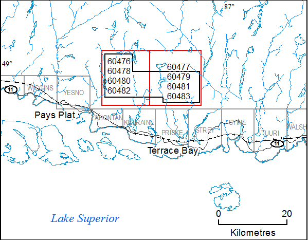
Map 60 476, Map 60 477
Airborne Magnetic and Gravimetric Surveys, Colour-Filled Contours of the Residual Magnetic Field, Pays Plat Lake Area; by Ontario Geological Survey, scale 1:20 000, colour. $9.00 each.
Map 60 478, Map 60 479
Airborne Magnetic and Gravimetric Surveys, Shaded Colour Image of the Second Vertical Derivative of the Residual Magnetic Field and Keating Correlation Coefficients, Pays Plat Lake Area; by Ontario Geological Survey, scale 1:20 000, colour. $9.00 each.
Map 60 480, Map 60 481
Airborne Magnetic and Gravimetric Surveys, Colour-Filled Contours of the Terrain-Corrected Bouguer Gravity, Pays Plat Lake Area; by Ontario Geological Survey, scale 1:20 000, colour. $9.00 each.
Map 60 482, Map 60 483
Airborne Magnetic and Gravimetric Surveys, Colour-Filled Contours of the First Vertical Derivative of the Terrain-Corrected Bouguer Gravity, Pays Plat Lake Area; by Ontario Geological Survey, scale 1:20 000, colour. $9.00 each.
Geophysical Data Set
Geophysical Data Set 1249
Ontario Airborne Geophysical Surveys, Magnetic and Gravimetric Data, Grid and Profile Data (ASCII and Geosoft® Formats) and Vector Data, Pays Plat Lake Area; by Ontario Geological Survey. The data are available on 1 DVD. $25.00.
Errata
In Open File Report 6271, Report of Activities 2011, Resident Geologist Program, Red Lake Regional Resident Geologist Report: Red Lake and Kenora Districts (released April 3, 2012), omissions and errors were noted in Figure 13 and Table 13 (page 33) of the “Red Lake Regional Resident Geologist (Red Lake District)—2011” report. In Figure 13, the channel sample location labels were omitted, and incorrect channel sample symbols had been added. In Table 13, the assay values for sample 2010SM-27 were omitted, and the lengths of the channel samples were not provided.
These omissions and errors have been corrected, and a replacement page is available. Please contact Publication Sales and the replacement page will be sent to you free of charge. Alternatively, you may download the corrected version of Open File Report 6271 from our GeologyOntario Web site. (notice issued: August 2, 2016)
Preliminary Map P.3710, Surficial Geology of the Lansdowne House Area Southeast, Northern Ontario (released June 4, 2013), was released with a slight registration problem north of Attawapiskat River. This error has been corrected and a replacement map is now available for those clients who purchased Preliminary Map P.3710. Please contact Publication Sales and a replacement map will be sent to you free of charge. Alternatively, you may download the corrected version of Preliminary Map P.3710 files from our GeologyOntario Web site. (notice issued: August 9, 2016)
Geophysical Data Set 1248
Ontario Airborne Geophysical Surveys, Magnetic Gradiometer Data, Grid and Profile Data (ASCII and Geosoft® Formats) and Vector Data, Moosonee Area—Purchased Data
Original Release Date: June 7, 2016
Notification Date of Data Errata: July 4, 2016
Errors in Geophysical Data Set 1248, Ontario Airborne Geophysical Surveys, Magnetic Gradiometer Data, Grid and Profile Data (ASCII and Geosoft® Formats) and Vector Data, Moosonee Area—Purchased Data (released June 7, 2016), were discovered in the data set and in the digital report as outlined below.
| Old File Name | Corrected File Name |
|---|---|
| “GeoTIFF Images” | |
| MO2VD83.TIF | MOG2VDMAGGSC83.TIF |
| MOMAG83.TIF | MOGMAGGSC83.TIF |
| “Vector Archive” | |
| MOMAG83.DXF | MOGMAGGSC83.DXF |
Corrected Files
| File name | File size | Date stamp | Time stamp |
|---|---|---|---|
| MOOSONEE.XYZ.ZIP | 363,590,697 | 06/22/2016 | 02:33p |
| MOOSONEE.GDB | 1,292,041,216 | 06/20/2016 | 01:41p |
| MOG2VDMAGGSC83.gxf | 102,371,381 | 06/15/2016 | 05:01p |
| MOGMAGGSC83.gxf | 84,566,534 | 06/15/2016 | 05:02p |
| MOLAG83.gxf | 92,962,627 | 06/15/2016 | 05:04p |
| MOLOG83.gxf | 93,105,398 | 06/15/2016 | 05:05p |
| MOMAG83.gxf | 88,012,760 | 06/22/2016 | 11:33a |
| MOG2VDMAGGSC83.grd | 45,801,692 | 06/20/2016 | 10:09a |
| MOGMAGGSC83.grd | 45,801,692 | 06/22/2016 | 11:42a |
| MOLAG83.grd | 45,989,492 | 06/20/2016 | 04:14p |
| MOLOG83.grd | 45,989,492 | 06/20/2016 | 04:14p |
| MOMAG83.grd | 47,413,416 | 06/22/2016 | 11:42a |
| MOG2VDMAGGSC83.tif | 286,477,749 | 06/15/2016 | 04:57p |
| MOGMAGGSC83.tif | 286,748,093 | 06/15/2016 | 04:58p |
| MOKC.csv | 253,604 | 06/15/2016 | 05:05p |
| MOKC.gdb | 292,864 | 06/20/2016 | 03:14p |
| MOGMAGGSC83.dxf | 42,652,449 | 06/15/2016 | 01:10p |
| MOKC83.dxf | 12,425,933 | 06/15/2016 | 01:10p |
- Three (3) files were incorrectly named in Geophysical Data Set 1248 and in the report (in “Appendix E. GeoTIFF and Vector Archive Definition” (p.23)). The following file names have been corrected.
- For Block 4 (“Block B Discovery East”), data in the final longitudinal and lateral gradients channels (channel names MAG_GRAD_LAT_FINAL and MAG_GRAD_LONG_FINAL) were switched. The affected flight-line numbers are L9010 to L10030. The described error is present in ASCII profile database MOOSONEE.XYZ and in Geosoft® binary profile database MOOSONEE.GDB. The final longitudinal and lateral gradients data for the affected flight lines have been corrected in the profile databases.
- All Geosoft® binary (.grd) and ASCII (.gxf) versions of the grids have been updated.
- The GeoTIFF (.tif) files have been corrected.
- The Keating correlation coefficients profile databases for both Geosoft® binary (.gdb) and ASCII (.csv) versions have been updated.
- Among vector files, the Keating correlation coefficients and residual magnetic contour lines have been corrected.
- An incorrect channel was used to create residual of the total magnetic field (MOMAG83) grids. Both Geosoft® binary (.grd) and ASCII (.gxf) versions of the grid have been updated with the correct channel.
These errors have been corrected and a replacement version of this Geophysical Data Set is available. If you have purchased a copy of this data set where your files do not match the file attributes shown above, please return the original DVD to Publication Sales, and a replacement copy will be sent to you free of charge. Alternatively, you may visit the GeologyOntario application to obtain the corrected version of Geophysical Data Set 1248.
We regret any inconvenience these errors may have caused.
For locations, see location map on Google Maps™ Mapping Service.
Location Map (PDF)
Earth Resources and Geoscience Mapping Section
Precambrian Geology – General
Open File Report 6289
A Library of Standards for Rock Names, Rock Modifiers and Terms Related to Structure, Alteration, Mineralization and Minerals for Precambrian Rocks in Ontario; by T.L. Muir, S. Buse, N.F. Trowell and M. Duguet, 204p. $100.00.
Precambrian Geology – Proterozoic and Grenville Province
Miscellaneous Release—Data 336
Geochemical Data Related to a Study of Platinum Group Element Mineralization in Nipissing Gabbro Intrusions and the River Valley Intrusion, Sudbury Region, Southern Province; by L.S. Jobin-Bevans. This digital release contains whole-rock geochemical data and assay data; field photographs, photomicrographs and back-scatter electron microscope images; and a summary of the project results. All these data were collected as part of a study of platinum group element (PGE) mineralization in Nipissing gabbro intrusions in the Southern Province in and around Sudbury, Ontario, between September 1996 and May 2004. This project was a collaborative effort between the Ontario Geological Survey, the Department of Earth Sciences at Laurentian University in Sudbury and the Department of Earth Sciences at the University of Western Ontario in London, Ontario, in support of a PhD thesis study by the author. This release comprises 104 images (as .jpg files), 2 Microsoft® Excel® 2010 (.xlsx) files and 6 documents in portable document format (.pdf). The data are available on 1 CD. $20.00.
Surficial Mapping and Sampling
Preliminary Map P.3788
Quaternary Geology, Swanson River Area, Northern Ontario; by C. Gao, scale 1:50 000, colour. $7.00.
Preliminary Map P.3789
Quaternary Geology, Chapleau Area, Northern Ontario; by C. Gao, scale 1:50 000, colour. $7.00.
Preliminary Map P.3790
Quaternary Geology, Nemegos Area, Northern Ontario; by C. Gao, scale 1:50 000, colour. $7.00.
Surficial Geochemistry
Open File Report 6311
Current Lake Area High-Density Lake Sediment and Water Survey, Northwestern Ontario; by R.D. Dyer and K.M. Dell, 99p. Geochemical data are available separately as Miscellaneous Release—Data 325 (see below). $16.00.
Miscellaneous Release—Data 325
Lake Sediment and Water Geochemical Data from the Current Lake Area, Northwestern Ontario; by K.M. Dell and R.D. Dyer. This digital release provides deep and shallow lake sediment geochemical data, lake water geochemical data and lake water quality (limnological) data, including quality-control data, collected from a survey of 234 sites in the Current Lake area. This release comprises 17 Microsoft® Excel® 2010 (.xlsx) files. The data are being released in conjunction with Open File Report 6311, available separately. The data are available on 1 CD. $20.00.
Geophysics
Airborne Geophysical Surveys
Moosonee Area—Purchased Data
1:50 000 Scale Map Sheets
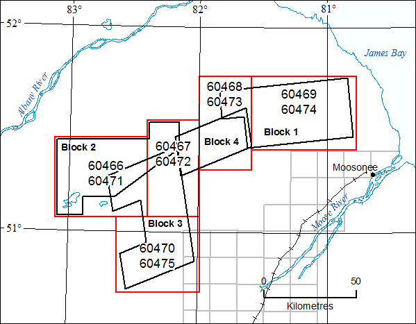
Map 60 466, Map 60 467, Map 60 468, Map 60 469, Map 60 470
Airborne Magnetic Gradiometer Survey, Colour-Filled Contours of the Residual Magnetic Field, Moosonee Area—Purchased Data; by Ontario Geological Survey, scale 1:50 000, colour. Map prices range from $9.00 to $13.00.
Map 60 471, Map 60 472, Map 60 473, Map 60 474, Map 60 475
Airborne Magnetic Gradiometer Survey, Shaded Colour Image of the Second Vertical Derivative of the Residual Magnetic Field and Keating Correlation Coefficients, Moosonee Area—Purchased Data; by Ontario Geological Survey, scale 1:50 000, colour. Map prices range from $9.00 to $13.00.
Geophysical Data Set
Geophysical Data Set 1248
Ontario Airborne Geophysical Surveys, Magnetic Gradiometer Data, Grid and Profile Data (ASCII and Geosoft® Formats) and Vector Data, Moosonee Area—Purchased Data; by Ontario Geological Survey. The data are available on 1 DVD. $25.00.
Errata
In Aggregate Resources Inventory Paper 159, Aggregate Resources Inventory of the County of Oxford and the County of Brant, Southern Ontario (released April 15, 2014), errors were noted regarding the naming of certain feature classes within the geodatabase, “ARIP159.mdb”, provided with the vector files. A feature class intended for display purposes only (i.e., “Sand_Gravel_Client”) was incorrectly named as the feature class intended to be used (i.e., “Sand_Gravel”). Several feature classes were incorrectly named and have been renamed (see table). Also, in the attribute table for the “Gradation” layer, the content of the field “TABLE_REF” stated incorrectly “Refer to Table 2”, but should state “Refer to Table 10”. Please refer to the “ARIP159_readme” file for further information on the intended use of these files.
| previous name | corrected name |
|---|---|
| Sand_Gravel | Sand_Gravel_merged |
| Sand_Gravel_Shape_Index | Sand_Gravel_merged_Shape_Index |
| Sand_Gravel_Client | Sand_Gravel |
| Sand_Gravel_Client_Shape_Index | Sand_Gravel_Shape_Index |
These errors have been corrected. You may download the corrected version of the vector files for Aggregate Resources Inventory Paper 159 from our GeologyOntario Web site. (notice issued: May 31, 2016)
Geophysical Data Set 1082a
Ontario Airborne Geophysical Surveys, Magnetic Gradiometer and Gamma-Ray Spectrometric Data, Grid and Profile Data (ASCII Format) and Vector Data, Smooth Rock Falls Area
Original Release Date: April 27, 2016
Notification Date of Data Errata: May 31, 2016
Errors in Geophysical Data Set 1082a, Ontario Airborne Geophysical Surveys, Magnetic Gradiometer and Gamma-Ray Spectrometric Data, Grid and Profile Data (ASCII Format) and Vector Data, Smooth Rock Falls Area (released April 27, 2016), were discovered in the data set and the digital report as outlined below.
- The latitude and longitude co-ordinates (channel names LAT_NAD83 and LON_NAD83) were incorrectly calculated for 10 flight lines comprising flight 491. The affected line numbers are 7550 to 7640. The UTM co-ordinates are unaffected. The described error is present in ASCII profile databases SRMAG.XYZ, SRSPEC.XYZ and SRSPEC256.XYZ. The latitude and longitude co-ordinates for the affected flight lines have been corrected in the profile databases.
- The description of the SRMAG.XYZ profile database channel name “height_mag” is incorrectly described in the table on page 70 of the report (section 4. DATA FILES in APPENDIX C. Archive Definitions) as “metres above terrain”. It should read “metres above sea level ”. This description has been corrected.
Corrected Files
| File name | File size | Date stamp | Time stamp |
|---|---|---|---|
| SRMAG.XYZ | 6,788,548,676 | 05/16/2016 | 4:13 PM |
| SRSPEC.XYZ | 444,504,228 | 05/16/2016 | 4:17 PM |
| SRSPEC256.XYZ | 18,986,040,708 | 05/17/2016 | 12:55 PM |
| SRMAG.XYZ.ZIP | 1,533,610,407 | 05/18/2016 | 9:00 AM |
| SRSPEC.XYZ.ZIP | 93,079,327 | 05/18/2016 | 9:06 AM |
| SRSPEC256.XYZ.ZIP | 993,445,734 | 05/18/2016 | 8:46 AM |
These errors have been corrected and a replacement version of this Geophysical Data Set is available. If you have purchased a copy of this data set where your files do not match the file attributes shown above, please return the original DVD to Publication Sales, and a replacement copy will be sent to you free of charge. Alternatively, you may visit the GeologyOntario application to obtain the corrected version of Geophysical Data Set 1082a.
Geophysical Data Set 1082b
Ontario Airborne Geophysical Surveys, Magnetic Gradiometer and Gamma-Ray Spectrometric Data, Grid and Profile Data (Geosoft® Format) and Vector Data, Smooth Rock Falls Area
Original Release Date: April 27, 2016
Notification Date of Data Errata: May 31, 2016
Errors in Geophysical Data Set 1082b, Ontario Airborne Geophysical Surveys, Magnetic Gradiometer and Gamma-Ray Spectrometric Data, Grid and Profile Data (Geosoft® Format) and Vector Data, Smooth Rock Falls Area (released April 27, 2016), were discovered in the data set and the digital report as outlined below.
- The latitude and longitude co-ordinates (channel names LAT_NAD83 and LON_NAD83) were incorrectly calculated for 10 flight lines comprising flight 491. The affected line numbers are 7550 to 7640. The UTM co-ordinates are unaffected. The described error is present in Geosoft® binary profile databases SRMAG.GDB, SRSPEC.GDB and SRSPEC256.GDB. The latitude and longitude co-ordinates for the affected flight lines have been corrected in the profile databases.
- The description of the SRMAG.GDB profile database channel name “height_mag” is incorrectly described in the table on page 70 of the report (section 4. DATA FILES in APPENDIX C. Archive Definitions) as “metres above terrain”. It should read “metres above sea level”. This description has been corrected.
- Incorrect registration (.gi) files were supplied with the Geosoft® binary (.grd) versions of the following grids: SRGMAGGSC83.grd, SRG1VDMAGGSC83.grd, SRG2VDMAGGSC83.grd. The error resulted in the displacement of these grids from their correct positions by approximately 150 m northeast. The incorrect registration files have been replaced. This error did not affect the ASCII (.gxf) versions of these grids.
Corrected Files
| File name | File size | Date stamp | Time stamp |
|---|---|---|---|
| SRGMAGGSC83.grd.gi | 14,336 | 05/16/2016 | 11:40 AM |
| SRG1VDMAGGSC83.grd.gi | 13,824 | 05/16/2016 | 11:34 AM |
| SRG2VDMAGGSC83.grd.gi | 13,824 | 05/16/2016 | 11:43 AM |
| SRGMAGGSC83.grd.ZIP | 31,539,996 | 05/16/2016 | 11:52 AM |
| SRG1VDMAGGSC83.grd.ZIP | 32,064,403 | 05/16/2016 | 11:54 AM |
| SRG2VDMAGGSC83.grd.ZIP | 32,261,140 | 05/16/2016 | 11:51 AM |
| SRMAG.GDB | 5,289,435,136 | 05/16/2016 | 1:41 PM |
| SRSPEC.GDB | 718,077,952 | 05/16/2016 | 4:16 PM |
| SRSPEC256.GDB | 2,601,336,832 | 05/16/2016 | 4:16 PM |
| SRMAG.GDB.ZIP | 1,934,573,519 | 05/18/2016 | 9:14 AM |
| SRSPEC.GDB.ZIP | 138,927,807 | 05/18/2016 | 9:14 AM |
| SRSPEC256.GDB.ZIP | 1,288,341,233 | 05/18/2016 | 9:17 AM |
These errors have been corrected and a replacement version of this Geophysical Data Set is available. If you have purchased a copy of this data set where your files do not match the file attributes shown above, please return the original DVD to Publication Sales, and a replacement copy will be sent to you free of charge. Alternatively, you may visit the GeologyOntario application to obtain the corrected version of Geophysical Data Set 1082b.
We regret any inconvenience these errors may have caused.
Location Map (PDF)
Announcement
The Ontario Geological Survey is proud to announce the celebration of its 125th anniversary on May 4, 2016. We are inviting students, staff, clients, educational partners and alumni to join us on May 4 at our Resident Geologist Program offices throughout the province and in the auditorium at the Willet Green Miller Centre in Sudbury (for addresses and times please see below). Coffee and cake will be provided.
Location | Time |
|---|---|
Kenora | 2:00 p.m. to 4:00 p.m. Central Time |
Red Lake | 3:00 p.m. to 5:00 p.m. Central Time |
Thunder Bay | 10:00 a.m. to 12:00 p.m. Eastern Time |
Sault Ste. Marie | 2:00 p.m.to 4:00 p.m. Eastern Time |
Timmins | 2:00 p.m. to 4:00 p.m. Eastern Time |
Kirkland Lake | 2:00 p.m. to 4:00 p.m. Eastern Time |
Sudbury | 2:00 p.m. to 4:00 p.m. Eastern Time |
| Tweed 126 Old Troy Road (613) 478-3161 | 2:00 p.m. to 4:00 p.m. Eastern Time |
Earth Resources and Geoscience Mapping Section
Precambrian Geology – Far North
Preliminary Map P.3800
Precambrian Geology of the Attwood Lake Area, Fort Hope Greenstone Belt; by B. Azar, S.A. Ferguson and C. Mayer, scale 1:50 000, colour. Geological, geochemical and geophysical data are available separately as Miscellaneous Release—Data 334 (see below). $21.00.
Miscellaneous Release—Data 334
Geological, Geochemical and Geophysical Data from the Attwood Lake Area, Fort Hope Greenstone Belt, Northwestern Ontario; by B. Azar. This digital data release consists of geological information, geochemical (whole-rock and assay) data, magnetic susceptibility data and selected field photographs, collected in 2014, for the Attwood Lake area in the Fort Hope greenstone belt. Also included are a previously published article and presentations to the public related to the project. This release comprises 308 photographs (.jpg files), 5 Microsoft® Excel® 2010 (.xlsx) files and 5 documents in portable document format (.pdf). These data augment Preliminary Map P.3800, Precambrian Geology of the Attwood Lake Area, Fort Hope Greenstone Belt; the marginal notes and the geological legend for this map are also provided in this MRD. The data are available on 1 CD. $20.00.
Precambrian Geology – Proterozoic and Grenville Province
Preliminary Map P.3785
Precambrian Geology of the Mud Lake Area, Grenville Province; by M. Duguet, V. Dubé-Bourgeois and S. Ma, scale 1:20 000, colour. Geological, geochemical and geophysical data are available separately as Miscellaneous Release—Data 327 (see below). $17.00.
Miscellaneous Release—Data 327
Geological, Geochemical and Geophysical Data Related to the Mud Lake Area, Grenville Province; by M. Duguet. This release contains field photographs, and whole-rock chemistry and magnetic susceptibility data collected as part of 1:20 000 scale mapping in the Mud Lake area during the summers of 2013, 2014 and 2015. Also included are previously published articles related to the project. This release comprises 78 photographs (as .jpg files), 2 Microsoft® Excel® 2003 (.xls) files and 3 documents in portable document format (.pdf). These data augment Preliminary Map P.3785, Precambrian Geology of the Mud Lake Area, Grenville Province; the geological legend for the map is also provided in this MRD. The data are available on 1 CD. $20.00.
Miscellaneous Release—Data 332
Geological, Geochemical, Geophysical and Geochronological Data from the Morin and Otter Townships Bedrock Geology Mapping Project, Southern and Superior Provinces; by C.A. Gordon. This digital data release contains whole-rock geochemical and assay data, geochronological data, outcrop photographs, magnetic susceptibility and scintillometer geophysical data, as well as public presentations, posters and articles related to the Morin and Otter townships 1:20 000 scale bedrock geology mapping project. Data were collected between June 1, 2012, and August 25, 2013. These data complement Preliminary Map P.3778, Precambrian Geology of Morin and Otter Townships, Southern and Superior Provinces, which was released in 2014. The marginal notes and the geological legend from the map are also provided in this MRD. The release consists of 111 photographs (as .jpg files), 4 Microsoft® Excel® (.xlsx) workbooks and 11 documents in portable document format (.pdf files). The data are available on 1 CD. $20.00.
Aggregate Resources and Industrial Minerals
Aggregate Resources Inventory Paper 78
Aggregate Resources Inventory of the County of Middlesex and the City of London, Southern Ontario; by V.L. Lee, 104p. $26.00.
Surficial Mapping and Sampling
Open File Report 6321
Results of Quaternary Geology Mapping in the Lindsay and Peterborough Areas, Southern Ontario; by A.S. Marich, 59p. Accompanied by Preliminary Maps P.3798 and P.3799. Till sample analyses are available separately as Miscellaneous Release—Data 333 (see below). $39.00.
Preliminary Map P.3798
Quaternary Geology, Lindsay Area, Southern Ontario; by A.S. Marich, scale 1:50 000, colour. $7.00.
Preliminary Map P.3799
Quaternary Geology, Peterborough Area, Southern Ontario; by A.S. Marich, scale 1:50 000, colour. $7.00.
Miscellaneous Release—Data 333
Results of Till Sample Analyses of the Lindsay and Peterborough Areas, Southern Ontario; by A.S. Marich. This digital data release contains grain size, pebble count and carbonate analyses of till samples (Newmarket and Dummer tills) collected in the Lindsay and Peterborough areas, southern Ontario. These data are being released in conjunction with Open File 6321 and maps P.3798 and P.3799. This release consists of 3 Microsoft® Excel® (.xlsx) workbooks. The data are available on 1 CD. $20.00.
Groundwater Studies
Groundwater Resources Study 15
Three-Dimensional Modelling of Surficial Deposits in the Orangeville–Fergus Area of Southern Ontario; by A.K. Burt and J.E.P. Dodge. This digital release contains comprehensive information regarding the three-dimensional (3-D) distribution and character of surficial materials that form groundwater aquifers and aquitards within the 1550 km2 Orangeville–Fergus area of southwestern Ontario. The results of 43 new continuously cored boreholes, together with new geophysical surveying, surface sampling and analysis of legacy data sets, were the basis for the creation of a 3-D model which subdivides the Quaternary sediments into a regional-scale aquifer–aquitard sequence consisting of 16 hydrostratigraphic units. Undifferentiated Paleozoic bedrock forms the basal hydrostratigraphic unit across the map area. The report included in this release contains extensive appendixes which describe in detail the data sources, the methodology, the results of the field work and analyses, the products of the study and how to extract and use them. In addition, the release contains analytical data files (Microsoft® Access® database (.mdb) and Microsoft® Excel® (.xlsx)), ArcInfo® grids (ESRI® ArcInfo® raster data sets), Google Earth™ mapping service files (keyhole markup (.kml, .kmz) and portable network graphic (.png)), modelled surfaces (as comma-separated values (.csv)), a section viewer (Microsoft® Virtual Earth™ executable SectionViewer), a subsurface database (Microsoft® Access® database (.mdb)), graphic borehole logs as portable document format (.pdf) files, high resolution plates (.pdf) and movies (.avi). The data are available on 1 DVD. $25.00.
Miscellaneous Release—Data 337
Groundwater Hydrochemistry Data for Multi-Depth Well Sampling in the Early Silurian Carbonates of the Niagara Escarpment Cuesta; by E.H. Priebe and V.L. Lee. This digital data release comprises the hydrochemical data for 4 seasonally targeted groundwater sampling events that were conducted during 2011 and 2012. The sampling points consisted of a network of 12 multi-depth wells located in the Early Silurian carbonates of the Niagara Escarpment cuesta. Each multi-depth monitoring well contains 3 to 5 ports designed for both groundwater sampling and water level monitoring. This data release contains the analyses for 210 groundwater samples, for a total of 16 380 individual chemical measurements. The laboratory analyses include major ions, trace elements, bacteria and nutrients. Field analyses include alkalinity, temperature, pH, reduction–oxidation potential and electrical conductivity. For each of the 12 multi-depth wells and for the entire data set, the hydrochemical data are provided as 13 Microsoft® Excel® 2010 (.xlsx) files; accuracy and precision (quality control) plots (.tif files) for analytical parameters are also provided. A report, in portable document format (.pdf), contains a description of the study area, borehole logs, multi-depth well geometries, sampling methods, and analytical and quality control methods. The data are available on 1 CD. $20.00.
Geophysics
Airborne Geophysical Surveys
Smooth Rock Falls Area
1:50 000 Scale Map Sheets
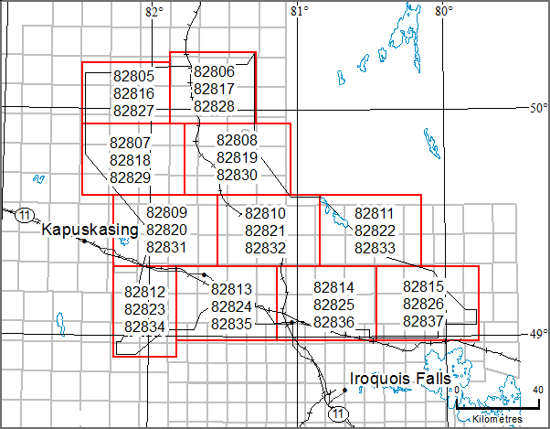
Map 82 805, Map 82 806, Map 82 807, Map 82 808,
Map 82 809, Map 82 810, Map 82 811, Map 82 812,
Map 82 813, Map 82 814, Map 82 815
Airborne Magnetic Gradiometer and Gamma-Ray Spectrometric Surveys, Colour-Filled Contours of the Residual Magnetic Field, Smooth Rock Falls Area; by Ontario Geological Survey, scale 1:50 000, colour. Map prices range from $9.00 to $10.00.
Map 82 816, Map 82 817, Map 82 818, Map 82 819,
Map 82 820, Map 82 821, Map 82 822, Map 82 823,
Map 82 824, Map 82 825, Map 82 826
Airborne Magnetic Gradiometer and Gamma-Ray Spectrometric Surveys, Shaded Colour Image of the Second Vertical Derivative of the Residual Magnetic Field and Keating Coefficients, Smooth Rock Falls Area; by Ontario Geological Survey, scale 1:50 000, colour. Map prices range from $8.00 to $11.00.
Map 82 827, Map 82 828, Map 82 829, Map 82 830,
Map 82 831, Map 82 832, Map 82 833, Map 82 834,
Map 82 835, Map 82 836, Map 82 837
Airborne Magnetic Gradiometer and Gamma-Ray Spectrometric Surveys, Ternary Radioelement Image, Smooth Rock Falls Area; by Ontario Geological Survey, scale 1:50 000, colour. Map prices range from $9.00 to $11.00.
Geophysical Data Sets
Geophysical Data Set 1082a
Ontario Airborne Geophysical Surveys, Magnetic Gradiometer and Gamma-Ray Spectrometric Data, Grid and Profile Data (ASCII Format) and Vector Data, Smooth Rock Falls Area; by Ontario Geological Survey. The data are available on 1 DVD. $25.00.
Geophysical Data Set 1082b
Ontario Airborne Geophysical Surveys, Magnetic Gradiometer and Gamma-Ray Spectrometric Data, Grid and Profile Data (Geosoft® Format) and Vector Data, Smooth Rock Falls Area; by Ontario Geological Survey. The data are available on 1 DVD. $25.00.
Resident Geologist Program
Open File Report 6317
Report of Activities 2015, Resident Geologist Program, Timmins Regional Resident Geologist Report: Timmins and Sault Ste. Marie Districts; by E. van Hees, P. Bousquet, A. Pace, C.M. Daniels, R.L. Debicki, A.C. Wilson, S.A. Beauchamp and J. Walmsley, 91p. $18.00.
Open File Report 6318
Report of Activities 2015, Resident Geologist Program, Kirkland Lake Regional Resident Geologist Report: Kirkland Lake and Sudbury Districts; by D.L. Guindon, D.G. Farrow, L.A.F. Hall, C.M. Daniels, R.L. Debicki, A.C. Wilson, L.A. Bardeggia and N. Sabiri. $25.00.
Open File Report 6319
Report of Activities 2015, Resident Geologist Program, Southern Ontario Regional Resident Geologist Report: Southeastern Ontario and Southwestern Ontario Districts, and Petroleum Operations; by P.J. Sangster, P.S. LeBaron, S.J. Charbonneau, D.A. Laidlaw, R.L. Debicki, A.C. Wilson and L. Fortner. 65p. $14.00.
Announcements
New Assay Results from Mapping of Rennie and Leeson Townships
Ontario Geological Survey geoscientists of the Earth Resources and Geoscience Mapping Section will be presenting talks at the upcoming Ontario Northeastern Mines and Minerals Symposium (NEOMMS) on April 27 and 28, 2016, in Sudbury (see announcement below). The oral presentation by L. Robichaud, titled “Bedrock Mapping in the Michipicoten Greenstone Belt”, will contain information on work conducted in the Michipicoten greenstone belt over the last 3 years. The focus of the presentation will be on the geology of Rennie and Leeson townships, which were mapped during the summer of 2015. The presentation will also contain new assay results from the 2015 mapping. These assay results will be available as a portable document format (.pdf) file download from the Ministry of Northern Development and Mines, Mines and Minerals Web site on April 27, at 10:00 a.m. Eastern Time, or 9:00 a.m. Central Time.
2016 Northeastern Ontario Mines and Minerals Symposium
April 27 and 28
Willet Green Miller Centre
933 Ramsey Lake Road, Sudbury
Once again, staff of the Mines and Minerals Division, Ministry of Northern Development and Mines will be participating in the annual Northeastern Ontario Mines and Minerals Symposium in Sudbury. Ministry staff will be presenting posters and talks on recent field work, geoscience projects and initiatives, and summaries of current exploration activities in Ontario. The symposium provides an excellent forum for members of Ontario’s prospector, mining and exploration community to gather for the exchange of geoscience and exploration information. For registration and other information about the Northeastern symposium, please visit the Ontario Prospectors Association Web site.
Location Map (PDF)
Earth Resources and Geoscience Mapping Section
Precambrian Geology – Northwestern Ontario
Miscellaneous Release—Data 329
Geochemistry of the Mesoproterozoic Badwater Gabbro South of Armstrong, Ontario; by S. Hinz, P. Hollings, R.M. Cundari and M.C. Smyk. This data release presents results of a study, conducted from 2014 to 2015, of the geochemistry of the Mesoproterozoic Badwater gabbro, located south of Armstrong, Ontario. Included in this release are an extended abstract, in portable document format (.pdf), describing the project and its results, as well as results of a whole rock geochemical analysis, in 1 Microsoft® Excel® 2010 (.xlsx) file, conducted on 45 samples obtained from the intrusion during this study (2 outcrop samples and 43 core samples). The data are available on 1 CD. $20.00.
Miscellaneous Release—Data 330
Characterization of the Mineralization and Alteration at Tower Mountain, Conmee Township, Shebandowan Greenstone Belt, Ontario; by B.R. Gélinas, R.W.D. Lodge and H.L. Gibson. This digital data release consists of field, core and thin section photographs and whole-rock geochemical data resulting from mapping of the Tower Mountain area in Conmee Township, northwestern Ontario. Also included are maps of the geology of the study area showing outcrop and sample locations. The Tower Mountain area includes a gold mineralized property hosted in an Archean syenite intrusion. This release contains 401 photographs (outcrops, core samples, petrographic and thin section images) as .jpeg files, a Microsoft® Excel® 2010 (.xlsx) workbook with the whole rock geochemical analysis for 46 samples (25 outcrop samples and 21 core samples), as well as 2 small geological maps in portable document format (.pdf). The data are available on 1 DVD. $25.00.
Miscellaneous Release—Data 335
Geochemical Data Related to the Minnitaki Lake Area, Sioux Lookout Greenstone Belt, Western Wabigoon Subprovince; by S.R. Meade. This digital data release contains whole-rock lithogeochemistry and assay data collected as part of a two-year geological mapping study in the Minnitaki Lake area where the rocks of the eastern portion of the Sioux Lookout greenstone belt are exposed. The data are presented in 1 Microsoft® Excel® 2010 (.xlsx) workbook with separate worksheets for lithogeochemical and assay data. The data include sample locations (in UTM Zone 15 co-ordinates, NAD83), rock unit names, lithotectonic units and the analytical results. The data are available on 1 CD. $20.00.
Precambrian Geology – Far North
Miscellaneous Release—Data 328
Geological, Geochemical, Geophysical, Geochronological and Petrographic Data from the Lang Lake Greenstone Belt, Central Uchi Domain, Superior Province; by S.J. Magnus. This release contains geological information, selected outcrop photographs and magnetic susceptibility data collected in 2014 during bedrock geology mapping in the Lang Lake greenstone belt. Whole-rock geochemical, geochronological and petrographic data are provided for collected samples. Also included are previously published articles and presentations to the public related to the project. This release comprises 95 images (as .jpg files), 11 Microsoft® Excel® 2010 (.xlsx) files and 21 documents in portable document format (.pdf). These data augment Preliminary Maps P.3794, Precambrian Geology of the Lang Lake Greenstone Belt (West Half) and P.3795, Precambrian Geology of the Lang Lake Greenstone Belt (East Half), which were released in April 2015; the geological legend and marginal notes for these maps are also provided in this MRD. The data are available on 1 CD. $20.00.
Surficial Geochemistry
Open File Report 6309
Results of Regional Till and Modern Alluvium Sampling in the McFaulds Lake (“Ring of Fire”) Area, Northern Ontario; by C. Gao and D.C. Crabtree. Digital data are available separately as Miscellaneous Release—Data 322 (see below), 164p.
Miscellaneous Release—Data 322
Indicator Mineral and Geochemistry Data for a Till and Alluvium Sampling Survey in the McFaulds Lake (“Ring of Fire”) Area, Northern Ontario; by C. Gao, D.C. Crabtree and R.D. Dyer. This digital data release presents the results of a regional till and modern alluvium sampling survey in the McFaulds Lake (“Ring of Fire”) area, in northern Ontario. The data consist of indicator mineral grain counts; geochemical and compositional data of kimberlite indicator minerals (KIMs), chromite, metamorphic/magmatic massive sulphide indicator minerals (MMSIM®*); and gold grains recovered from till and river sand and gravel (alluvium) samples. The data are being released in conjunction with Open File Report 6309, available separately. The files, provided in 17 Microsoft® Excel® 2010 (.xlsx) spreadsheets, contain information on sample site locations, sample processing data, KIMs picked and picking remarks, electron probe microanalyzer results of KIM and chromite grains, adjusted KIM results, gold grain data, MMSIM ®* data, clastic lithology data and geochemical data from the <0.063 mm fraction of the bulk samples. The data are available on 1 CD. $20.00.
*MMSIM is a registered trademark of Overburden Drilling Management Limited, Nepean, Ontario.
Resident Geologist Program
Open File Report 6314
Report of Activities 2015, Resident Geologist Program, Red Lake Regional Resident Geologist Report: Red Lake and Kenora Districts; by A.F. Lichtblau, C. Ravnaas, C.C. Storey, R.D. Tuomi, A. Tims, R.L. Debicki, T.K. Pettigrew, G.F. Paju and J. Wetendorf, 130p. $30.00.
Open File Report 6315
Report of Activities 2015, Resident Geologist Program, Thunder Bay North Regional Resident Geologist Report: Thunder Bay North District; by G.D. White, R.M. Cundari, M.R. Brunelle, T.K. Pettigrew, R.D. Tuomi, A. Tims and R.L. Debicki, 68p. $18.00.
Open File Report 6316
Report of Activities 2015, Resident Geologist Program, Thunder Bay South Regional Resident Geologist Report: Thunder Bay South District; by M.A. Puumala, D.A. Campbell, R.D. Tuomi, A. Tims, R.L. Debicki, T.K. Pettigrew and M.R. Brunelle, 85p. $22.00.
Mineral Deposit Inventory
The Resident Geologist Program announces the availability of an updated version of the Mineral Deposit Inventory (MDI). This database is an inventory of mineral deposits in the province of Ontario and supersedes previous MDI releases. Originally compiled in the early 1970s by the Resident Geologist Program (RGP), the database is continually being reviewed and updated by RGP staff. There are 49 new records, 714 updated records and a total of 19 179 records in the 2016 MDI database.
The Mineral Deposit Inventory is available as a direct download (similar to, as examples, “Drill Hole Records” and “Abandoned, Inactive Mine Sites and Mine Hazards”) from GeologyOntario
Each MDI record provides all or some of the following information: deposit name(s), location, status (e.g., occurrence, prospect, producer, past producer), commodities, character/classification, geological structure, lithology, minerals and mineral alteration, geochemistry, exploration history, and production and reserve data where available. Also included are notes on deposit visits and references to additional publications related to the deposit.
The compressed (.zip) download file provides MDI data in 2 formats: 1) a relational database, and 2) MDI provincial coverage in a geospatial GIS (ESRI® shape file) format. The complete MDI relational database is provided in Microsoft® Access® 2010 (.mdb) format. For the geospatial data, basic mineral deposit information (MDI number, commodities and property status) is provided. Geospatial data are provided in North American Datum 1983 (NAD83) geographic co-ordinate system using Geodetic Reference System 1980 (GRS80).
Announcement
2016 Northwestern Ontario Mines and Minerals Symposium
April 5 – 6
“Seeking Minerals for the Future”
Valhalla Inn, Thunder Bay
Once again, staff of the Mines and Minerals Division, Ministry of Northern Development and Mines will be participating in the annual Northwestern Mines and Minerals Symposium in Thunder Bay. Ministry staff will be presenting posters and talks on recent field work, geoscience projects and initiatives, and summaries of current exploration activities in Ontario. The symposium provides an excellent forum for members of Ontario’s prospector, mining and exploration community to gather for the exchange of geoscience and exploration information. For registration and other information about the Northwestern symposium, please visit the Ontario Prospectors Association Web site at http://www.ontarioprospectors.com/.
Location Map (PDF)
Announcement
Ontario Pavilion—PDAC 2016
Plans are underway for the “Ontario Pavilion” at the 2016 Prospectors and Developers Association of Canada’s (PDAC) convention in Toronto, Ontario, Canada. The event will take place from March 6–9, 2016, at the Metro Toronto Convention Centre. The Ministry of Northern Development and Mines (MNDM) Ontario Pavilion will be located on the main trade show floor in the South building of the convention centre. The Ontario Pavilion will continue to highlight the advantages of conducting mining and exploration in the province. It also provides an excellent forum for networking with companies, investors and MNDM staff. MNDM staff will be available to discuss any projects and concepts you might have in Ontario and to answer delegate’s questions.
If you would like further information on this event, please contact Sean MacLean:
Ministry of Northern Development and Mines
159 Cedar St, Suite 700
Sudbury, Ontario P3E 6A5
Tel: (705) 564-7613
E-mail: sean.maclean@ontario.ca
Earth Resources and Geoscience Mapping Section
Aggregate Resources and Industrial Minerals
Aggregate Resources of Ontario—2015 (ARO—2015)
The Ontario Geological Survey (OGS) is releasing a GIS-based compilation of the aggregate resources of Ontario. This compilation is based on data compiled from aggregate resources inventory mapping conducted by the OGS from 1980 to 2015. It is intended that this compilation will be updated annually. This compilation includes data updated from the previously published information and may include newer geological data and/or mapping, where the latter are available.
It is important to note that this compilation is not intended to be used as a standalone product and the referenced original reports should always be consulted in conjunction with this compilation. Information contained within the referenced original reports (i.e., test results, resource properties and potential) is still highly relevant. However, it is possible that resource estimates provided in the referenced original reports may no longer be accurate, and may not reflect the data contained in this compilation. It must also be noted that, although the data represented in this compilation have been modified and updated since the release of the previously published information, the referenced original publications have not been revised to incorporate these changes.
The “Aggregate Resources of Ontario—2015” (or ARO—2015) is available as a direct download from from OGSEarth. The compressed (.zip) download file provides ARO—2015 data in geodatabase format using ESRI® ArcGIS® 9.3.1 with a completed project file (.mxd). Geospatial data are provided in North American Datum 1983 (NAD83) geographic co-ordinate system using decimal degrees. A user document and readme file that explains the GIS content is provided.
Surficial Mapping and Sampling
Preliminary Map P.3625
Surficial Geology of the Black Duck River Area North, Northern Ontario; by P.J. Barnett, K.H. Yeung and J.D. McCallum, scale 1:100 000, colour. $9.00.
Preliminary Map P.3626
Surficial Geology of the Black Duck River Area Southwest, Northern Ontario; by P.J. Barnett, K.H. Yeung and J.D. McCallum, scale 1:100 000, colour. $6.00.
Preliminary Map P.3627
Surficial Geology of the Black Duck River Area Southeast, Northern Ontario; by P.J. Barnett, K.H. Yeung and J.D. McCallum, scale 1:100 000, colour. $9.00.
Preliminary Map P.3628
Surficial Geology of the Sturgeon Lake Area North and Kaskattama River Area Southeast, Northern Ontario; by P.J. Barnett, K.H. Yeung and J.D. McCallum, scale 1:100 000, colour. $11.00.
Preliminary Map P.3629
Surficial Geology of the Island River Area Northwest, Northern Ontario; by P.J. Barnett, K.H. Yeung and J.D. McCallum, scale 1:100 000, colour. $7.00.
Preliminary Map P.3630
Surficial Geology of the Island River Area Northeast, Northern Ontario; by P.J. Barnett, K.H. Yeung and J.D. McCallum, scale 1:100 000, colour. $7.00.
Preliminary Map P.3631
Surficial Geology of the Fort Severn Area Northwest, Northern Ontario; by P.J. Barnett, K.H. Yeung and J.D. McCallum, scale 1:100 000, colour. $7.00.
Miscellaneous
The Ministry of Northern Development and Mines has prepared supplements for Miscellaneous Papers (MP) 177 and 178 to include publications released in 2015. Also, the Bedrock Geology Index to Maps and Surficial Geology Index to Maps are updated to include all maps released in 2015. Miscellaneous Paper 177 (Supplement 2011–2015), MP 178 (Supplement 2011–2015) and the maps are available as free downloads or can be purchased in hard-copy format from Publication Sales.
Miscellaneous Paper (MP) 177 (Supplement 2011–2015)
Index to Published Reports, Maps and Digital Data, 2011–2015
This report provides a listing of all publications released since the publication of MP 177 (Supplement 1993–2010), Index to Published Reports, Maps and Digital Data, 1993–2010. Publications are listed by series only. 98p. $6.00.
Miscellaneous Paper (MP) 178 (Supplement 2011–2015)
Geographic Index to Published Reports, Maps and Digital Data, 2011–2015
This report provides a listing of all publications released since the publication of MP 178 (Supplement 1994–2010), Geographic Index to Published Reports, Maps and Digital Data, 1994–2010. Publications are indexed by geographic areas, which include National Topographic System (NTS) areas, geographic townships and Ministry of Natural Resources (MNR) “areas”. Publications are listed under the main geographic areas where they are located. 266p. $16.00.
Index to Maps, Bedrock Geology, 1991–2015; produced by the Publication Services Section, scale 1:1 000 000, colour. Available as a set of 4 maps. $12.00.
Index to Maps, Surficial Geology, 1991–2015; produced by the Publication Services Section, scale 1:1 000 000, colour. Available as a set of 4 maps. $12.00.
Location Map (PDF)
2015 Publications
Earth Resources and Geoscience Mapping Section
Paleozoic Geology and Energy Studies
Open File Report 6312
Upper Ordovician Organic-Rich Mudstones of Southern Ontario: Drilling Project Results; by C. Béland Otis. Geological, geochemical and geophysical data available as Miscellaneous Release—Data 326 (see below). 59p. $17.00.
Miscellaneous Release—Data 326
Geological, Geochemical and Geophysical Data from the Ordovician Shales Drilling Program and the Regional Sampling Program, Southern Ontario; by C. Béland Otis. This data release contains geological, geochemical and geophysical data collected as part of the Ordovician shale drilling program that took place near Mount Forest in 2011 and the regional sampling program conducted throughout southern Ontario in the summer of 2012. The data are being released in conjunction with Open File Report 6312, Upper Ordovician Organic-Rich Mudstones of Southern Ontario: Drilling Project Results. The geochemical and geological data are provided in 33 tables as Microsoft® Excel® 2010 (.xlsx) files. The geophysical data are presented in 5 Log ASCII Standard (.las) files and as graphic logs in 8 .tif files. Available on 1 CD. $20.00.
Miscellaneous
Open File Report 6313
Summary of Field Work and Other Activities, 2015; by Ontario Geological Survey, 488p. $12.00.
The Contents may be viewed on the Summary of Field Work and Other Activities, 2015 page.
Location Map (PDF)
Earth Resources and Geoscience Mapping Section
Aggregate Resources and Industrial Minerals
Aggregate Resources Inventory Paper 165—Revised
Drift Thickness Data (2015 Update) for the Caledon Village–Sleswick–Mono Mills Area, Regional Municipality of Peel, Southern Ontario; by Ontario Geological Survey, scale 1:50 000, colour. Based upon existing and new drilling information obtained and verified by the Ontario Geological Survey, updated drift thickness data are available for the Caledon Village–Sleswick–Mono Mills area in the Regional Municipality of Peel. The information depicted on this map updates and replaces previous drift thickness interpretations—for this area only—including those shown on Aggregate Resources Inventory Paper 165—Revised Bedrock Resources Map 165–2 (published in 2009). $3.00.
Available November 4, 2015, at 10:00 a.m. Eastern Time, or 9:00 a.m. Central Time.
Surficial Mapping and Sampling
Preliminary Map P.3722
Surficial Geology of the Miminiska Lake Area Northeast, Northern Ontario; by P.J. Barnett and K.H. Yeung, scale 1:100 000, colour. $7.00.
Preliminary Map P.3735
Surficial Geology of the Fort Hope Area Southwest, Northern Ontario; by P.J. Barnett and K.H. Yeung, scale 1:100 000, colour. $7.00.
Location Map (PDF)
Earth Resources and Geoscience Mapping Section
Precambrian Geology – Northwestern Ontario
Miscellaneous Release—Data 315
Geochemistry of Neoarchean Volcanic and Intrusive Rocks in Aldina Township, Northwestern Ontario; by R.W.D. Lodge. This geographic information system (GIS)-based release comprises field photographs and geochemical data that were collected during the mapping of Aldina Township, northwestern Ontario, in 2010 and 2013. The geospatially controlled field and geochemical data include observations and descriptions of lithofacies, alteration and mineralization; photographs of a variety of outcrops and rock textures from the field; and various plots (proportional dot plots, coloured-by-value plots) illustrating values of important petrogenetic trace-element ratios and concentrations of base metals in the rocks. Presentation of the data for Aldina Township is provided as GIS project files (ESRI® ArcGIS® 10.1 and 9.3 project (.mxd) files and ESRI® ArcGIS® 9.3 geodatabase (.gdb) project files); also provided are the results of 65 geochemical analyses in Microsoft® Excel® format (.xlxs). Field observations with descriptions of lithofacies, alteration and mineralization, and the photograph descriptions are provided within the GIS project files. This release also includes 65 photographs (.jpg files of field, sample slabs, thin sections), images of various plots (.lyr format files, to be used in ESRI® ArcGIS®), and supporting documentation (as a portable document format (.pdf) file). The data are available on 1 CD. $20.00.
Surficial Mapping and Sampling
Open File Report 6308
Results of Regional Till Sampling in the Mowe Lake Area, Northwestern Ontario; by A.S. Marich, 66p. Digital data available as Miscellaneous Release—Data 320 (see below). $22.00.
Miscellaneous Release—Data 320
Till Sample and Indicator Mineral Data for the Mowe Lake Area, Northwestern Ontario; by A.S. Marich. This release presents the results of a regional till sampling and surficial geology mapping project undertaken in the Mowe Lake area in northwestern Ontario in 2010 and 2011. The data comprise fine-fraction (-63 µm) geochemical analyses, and geochemical and compositional analyses of particulate gold grains and metamorphic/magmatic massive sulphide indicator minerals (MMSIM®*) recovered from 193 till samples. The data are being released in conjunction with Open File Report 6308, available separately. Files, provided as 10 Microsoft® Excel® 97–2003 (.xls) spreadsheets, contain information on sample site locations, geochemical analyses, gold grain data, MMSIM ® data and pebble lithology data. The data are available on 1 CD. $20.00.
Miscellaneous Release—Data 324
Results of 2011–13 Overburden Drilling Programs in the Southern Part of the County of Simcoe, South-Central Ontario; by A.F. Bajc, R.P.M. Mulligan, D.R.B. Rainsford and J.L. Webb. This digital data release contains borehole information resulting from overburden drilling programs conducted within the southern part of the County of Simcoe in 2011, 2012 and 2013. A total of 25 PQ diameter (8 to 9 cm) continuous cores, 24 of which extend to bedrock, are being reported on in this digital data release. Cores were obtained using a mud rotary drill equipped with a Christensen core barrel retrievable by wire line. Core was visually logged, photographed and representative intervals sampled in the field for combinations of grain size, carbonate and heavy mineral content as well as radiocarbon dating. Induction (EM conductivity) and natural gamma borehole geophysical surveys were also conducted in 12 of the 25 boreholes. Graphic and written logs (.pdf), high resolution core photos (.jpeg) and associated analytical data sets (Microsoft® Excel® 2003 .xls) are stored in nested folders. A visual representation of this information is included in a hyperlinked format, accessible from an index map provided in portable document format (.pdf). The data are available on 1 DVD. $25.00.
Groundwater Studies
Open File Report 6310
Workshop Summary and Gap Analysis Report: Unifying Groundwater Science in Southern Ontario; by H.A.J. Russell, E.H. Priebe and J.R. Parker, 64p., $11.00.
Geophysics
Ground Gravity Geophysical Surveys
Central Simcoe County Area
1:50 000 Scale Map Sheets
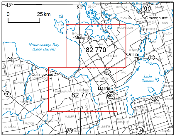
Map 82 770
Ground Gravity Survey, Residual of the Bouguer Anomaly, Central Simcoe County Area; by Ontario Geological Survey, scale 1:50 000, colour. $9.00.
Map 82 771
Ground Gravity Survey, Residual of the Bouguer Anomaly, Central Simcoe County Area; by Ontario Geological Survey, scale 1:50 000, colour. $11.00.
Geophysical Data Set
Geophysical Data Set 1080
Ontario Geophysical Surveys, Ground Gravity Data, Grid and Point Data (ASCII and Geosoft® Formats) and Vector Data, Central Simcoe County Area; by Ontario Geological Survey. The data are on 1 CD. $20.00.
Airborne Geophysical Surveys
Matachewan–Timmins Area—Purchased Data
1:20 000 Scale Map Sheets
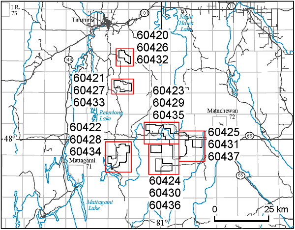
Map 60 420, Map 60 421, Map 60 422,
Map 60 423, Map 60 424, Map 60 425
Airborne Magnetic and Electromagnetic Surveys, Colour-Filled Contours of the Residual Magnetic Field and Electromagnetic Anomalies, Matachewan–Timmins Area—Purchased Data; by Ontario Geological Survey, scale 1:20 000, colour. Map prices range from $4.00 to $9.00.
Map 60 426, Map 60 427, Map 60 428,
Map 60 429, Map 60 430, Map 60 431
Airborne Magnetic and Electromagnetic Surveys, Shaded Colour Image of the Second Vertical Derivative of the Residual Magnetic Field and Keating Coefficients, Matachewan–Timmins Area—Purchased Data; by Ontario Geological Survey, scale 1:20 000, colour. Map prices range from $4.00 to $9.00.
Map 60 432, Map 60 433, Map 60 434,
Map 60 435, Map 60 436, Map 60 437
Airborne Magnetic and Electromagnetic Surveys, Colour-Filled Contours of the EM Decay Constant and Electromagnetic Anomalies, Matachewan–Timmins Area—Purchased Data; by Ontario Geological Survey, scale 1:20 000, colour. Map prices range from $4.00 to $9.00.
Geophysical Data Set
Geophysical Data Set 1243
Ontario Airborne Geophysical Surveys, Magnetic and Electromagnetic Data, Grid and Profile Data (ASCII and Geosoft® Formats) and Vector Data, Matachewan–Timmins Area—Purchased Data; by Ontario Geological Survey. The data are on 1 DVD. $25.00.
Airborne Geophysical Surveys
Scadding Township Area—Purchased Data
1:20 000 Scale Map Sheets
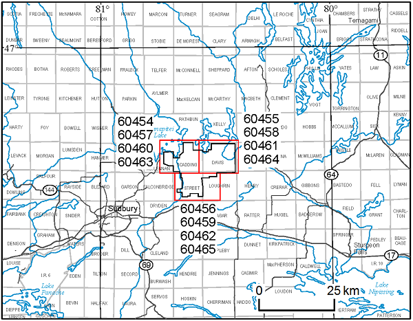
Map 60 454, Map 60 455, Map 60 456
Airborne Magnetic, Electromagnetic and Gamma-Ray Spectrometric Surveys, Colour-Filled Contours of the Residual Magnetic Field, Scadding Township Area—Purchased Data; by Ontario Geological Survey, scale 1:20 000, colour. Map prices range from $6.00 to $7.00.
Map 60 457, Map 60 458, Map 60 459
Airborne Magnetic, Electromagnetic and Gamma-Ray Spectrometric Surveys, Shaded Colour Image of the Second Vertical Derivative of the Residual Magnetic Field and Keating Correlation Coefficients, Scadding Township Area—Purchased Data; by Ontario Geological Survey, scale 1:20 000, colour. $7.00 each.
Map 60 460, Map 60 461, Map 60 462
Airborne Magnetic, Electromagnetic and Gamma-Ray Spectrometric Surveys, Ternary Radioelement Image, Scadding Township Area—Purchased Data; by Ontario Geological Survey, scale 1:20 000, colour. Map prices range from $6.00 to $7.00.
Map 60 463, Map 60 464, Map 60 465
Airborne Magnetic, Electromagnetic and Gamma-Ray Spectrometric Surveys, Colour-Filled Contours of the VLF–EM Vertical Field, Scadding Township Area—Purchased Data; by Ontario Geological Survey, scale 1:20 000, colour. Map prices range from $6.00 to $7.00.
Geophysical Data Set
Geophysical Data Set 1247
Ontario Airborne Geophysical Surveys, Magnetic, Electromagnetic and Gamma-Ray Spectrometric Data, Grid and Profile Data (ASCII and Geosoft® Formats) and Vector Data, Scadding Township Area—Purchased Data; by Ontario Geological Survey. The data are on 1 DVD. $25.00.
*MMSIM is a registered trademark of Overburden Drilling Management Limited, Nepean, Ontario.
Location Map (PDF)
Earth Resources and Geoscience Mapping Section
Precambrian Geology – Northeastern Ontario
Preliminary Map P.3797
Precambrian Geology of Brackin Township, Michipicoten Greenstone Belt; by L. Robichaud, J.A. McDivitt, N.J. Krystopowicz and N. Szumylo, scale 1:20 000, colour. $8.00.
Precambrian Geology – Proterozoic and Grenville Province
Open File Report 6299
Geology, Geochemistry and Mineral Potential of the Chenaux Gabbro, Northeastern Central Metasedimentary Belt, Grenville Province; by B. Azar, 87p. Accompanied by Preliminary Map P.3781. $26.00.
Preliminary Map P.3781
Precambrian Geology of the Chenaux Gabbro, Grenville Province; by B. Azar and R.M. Easton, scale 1:20 000, colour. $7.00.
Preliminary Map P.3791
Precambrian Geology of Eastern Ontario Interpreted from Aeromagnetic and Compiled Geological Data—Northwest Sheet; by S.J. Magnus and R.M. Easton, scale 1:100 000, colour. $19.00.
Preliminary Map P.3792
Precambrian Geology of Eastern Ontario Interpreted from Aeromagnetic and Compiled Geological Data—Northeast Sheet; by S.J. Magnus and R.M. Easton, scale 1:100 000, colour. $19.00.
Preliminary Map P.3793
Precambrian Geology of Eastern Ontario Interpreted from Aeromagnetic and Compiled Geological Data—South Sheet; by S.J. Magnus and R.M. Easton, scale 1:100 000, colour. $20.00.
Surficial Geochemistry
Miscellaneous Release—Data 321
McFaulds Lake (“Ring of Fire”) Area Stream Sediment Geochemistry; by R.D. Dyer and L.A. Handley. This digital data release consists of stream sediment geochemical data from 146 samples obtained from within the Attawapiskat and Muketei rivers in the McFaulds Lake (“Ring of Fire”) area of northern Ontario. These results are supplemental to previously released indicator mineral data reported in Open File Report (OFR) 6108 and MRD 119, published in 2003. Geochemical analysis on the fine fraction (-80 mesh; 180 µm) was performed on a separate sample aliquot from the bulk samples that were processed for indicator minerals as described and reported in OFR 6108 and MRD 119. The samples were sieved to retain the -80 mesh size fraction, which underwent aqua regia digestion followed by inductively coupled plasma optical emission spectroscopy (ICP-OES) and inductively coupled plasma mass spectrometry (ICP-MS) for a suite of 51 metals. Loss-on-ignition (LOI) was also performed and reported here. Quality control data, consisting of the results from the analysis of duplicate pairs and certified reference materials, are included in this release as well. The data are available as 4 Microsoft® Excel® 97–2003 (.xls) files, and documentation as 2 portable document format (.pdf) files, on 1 CD. $20.00.
Geophysics
Airborne Geophysical Surveys
Bull Lake Area
1:20 000 Scale Map Sheets
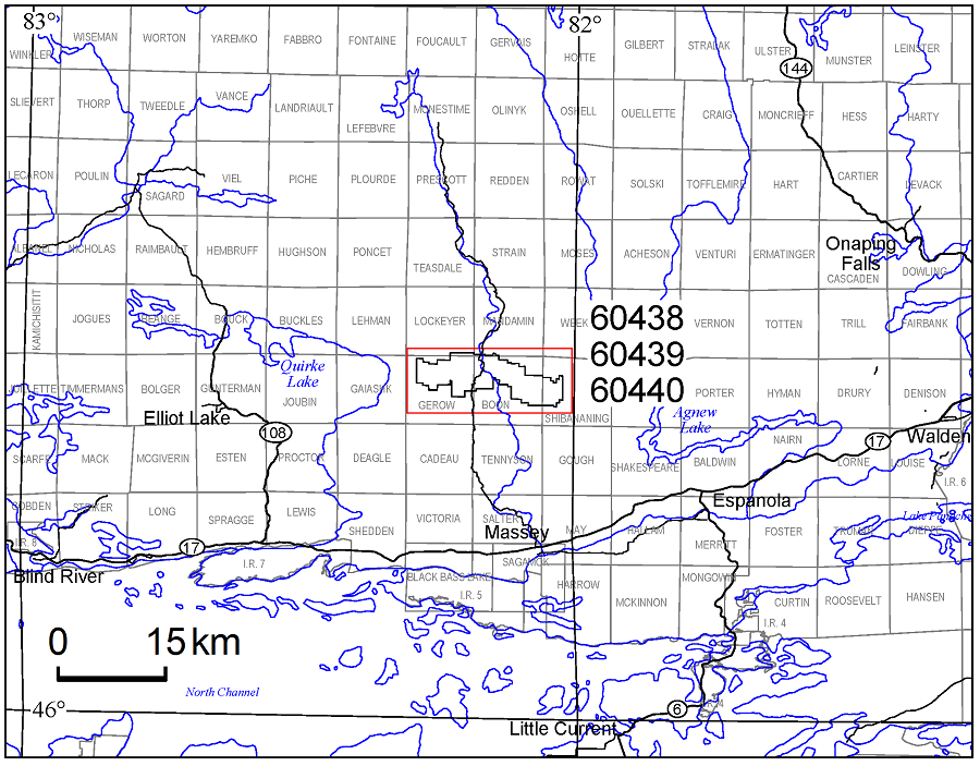
Map 60 438
Airborne Magnetic and Electromagnetic Surveys, Colour-Filled Contours of the Residual Magnetic Field and Electromagnetic Anomalies, Bull Lake Area—Purchased Data; by Ontario Geological Survey, scale 1:20 000, colour. $9.00.
Map 60 439
Airborne Magnetic and Electromagnetic Surveys, Shaded Colour Image of the Second Vertical Derivative of the Residual Magnetic Field and Keating Correlation Coefficients, Bull Lake Area—Purchased Data; by Ontario Geological Survey, scale 1:20 000, colour. $9.00.
Map 60 440
Airborne Magnetic and Electromagnetic Surveys, Colour-Filled Contours of the EM Decay Constant and Electromagnetic Anomalies, Bull Lake Area—Purchased Data; by Ontario Geological Survey, scale 1:20 000, colour. $9.00.
Geophysical Data Set
Geophysical Data Set 1244
Ontario Airborne Geophysical Surveys, Magnetic and Electromagnetic Data, Grid and Profile Data (ASCII and Geosoft® Formats) and Vector Data, Bull Lake Area—Purchased Data; by Ontario Geological Survey. The data are on 1 DVD. $25.00.
Gullrock Lake Area
1:20 000 Scale Map Sheets
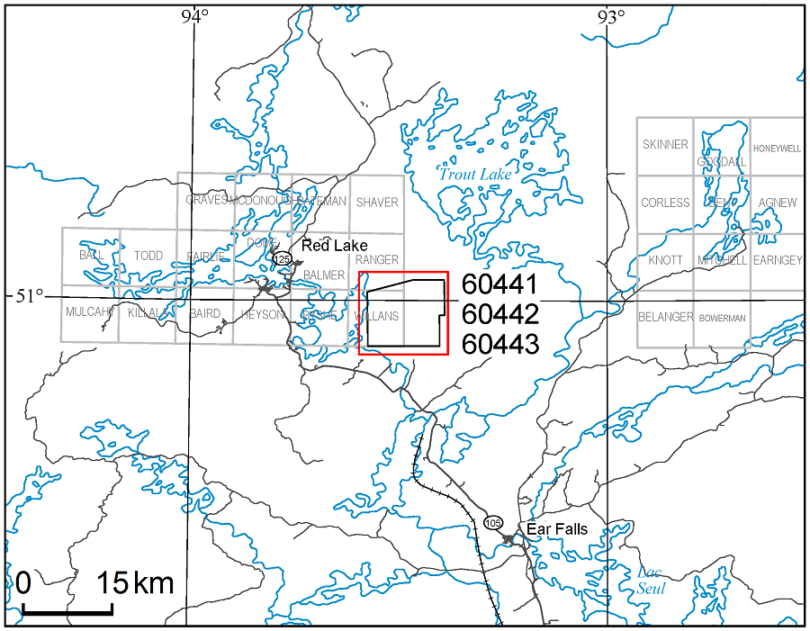
Map 60 441
Airborne Magnetic and Electromagnetic Surveys, Colour-Filled Contours of the Residual Magnetic Field and Electromagnetic Anomalies, Gullrock Lake Area—Purchased Data; by Ontario Geological Survey, scale 1:20 000, colour. $8.00.
Map 60 442
Airborne Magnetic and Electromagnetic Surveys, Shaded Colour Image of the Second Vertical Derivative of the Residual Magnetic Field and Keating Correlation Coefficients, Gullrock Lake Area—Purchased Data; by Ontario Geological Survey, scale 1:20 000, colour. $9.00.
Map 60 443
Airborne Magnetic and Electromagnetic Surveys, Colour-Filled Contours of the EM Decay Constant and Electromagnetic Anomalies, Gullrock Lake Area—Purchased Data; by Ontario Geological Survey, scale 1:20 000, colour. $8.00.
Geophysical Data Set
Geophysical Data Set 1245
Ontario Airborne Geophysical Surveys, Magnetic and Electromagnetic Data, Grid and Profile Data (ASCII and Geosoft® Formats) and Vector Data, Gullrock Lake Area—Purchased Data; by Ontario Geological Survey. The data are on 1 DVD. $25.00.
Dog Lake and East Nipigon Areas
1:50 000 Scale Map Sheets
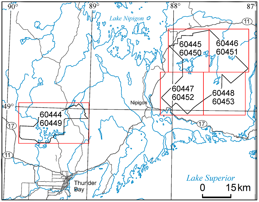
Map 60 444, Map 60 445, Map 60 446, Map 60 447, Map 60 448
Airborne Magnetic Survey, Colour-Filled Contours of the Residual Magnetic Field, Dog Lake and East Nipigon Areas—Purchased Data; by Ontario Geological Survey, scale 1:50 000, colour. Map prices range from $8.00 to $13.00.
Map 60 449, Map 60 450, Map 60 451, Map 60 452, Map 60 453
Airborne Magnetic Survey, Shaded Colour Image of the Second Vertical Derivative of the Residual Magnetic Field and Keating Coefficients, Dog Lake and East Nipigon Areas—Purchased Data; by Ontario Geological Survey, scale 1:50 000, colour. Map prices range from $9.00 to $12.00.
Geophysical Data Set
Geophysical Data Set 1246
Ontario Airborne Geophysical Surveys, Magnetic Data, Grid and Profile Data (ASCII and Geosoft® formats) and Vector Data, Dog Lake and East Nipigon Areas—Purchased Data; by Ontario Geological Survey. The data are on 1 DVD. $25.00.
Errata
We regret any inconvenience these errors may have caused.
Preliminary Map P.3770, Quaternary Geology, Burntbush Area, Northeastern Ontario (released on April 16, 2013), was published with errors in the geological legend. The box showing the colour for Unit 8 was missing; additionally, the colours for Unit 7 and Unit 6 were matched to the wrong description in the legend. The remainder of the legend is correct.
These errors have been fixed and a replacement map is now available for those clients who purchased Preliminary Map P.3770 with the incorrect legend. Please contact Publication Sales and a replacement map will be sent to you free of charge. Alternatively, you may download the corrected version of Preliminary Map P.3770 files from our GeologyOntario Web site.
In Open File Report 6297, Results of Regional Till Sampling in the Detour Lake and Burntbush Area, Northern Ontario (released April 14, 2015), the Universal Transverse Mercator (UTM) co-ordinates displayed on Figure 2 (in the back pocket) have incorrect “N” (northing) and “E” (easting) labels. In the top right corner of the figure, the co-ordinates should be indicated as 612185 mE and 5570955 mN; in the bottom left, 510615 mE and 5410990 mN.
These errors have been fixed and a replacement report is now available. You may download the corrected version of Open File Report 6297 from our GeologyOntario Web site.
In Miscellaneous Release—Data 283–Revised, Ambient Groundwater Geochemistry Data for Southern Ontario, 2007–2014 (released on January 13, 2015), the following errors have been noted in the Microsoft® Excel® 2010 file “MRD_283_data(revised_2014).xlsx”.
- An erroneous concentration for bromide (Br–) for sample 08-AG-178; the value 26.72 mg/L has been replaced with the correct value of 0.15 mg/L.
- Incorrect sums of total dissolved solids (TDS) for 60 samples; sample numbers are listed below.
- Degrees of Latitude and Longitude were reversed for 60 samples (the UTM co-ordinates were not affected); sample numbers are listed below.
The sample numbers (Sample) in file “MRD_283_data(revised_2014).xlsx”, corrected for Latitude, Longitude and TDS sum, are listed below.
Sample Sample Sample Sample Sample Sample 07-AG-021 07-AG-144 08-AG-013 08-AG-228 09-AG-061 09-AG-217 07-AG-033 07-AG-147 08-AG-025 08-AG-246 09-AG-073 09-AG-223 07-AG-044 07-AG-158 08-AG-038 09-AG-003 09-AG-083 09-AG-227 07-AG-055 07-AG-173 08-AG-049 09-AG-013 09-AG-118 09-AG-260 07-AG-066 07-AG-183 08-AG-080 09-AG-026 09-AG-192 09-AG-270 07-AG-080 07-AG-194 08-AG-092 09-AG-030 09-AG-195 09-AG-280 07-AG-085 07-AG-201 08-AG-108 09-AG-038 09-AG-197 09-BW03-02 07-AG-096 07-AG-206 08-AG-186 09-AG-049 09-AG-203 09-BW04-01 07-AG-121 07-AG-221 08-AG-206 09-AG-054 09-AG-206 09-BW06-02 07-AG-133 07-AG-230 08-AG-215 09-AG-058 09-AG-216 09-BW09-02 In addition, the terminology of the following parameters was standardized (see column headings in file “MRD_283_data(revised_2014).xlsx”).
- Well_head_security
- Water_colour
- Water_smell
- H2S (note: the way in which non-detectable values, i.e., <0.01 mg/L H2S, are presented is standardized from year to year)
These errors have been corrected and a replacement CD is available for those clients who purchased Miscellaneous Release—Data 283–Revised with the incorrect data. Please contact Publication Sales and a replacement CD will be sent to you free of charge. Alternatively, you may download the corrected version of Miscellaneous Release—Data 283–Revised from our GeologyOntario Web site.
Announcement
Mineral Deposit Inventory
The Ministry of Northern Development and Mines announces the availability of an updated version of the Mineral Deposit Inventory (MDI). This database is an inventory of mineral deposits in the province of Ontario and supersedes previous MDI releases. Originally compiled in the early 1970s by the Resident Geologist Program (RGP), the database is continually being reviewed and updated by RGP staff. There are 58 new records, 829 updated records and a total of 19 253 records in the 2015 MDI database.
The Mineral Deposit Inventory will no longer be released and sold as a separate publication; instead, it is available as a direct download (similar to, as examples, “Drill Hole Records” and “Abandoned, Inactive Mine Sites and Mine Hazards”) from GeologyOntario.
Each MDI record provides all or some of the following information: deposit name(s), location, status (e.g., occurrence, prospect, producer, past producer), commodities, character/classification, geological structure, lithology, minerals and mineral alteration, geochemistry, exploration history, and production and reserve data where available. Also included are notes on deposit visits and references to additional publications related to the deposit.
The compressed (.zip) download file provides MDI data in 2 formats: 1) a relational database, and 2) MDI provincial coverage in a geospatial GIS (ESRI® shape file) format. The complete MDI relational database is provided in Microsoft® Access® 2010 (.mdb) format. For the geospatial data, basic mineral deposit information (MDI number, commodities and property status) is provided. Geospatial data are provided in North American Datum 1983 (NAD83) geographic co-ordinate system using Geodetic Reference System 1980 (GRS80).
Location Map (PDF)
Earth Resources and Geoscience Mapping Section
Precambrian Geology – Northeastern Ontario
Preliminary Map P.3787
Precambrian Geology of Marsh and Lang Townships, Michipicoten Greenstone Belt; by L. Robichaud, K.S. Whitney, E. Munro and S. Préfontaine, scale 1:20 000, colour. $10.00.
Precambrian Geology – Northwestern Ontario
Preliminary Map P.3796
Precambrian Geology of Minnitaki Lake, Northeast Bay Area; by S.R. Meade, scale 1:20 000, colour. $11.00.
Precambrian Geology – Far North
Preliminary Map P.3794
Precambrian Geology of the Lang Lake Greenstone Belt (West Half); by S.J. Magnus, scale 1:20 000, colour. $15.00.
Preliminary Map P.3795
Precambrian Geology of the Lang Lake Greenstone Belt (East Half); by S.J. Magnus, scale 1:20 000, colour. $19.00.
Aggregate Resources and Industrial Minerals
Aggregate Resources Inventory Paper 69
Aggregate Resources Inventory of the Central and Eastern Parts of the District of Parry Sound, Central Ontario; by D.J. Rowell, 101p. $35.00.
Open File Report 6307
Aggregate and Industrial Mineral Potential of the Guelph Formation, Southern Ontario; by D.J. Rowell, 66p. $17.00.
Surficial Geochemistry
Open File Report 6297
Results of Regional Till Sampling in the Detour Lake and Burntbush Area, Northern Ontario; by C. Gao, 120p. Indicator mineral grain counts and geochemical and compositional data are available as Miscellaneous Release—Data 312 (see below). $31.00.
Miscellaneous Release—Data 312
Till Sample and Indicator Mineral Data for the Detour Lake and Burntbush Area, Northern Ontario; by C. Gao. This release presents the results of a regional till sampling and surficial mapping project undertaken in the Detour Lake and Burntbush area of northeastern Ontario in 2008 and 2009. The results consist of indicator mineral grain counts as well as geochemical and compositional data of kimberlite indicator minerals (KIMs), metamorphic/magmatic massive sulphide indicator minerals (MMSIM®) and gold grains recovered from till and glaciofluvial sand and gravel samples. The data are being released in conjunction with Open File Report 6297, available separately. Files in this release contain information on sample site locations, sample processing data, KIMs picked and picking remarks, electron probe microanalyzer results of KIMs, adjusted KIM results, gold grain data, MMSIM ® data, clastic lithology data, and geochemical data from <0.063 mm till matrix material. The data are available as Microsoft® Excel® 2010 files on 1 CD. $20.00.
Geophysics
Airborne Geophysical Survey
Lac des Mille Lacs–Nagagami Lake Area
1:50 000 Scale Map Sheets
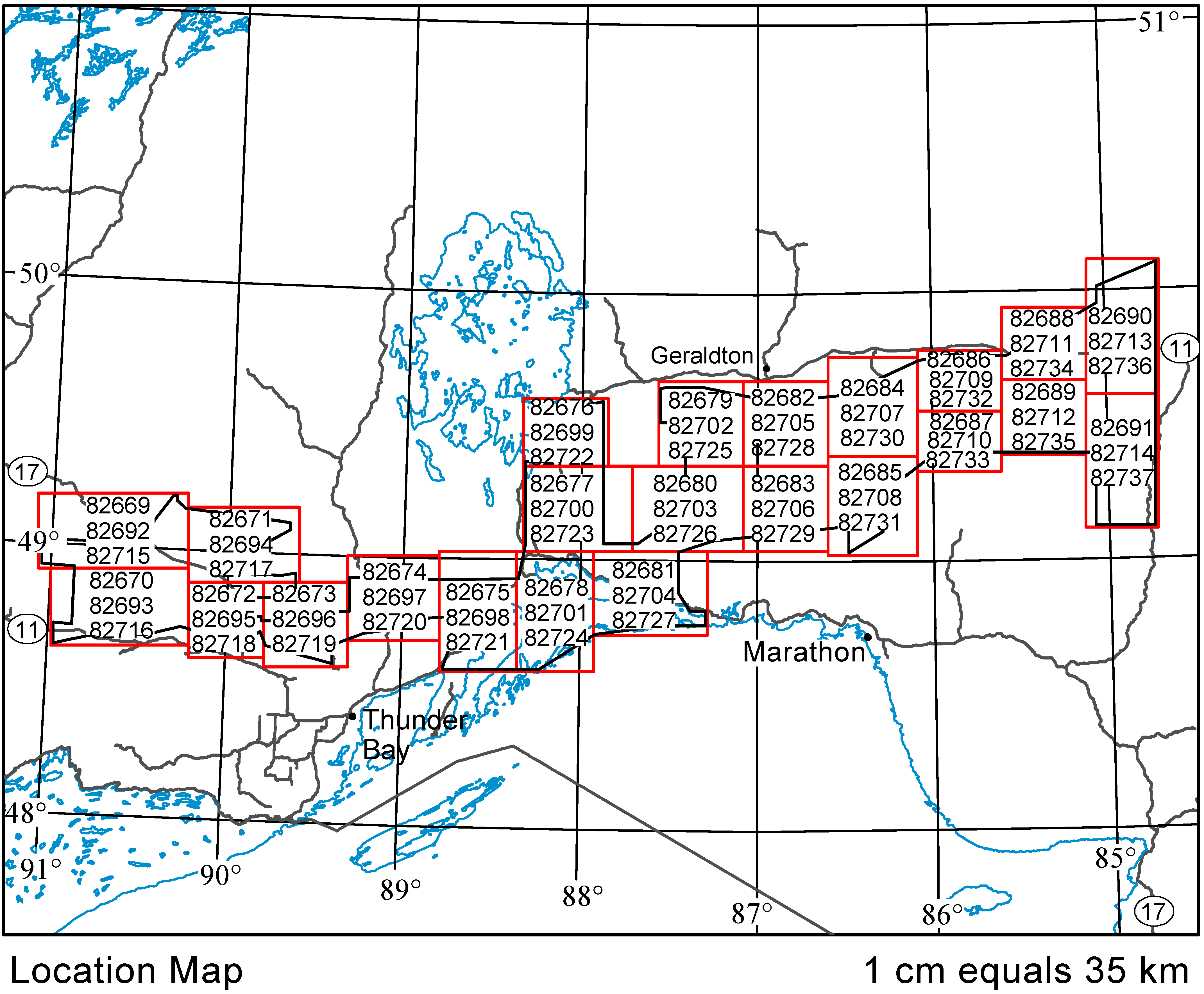
Map 82 669, Map 82 670, Map 82 671, Map 82 672, Map 82 673,
Map 82 674, Map 82 675, Map 82 676, Map 82 677, Map 82 678,
Map 82 679, Map 82 680, Map 82 681, Map 82 682, Map 82 683,
Map 82 684, Map 82 685, Map 82 686, Map 82 687, Map 82 688,
Map 82 689, Map 82 690, Map 82 691
Airborne Magnetic and Gamma-Ray Spectrometric Surveys, Colour-Filled Contours of the Residual Magnetic Field, Lac des Mille Lacs–Nagagami Lake Area; by Ontario Geological Survey, scale 1:50 000, colour. Map prices range from $6.00 to $11.00.
Map 82 692, Map 82 693, Map 82 694, Map 82 695, Map 82 696, Map 82 697,
Map 82 698, Map 82 699, Map 82 700, Map 82 701, Map 82 702, Map 82 703,
Map 82 704, Map 82 705, Map 82 706, Map 82 707, Map 82 708, Map 82 709,
Map 82 710, Map 82 711, Map 82 712, Map 82 713, Map 82 714
Airborne Magnetic and Gamma-Ray Spectrometric Surveys, Shaded Colour Image of the Second Vertical Derivative of the Residual Magnetic Field and Keating Coefficients, Lac des Mille Lacs–Nagagami Lake Area; by Ontario Geological Survey, scale 1:50 000, colour. Map prices range from $7.00 to $11.00.
Map 82 715, Map 82 716, Map 82 717, Map 82 718, Map 82 719, Map 82 720,
Map 82 721, Map 82 722, Map 82 723, Map 82 724, Map 82 725, Map 82 726,
Map 82 727, Map 82 728, Map 82 729, Map 82 730, Map 82 731, Map 82 732,
Map 82 733, Map 82 734, Map 82 735, Map 82 736, Map 82 737
Airborne Magnetic and Gamma-Ray Spectrometric Surveys, Ternary Radioelement Image, Lac des Mille Lacs–Nagagami Lake Area; by Ontario Geological Survey, scale 1:50 000, colour. Map prices range from $7.00 to $12.00.
Geophysical Data Sets
Geophysical Data Set 1078a
Ontario Airborne Geophysical Surveys, Magnetic and Gamma-Ray Spectrometric Data, Grid and Profile Data (ASCII format) and Vector Data, Lac des Mille Lacs–Nagagami Lake Area; by Ontario Geological Survey. The data are available on 1 DVD. $25.00.
Geophysical Data Set 1078b
Ontario Airborne Geophysical Surveys, Magnetic and Gamma-Ray Spectrometric Data, Grid and Profile Data (Geosoft® format) and Vector Data, Lac des Mille Lacs–Nagagami Lake Area; by Ontario Geological Survey. The data are available on 1 DVD. $25.00.
Airborne Geophysical Survey
Kabinakagami Lake Area
1:20 000 Scale Map Sheets
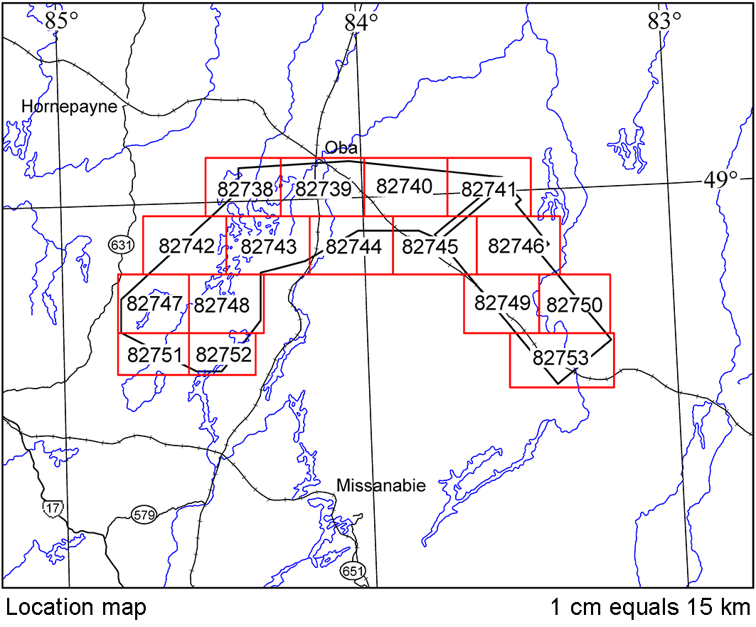
Map 82 738, Map 82 739, Map 82 740, Map 82 741,
Map 82 742, Map 82 743, Map 82 744, Map 82 745,
Map 82 746, Map 82 747, Map 82 748, Map 82 749,
Map 82 750, Map 82 751, Map 82 752, Map 82 753
Airborne Magnetic and Electromagnetic Surveys, Residual Magnetic Field Contours with Electromagnetic Anomalies and Keating Coefficients, Kabinakagami Lake Area; by Ontario Geological Survey, scale 1:20 000, colour. Map prices range from $7.00 to $12.00.
1:50 000 Scale Map Sheets
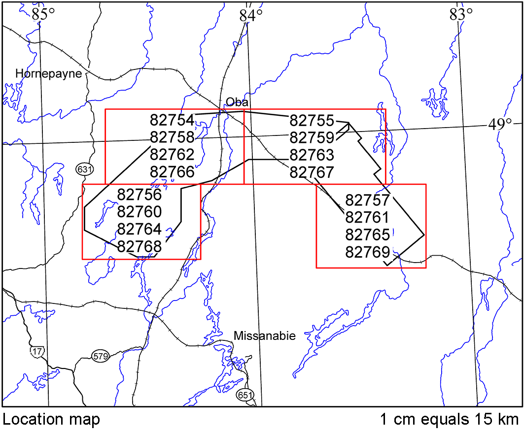
Map 82 754, Map 82 755, Map 82 756, Map 82 757
Airborne Magnetic and Electromagnetic Surveys, Colour-Filled Contours of the Residual Magnetic Field and Electromagnetic Anomalies, Kabinakagami Lake Area; by Ontario Geological Survey, scale 1:50 000, colour. Map prices range from $7.00 to $8.00.
Map 82 758, Map 82 759, Map 82 760, Map 82 761
Airborne Magnetic and Electromagnetic Surveys, Shaded Colour Image of the Second Vertical Derivative of the Residual Magnetic Field and Keating Coefficients, Kabinakagami Lake Area; by Ontario Geological Survey, scale 1:50 000, colour. Map prices range from $7.00 to $8.00.
Map 82 762, Map 82 763, Map 82 764, Map 82 765
Airborne Magnetic and Electromagnetic Surveys, Airborne Magnetic and Electromagnetic Surveys, Colour-Filled Contours of the EM Decay Constant and Electromagnetic Anomalies, Kabinakagami Lake Area; by Ontario Geological Survey, scale 1:50 000, colour. Map prices range from $7.00 to $8.00.
Map 82 766, Map 82 767, Map 82 768, Map 82 769
Airborne Magnetic and Electromagnetic Surveys, Colour-Filled Contours of the Apparent Conductivity and Electromagnetic Anomalies, Kabinakagami Lake Area; by Ontario Geological Survey, scale 1:50 000, colour. Map prices range from $7.00 to $8.00.
Geophysical Data Sets
Geophysical Data Set 1079a
Ontario Airborne Geophysical Surveys, Magnetic and Electromagnetic Data, Grid and Profile Data (ASCII Format) and Vector Data, Kabinakagami Lake Area; by Ontario Geological Survey. The data are available on 3 DVDs. $75.00.
Geophysical Data Set 1079b
Ontario Airborne Geophysical Surveys, Magnetic and Electromagnetic Data, Grid and Profile Data (Geosoft® format) and Vector Data, Kabinakagami Lake Area; by Ontario Geological Survey. The data are available on 3 DVDs. $75.00.
Resident Geologist Program
Open File Report 6301
Report of Activities 2014, Resident Geologist Program, Red Lake Regional Resident Geologist Report: Red Lake and Kenora Districts; by A.F. Lichtblau, C. Ravnaas, C.C. Storey, A. Tims, R.L. Debicki, T.K. Pettigrew, A.C. Wilson and J. Wetendorf, 83p. $20.00.
Open File Report 6302
Report of Activities 2014, Resident Geologist Program, Thunder Bay North Regional Resident Geologist Report: Thunder Bay North District; by G.D. White, R.M. Cundari, M.R. Brunelle, T.K. Pettigrew, A. Tims and R.L. Debicki, 54p. $16.00.
Open File Report 6303
Report of Activities 2014, Resident Geologist Program, Thunder Bay South Regional Resident Geologist Report: Thunder Bay South District; by M.A. Puumala, D.A. Campbell, A. Tims, R.L. Debicki, T.K. Pettigrew and M.R. Brunelle, 75p. $20.00.
Open File Report 6304
Report of Activities 2014, Resident Geologist Program, Timmins Regional Resident Geologist Report: Timmins and Sault Ste. Marie Districts; by P. Bousquet, A. Pace, C.M. Daniels, R.L. Debicki, A.C. Wilson, A. Samuel and A. Yukich, 83p. $16.00.
Open File Report 6305
Report of Activities 2014, Resident Geologist Program, Kirkland Lake Regional Resident Geologist Report: Kirkland Lake and Sudbury Districts; by D.L. Guindon, D.G. Farrow, J. Suma-Momoh, C.M. Daniels, R.L. Debicki, A.C. Wilson, L.A.F. Hall and N. Sabiri, 83p. $15.00
Open File Report 6306
Report of Activities 2014, Resident Geologist Program, Southern Ontario Regional Resident Geologist Report: Southeastern Ontario and Southwestern Ontario Districts, and Petroleum Operations; by P.J. Sangster, P.S. LeBaron, S.J. Charbonneau, D.A. Laidlaw, R.L. Debicki, A.C. Wilson and L. Fortner, 69p. $14.00
Miscellaneous
GeoTours Northern Ontario
The Ontario Geological Survey and Natural Resources Canada’s Geological Survey of Canada are pleased to announce the availability of the GeoTours Northern Ontario series, 17 self-guided tours highlighting geological sites of interest in or near various communities across Northern Ontario.
Rugged Canadian Shield landscapes and a rich mining heritage define much of Northern Ontario. The GeoTour series digs into the geological stories that explain how Northern Ontario’s well-known geological features came to be. We visit lakes and waterfalls, cliffs and canyons, mines and museums. Seven of the GeoTours highlight the Greater Sudbury area, where a meteorite impact 1.85 billion years ago resulted in rich nickel-copper ore deposits that have made the Greater Sudbury area world famous. Also explored are fascinating geological sites from Thunder Bay to Parry Sound and Killarney to Timmins. By telling the intriguing stories of Northern Ontario’s geology, we hope to inspire you to visit these places and learn about their remarkable landscapes, their astounding geological origins and vibrant mining history and economy.
The GeoTours can be obtained from the Ministry of Northern Development and Mines, Mines and Minerals Geology Web page as a free download. Each GeoTour is available as a portable document format (PDF) file that can be printed out or saved on your tablet for easy reference when visiting the various sites.
GeoTours of Northern Ontario
Available April 14, 2015, at 10:00 a.m. Eastern Time, or 9:00 a.m. Central Time.
Greater Sudbury GeoTours
A.Y. Jackson Lookout
High Falls and Greater Sudbury’s famous meteorite crater
Copper Cliff
A driving tour of Greater Sudbury’s mining industry
Copper Cliff Smelter Superstack
Metals from minerals, managing environmental impacts and historic mining
Discovery Site of Sudbury Mining Camp
Birthplace of a world-famous mining district
Dynamic Earth
Ancient seafloor, meteorite-blasted rock, ice age sculpture and Greater Sudbury’s smelter
Jane Goodall Reclamation Trail
Healing Greater Sudbury’s landscape
Science North
Canadian Shield rock with stories of ancient meteorite impact, faulting and glacial sculpting
Other Northern Ontario GeoTours
French River Provincial Park
A historic waterway through Canadian Shield gneiss
Heritage Silver Trail, Cobalt
Road tour of a historic silver mining camp
Killarney
Famous Canadian Shield white mountains and pink shores
Lake Superior Provincial Park
On the geological shores of the world’s largest freshwater lake
Mining Heritage Tour, Kirkland Lake
A century of mining the “Mile of Gold”
Nipigon
Palisades and red rocks on Lake Superior’s dramatic northwest shore
Parry Sound
Canadian Shield and glacier-sculpted gneiss in cottage country
Temiskaming Shores
Flat farmland, diamonds and a rift valley
Thunder Bay
Geology of the Lakehead region
Timmins
Canada’s greatest goldfields!
Erratum
Preliminary Map P.3786, Precambrian Geology of Thorneloe and Price Townships (released on April 15, 2014), was published with an incorrect longitudinal measurement plotted at 1 corner of the map sheet: the northeastern extent is 48°21′50″N, 81°20′07″W (not 48°21′50″N, 84°20′07″W); all other measurements are correct.
This error has been corrected and a replacement map is available. If you purchased a copy of this map and wish to receive a replacement copy, please contact Publication Sales and a correct plot of this map will be sent to you free of charge. Alternatively, and for clients who downloaded the map from GeologyOntario, the corrected version is available for downloading at: Preliminary Map P3786.
We regret any inconvenience this error may have caused.
Announcement
2015 Northwestern Ontario Mines and Minerals Symposium
April 14 – 15
“Turning the Corner?”
Valhalla Inn, Thunder Bay
Once again, staff of the Mines and Minerals Division, Ministry of Northern Development and Mines will be participating in the annual Northwestern Ontario Mines and Minerals Symposium in Thunder Bay. Ministry staff will be presenting posters and talks on recent field work, geoscience projects and initiatives, and summaries of current exploration activities in Ontario. The symposium provides an excellent forum for members of Ontario’s prospector, mining and exploration community to gather for the exchange of geoscience and exploration information. For registration and other information about the Northwestern symposium, please visit the Ontario Prospectors Association Web site.
Location Map (PDF)
Targeted Geoscience Initiative 4 (TGI-4)
Miscellaneous Release—Data 318
Lithogeochemistry of Iron-Titanium-Vanadium-Phosphorus Mineralized Mafic Intrusions in the McFaulds Lake Area, Northern Ontario; by B. Kuzmich, P. Hollings and M.G. Houlé. This digital data release includes newly acquired whole-rock and trace element analyses for 100 drill-core samples of mafic and ultramafic igneous rocks related to iron-titanium-vanadium-phosphorus mineralized mafic intrusions in the McFaulds Lake area (“Ring of Fire”) of northern Ontario. A general description of the units sampled, their petrography and geochemistry, as well as a brief interpretation of the data, are provided as a Microsoft® Excel® 2010 (.xlsx) spreadsheet and a portable document format (.pdf) file, respectively. The data and interpretation presented in this publication represent part of an unpublished Master of Science (MSc) thesis by the lead author at Lakehead University. The files are provided on 1 CD. $20.00.
Miscellaneous Release—Data 319
Whole-Rock Geochemistry of the Mafic to Ultramafic Thunder Intrusion, Midcontinent Rift, Thunder Bay, Ontario; by B. Trevisan, P. Hollings and D.E. Ames. This digital data release includes newly acquired whole-rock and trace element analyses for 104 surface and drill-core samples of mafic and ultramafic igneous rocks related to the Thunder intrusion of the Midcontinent Rift in northern Ontario. A general description of the units sampled, their petrography and geochemistry, as well as a brief interpretation of the data, are provided as a Microsoft® Excel® 2010 (.xlsx) spreadsheet and a portable document format (.pdf) file, respectively. The data and interpretation presented in this publication represent part of an unpublished Master of Science (MSc) thesis by the lead author at Lakehead University. The files are provided on 1 CD. $20.00.
Miscellaneous
The Ministry of Northern Development and Mines has prepared supplements for Miscellaneous Papers (MP) 177 and 178 to include publications released in 2014. Also, the Bedrock Geology Index to Maps and Surficial Geology Index to Maps are updated to include all maps released in 2014. Miscellaneous Paper 177 (Supplement 2011–2014), MP 178 (Supplement 2011–2014) and the maps are available as free downloads or can be purchased in hard-copy format from Publication Sales.
Miscellaneous Paper (MP) 177 (Supplement 2011–2014)
Index to Published Reports, Maps and Digital Data, 2011–2014
This report provides a listing of all publications released since the publication of MP 177 (Supplement 1993–2010), Index to Published Reports, Maps and Digital Data, 1993–2010. Publications are listed by series only. 67p. $4.00.
Miscellaneous Paper (MP) 178 (Supplement 2011–2014)
Geographic Index to Published Reports, Maps and Digital Data, 2011–2014
This report provides a listing of all publications released since the publication of MP 178 (Supplement 1994–2010), Geographic Index to Published Reports, Maps and Digital Data, 1994–2010. Publications are indexed by geographic areas, which include National Topographic System (NTS) areas, geographic townships and Ministry of Natural Resources (MNR) “areas”. Publications are listed under the main geographic areas where they are located. 82p. $5.00.
Index to Maps, Bedrock Geology, 1991–2014; produced by the Publication Services Unit, scale 1:1 000 000, colour. Available as a set of 4 maps. $12.00.
Index to Maps, Surficial Geology, 1991–2014; produced by the Publication Services Unit, scale 1:1 000 000, colour. Available as a set of 4 maps. $12.00.
Location Map (PDF)
Earth Resources and Geoscience Mapping Section
Groundwater Studies
Miscellaneous Release—Data 283–Revised
Ambient Groundwater Geochemistry Data for Southern Ontario, 2007–2014; by S.M. Hamilton. This digital data release comprises a revision of data collected in the Ambient Groundwater Geochemistry project, and an update of the original release of Miscellaneous Release—Data 283 in 2011. The project provides a comprehensive analytical characterization of the chemical state of groundwater across all of southern Ontario resulting in coverage of an area of approximately 96 000 km2. The previous release included data from the 2007 to 2010 field seasons. This release contains a compilation of geochemical data collected during the course of all 8 field seasons from 2007 to 2014. The data include detailed inorganic chemistry for almost 2300 water samples. Parameters tested include dissolved gases, major ions, trace elements, isotopes of water, and field measurements of alkalinity, temperature, pH, redox potential and electrical conductivity. The release includes a report (.pdf) with a brief explanation of the data and quality control methods; precision and accuracy plots (.jpg) for all parameters; single-parameter maps (.tif) for bedrock wells plotted over bedrock geology; single-parameter maps (.tif) for overburden wells plotted over surficial geology; and a Microsoft® Excel® 2010 spreadsheet (.xlsx) containing analytical data plus station data that include well depth, type, deepest formation penetrated and other parameters. The data are available on 1 DVD. $25.00.
Geophysics
Airborne Geophysical Survey
Mahon Lake and Flatrock Lake Areas
1:50 000 Scale Map Sheets
Map 82 651, Map 82 652, Map 82 653,
Map 82 654, Map 82 655, Map 82 656
Airborne Magnetic and Gamma-Ray Spectrometric Surveys, Colour-Filled Contours of the Residual Magnetic Field, Mahon Lake and Flatrock Lake Areas; by Ontario Geological Survey, scale 1:50 000, colour. Map prices range from $8.00 to $12.00.
Map 82 657, Map 82 658, Map 82 659,
Map 82 660, Map 82 661, Map 82 662
Airborne Magnetic and Gamma-Ray Spectrometric Surveys, Shaded Colour Image of the Second Vertical Derivative of the Residual Magnetic Field and Keating Coefficients, Mahon Lake and Flatrock Lake Areas; by Ontario Geological Survey, scale 1:50 000, colour. Map prices range from $8.00 to $12.00.
Map 82 663, Map 82 664, Map 82 665,
Map 82 666, Map 82 667, Map 82 668
Airborne Magnetic and Gamma-Ray Spectrometric Surveys, Ternary Radioelement Image, Mahon Lake and Flatrock Lake Areas; by Ontario Geological Survey, scale 1:50 000, colour. Map prices range from $8.00 to $13.00.
Geophysical Data Set
Geophysical Data Set 1077
Ontario Airborne Geophysical Surveys, Magnetic and Gamma-Ray Spectrometric Data, Grid and Profile Data (ASCII and Geosoft® Formats) and Vector Data, Mahon Lake and Flatrock Lake Areas; by Ontario Geological Survey. The data are on 1 DVD. $25.00.
Location Map (PDF)
2014 Publications
Miscellaneous
Open File Report 6300
Summary of Field Work and Other Activities, 2014; by Ontario Geological Survey, 430p. $12.00.
The Contents may be viewed on the Summary of Field Work and Other Activities, 2014 page.
Ontario Geological Survey geoscientists of the Earth Resources and Geoscience Mapping Section presented posters and talks at the Ontario Exploration and Geoscience Symposium (OEGS) in November. Edited articles (“postprints”) related to these posters and talks were made available on the Ministry of Northern Development and Mines (MNDM) Web site. Those postprints are included in Open File Report (OFR) 6300 and are no longer available on the MNDM Web site.
Errata
Geophysical Data Set 1035
Single Master Gravity and Aeromagnetic Data for Ontario, ASCII, Excel® and Access® Formats
Geophysical Data Set 1036
Single Master Gravity and Aeromagnetic Data for Ontario, Geosoft® Format
Original Release Date: July 12, 1999
Notification Date of Data Errata: December 9, 2014
An error was discovered in the Lambert Conformal Conic co-ordinates of the magnetic and gravity databases. The X co-ordinate values should have had 1 000 000 added to them. The latitude and longitude values are unaffected. Also, in the database of digitized aeromagnetic values, “ONDTZMAG”, it was found that the parameter names “EDITMAG” and “LEVMAG” had been switched. Both of these errors are present in Geophysical Data Set 1035 (ASCII format) and in Geophysical Data Set 1036 (Geosoft® binary format).
These errors have been corrected and replacement versions of these Geophysical Data Sets are available. If you purchased this product on CD, please contact Publication Sales and a replacement CD will be sent to you free of charge. Alternatively, you may visit the GeologyOntario application to obtain the corrected versions of Geophysical Data Set 1035 and Geophysical Data Set 1036.
We regret any inconvenience these errors may have caused.
Earth Resources and Geoscience Mapping Section
Announcement
Ontario Geological Survey geoscientists of the Earth Resources and Geoscience Mapping Section will be presenting posters and talks at the upcoming Ontario Exploration and Geoscience Symposium (OEGS) November 4 and 5, 2014 (see below). Edited articles (“postprints”) related to these posters and talks will also be made available, as portable document format (.pdf) files, on the Ministry of Northern Development and Mines (MNDM) Web site on November 4, 2014, which is the first day of OEGS presentations. These articles will be included in Open File Report (OFR) 6300, Summary of Field Work and Other Activities, 2014. However, please note, these postprints will remain on the MNDM Web site only until the release of OFR 6300 in early December.
Announcement
Ontario Exploration and Geoscience Symposium
November 4 and 5, 2014,
United Steelworkers Local 6500 Hall, 66 Brady Street, Sudbury, Ontario
Once again, staff of the Mines and Minerals Division, Ministry of Northern Development and Mines, will be participating in the annual Ontario Prospectors Association’s (OPA), Ontario Exploration and Geoscience Symposium (OEGS) in Sudbury. The symposium provides an excellent forum for members of Ontario’s mining and exploration community to gather for the exchange of geoscience and exploration information. Ministry staff will be presenting posters and talks on recent field work, geoscience projects and initiatives, and summaries of current exploration activities in Ontario. The symposium will include presentations on recent exploration throughout Ontario. For more information about the Ontario Exploration and Geoscience Symposium, please visit the OPA web site.
Earth Resources and Geoscience Mapping Section
Geophysics
Miscellaneous Release—Data 317
Chatham Sag Aeromagnetic Lineament Study; by Ontario Geological Survey. This release contains a lineament analysis of aeromagnetic data in the Chatham area of southwestern Ontario. In 2009, the Ontario Geological Survey conducted an aeromagnetic survey (Geophysical Data Set 1065) over the Chatham Sag, which is a depression on the ridge between the Michigan and Appalachian basins. It is within this depression that the thickest Paleozoic strata in southern Ontario have accumulated. Important regional faults (Dawn, Electric) have previously been identified in the study area. In 2013, a lineament analysis of the aeromagnetic survey was contracted to TerraNotes Ltd. The structures identified through the analysis by TerraNotes Ltd. were recognized solely based on the aeromagnetic survey and, therefore, were determined to be associated with the Grenvillian basement. The products found in this release were all generated by TerraNotes Limited. This release includes a report in portable document format (.pdf); 21 grids in Geosoft® binary GDB format (.grd, .grd.gi files); 140 images (4 .tif and 136 .png files); 25 shapefiles (.cpg, .dbf, .prj, .sbn, .sbx, .shp, .shx files); and 4 structural indices (comma-delimited ASCII (.csv) files) used in the Euler deconvolution of the magnetic data to obtain apparent depths to magnetic sources. The projection for all grids and shapefiles is in Universal Transverse Mercator (UTM) Zone 17 using North American Datum 1983 (NAD83). The study and associated files are provided on 1 DVD. $25.00.
Airborne Geophysical Survey
Burchell Lake Area—Purchased Data
1:20 000 Scale Map Sheets
Map 60 401, Map 60 402, Map 60 403, Map 60 404
Airborne Magnetic and Electromagnetic Surveys, Colour-filled Contours of the Residual Magnetic Field and Electromagnetic Anomalies, Burchell Lake Area—Purchased Data; by Ontario Geological Survey, scale 1:20 000, colour. Map prices range from $10.00 to $11.00.
Map 60 405, Map 60 406, Map 60 407, Map 60 408
Airborne Magnetic and Electromagnetic Surveys, Shaded Colour Image of the Second Vertical Derivative of the Residual Magnetic Field and Keating Coefficients, Burchell Lake Area—Purchased Data; by Ontario Geological Survey, scale 1:20 000, colour. Map prices range from $10.00 to $11.00.
Map 60 409, Map 60 410, Map 60 411, Map 60 412
Airborne Magnetic and Electromagnetic Surveys, Colour-filled Contours of the EM Decay Constant and Electromagnetic Anomalies, Burchell Lake Area—Purchased Data; by Ontario Geological Survey, scale 1:20 000, colour. Map prices range from $10.00 to $11.00.
Geophysical Data Set
Geophysical Data Set 1241
Ontario Airborne Geophysical Surveys, Magnetic and Electromagnetic Data, Grid and Profile Data (ASCII and Geosoft® Formats) and Vector Data, Burchell Lake Area—Purchased Data; by Ontario Geological Survey. The data are on 1 DVD. $25.00.
Miscellaneous
Annual Statistical Report (ASR) 9
Ontario Mineral and Exploration Statistics 2013; by B. Greenwell and S. Jessome. This release provides a statistical profile of the exploration and mining industries in Ontario. It includes the most recent data on all of the minerals produced in Ontario; volume and value of production is provided for metals and non-metals, including fuels, sand/gravel and stone production. Statistics on mining claims, prospector’s licenses, assessment work recorded, exploration and deposit appraisal, and mine complex development are also provided. 64p. $27.00.
Location Map (PDF)
Earth Resources and Geoscience Mapping Section
Geophysics
Airborne Geophysical Survey
Nestor Falls Area
1:20 000 Scale Map Sheets
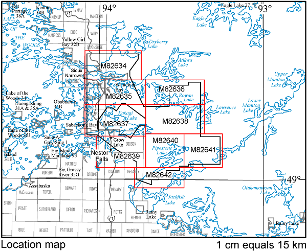
Map 82 634, Map 82 635, Map 82 636,
Map 82 637, Map 82 638, Map 82 639,
Map 82 640, Map 82 641, Map 82 642
Airborne Magnetic and Electromagnetic Surveys, Residual Magnetic Field Contours with Electromagnetic Anomalies and Keating Coefficients, Nestor Falls Area; by Ontario Geological Survey, scale 1:20 000, colour. Map prices range from $8.00 to $14.00.
1:50 000 Scale Map Sheets
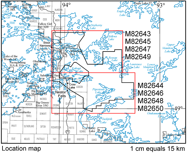
Map 82 643
Airborne Magnetic and Electromagnetic Surveys, Colour-Filled Contours of the Residual Magnetic Field and Electromagnetic Anomalies, Nestor Falls Area; by Ontario Geological Survey, scale 1:50 000, colour. $10.00.
Map 82 644
Airborne Magnetic and Electromagnetic Surveys, Colour-Filled Contours of the Residual Magnetic Field and Electromagnetic Anomalies, Nestor Falls Area; by Ontario Geological Survey, scale 1:50 000, colour. $11.00.
Map 82 645
Airborne Magnetic and Electromagnetic Surveys, Shaded Colour Image of the Second Vertical Derivative of the Residual Magnetic Field and Keating Coefficients, Nestor Falls Area; by Ontario Geological Survey, scale 1:50 000, colour. $10.00.
Map 82 646
Airborne Magnetic and Electromagnetic Surveys, Shaded Colour Image of the Second Vertical Derivative of the Residual Magnetic Field and Keating Coefficients, Nestor Falls Area; by Ontario Geological Survey, scale 1:50 000, colour. $11.00.
Map 82 647
Airborne Magnetic and Electromagnetic Surveys, Colour-Filled Contours of the EM Decay Constant and Electromagnetic Anomalies, Nestor Falls Area; by Ontario Geological Survey, scale 1:50 000, colour. $10.00.
Map 82 648
Airborne Magnetic and Electromagnetic Surveys, Colour-Filled Contours of the EM Decay Constant and Electromagnetic Anomalies, Nestor Falls Area; by Ontario Geological Survey, scale 1:50 000, colour. $11.00.
Map 82 649
Airborne Magnetic and Electromagnetic Surveys, Colour-Filled Contours of the Apparent Conductivity and Electromagnetic Anomalies, Nestor Falls Area; by Ontario Geological Survey, scale 1:50 000, colour. $10.00.
Map 82 650
Airborne Magnetic and Electromagnetic Surveys, Colour-Filled Contours of the Apparent Conductivity and Electromagnetic Anomalies, Nestor Falls Area; by Ontario Geological Survey, scale 1:50 000, colour. $11.00.
Geophysical Data Set
Geophysical Data Set 1076
Ontario Airborne Geophysical Surveys, Magnetic and Electromagnetic Data, Grid and Profile Data (ASCII and Geosoft® Formats) and Vector Data, Nestor Falls Area; by Ontario Geological Survey. The data are on 1 DVD. $25.00.
Location Map (PDF)
Earth Resources and Geoscience Mapping Section
Groundwater Studies
Groundwater Resources Studies 14
An Assessment of Subsurface Sediments in the Central Norfolk Sand Plain, Norfolk and Oxford Counties, Southern Ontario; by A.S. Marich. This digital data release contains information regarding the subsurface geology of the central Norfolk sand plain in southern Ontario. The data include graphic and written descriptions of the borehole logs, high-resolution photographs (.jpg) of logged core; tables of analytical data for select core samples; and cross sections showing interpreted sedimentary packages of the study area. Data files are available as Microsoft® Excel® 2010 workbooks (.xlsx); graphic borehole logs as .tif and hyperlinked portable document format (.pdf) files; written logs in Microsoft® Word 2003 and 2010 (.doc and .docx) and a report in portable document format (.pdf). The data are available on 1 DVD. $25.00.
Location Map (PDF)
Earth Resources and Geoscience Mapping Section
Precambrian Geology – Proterozoic and Grenville Province
Miscellaneous Release—Data 316
Geological, Geochemical and Geophysical Data Related to the Admaston–Horton Area, Grenville Province; by M. Duguet. This digital data release contains field photographs, whole-rock geochemical data, assay data, and magnetic susceptibility and scintillometer data collected as part of the Admaston–Horton areas mapping project during the summers of 2011 and 2012. Also included are previously published articles and scientific presentations related to the project. This release comprises 151 images (as .jpg files), 3 Microsoft® Excel® 2003 (.xls) workbook files and 8 documents in portable document format (.pdf). These data augment Preliminary Maps P.3783, Precambrian Geology of the Admaston Area, Grenville Province, and P.3784, Precambrian Geology of the Horton Area, Grenville Province; the geological legend for the maps is also provided. The data are available on 1 CD. $20.00.
Geophysics
Ground Geophysical Survey
Niagara Area
1:50 000 Scale Map Sheets
Map 82 590, Map 82 591, Map 82 592,
Map 82 593, Map 82 594, Map 82 595
Ground Gravity Survey, Residual of the Bouguer Anomaly, Niagara Area; by Ontario Geological Survey, scale 1:50 000, colour. Map prices range from $3.00 to $7.00.
Geophysical Data Set
Geophysical Data Set 1073
Ontario Geophysical Surveys, Ground Gravity Data, Grid and Point Data (ASCII and Geosoft® Formats) and Vector Data, Niagara Area; by Ontario Geological Survey. The data are on 1 CD. $20.00.
Airborne Geophysical Survey
Renfrew Area
1:50 000 Scale Map Sheets
Map 82 596, Map 82 597, Map 82 598,
Map 82 599, Map 82 600, Map 82 601
Airborne Magnetic and Gamma-Ray Spectrometric Surveys, Colour-Filled Contours of the Residual Magnetic Field, Renfrew Area; by Ontario Geological Survey, scale 1:50 000, colour. Map prices range from $7.00 to $12.00.
Available June 18, 2014, at 10:00 a.m. Eastern Time, or 9:00 a.m. Central Time.
Map 82 602, Map 82 603, Map 82 604,
Map 82 605, Map 82 606, Map 82 607
Airborne Magnetic and Gamma-Ray Spectrometric Surveys, Shaded Colour Image of the Second Vertical Derivative of the Residual Magnetic Field and Keating Coefficients, Renfrew Area; by Ontario Geological Survey, scale 1:50 000, colour. Map prices range from $7.00 to $12.00.
Available June 18, 2014, at 10:00 a.m. Eastern Time, or 9:00 a.m. Central Time.
Map 82 608, Map 82 609, Map 82 610,
Map 82 611, Map 82 612, Map 82 613
Airborne Magnetic and Gamma-Ray Spectrometric Surveys, Ternary Radioelement Image, Renfrew Area; by Ontario Geological Survey, scale 1:50 000, colour. Map prices range from $9.00 to $13.00.
Available June 18, 2014, at 10:00 a.m. Eastern Time, or 9:00 a.m. Central Time
Geophysical Data Set
Geophysical Data Set 1074
Ontario Airborne Geophysical Surveys, Magnetic and Gamma-Ray Spectrometric Data, Grid and Profile Data (ASCII and Geosoft® Formats) and Vector Data, Renfrew Area; by Ontario Geological Survey. The data are on 1 DVD. $25.00.
Available June 18, 2014, at 10:00 a.m. Eastern Time, or 9:00 a.m. Central Time.
Airborne Geophysical Survey
Eastern Ontario Area
1:50 000 Scale Map Sheets
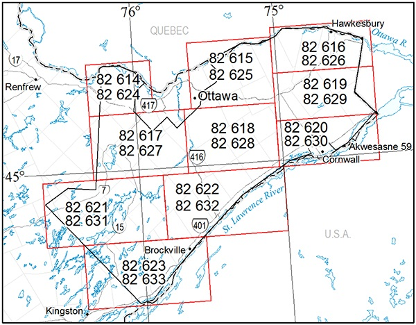
Map 82 614, Map 82 615, Map 82 616,
Map 82 617, Map 82 618, Map 82 619,
Map 82 620, Map 82 621, Map 82 622, Map 82 623
Airborne Magnetic Survey, Colour-Filled Contours of the Residual Magnetic Field, Eastern Ontario Area; by Ontario Geological Survey, scale 1:50 000, colour. Map prices range from $6.00 to $13.00.
Map 82 624, Map 82 625, Map 82 626,
Map 82 627, Map 82 628, Map 82 629,
Map 82 630, Map 82 631, Map 82 632, Map 82 633
Airborne Magnetic Survey, Shaded Colour Image of the First Vertical Derivative of the Residual Magnetic Field and Keating Coefficients, Eastern Ontario Area; by Ontario Geological Survey, scale 1:50 000, colour. Map prices range from $7.00 to $13.00.
Geophysical Data Set
Geophysical Data Set 1075
Ontario Airborne Geophysical Surveys, Magnetic Data, Grid and Profile Data (ASCII and Geosoft® Formats) and Vector Data, Eastern Ontario Area; by Ontario Geological Survey. The data are on 1 DVD. $25.00.
Erratum
In Open File Report 6298, The Rex–Werner–Separation Lakes Area High-Density Lake Sediment and Water Geochemical Survey, Northwestern Ontario (released April 8, 2014), an error in a location has been noted. On page 40, for Anomalous Area 14, site 10-RDD-1487, the UTM co-ordinates are incorrect. The correct UTM co-ordinates are 389503 mE, 5545420 mN.
This error has been corrected and a replacement report is available for those clients who purchased Open File Report 6298 with the incorrect co-ordinates. Please contact Publication Sales and the replacement report will be sent to you free of charge. Alternatively, you may download the corrected file (OFR6298) from our GeologyOntario website
We regret any inconvenience this error may have caused.
Location Map (PDF)
Earth Resources and Geoscience Mapping Section
Precambrian Geology – Northeastern Ontario
Preliminary Map P.3786
Precambrian Geology of Thorneloe and Price Townships; by S. Préfontaine, scale 1:20 000, colour. $13.00.
Available April 15, 2014, at 10:00 a.m. Eastern Time, or 9:00 a.m. Central Time.
Precambrian Geology – Northwestern Ontario
Preliminary Map P.3776
Precambrian Geology of Aldina Township; by R.W.D. Lodge, scale 1:20 000, colour. $5.00.
Available April 8, 2014, at 10:00 a.m. Eastern Time, or 9:00 a.m. Central Time.
Preliminary Map P.3777
Precambrian Geology of Minnitaki Lake, Southeast Bay Area; by S.R. Meade, scale 1:20 000, colour. $10.00.
Available April 8, 2014, at 10:00 a.m. Eastern Time, or 9:00 a.m. Central Time.
Precambrian Geology – Proterozoic and Grenville Province
Preliminary Map P.3778
Precambrian Geology of Morin and Otter Townships, Southern and Superior Provinces; by C.A. Gordon, scale 1:20 000, colour. $10.00.
Available April 15, 2014, at 10:00 a.m. Eastern Time, or 9:00 a.m. Central Time.
Preliminary Map P.3779
Precambrian Geology of Varley Township, Southern and Superior Provinces; by D. Lewis, D. Sprague and N. Szumylo, scale 1:20 000, colour. $5.00.
Available April 15, 2014, at 10:00 a.m. Eastern Time, or 9:00 a.m. Central Time.
Preliminary Map P.3783
Precambrian Geology of the Admaston Area, Grenville Province; by M. Duguet, S.J. Magnus and L.M. Ratcliffe, scale 1:20 000, colour. $16.00.
Available April 15, 2014, at 10:00 a.m. Eastern Time, or 9:00 a.m. Central Time.
Preliminary Map P.3784
Precambrian Geology of the Horton Area, Grenville Province; by M. Duguet, S.J. Magnus and L.M. Ratcliffe, scale 1:20 000, colour. $17.00.
Available April 15, 2014, at 10:00 a.m. Eastern Time, or 9:00 a.m. Central Time.
Miscellaneous Release—Data 311
Geological, Geochemical, Geophysical and Petrographic Data Related to a Study of Plutons Intruded circa 1090 to 1065 Ma in the Southeastern Central Metasedimentary Belt, Grenville Province; by J.A. Cutts. This digital data release contains photographs of outcrops, hand samples and thin sections; whole rock and isotope geochemical data; and magnetic susceptibility and scintillometer data collected between May 2010 and October 2013 as part of a study of the plutons intruded circa 1090 to 1065 Ma in the southeastern Central Metasedimentary Belt. This project was supported by the Ontario Geological Survey and constitutes and in part fulfills the requirements of an MSc thesis at Carleton University by the author. This release consists of 155 images as .jpg files, 17 scanning electron microscope cathodoluminescence images as .tif files, 6 Microsoft® Excel® 2010 (.xlsx) files, and 5 supporting documents in portable document format (.pdf). The data are available on 1 CD. $20.00.
Available April 8, 2014, at 10:00 a.m. Eastern Time, or 9:00 a.m. Central Time.
Aggregate Resources and Industrial Minerals
Aggregate Resources Inventory Paper 159
Aggregate Resources Inventory of the County of Oxford and the County of Brant, Southern Ontario; by D.J. Rowell. 107p. $26.00.
Available April 15, 2014, at 10:00 a.m. Eastern Time, or 9:00 a.m. Central Time.
Aggregate Resources Inventory Paper 163—Revision 2
Aggregate Resources Inventory of Dufferin County, Southern Ontario; by MacNaughton Hermsen Britton Clarkson Planning Limited, White LandScience, Robinson Consultants, D.J. Rowell and F.R. Brunton. 64p. $16.00.
Available April 15, 2014, at 10:00 a.m. Eastern Time, or 9:00 a.m. Central Time.
Surficial Mapping and Sampling
Preliminary Map P.3695
Surficial Geology of the Wunnummin Lake Area Northeast, Northern Ontario; by P.J. Barnett and K.H. Yeung, scale 1:100 000, colour. $7.00.
Available April 8, 2014, at 10:00 a.m. Eastern Time, or 9:00 a.m. Central Time.
Preliminary Map P.3708
Surficial Geology of the Wunnummin Lake Area Southeast, Northern Ontario; by P.J. Barnett and K.H. Yeung, scale 1:100 000, colour. $7.00.
Available April 8, 2014, at 10:00 a.m. Eastern Time, or 9:00 a.m. Central Time.
Preliminary Map P.3709
Surficial Geology of the Lansdowne House Area Southwest, Northern Ontario; by P.J. Barnett and K.H. Yeung, scale 1:100 000, colour. $7.00.
Available April 8, 2014, at 10:00 a.m. Eastern Time, or 9:00 a.m. Central Time.
Preliminary Map P.3723
Surficial Geology of the Fort Hope Area Northwest, Northern Ontario; by P.J. Barnett and K.H. Yeung, scale 1:100 000, colour. $7.00.
Available April 8, 2014, at 10:00 a.m. Eastern Time, or 9:00 a.m. Central Time.
Surficial Geochemistry
Open File Report 6298
Rex–Werner–Separation Lakes Area High-Density Lake Sediment and Water Geochemical Survey, Northwestern Ontario; by H.E. Burke and R.D. Dyer. Geochemical data are available as Miscellaneous Release—Data 314 (see below). 231p. $23.00.
Available April 8, 2014, at 10:00 a.m. Eastern Time, or 9:00 a.m. Central Time.
Miscellaneous Release—Data 314
Lake Sediment and Water Geochemical Data of the Rex–Werner–Separation Lakes Area, Northwestern Ontario; by H.E. Burke and R.D. Dyer. Lake sediment and water geochemical data and lake water quality (limnological) data, including quality control data, collected from a survey of 1721 sites in the Rex, Werner and Separation lakes area north of Minaki, are being released in conjunction with Open File Report 6298. The data are available as Microsoft® Excel® 2010 (.xlsx) format files on 1 CD. $20.00.
Available April 8, 2014, at 10:00 a.m. Eastern Time, or 9:00 a.m. Central Time.
Groundwater Studies
Miscellaneous Release—Data 313
Interactive Graphic Borehole Logs and Hydrostratigraphic Correlations, Orangeville–Fergus Three-Dimensional Study Area; by A.K. Burt and J.E. Chartrand. This release contains borehole information from drilling programs conducted in the Orangeville–Fergus area of southwestern Ontario in 2008, 2009 and 2010. A total of 43 PQ (8.5 cm) diameter continuous cores were obtained using a mud rotary drill. The cores were logged, photographed and sampled on site. This information, supplemented with laboratory data (pebble counts, particle size analysis and carbonate analysis), was used to classify the sediments into a series of hydrostratigraphic units. The data consist of detailed graphic logs presented on interactive and printable maps accessible via a hyperlinked portable document format (PDF) file, best accessed and viewed using Adobe® Reader®. This release also contains a slideshow of drilling operations and background information, including the conceptual geologic model and descriptions of the hydrostratigraphic units. Also included in this release are the complete data set, as Microsoft® Excel® 2003 and Microsoft® Access® 2003 files, and a fully functioning ESRI® ArcGIS® project containing files used to build the hydrostratigraphic map. This release is a preliminary product designed to make information available to clients prior to the completion of the wireframe surfaces, three-dimensional block model and detailed Groundwater Resources Study (GRS). Available on 1 CD. $20.00.
Available April 15, 2014, at 10:00 a.m. Eastern Time, or 9:00 a.m. Central Time.
Resident Geologist Program
Open File Report 6291
Report of Activities 2013, Resident Geologist Program, Red Lake Regional Resident Geologist Report: Red Lake and Kenora Districts; by A.F. Lichtblau, C. Ravnaas, C.C. Storey, R.D. Tuomi, R.L. Debicki, A.C. Wilson, P. Moses, S. Ali, J. Wetendorf and T. Jeffries. 93p. $22.00.
Available April 8, 2014, at 10:00 a.m. Eastern Time, or 9:00 a.m. Central Time.
Open File Report 6292
Report of Activities 2013, Resident Geologist Program, Thunder Bay North Regional Resident Geologist Report: Thunder Bay North District; by G.D. White, R.M. Cundari, R.D. Tuomi, M.R. Brunelle, R.L. Debicki, P. Moses, A.C. Wilson and S.E. Zurevinski. 63p. $17.00.
Available April 8, 2014, at 10:00 a.m. Eastern Time, or 9:00 a.m. Central Time.
Open File Report 6293
Report of Activities 2013, Resident Geologist Program, Thunder Bay South Regional Resident Geologist Report: Thunder Bay South District; by M.A. Puumala, D.A. Campbell, R.D. Tuomi, R.L. Debicki, A.C. Wilson, P. Moses and M.R. Brunelle. 71p. $17.00.
Available April 8, 2014, at 10:00 a.m. Eastern Time, or 9:00 a.m. Central Time.
Open File Report 6294
Report of Activities 2013, Resident Geologist Program, Timmins Regional Resident Geologist Report: Timmins and Sault Ste. Marie Districts; by B.T. Atkinson, P. Bousquet, A. Pace, R.L. Debicki, C.M. Daniels, A.C. Wilson, S.E. Halet, S. Beauchamp and R. McMillan. 121p. $25.00
Available April 15, 2014, at 10:00 a.m. Eastern Time, or 9:00 a.m. Central Time.
Open File Report 6295
Report of Activities 2013, Resident Geologist Program, Kirkland Lake Regional Resident Geologist Report: Kirkland Lake and Sudbury Districts; by D.L. Guindon, D.G. Farrow, C.M. Daniels, R.L. Debicki, A.C. Wilson, S.E. Halet, L.A. Bardeggia and N. Sabiri. 86p. $15.00
Available April 15, 2014, at 10:00 a.m. Eastern Time, or 9:00 a.m. Central Time.
Open File Report 6296
Report of Activities 2013, Resident Geologist Program, Southern Ontario Regional Resident Geologist Report: Southeastern Ontario and Southwestern Ontario Districts, and Petroleum Operations; by P.J. Sangster, P.S. LeBaron, S.J. Charbonneau, D.A. Laidlaw, R.L. Debicki, A.C. Wilson, S.E. Halet, T.R. Carter and L. Fortner. 83p. $15.00
Available April 15, 2014, at 10:00 a.m. Eastern Time, or 9:00 a.m. Central Time.
Miscellaneous
The Ministry of Northern Development and Mines has prepared supplements for Miscellaneous Papers (MP) 177 and 178 to include publications released in 2013. Also, the Bedrock Geology Index to Maps and Surficial Geology Index to Maps are updated to include all maps released in 2013. Miscellaneous Paper 177 (Supplement 2011–2013), MP 178 (Supplement 2011–2013) and the maps are available as free downloads or can be purchased in hard-copy format from Publication Sales.
Miscellaneous Paper (MP) 177 (Supplement 2011–2013)
Index to Published Reports, Maps and Digital Data, 2011–2013
This report provides a listing of all publications released since the publication of MP 177 (Supplement 1993–2010), Index to Published Reports, Maps and Digital Data, 1993–2010. Publications are listed by series only. 53p. $4.00.
Available April 8, 2014, at 10:00 a.m. Eastern Time, or 9:00 a.m. Central Time.
Miscellaneous Paper (MP) 178 (Supplement 2011–2013)
Geographic Index to Published Reports, Maps and Digital Data, 2011–2013
This report provides a listing of all publications released since the publication of MP 178 (Supplement 1994–2010), Geographic Index to Published Reports, Maps and Digital Data, 1994–2010. Publications are indexed by geographic areas, which include National Topographic System (NTS) areas, geographic townships and Ministry of Natural Resources (MNR) “areas”. Publications are listed under the main geographic areas where they are located. 56p. $4.00.
Available April 8, 2014, at 10:00 a.m. Eastern Time, or 9:00 a.m. Central Time.
Index to Maps, Bedrock Geology, 1991–2013; produced by the Publication Services Section, scale 1:1 000 000, colour. Available as a set of 4 maps. $12.00.
Available April 8, 2014, at 10:00 a.m. Eastern Time, or 9:00 a.m. Central Time.
Index to Maps, Surficial Geology, 1991–2013; produced by the Publication Services Section, scale 1:1 000 000, colour. Available as a set of 4 maps. $12.00.
Available April 8, 2014, at 10:00 a.m. Eastern Time, or 9:00 a.m. Central Time.
Mineral Deposit Inventory—2014
The Ministry of Northern Development and Mines is releasing an updated version of the Mineral Deposit Inventory (MDI). This database is an inventory of mineral deposits in the province of Ontario and supersedes previous MDI releases. Originally compiled in the early 1970s by the Resident Geologist Program (RGP), the database is continually being reviewed and updated by RGP staff. There are approximately 40 new records and 800 updated records in the 2014 release.
Each MDI record provides all or some of the following information: deposit name(s), location, status (e.g., occurrence, prospect, producer, past producer), commodities, character/classification, geological structure, lithology, minerals and mineral alteration, geochemistry, exploration history, and production and reserve data where available. Also included are notes on deposit visits and references to additional publications related to the deposit.
MDI data are provided in 2 formats in this release: 1) a relational database, and 2) MDI provincial coverage in a geospatial GIS (ESRI® shape file) format. The complete MDI relational database is provided in Microsoft® Access® 2010 (.mdb) format. For the geospatial data, basic mineral deposit information (MDI number, commodities and property status) is provided. Geospatial data are provided in North American Datum 1983 (NAD83) geographic co-ordinate system using Geodetic Reference System 1980 (GRS80).
The database is available on 1 CD. $20.00.
Available April 8, 2014, at 10:00 a.m. Eastern Time, or 9:00 a.m. Central Time.
Erratum
In Miscellaneous Release—Data 9 – Revised, Lake Sediment Geochemical Survey of the Cow River Area, Batchewana Greenstone Belt (released March 5, 2007), the location co-ordinates for the samples listed in file “COWRIVER.xls” were converted to latitude and longitude from NAD27 UTM co-ordinates in an incorrect grid zone resulting in an error of 6° longitude. Additionally, there was a typographic error in the UTM location of sample A5-126: the correct location is 297075E 5239225N.
These errors have been corrected and a replacement CD is available for those clients who purchased the CD with the incorrect file. Please contact Publication Sales and the replacement CD will be sent to you free of charge. Alternatively, the corrected version of MRD 9 – Revised is available to download for free from the GeologyOntario application at MRD009-REV.
We regret any inconvenience these errors may have caused.
Announcement
2014 NW and NE Ontario Mines and Minerals Symposia
Northwestern
April 8 – 9
“Perseverence in Challenging Times”
Valhalla Inn, Thunder Bay
Northeastern
April 15 – 16
“Focusing on the Future”
McIntyre Arena, Timmins
Once again, staff of the Mines and Minerals Division, Ministry of Northern Development and Mines will be participating in the annual Northwestern and Northeastern Ontario Mines and Minerals Symposia in Thunder Bay and Timmins, respectively. Ministry staff will be presenting posters and talks on recent field work, geoscience projects and initiatives, and summaries of current exploration activities in Ontario. The symposia provide an excellent forum for members of Ontario’s prospector, mining and exploration community to gather for the exchange of geoscience and exploration information. For registration and other information about the Northwestern and Northeastern symposia, please visit the Ontario Prospectors Association Web site at http://www.ontarioprospectors.com/ and the Porcupine Prospectors and Developers Association Web site at http://www.porcupineprospectors.com/events/2014-northeastern-ontario-mines-minerals-symposium/, respectively.
Location Map (PDF)
2013 Publications
Earth Resources and Geoscience Mapping Section
Geophysics
Airborne Geophysical Survey
Latchford (Banting–Chambers) Area—Purchased Data
1:20 000 Scale Map Sheets
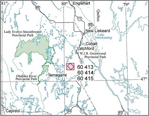
Map 60 413
Airborne Magnetic and Electromagnetic Surveys, Colour-Filled Contours of the Gradient-Enhanced Residual Magnetic Field and Electromagnetic Anomalies, Latchford (Banting–Chambers) Area—Purchased Data; by Ontario Geological Survey, scale 1:20 000, colour. $4.00.
Map 60 414
Airborne Magnetic and Electromagnetic Surveys, Colour-Filled Contours of the EM Decay Constant and Electromagnetic Anomalies, Latchford (Banting–Chambers) Area—Purchased Data; by Ontario Geological Survey, scale 1:20 000, colour. $4.00.
Map 60 415
Airborne Magnetic and Electromagnetic Surveys, Shaded Colour Image of the Second Vertical Derivative of the Gradient-Enhanced Residual Magnetic Field and Keating Coefficients, Latchford (Banting–Chambers) Area—Purchased Data; by Ontario Geological Survey, scale 1:20 000, colour. $4.00.
Airborne Geophysical Survey
Latchford Area—Purchased Data
1:50 000 Scale Map Sheets
Map 60 416
Airborne Magnetic Survey, Colour-Filled Contours of the Gradient-Enhanced Residual Magnetic Field, Latchford Area—Purchased Data; by Ontario Geological Survey, scale 1:50 000, colour. $9.00.
Map 60 417
Airborne Magnetic Survey, Colour-Filled Contours of the Gradient-Enhanced Residual Magnetic Field, Latchford Area—Purchased Data; by Ontario Geological Survey, scale 1:50 000, colour. $8.00.
Map 60 418
Airborne Magnetic Survey, Shaded Colour Image of the Second Vertical Derivative of the Gradient-Enhanced Residual Magnetic Field and Keating Coefficients, Latchford Area—Purchased Data; by Ontario Geological Survey, scale 1:50 000, colour. $9.00.
Map 60 419
Airborne Magnetic Survey, Shaded Colour Image of the Second Vertical Derivative of the Gradient-Enhanced Residual Magnetic Field and Keating Coefficients, Latchford Area—Purchased Data; by Ontario Geological Survey, scale 1:50 000, colour. $8.00.
Geophysical Data Set
Geophysical Data Set 1242
Ontario Airborne Geophysical Surveys, Magnetic and Electromagnetic Data, Grid and Profile Data (ASCII and Geosoft® Formats) and Vector Data, Latchford Area—Purchased Data; by Ontario Geological Survey. The data are on 1 DVD. $25.00.
Location Map (PDF)
Miscellaneous
Open File Report 6290
Summary of Field Work and Other Activities, 2013; by Ontario Geological Survey, 584p. $12.00.
The Contents may be viewed at the Summary of Field Work and Other Activitives, 2013 page.
Errata
In Miscellaneous Release—Data 300, The Montclerg Gold Deposit, Abitibi Greenstone Belt, East Timmins Region, Ontario: Stratigraphy, Lithogeochemistry, Mineralization and Nature of Vein Fluids (released October 1, 2013), 2 errors have been noted. On page 104 of the report, The Montclerg gold deposit, Abitibi greenstone belt, east Timmins region, Ontario: Stratigraphy, lithogeochemistry, mineralization and nature of vein fluids—Discover Abitibi Initiative, in the last paragraph, the last 2 sentences starting with “In the Lightning Zone of the Holloway Mine, which...” are replaced with the 3 sentences shown below. The reference for Berger and Amelin (1999) has been added to “References”.
“...In the Lightning Zone of the Holloway Mine, much of the gold is hosted by a ferrodacitic unit (Ropchan et al. 2002; Barrett 2011a). However, this is less surprising an occurrence than rhyolite-hosted gold, as ferrodacite should chemically make a better host rock as a result of its notably higher Fe/Mg ratio. Although an age has not been determined for the ferrodacite unit, Berger and Amelin (1999) reported an age of 2716.3±1.5 Ma for a Kidd–Munro assemblage intermediate tuff-breccia located approximately 2 km northeast of the Holloway Mine.”
These errors have been corrected and a replacement CD is available for those clients who purchased the CD with the incorrect files. Please contact Publication Sales and the replacement CD will be sent to you free of charge. Alternatively, you may download the corrected files (MRD 300) from our GeologyOntario website.
We regret any inconvenience these errors may have caused.
Announcement
Ontario Exploration and Geoscience Symposium
November 5 and 6, 2013, United Steelworkers Local 6500 Hall, 66 Brady Street, Sudbury, Ontario
Once again, staff of the Mines and Minerals Division, Ministry of Northern Development and Mines, will be participating in the annual Ontario Prospectors Association’s (OPA), Ontario Exploration and Geoscience Symposium (OEGS) in Sudbury. The symposium provides an excellent forum for members of Ontario’s mining and exploration community to gather for the exchange of geoscience and exploration information. Ministry staff will be presenting posters and talks on recent field work, geoscience projects and initiatives, and summaries of current exploration activities in Ontario. The symposium will include presentations on recent exploration throughout Ontario. For more information about the Ontario Exploration and Geoscience Symposium, please visit the OPA web site.
Discover Abitibi
The Discover Abitibi Initiative is a regional, cluster economic development project providing geoscientific investigations of the Western Abitibi Greenstone Belt in Ontario. The project has brought together funding partners FedNor, Northern Ontario Heritage Fund Corporation and the private sector to complete projects, which will further stimulate exploration activity and mining in this prolific belt. To support this successful endeavor, user stakeholders have provided the project ideas. The technical expertise to evaluate the projects has been provided by volunteers on the technical and management committees. For further information regarding this initiative, contact the Timmins Economic Development Corporation by email at tedc@timmins.ca.
Miscellaneous Release—Data 299
Geological Mapping and Compilation of the Burntbush–Normétal Volcanic Belt, Abitibi Greenstone Belt, Ontario–Quebec; by T.J. Barrett, J.A. Ayer, J.C. Ordóñez-Calderón and M.A. Hamilton. This release presents the results of a collaborative project between the Discover Abitibi Initiative and the Ontario Geological Survey to improve the geological database and understanding of the Burntbush (Ontario) to Normétal (Quebec) portion of the Abitibi greenstone belt. A report outlines the project methods and summarizes the results of the project: to define the ages and compositions of the major stratigraphic and intrusive units of the Burntbush–Normétal volcanic belt, to determine their structural setting, and to determine the relation of massive sulphide and local gold mineralization to these units. The following information is provided: field data collected from geological mapping the Burntbush and Normétal areas with a detailed structural analysis of the Burntbush area; 500 whole-rock lithogeochemical analyses, 11 U/Pb zircon ages, and 15 neodymium-hafnium isotope analyses on whole rock (among which 10 samples were chosen for hafnium isotope analyses on zircon fractions) from along the length of the belt; 25 sulphur isotope analyses from the Normétal area; and petrographic examination of 50 samples. In addition, 1077 field photographs and 204 thin-section photomicrographs of samples from the Burntbush and the Normétal areas; and 382 core photos from the Normétal area are included. Location data are provided in the Universal Transverse Mercator (UTM) projection and grid system, Zone 17, North American Datum 1983 (NAD83). Report files are provided in portable document format (.pdf), analytical results as Microsoft® Excel® 2003 or 2010 (.xls or .xlsx) and photographs as .jpg format files. The files are provided on 1 DVD. $25.00.
Miscellaneous Release—Data 300
The Montclerg Gold Deposit, Abitibi Greenstone Belt, East Timmins Region, Ontario: Stratigraphy, Lithogeochemistry, Mineralization and Nature of Vein Fluids; by T.J. Barrett, G.C. Wilson, M.A. Hamilton, D.J. Kontak, M. Burns, J.A. Ayer and G.M. Stott. This release provides the results of a study, undertaken as part of the Discover Abitibi Initiative, on the Montclerg gold deposit located east-northeast of Timmins. A report (portable document format (.pdf) file) presents the results of a detailed lithogeochemical and petrographic study of the host rocks of the Montclerg Zone, and new U/Pb zircon ages, as well as stable isotopic (oxygen, sulphur, carbon) data, electron microprobe data and fluid inclusion data on the veins minerals. Data were also obtained for comparative purposes from the Canamax Zone (400 to 500 m to the south) and the Clavos Mine (9 km to the west-southwest). Supporting data tables are provided as Microsoft® Excel® 2010 (.xlsx) format files. Location data are provided in the Universal Transverse Mercator (UTM) projection and grid system, Zone 17, North American Datum 1983 (NAD83). The files are provided on 1 CD. $20.00.
Location Map (PDF)
Earth Resources and Geoscience Mapping Section
Precambrian Geology – Northwestern Ontario
Miscellaneous Release—Data 310
Mineralogical Analyses of Ijolites and Related Rocks, Mesoproterozoic Prairie Lake Carbonatite Complex, Northwestern Ontario; by S.E. Zurevinski and D.C. Crabtree. This data release comprises the data set of electron microprobe analyses of garnet, clinopyroxene, nepheline, magnetite, wollastonite and biotite from a variety of ijolites and related rocks from the Prairie Lake Carbonatite Complex. The complex is part of a Mesoproterozoic Midcontinent Rift-related alkalic rock – carbonatite petrologic province north of Lake Superior, associated with the northern extension of the Trans Superior Tectonic Zone. The collection and analysis of these samples were part of a study of the Prairie Lake Carbonatite Complex, which was published as Ontario Geological Survey, Study 46 by R.P. Sage in 1987, but the orbicular ijolite data had never been published. It is the only known occurrence of orbicular ijolite in the world. The data are available as 10 worksheets in 1 Microsoft® Excel® 2010 (.xlsx) file, on 1 CD. $20.00.
Precambrian Geology – Proterozoic and Grenville Province
Preliminary Map P.3774
Precambrian Geology, Raglan Hills Metagabbro and Environs, Grenville Province; by S.J. Magnus, scale 1:20 000, colour. Geological, geochemical, geophysical and petrographic data available as Miscellaneous Release—Data 309 (see below). $12.00.
Miscellaneous Release—Data 309
Geological, Geochemical, Geophysical and Petrographic Data from the Raglan Hills Area, Central Metasedimentary Belt, Grenville Province; by S.J. Magnus. This release contains field notes, outcrop photographs, whole rock and isotope geochemical data, magnetic susceptibility data and scintillometer data collected as part of the Raglan Hills mapping project between August 2011 and September 2012, and all related presentations to the public by the author. The Raglan Hills mapping project was supported through the Ontario Geological Survey–Carleton University Graduate Mapping School Program; these data are part of an unpublished Master of Science (MSc) thesis. This release comprises 1064 images (as .jpg files), 15 Microsoft® Excel® 2010 (.xlsx) workbook files and 10 documents in portable document format (.pdf). The data are available on 1 DVD. $25.00.
Aggregate Resources and Industrial Minerals
Aggregate Resources Inventory Paper 175
Aggregate Resources Inventory of the County of Perth, Southern Ontario; by D.J. Rowell. 75p. $21.00.
Paleozoic Geology and Energy Studies
Open File Report 6279
Gas Assessment of the Devonian Kettle Point Formation; by C. Béland Otis. Geological, geochemical and geophysical data available as Miscellaneous Release—Data 304 (see below). 63p. $9.00.
Miscellaneous Release—Data 304
Geological, Geochemical and Geophysical Data from the Kettle Point Formation Drilling Program, Southern Ontario; by C. Béland Otis. This data release contains geochemical and geophysical data collected as part of the Kettle Point Formation drilling program that took place in March and April 2010, and is being released in conjunction with Open File Report 6279, Gas Assessment of the Devonian Kettle Point Formation. The release consists of 13 geochemistry tables as Microsoft® Excel® 2003 (.xls) files, 10 geophysical log (.tif) files and 13 additional geophysical logs as Log ASCII Standard (.las) files. Available on 1 CD. $20.00.
Erratum
In the Ontario Drill Hole Database—2013 (released June 4, 2013), the .dbf file for the shape file is missing attribute data. A new .dbf file has been created. These errors have been corrected and a replacement version of the database is available. If you purchased this product on CD, please contact Publication Sales and a replacement CD will be sent to you free of charge. Alternatively, the corrected version of Ontario Drill Hole Database—2013 is also available to download from the OGSEarth page (ODHD).
We regret any inconvenience this error may have caused.
Location Map (PDF)
View Publications Release Notice — June 4, 2013. Avis de parution — Le 4 juin 2013 in a larger map
Earth Resources and Geoscience Mapping Section
Precambrian Geology – Northwestern Ontario
Miscellaneous Release—Data 306
Establishing Regional Geodynamic Settings and the Metallogeny of Volcanogenic Massive Sulphide Mineralization of Greenstone Belt Assemblages (Circa 2720 Ma) of the Wawa Subprovince via Geochemical Comparisons; by R.W.D. Lodge and J.E. Chartrand. This geographic information system (GIS)-based release covers 3 study areas—the Shebandowan, Winston Lake and Manitouwadge greenstone belts—in the Wawa Subprovince and comprises field observations, geochemical data and geochemical diagram images, and photographs hyperlinked to the geodatabase for the corresponding study area. Part of a doctoral (PhD) thesis study, the data provide characterizations of the greenstone belt assemblages (circa 2720 Ma) of the Wawa Subprovince, which were used to determine the petrogenetic and geodynamic controls on the base metal metallogeny in this region. The study was supported by the Ontario Geological Survey and by the Mineral Exploration Research Centre of Laurentian University through the Ontario Geological Survey–Laurentian University Graduate Mapping School Program. Presentation of the data for the 3 study areas are provided as GIS project files (ESRI® ArcGIS® 10.1 and 9.3 project (.mxd) files and ESRI® ArcGIS® 9.3 geodatabase (.gdb) project files); also provided are associated shapefile (.shp) format files for geology, geochemical data, isotope data and tectonic affinity. Field observations with descriptions of lithofacies, alteration and mineralization, and the photograph descriptions are provided within the GIS project files. This release also provides 400 geochemical, 14 geochronologic and 140 isotopic analyses, and 37 Mineral Deposit Inventory records (9 Microsoft® Excel® 2003 (.xls) and 2010 (.xlsx) format files); more than 4300 photographs (field, sample slabs, thin sections) and images of various plots (.jpg format files); and supporting documentation (portable document format (.pdf) file). Available on 1 DVD. $25.00.
Precambrian Geology – Proterozoic and Grenville Province
Miscellaneous Release—Data 308
New and Compiled Whole-Rock Geochemical and Isotope Data of Midcontinent Rift–Related Rocks, Thunder Bay Area; by R.M. Cundari, C.F.J. Carl, P. Hollings and M.C. Smyk. This digital data release includes newly acquired whole-rock and trace element analyses for 114 bedrock samples of mafic igneous rocks related to the Mesoproterozoic Midcontinent Rift. The release also includes a compilation of geochemical data for Midcontinent Rift–related rocks compiled from previously released digital data sets (Miscellaneous Release—Data (MRD) 114, 132, 133, 146, 147, 190, 194 and 261—Revised) totalling 2358 spatially referenced data points with geochemical analyses, in addition to the 114 new samples. Additionally, 20 samples with Sm-Nd and Rb-Sr isotope data are also included in this release. The data presented in this publication represents the data analyzed as part of an unpublished Master of Science (MSc) thesis by the lead author at Lakehead University. The compilation, the new data and a brief overview of the referenced MRDs and analytical procedures are presented as Microsoft® Excel® 2010 (.xlsx) and portable document format (.pdf) files. The data are available on 1 CD. $20.00.
Geophysics
Ground Gravity Survey
Orangeville Area
1:50 000 Map Sheets
Map 82 588 and Map 82 589
Ground Gravity Survey, Residual of the Bouguer Anomaly, Orangeville Area; by Ontario Geological Survey, scale 1:50 000, colour. $7.00 each.
Geophysical Data Set
Geophysical Data Set 1072
Ontario Geophysical Surveys, Ground Gravity Data, Grid and Point Data (ASCII and Geosoft® Formats) and Vector Data, Orangeville Area; by Ontario Geological Survey. The data are on 1 CD. $20.00.
Aggregate Resources and Industrial Minerals
Aggregate Resources Inventory Paper 189
Aggregate Resources Inventory of the County of Lanark, Southern Ontario; by V.L. Lee. 85p. $23.00.
Surficial Mapping and Sampling
Preliminary Map P.3696
Surficial Geology of the Lansdowne House Area Northwest, Northern Ontario; by P.J. Barnett, K.H. Yeung and J.D. McCallum, scale 1:100 000, colour. $7.00.
Preliminary Map P.3697
Surficial Geology of the Lansdowne House Area Northeast, Northern Ontario; by P.J. Barnett, K.H. Yeung and J.D. McCallum, scale 1:100 000, colour. $7.00.
Preliminary Map P.3710
Surficial Geology of the Lansdowne House Area Southeast, Northern Ontario; by P.J. Barnett, K.H. Yeung and J.D. McCallum, scale 1:100 000, colour. $7.00.
Preliminary Map P.3724
Surficial Geology of the Fort Hope Area Northeast, Northern Ontario; by P.J. Barnett, K.H. Yeung and J.D. McCallum, scale 1:100 000, colour. $7.00.
Preliminary Map P.3736
Surficial Geology of the Fort Hope Area Southeast, Northern Ontario; by P.J. Barnett, K.H. Yeung and J.D. McCallum, scale 1:100 000, colour. $7.00.
Preliminary Map P.3744
Surficial Geology of the Nakina Area Northeast, Northern Ontario; by P.J. Barnett, K.H. Yeung and J.D. McCallum, scale 1:100 000, colour. $9.00.
Preliminary Map P.3767
Surficial Geology of the Nakina Area South, Northern Ontario; by P.J. Barnett, K.H. Yeung and J.D. McCallum, scale 1:100 000, colour. $7.00.
Miscellaneous
Ontario Drill Hole Database—2013
The Ministry of Northern Development and Mines is releasing an updated version of the Ontario Drill Hole Database (ODHD). This database is an inventory of drill holes in the province of Ontario. Drill hole data are compiled from assessment files on a regular basis; the Ontario Drill Hole Database is continuously updated and is released periodically on CD. This release includes drill holes for which information was received by March 31, 2013, adding more than 15 000 new drill holes since the last release (ERLIS Data Set 13—Revision 1, December 2005). A number of data and location errors have also been corrected. This release supersedes all previous releases.
The Ontario Drill Hole Database contains information for over 141 000 percussion, overburden, sonic and diamond-drill holes. Data include location, company name, company hole number, hole orientation, hole depth, and overburden depth if applicable. The presence of assay results with cutoff values for gold, silver, copper, zinc, lead, nickel and platinum group elements is noted. Source assessment file numbers are captured for cross referencing with the assessment file database (AFRI).
Data are provided in 2 formats in this release: 1) a relational database and 2) seamless ODHD provincial coverage in a geospatial GIS (ESRI® shapefile) format. The complete ODHD relational database is provided in Microsoft® Access® 2007/2010 (.accdb) format. Geospatial data are provided in North American Datum 1983 (NAD83) geographic co-ordinate system using Geodetic Reference System 1980 (GRS80).
The database is available on 1 CD. $20.00.
Location Map (PDF)
Discover Abitibi
The Discover Abitibi Initiative is a regional, cluster economic development project providing geoscientific investigations of the Western Abitibi Greenstone Belt in Ontario. The project has brought together funding partners FedNor, Northern Ontario Heritage Fund Corporation and the private sector to complete projects, which will further stimulate exploration activity and mining in this prolific belt. To support this successful endeavor, user stakeholders have provided the project ideas. The technical expertise to evaluate the projects has been provided by volunteers on the technical and management committees. For further information regarding this initiative, contact the Timmins Economic Development Corporation by email at tedc@timmins.ca.
Miscellaneous Release—Data 294
Results from the Shining Tree, Chester Township and Matachewan Gold Projects and the Northern Cobalt Embayment Polymetallic Vein Project; edited by J.A. Ayer, D.J. Kontak, R.L. Linnen and S. Lin. This release provides the results of studies—as part of the Discover Abitibi Initiative—on Archean gold mineralization in a number of different areas of the southern Abitibi greenstone belt and a study of Proterozoic vein mineralization. This data release consists of 3 sections, each co-authored by the research groups in the various areas: Section 1, Shining Tree and Gowganda Archean Gold Study and Northern Cobalt Embayment Proterozoic Vein Study, by J.A. Ayer, T.J. Barrett, R.A. Creaser, M.A. Hamilton, B. Lafrance and G.M. Stott; Section 2, Geological and Geochemical Studies of the Côté Lake Au(-Cu) Deposit Area, Chester Township, by D.J. Kontak, R.A. Creaser and M.A. Hamilton; Section 3, Synthesis of the Structure, Petrology, Geochronology and Geochemistry of the Young–Davidson Gold Deposit and Surrounding Area, by R.L. Linnen, S. Lin, J. Zhang, R.D. Martin, N. Naderi, D.W. Davis, M.A. Hamilton, R.A. Creaser, B.R. Berger, N.R. Banerjee, B.A. Wing and C. Wu. Each section includes comprehensive results based on field studies and various analytical techniques including U/Pb zircon and Re/Os geochronology, lithogeochemistry, petrographic examination of thin sections, scanning electron microscope analysis of alteration and ore mineralogy, and stable isotopes (oxygen, sulphur and carbon) as well as detailed geological and structural mapping. This information has been used to provide syntheses of the setting, timing and characteristics of Archean gold mineralization in the study areas. Location data are provided in the Universal Transverse Mercator (UTM) projection and grid system, Zone 17, North American Datum 1983 (NAD83). Report files are provided in portable document format (.pdf) and analytical results, as Microsoft® Excel® (.xls and/or .xlsx) files. Available on 1 CD. $20.00.
Earth Resources and Geoscience Mapping Section
Precambrian Geology – Northeastern Ontario
Preliminary Map P.3771
Precambrian Geology of Nursey Township; by L. Robichaud, S. Préfontaine and S.J. Magnus, scale 1:20 000, colour. $5.00.
Preliminary Map P.3772
Precambrian Geology of Midlothian Township; by S. Préfontaine and L. Robichaud, scale 1:20 000, colour. $7.00.
Precambrian Geology – Proterozoic and Grenville Province
Preliminary Map P.3773
Precambrian Geology of Albanel Township, Southern and Superior Provinces; by D. Lewis, scale 1:20 000, colour. $7.00.
Preliminary Map P.3775
Precambrian Geology, Pecors–Whiskey Area; by R.M. Easton, scale 1:20 000, colour. This map also includes a detailed inset map, at a scale of 1:10 000, and marginal notes. Geological, geochemical and geophysical data from this study area are available as Miscellaneous Release—Data 305 (see below). $23.00.
Miscellaneous Release—Data 305
Geological, Geochemical and Geophysical Data from the Elliot Lake Area, Southern and Superior Provinces, Ontario; by R.M. Easton. This release contains field photographs, whole-rock chemistry, isotope geochemistry, assay, geochronology, magnetic susceptibility and scintillometer data collected as part of the Pecors–Whiskey mapping project (Project Unit 09-004) and the East Bull Lake–Agnew intrusions compilation project (Project Unit 07-002), which were collected between June 2008 and December 2012. This release consists of 395 photographs (as .jpg files), 10 Microsoft® Excel® 2003 (.xls) workbooks and 16 documents (portable document format (.pdf) files). These data augment Preliminary Map P.3775, Precambrian Geology, Pecors–Whiskey Area; the marginal notes and the geological legend from the map are also provided. The data are available on 1 DVD. $25.00.
Aggregate Resources and Industrial Minerals
Aggregate Resources Inventory Paper 188
Aggregate Resources Inventory of the County of Simcoe, Southern Ontario; by D.J. Rowell. 94p. $34.00.
Surficial Mapping and Sampling
Preliminary Map P.3769
Quaternary Geology, Detour Lake Area, Northeastern Ontario; by C. Gao, scale 1:50 000, colour. $11.00.
Preliminary Map P.3770
Quaternary Geology, Burntbush Area, Northeastern Ontario; by C. Gao, scale 1:100 000, colour. $9.00.
Groundwater Studies
Miscellaneous Release—Data 303
Results of the 2008, 2009 and 2010 Drilling Programs in the Orangeville–Fergus Area of Southwestern Ontario; by A.K. Burt and J.L. Webb. This release contains borehole information resulting from the 2008, 2009 and 2010 drilling programs conducted within the Orangeville–Fergus area of southwestern Ontario. A total of 43 PQ (8.5 cm) diameter continuous cores were obtained using a Christensen mud rotary drill. The cores were logged, sampled and photographed on site. The data consist of detailed written logs, graphic logs, analytical data (pebble counts, particle size analysis and carbonate analysis) and core photos. The 43 graphic and written logs (.pdf), 44 pebble count, grain size and carbonate data files (Microsoft® Excel® 2003 .xls), 9786 core photos (.jpg) and a complete Microsoft® Access® 2003 database (.mdb) are stored in nested folders. A visual representation of this information is included in a hyperlinked format, accessible from an index map provided in portable document format (.pdf). Available on 1 DVD. $25.00.
Resident Geologist Program
Open File Report 6286
Report of Activities 2012, Resident Geologist Program, Timmins Regional Resident Geologist Report: Timmins and Sault Ste. Marie Districts; by B.T. Atkinson, P. Bousquet, A. Pace, R.L. Debicki, G.P.B. Grabowski, H.C. Lockwood, A.C. Wilson, S.E. Halet, C. Larche, R. McMillan and D.M. Draper. 126p. $24.00.
Open File Report 6287
Report of Activities 2012, Resident Geologist Program, Kirkland Lake Regional Resident Geologist Report: Kirkland Lake and Sudbury Districts; by D.L. Guindon, D.G. Farrow, G.P.B. Grabowski, R.L. Debicki, H.C. Lockwood, A.C. Wilson, S.E. Halet, L.A. Bardeggia and N. Sabiri. 117p. $16.00.
Open File Report 6288
Report of Activities 2012, Resident Geologist Program, Southern Ontario Regional Resident Geologist Report: Southeastern Ontario and Southwestern Ontario Districts, and Petroleum Operations; by P.J. Sangster, P.S. LeBaron, S.J. Charbonneau, D.A. Laidlaw, A.C. Wilson, T.R. Carter and L. Fortner. 78p. $12.00.
Miscellaneous
Mineral Deposit Inventory—2013
The Ministry of Northern Development and Mines is releasing an updated version of the Mineral Deposit Inventory (MDI). This database is an inventory of mineral deposits in the province of Ontario and supersedes previous MDI releases. Originally compiled in the early 1970s by the Resident Geologist Program (RGP), the database is continually being reviewed and updated by RGP staff. There are approximately 150 new records and 850 updated records in the 2013 release.
Each MDI record provides all or some of the following information: deposit name(s), location, status (e.g., occurrence, prospect, producer, past producer), commodities, character/classification, geological structure, lithology, minerals and mineral alteration, geochemistry, exploration history, and production and reserve data where available. Also included are notes on deposit visits and references to additional publications related to the deposit.
MDI data are provided in 2 formats in this release: 1) a relational database, and 2) MDI provincial coverage in a geospatial GIS (ESRI® shape file) format. The complete MDI relational database is provided in Microsoft® Access® 2003 format. For the geospatial data, basic mineral deposit information (MDI number, commodities and property status) is provided. Geospatial data are provided in North American Datum 1983 (NAD83) geographic co-ordinate system using Geodetic Reference System 1980 (GRS80).
The database is available on 1 CD. $20.00.
Location Map (PDF)
Announcement
2013 N.W. and N.E. Ontario Mines and Minerals Symposia
Northwestern
April 2 – 3
“Advancing Towards Production”
Valhalla Inn, Thunder Bay
Northeastern
April 16 – 17
“Bush Planes and Prospectors: A Common Heritage”
Canadian Bush Plane Heritage Centre, Sault Ste. Marie
Once again, staff of the Mines and Minerals Division, Ministry of Northern Development and Mines will be participating in the annual Northwestern and Northeastern Ontario Mines and Minerals Symposia in Thunder Bay and Sault Ste. Marie, respectively. Ministry staff will be presenting posters and talks on recent field work, geoscience projects and initiatives, and summaries of current exploration activities in Ontario. The symposia provide an excellent forum for members of Ontario’s prospector, mining and exploration community to gather for the exchange of geoscience and exploration information. For registration and other information about the symposia, please visit the Ontario Prospectors Association Web site at http://www.ontarioprospectors.com/.
Earth Resources and Geoscience Mapping Section
Precambrian Geology – Northwestern Ontario
Miscellaneous Release—Data 307
Geological, Geochemical and Geophysical Data Related to the Rowan Lake Area, Superior Province; by D. Lewis. This digital release complements geological mapping results recently published as Preliminary Map P.3766, Precambrian Geology of the Rowan Lake Area, Northwestern Ontario, and contains geochemical, geochronological, and magnetic susceptibility data, and photographs hyperlinked to a geodatabase in ESRI® ArcGIS® 9.3 format on a MNR digital base map. The geochemical, geochronological, and magnetic susceptibility data are provided as Microsoft® Excel® 2003 (.xls) spreadsheets. Digital photographs are provided in .jpg format. Location data are provided in Universal Transverse Mercator (UTM) projection and grid system, Zone 15, North American Datum 1983 (NAD83). Available on 1 DVD. $25.00.
Resident Geologist Program
Open File Report 6283
Report of Activities 2012, Resident Geologist Program, Red Lake Regional Resident Geologist Report: Red Lake and Kenora Districts; by A.F. Lichtblau, C. Ravnaas, C.C. Storey, R.L. Debicki, H.C. Lockwood, R.D. Tuomi, S.E. Zurevinksi, P. Moses and J. Bongfeldt. 132p. $27.00.
Open File Report 6284
Report of Activities 2012, Resident Geologist Program, Thunder Bay North Regional Resident Geologist Report: Thunder Bay North District; by G.D. White, R.M. Cundari, H.C. Lockwood, R.D. Tuomi, R.L. Debicki, P. Moses and S.E. Zurevinski. 62p. $18.00.
Open File Report 6285
Report of Activities 2012, Resident Geologist Program, Thunder Bay South Regional Resident Geologist Report: Thunder Bay South District; by M.A. Puumala, D.A. Campbell, R.M. Cundari, S.E. Zurevinski, R.D. Tuomi, H.C. Lockwood, R.L. Debicki, P. Moses, M.R. Brunelle and R. Pelaia. 67p. $18.00.
Erratum
In Open File Report 6280, Summary of Field Work and Other Activities 2012 (released November 6, 2012), in Article 2, Earth Resources and Geoscience Mapping Section: Program and Project Overview, a portion of Table 2.1, following page 2-5, was omitted. The new pages have been added and the pages following them are re-numbered.
These errors have been corrected and a replacement version of this article is available. If you would like a paper copy of this article, please contact Publication Sales and it will be sent to you free of charge. The corrected version of OFR 6280 is also available to download from GeologyOntario.
We regret any inconvenience these errors may have caused.
Location Map (PDF)
Announcement
Ontario Pavilion—PDAC 2013
Plans are underway for the “Ontario Pavilion” at the 2013 Prospectors and Developers Association of Canada’s (PDAC) convention in Toronto, Ontario, Canada. The event will take place from March 3–6, 2013, at the Metro Toronto Convention Centre. The Ministry of Northern Development and Mines (MNDM) Ontario Pavilion will be located on the main trade show floor in the South building of the convention centre. The Ontario Pavilion will continue to highlight the advantages of conducting mining and exploration in the province. It also provides an excellent forum for networking with companies, investors and MNDM staff. MNDM staff will be available to discuss any projects and concepts you might have in Ontario and to answer delegate’s questions.
If you would like further information on this event, please contact Sean MacLean:
Ministry of Northern Development and Mines
933 Ramsey Lake Road
Sudbury, Ontario P3E 6B5
Tel: (705) 670-5810
Fax: (705) 670-5807
E-mail: sean.maclean@ontario.ca
Earth Resources and Geoscience Mapping Section
Geophysics
Miscellaneous Release—Data 273—Revised
Ontario Precambrian Bedrock Magnetic Susceptibility Geodatabase for 2001 to 2012; compiled by T.L. Muir. This digital release contains magnetic susceptibility data compiled from 46 field mapping projects undertaken by the former Precambrian Geology Section (now the Earth Resources and Geoscience Mapping Section, ERGMS) of the Ontario Geological Survey. Almost 29 000 sets of outcrop readings were obtained between 2001 and 2012 and are presented in ESRI® ArcMap® document (.mxd), geodatabase (.mdb) and shapefile (.shp) formats and a comma delimited (.csv) file. Provincial-scale base (map) data for the province boundary (.mdb), drainage (.mdb) and township/area outlines (.shp) are included. A report describing the instrumentation, data acquisition, processing and sources, and data uses is provided in a portable document format (.pdf) file along with a template in Microsoft® Excel® (.xls) that is used for entering data in the field. The data are available on 1 DVD. $25.00.
Aggregate Resources and Industrial Minerals
Aggregate Resources Inventory Paper 191
Aggregate Resources Inventory of the City of Ottawa, Southern Ontario; by V.L. Lee. 80p. $22.00.
Miscellaneous
The Ministry of Northern Development and Mines has prepared supplements for Miscellaneous Papers (MP) 177 and 178 to include publications released in 2012. Also, the Bedrock Geology Index to Maps and Surficial Geology Index to Maps are updated to include all maps released in 2012. Miscellaneous Paper 177 (Supplement 2011–2012), MP 178 (Supplement 2011–2012) and the maps are available as free downloads or can be purchased in hard-copy format from Publication Sales.
Miscellaneous Paper (MP) 177 (Supplement 2011–2012)
Index to Published Reports, Maps and Digital Data, 2011–2012
This report provides a listing of all publications released since the publication of MP 177 (Supplement 1993–2010), Index to Published Reports, Maps and Digital Data, 1993–2010. Publications are listed by series only. 45p. $7.00.
Miscellaneous Paper (MP) 178 (Supplement 2011–2012)
Geographic Index to Published Reports, Maps and Digital Data, 2011–2012
This report provides a listing of all publications released since the publication of MP 178 (Supplement 1994–2010), Geographic Index to Published Reports, Maps and Digital Data, 1994–2010. Publications are indexed by geographic areas, which include National Topographic System (NTS) areas, geographic townships and Ministry of Natural Resources (MNR) “areas”. Publications are listed under the main geographic areas where they are located. 46p. $7.00.
Index to Maps, Bedrock Geology, 1991–2012; produced by the Publication Services Section, scale 1:1 000 000, colour. Available as a set of 4 maps. $12.00.
Index to Maps, Surficial Geology, 1991–2012; produced by the Publication Services Section, scale 1:1 000 000, colour. Available as a set of 4 maps. $12.00.
Location Map (PDF)
2012 Publications
Precambrian Geoscience
Open File Report 6282
Winston Lake and Manitouwadge Revisited: Modern Views of Two Volcanogenic Massive Sulphide (VMS)-Endowed Greenstone Belts. A Field Trip Guidebook; by R.W.D. Lodge. 34p. $19.00.
Sedimentary Geoscience
Preliminary Map P.3768
Quaternary Geology of the Alliston Area, Southern Ontario; by R.P.M. Mulligan and A.F. Bajc, scale 1:50 000, colour. $7.00.
Location Map (PDF)
Miscellaneous
Open File Report 6280
Summary of Field Work and Other Activities, 2012; edited by Ontario Geological Survey, 472p. $12.00.
Table of contents may be viewed at the Summary of Field Work and Other Activitives, 2012 page.
Announcement
Ontario Exploration and Geoscience Symposium
November 6 and 7, 2012, United Steelworkers Local 6500 Hall, 66 Brady Street, Sudbury, Ontario
Once again, staff of the Mines and Minerals Division, Ministry of Northern Development and Mines, will be participating in the annual Ontario Prospectors Association’s (OPA), Ontario Exploration and Geoscience Symposium (OEGS) in Sudbury. The symposium provides an excellent forum for members of Ontario’s mining and exploration community to gather for the exchange of geoscience and exploration information. Ministry staff will be presenting posters and talks on recent field work, geoscience projects and initiatives, and summaries of current exploration activities in Ontario. The symposium will include presentations on recent exploration throughout Ontario (Debut Diamonds Inc., GTA Resources & Mining, Osisko Hammond Reef Gold, Solid Gold Resources Corp., Superior Copper Corporation, and Wallbridge Mining Company Limited). For more information about the Ontario Exploration and Geoscience Symposium, please visit the OPA web site.
Precambrian Geoscience
Miscellaneous Release—Data 298
Ontario Rhyolite Database—Northwestern Ontario and the Grenville Province; by B.R. Berger and J.E. Chartrand. This digital release is a compilation and interpretation of rhyolite occurrences in northwestern Ontario and the Grenville Province. This digital data set provides information on areas where rhyolite is identified by geology or geochemistry in northwestern Ontario and the Grenville Province. This publication complements the data set on the compilation and interpretation of rhyolite occurrences in northeastern Ontario, Miscellaneous Release—Data 281, Northeastern Ontario Rhyolite Database. The data are presented in geodatabase (.mdb) and shapefile (.shp) formats (created using ESRI® ArcGIS® 9.3) on a colour geology base derived from Miscellaneous Release—Data 126–Revised, 1:250 000 Scale Bedrock Geology of Ontario. The data comprise a polygon layer containing outlines of rhyolite and “felsic metavolcanic rocks”; geochemistry, geochronology and mineral occurrence layers; and Microsoft® Excel® 2003 (.xls) files containing geochronological data and geochemical analyses. Locations of point source rhyolite occurrences are inferred from the locations of the geochemical samples. Location data are provided in the latitude and longitude as well as Universal Transverse Mercator (UTM) projection and grid system, zones 15, 16, 17 and 18, North American Datum 1983 (NAD83). Data are available on 1 CD. $20.00.
Sedimentary Geoscience
Open File Report 6278
Shale Resources of Southern Ontario: An Update; by D.J. Rowell. Geochemical, mineralogical and brick testing results are available as Miscellaneous Release—Data 301 (see below). 46p. $12.00.
Open File Report 6281
Mine Centre Area Lake Sediment and Water Geochemical Survey, Northwestern Ontario; by R.D. Dyer and H.E. Burke. Geochemical data are available as Miscellaneous Release—Data 296 (see below). 179p. $24.00.
Miscellaneous Release—Data 296
Lake Sediment and Water Geochemical Data from the Mine Centre Area, Northwestern Ontario; by R.D. Dyer and H.E. Burke. Deep and shallow lake sediment geochemical data, and lake water geochemical and quality data, including quality-control data, collected from a survey of 1726 sites from the Mine Centre area, are being released in conjunction with Open File Report 6281. Data are available as Microsoft® Excel® 2003 (.xls) format files on 1 CD. $20.00.
Miscellaneous Release—Data 301
Geochemical, Mineralogical and Brick Testing Results for Shale Resources of Southern Ontario; by D.J. Rowell. This data release, released in conjunction with Open File Report (OFR) 6278, Shale Resources of Southern Ontario: An Update, contains brick testing results for the historical brick and tile manufacturing shale formations, collected and collated by the Ontario Geological Survey (OGS) over many years and at various locations throughout southern Ontario. Also presented in this release are the results of geochemical and mineralogical testing on these same shale formations. The test results are provided in tables in Microsoft® Excel® 2003 (.xls) format. The release also includes an ESRI® ArcGIS® map that displays the geographic distribution and location of these samples. The map is also provided in portable document (.pdf) format. Many of these test results have been published in a variety of OGS reports; however, with the release of OFR 6278, it is important to provide this information digitally and in a single, summarized release. Available on 1 CD. $20.00.
Miscellaneous Release—Data 302
Preliminary Data Release, Southern Ontario Stream Sediment Geochemistry Survey; by R.D. Dyer and H.E. Burke. Stream sediment data, including results from particle size analysis and aqua regia digestion/inductively coupled plasma (ICP) spectrometric analysis for inorganic (metals) chemistry, including quality control data, collected from a survey of 2133 sites in southern Ontario are being released. Data are available as Microsoft® Excel® 2003 (.xls) files on 1 CD. $20.00.
Airborne Magnetic and Electromagnetic Surveys
South Simcoe County Area
1:20 000 Scale Map Sheets
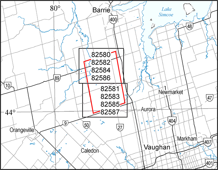
Map 82 580 and Map 82 581
Airborne Magnetic and Electromagnetic Survey, Colour-Filled Contours of the Residual Magnetic Field, South Simcoe County Area; by Ontario Geological Survey, scale 1:20 000, colour. $10.00 each.
Map 82 582 and Map 82 583
Airborne Magnetic and Electromagnetic Survey, Colour-Filled Contours of the EM Decay Constant, South Simcoe County Area; by Ontario Geological Survey, scale 1:20 000, colour. $10.00 each.
Map 82 584 and Map 82 585
Airborne Magnetic and Electromagnetic Survey, Colour-Filled Contours of the Apparent Conductance, South Simcoe County Area; by Ontario Geological Survey, scale 1:20 000, colour. $10.00 each.
Map 82 586 and Map 82 587
Airborne Magnetic and Electromagnetic Survey, Shaded Colour Image of the First Vertical Derivative of the Residual Magnetic Field, South Simcoe County Area; by Ontario Geological Survey, scale 1:20 000, colour. $10.00 each.
Geophysical Data Set
Geophysical Data Set 1070a
Ontario Airborne Geophysical Surveys, Magnetic and Electromagnetic Data, Grid and Profile Data (ASCII and Geosoft® Formats) and Vector Data, South Simcoe County Area; by Ontario Geological Survey. The data are on 1 DVD. $25.00.
Geophysical Data Set 1070b
Ontario Airborne Geophysical Surveys, Magnetic and Electromagnetic Data, Halfwave Data (Binary Format) and Calibration Data, South Simcoe County Area; by Ontario Geological Survey. The data are on 1 DVD. $25.00.
Location Map (PDF)
Discover Abitibi Initiative
The Discover Abitibi Initiative is a regional, cluster economic development project providing geoscientific investigations of the Western Abitibi Greenstone Belt in Ontario. The project has brought together funding partners FedNor, Northern Ontario Heritage Fund Corporation and the private sector to complete projects, which will further stimulate exploration activity and mining in this prolific belt. To support this successful endeavor, user stakeholders have provided the project ideas. The technical expertise to evaluate the projects has been provided by volunteers on the technical and management committees. Further information regarding this initiative can be found by contacting the Timmins Economic Development Corporation by email at tedc@timmins.ca.
Miscellaneous Release—Data 291
Regional Lithogeochemical Study of the Kidd–Munro MEGATEM® Survey Areas, Timmins–Kirkland Lake Region, Northern Ontario: Discover Abitibi Initiative; by M.D. Hannington, A. Coombs, G. van Hees, S. Duff and N. Campos-Alvarez. This release presents the results of a lithogeochemical study of the Kidd–Munro area in the Timmins–Kirkland Lake region of northern Ontario, with an emphasis on carbonaceous argillite units associated with base metal and gold mineralization, and with particular attention to the areas covered by the 2002–2003 MEGATEM® surveys and in adjacent townships. New whole-rock lithogeochemical data on 564 samples of carbonaceous argillites in drill core were used to characterize the lithogeochemistry of interflow metasedimentary units associated with a wide range of mineralization styles hosted by metavolcanic rocks and clastic metasedimentary units throughout the study area. Samples were obtained from the MNDM core archives at Timmins and Kirkland Lake, and from 19 mining and exploration companies operating in the region. The sampled area includes 76 townships, encompassing an area of more than 15 000 km2. Complete, high-precision analytical data for 67 elements are provided, together with a preliminary analysis of the data. A portable X-ray fluorescence (XRF) analyzer was also used to test the reliability of field-portable units in the detection and analysis of selected pathfinder elements in carbonaceous argillite. The main products of this study are 1) a report outlining the project methods, results and products (portable document format (.pdf) files); 2) maps illustrating the regional distribution of sampled carbonaceous argillite units, together with quartile plots of the data distribution for selected pathfinder elements (ESRI® ArcGIS® 10.0 and 9.2 and portable document format (.pdf) files); 3) sample description information (Microsoft® Excel® 2003 (.xls) format files); 4) tables of whole-rock lithogeochemical data for the analyzed samples (Microsoft® Excel® 2003 (.xls) format files); and 5) summary statistical data used to characterize the geochemistry of different argillite lithotypes (Microsoft® Excel® 2003 (.xls) format files). The products of this study will aid explorationists in identifying areas of anomalous metal enrichment in drilled carbonaceous argillite units that may be related to volcanic-hosted base metal deposits, ultramafic-associated nickel deposits, and volcanic- and sedimentary-hosted orogenic gold deposits in the region. Location data are provided in the Universal Transverse Mercator (UTM) projection and grid system, Zone 17, North American Datum 1983 (NAD83). The files are available on 1 DVD. $25.00.
Precambrian Geoscience
Open File Report 6229
Precambrian Geology of Cavendish Township, Central Metasedimentary Belt, Grenville Province; by R.M. Easton, 141p. Accompanied by Preliminary Map P.3605. $47.00.
Miscellaneous Release—Data 295
Lithogeochemistry of the Dog Lake Granite Chain, Northwestern Ontario; by B. Kuzmich, P. Hollings and D.A. Campbell. This release contains whole-rock geochemical data for the granitic intrusions of the Dog Lake granite chain in the Quetico Basin, north of Thunder Bay, northwestern Ontario. A document (portable document format (.pdf) file) provides a general description of the units sampled, their petrography and geochemistry as well as an interpretation of the data. The results of the geochemical analyses are provided as a Microsoft® Excel® 2003 (.xls) file. The data are available on 1 CD. $20.00.
Sedimentary Geoscience
Open File Report 6259
Results of Regional Till Sampling in the Cobalt–New Liskeard–Englehart Areas, Northern Ontario; by C. Gao. Digital data available as Miscellaneous Release—Data 284 (see below). 87p. $26.00.
Miscellaneous Release—Data 284
Till Sample and Indicator Mineral Data for the Cobalt, New Liskeard and Englehart Areas, Northern Ontario; by C. Gao. This release presents the results of a regional till sampling and surficial mapping project undertaken in the Cobalt, New Liskeard and Englehart areas in northern Ontario between 2007 and 2009. The results consist of geochemical and compositional data of kimberlite indicator minerals (KIMs), metamorphic/magmatic massive sulphide indicator minerals (MMSIM®*) and gold grains recovered from till and glaciofluvial sand and gravel samples. The data are being released in conjunction with Open File Report 6259, available separately. Files in this release contain information on sample site locations; a list of abbreviations; sample processing data; KIMs picked and picking remarks; microprobe analyses of KIMs ; gold grain data; MMSIM ® data; pebble lithology data; and adjusted KIM and MMSIM ® results. The data are available on 1 CD. $20.00.
Miscellaneous Release—Data 297
Aggregate Test Results for Various Rock Types in Ontario; by D.J. Rowell and J.E.P. Dodge. These data represent the results of “standard” aggregate testing collected and collated by the Ontario Geological Survey (OGS) over many years and at locations throughout various parts of northern, central and southern Ontario. Most of the bedrock test results have been published in a variety of OGS reports; however, some bedrock test results have not been released previously and are being released for the first time through this Miscellaneous Release—Data (MRD). The data and supporting information are provided as Microsoft® Excel® 2003 (.xls) and portable document format (.pdf) files, and as Google Earth™ mapping service (.kml, .kmz) depicting sample locations and other information. The data are available on 1 CD. $20.00.
*MMSIM is a registered trademark of Overburden Drilling Management Limited, Nepean, Ontario.
Location Map (PDF)
Precambrian Geoscience
- Preliminary Map P.3762—Revised
Precambrian Geology, South of Gogama Area; by B.R. Berger, scale 1:50 000, colour. $5.00. - Miscellaneous Release—Data 292
Geology, Petrography, Geochemistry and Photographs of the South of Gogama Area; by B.R. Berger. This digital release contains geochemical data and photographs hyperlinked to a geodatabase in ESRI® ArcGIS® 9.3 format on a Ministry of Natural Resources digital base map. The geochemical analyses and petrography are also provided as a Microsoft® Excel® (.xls) spreadsheet and (.csv) file. Rare earth element (REE) and extended element plots are provided in .jpg format and are hyperlinked to the base map. The geochemical plots were generated using IgPet 2008, Terra Softa Inc. software. Digital photographs are provided in .jpg format. Location data are provided in Universal Transverse Mercator (UTM) projection and grid system, Zone 17, North American Datum 1983 (NAD83). Available on 1 CD. $20.00. - Miscellaneous Release—Data 293
Geochemical and Geological Data from the Keezhik Lake and Miminiska Lake Area, Fort Hope Greenstone Belt, Northwestern Ontario; by S. Buse. This digital release consists of geochemical data, magnetic susceptibility data, geological information and selected field photographs for the Keezhik Lake and Miminiska Lake area in the Fort Hope greenstone belt, which were collected during the 2010 and 2011 field seasons, respectively. This release contains whole-rock chemistry (major elements, trace elements, rare earth elements) and assay data, and magnetic susceptibility data (2 Microsoft® Excel® 2003 (.xls) files) and 189 photographs (.jpg format files) with descriptions (1 Microsoft® Excel® 2003 (.xls) file). These data augment published Preliminary Maps P.3763, Precambrian Geology of the Keezhik Lake Area, Fort Hope Greenstone Belt and P.3764, Precambrian Geology of the Miminiska Lake Area, Fort Hope Greenstone Belt; the marginal notes and the geological legends (as 3 portable document format (.pdf) files) from the 2 Preliminary Maps are also provided. Location data are provided in the Universal Transverse Mercator (UTM) projection and grid system, Zone 16, North American Datum 1983 (NAD83). Available on 1 DVD. $25.00.
Sedimentary Geoscience
- Preliminary Map P.3632
Surficial Geology of the Fort Severn Area Northeast and Winisk Area Northwest, Northern Ontario; by P.J. Barnett, K.H. Yeung and J.D. McCallum, scale 1:100 000, colour. $9.00. - Preliminary Map P.3638
Surficial Geology of the Fort Severn Area Southeast, Northern Ontario; by P.J. Barnett, K.H. Yeung and J.D. McCallum, scale 1:100 000, colour. $7.00. - Preliminary Map P.3639
Surficial Geology of the Winisk Area Southwest, Northern Ontario; by P.J. Barnett, K.H. Yeung and J.D. McCallum, scale 1:100 000, colour. $7.00. - Preliminary Map P.3640
Surficial Geology of the Winisk Area Southeast, Northern Ontario; by P.J. Barnett, K.H. Yeung and J.D. McCallum, scale 1:100 000, colour. $7.00. - Preliminary Map P.3648
Surficial Geology of the Clendenning River Area Northeast, Northern Ontario; by P.J. Barnett, K.H. Yeung and J.D. McCallum, scale 1:100 000, colour. $7.00. - Preliminary Map P.3649
Surficial Geology of the Sutton Lake Area Northwest, Northern Ontario; by P.J. Barnett, K.H. Yeung and J.D. McCallum, scale 1:100 000, colour. $7.00. - Preliminary Map P.3650
Surficial Geology of the Sutton Lake Area Northeast, Northern Ontario; by P.J. Barnett, K.H. Yeung and J.D. McCallum, scale 1:100 000, colour. $7.00.
Erratum
In Open File Report 6273, Report of Activities 2011, Resident Geologist Program, Thunder Bay South Regional Resident Geologist Report: Thunder Bay South District (released April 3, 2012), an error was noted regarding the years of production. In Table 1 (page 2), the column heading “Production to End of 2010” should read “Production to End of 2011”.
This error has been corrected. A replacement page can be obtained by downloading the corrected publication.
Location Map (PDF)
Sedimentary Geoscience
- Aggregate Resources Inventory Paper 187
Aggregate Resources Inventory of the County of Frontenac, Southern Ontario; by A.S. Marich. 51p. $23.00
Available April 17, 2012, at 10:00 a.m. Eastern Time, or 9:00 a.m. Central Time. - Open File Report 6269
Preliminary Results from the McFaulds Lake (“Ring of Fire”) Area Lake Sediment Geochemistry Pilot Study, Northern Ontario; by R.D. Dyer and H.E. Burke. 26p. $11.00.
Available April 3, 2012, at 10:00 a.m. Eastern Time, or 9:00 a.m. Central Time. - Preliminary Map P.3740
Surficial Geology of the Ghost River Area Southeast, Northern Ontario; by P.J. Barnett, K.H. Yeung and J.D. McCallum, scale 1:100 000, colour. $7.00.
Available April 17, 2012, at 10:00 a.m. Eastern Time, or 9:00 a.m. Central Time. - Preliminary Map P.3748
Surficial Geology of the Smoky Falls Area Northeast, Northern Ontario; by P.J. Barnett, K.H. Yeung and J.D. McCallum, scale 1:100 000, colour. $7.00.
Available April 17, 2012, at 10:00 a.m. Eastern Time, or 9:00 a.m. Central Time. - Preliminary Map P.3755
Surficial Geology of the Smoky Falls Area Southeast, Northern Ontario; by P.J. Barnett, K.H. Yeung and J.D. McCallum, scale 1:100 000, colour. $7.00.
Available April 17, 2012, at 10:00 a.m. Eastern Time, or 9:00 a.m. Central Time. - Miscellaneous Release—Data 290
Graphic Borehole Logs of Sediments Composing the Oak Ridges Moraine, Whitchurch–Stouffville and Uxbridge Township Municipalities; by P.J. Barnett. During field investigations into the sediments composing the Oak Ridges moraine and their distribution, 6 boreholes were drilled in Whitchurch–Stouffville and Uxbridge township municipalities in 1993. The graphic logs of the 6 boreholes provide information on sediment distribution with depth to supplement local surficial geological mapping (references are supplied in the readme file). Files are provided in Microsoft® Word (.doc) and portable document (.pdf) formats on 1 CD. $20.00.
Available April 17, 2012, at 10:00 a.m. Eastern Time, or 9:00 a.m. Central Time.
Resident Geologist Program
- Open File Report 6271
Report of Activities 2011, Resident Geologist Program, Red Lake Regional Resident Geologist Report: Red Lake and Kenora Districts; by A.F. Lichtblau, C. Ravnaas, C.C. Storey, J. Bongfeldt, H.C. Lockwood and A.C. Wilson. 98p. $21.00.
Available April 3, 2012, at 10:00 a.m. Eastern Time, or 9:00 a.m. Central Time. - Open File Report 6272
Report of Activities 2011, Resident Geologist Program, Thunder Bay North Regional Resident Geologist Report: Thunder Bay North District; by G.D. White, M.C. Smyk, A. Cooke, H.C. Lockwood and A.C. Wilson. 51p. $14.00.
Available April 3, 2012, at 10:00 a.m. Eastern Time, or 9:00 a.m. Central Time. - Open File Report 6273
Report of Activities 2011, Resident Geologist Program, Thunder Bay South Regional Resident Geologist Report: Thunder Bay South District; by D.A. Campbell, J.F. Scott, A. Cooke, M.R. Brunelle, H.C. Lockwood and A.C. Wilson. 59p. $16.00
Available April 3, 2012, at 10:00 a.m. Eastern Time, or 9:00 a.m. Central Time. - Open File Report 6274
Report of Activities 2011, Resident Geologist Program, Timmins Regional Resident Geologist Report: Timmins and Sault Ste. Marie Districts; by B.T. Atkinson, P. Bousquet, A. Pace, S. Butorac, S. Harvey, D.M. Draper, R.L. Debicki and A.C. Wilson. 141p. $24.00.
Available April 17, 2012, at 10:00 a.m. Eastern Time, or 9:00 a.m. Central Time. - Open File Report 6275
Report of Activities 2011, Resident Geologist Program, Kirkland Lake Regional Resident Geologist Report: Kirkland Lake District; by D.L. Guindon, G.P.B. Grabowski, N. Sabiri, A.C. Wilson and R.L. Debicki. 60p. $11.00.
Available April 17, 2012, at 10:00 a.m. Eastern Time, or 9:00 a.m. Central Time. - Open File Report 6276
Report of Activities 2011, Resident Geologist Program, Kirkland Lake Regional Resident Geologist Report: Sudbury District; by D.G. Farrow, R.M. Alemany, P.J. Sangster, R.L. Debicki and A.C. Wilson. 51p. $10.00
Available April 17, 2012, at 10:00 a.m. Eastern Time, or 9:00 a.m. Central Time. - Open File Report 6277
Report of Activities 2011, Resident Geologist Program, Southern Ontario Regional Resident Geologist Report: Southeastern and Southwestern Ontario Districts, and Petroleum Resources Centre; by P.J. Sangster, P.S. LeBaron, S.J. Charbonneau, D.A. Laidlaw, A.C. Wilson, T.R. Carter and L. Fortner. 72p. $12.00
Available April 17, 2012, at 10:00 a.m. Eastern Time, or 9:00 a.m. Central Time.
Miscellaneous
Airborne Magnetic, Electromagnetic, and Gamma-Ray Spectrometric Surveys
Opeepeesway Lake Area—Purchased Data
1:20 000 Scale Map Sheets
- Map 60 374, Map 60 375
Airborne Magnetic, Electromagnetic and Gamma-Ray Spectrometric Surveys, Colour-Filled Contours of the Residual Magnetic Field and Electromagnetic Anomalies, Opeepeesway Lake Area―Purchased Data; by Ontario Geological Survey, scale 1:20 000, colour. Map prices range from $12.00 to $13.00.
Available April 17, 2012, at 10:00 a.m. Eastern Time, or 9:00 a.m. Central Time. - Map 60 376, Map 60 377
Airborne Magnetic, Electromagnetic and Gamma-Ray Spectrometric Surveys, Shaded Colour Image of the Second Vertical Derivative of the Residual Magnetic Field and Keating Coefficients, Opeepeesway Lake Area―Purchased Data; by Ontario Geological Survey, scale 1:20 000, colour. Map prices range from $12.00 to $13.00.
Available April 17, 2012, at 10:00 a.m. Eastern Time, or 9:00 a.m. Central Time. - Map 60 378, Map 60 379
Airborne Magnetic, Electromagnetic and Gamma-Ray Spectrometric Surveys, Colour-Filled Contours of the Apparent Resistivity and Electromagnetic Anomalies, Opeepeesway Lake Area―Purchased Data; by Ontario Geological Survey, scale 1:20 000, colour. Map prices range from $12.00 to $13.00.
Available April 17, 2012, at 10:00 a.m. Eastern Time, or 9:00 a.m. Central Time. - Map 60 380, Map 60 381
Airborne Magnetic, Electromagnetic and Gamma-Ray Spectrometric Surveys, Ternary Radioelement Image, Opeepeesway Lake Area―Purchased Data; by Ontario Geological Survey, scale 1:20 000, colour. Map prices range from $13.00 to $14.00.
Available April 17, 2012, at 10:00 a.m. Eastern Time, or 9:00 a.m. Central Time.
Geophysical Data Set
- Geophysical Data Set 1238
Ontario Airborne Geophysical Surveys, Magnetic, Electromagnetic and Radiometric Data, Grid and Profile Data (ASCII and Geosoft® Formats) and Vector Data, Opeepeesway Lake Area—Purchased Data; by Ontario Geological Survey. The data are on 1 DVD. $25.00.
Available April 17, 2012, at 10:00 a.m. Eastern Time, or 9:00 a.m. Central Time.
Airborne Magnetic and Electromagnetic Surveys
Marshall Lake Area—Purchased Data
1:20 000 Scale Map Sheets
- Map 60 382
Airborne Magnetic and Electromagnetic Surveys, Colour-Filled Contours of the Residual Magnetic Field and Electromagnetic Anomalies, Marshall Lake Area―Purchased Data; by Ontario Geological Survey, scale 1:20 000, colour. $14.00.
Available April 3, 2012, at 10:00 a.m. Eastern Time, or 9:00 a.m. Central Time. - Map 60 383
Airborne Magnetic and Electromagnetic Surveys, Shaded Colour Image of the Second Vertical Derivative of the Residual Magnetic Field and Keating Coefficients, Marshall Lake Area―Purchased Data; by Ontario Geological Survey, scale 1:20 000, colour. $14.00.
Available April 3, 2012, at 10:00 a.m. Eastern Time, or 9:00 a.m. Central Time. - Map 60 384
Airborne Magnetic and Electromagnetic Surveys, Colour-Filled Contours of the EM Decay Constant and Electromagnetic Anomalies, Marshall Lake Area―Purchased Data; by Ontario Geological Survey, scale 1:20 000, colour. $14.00.
Available April 3, 2012, at 10:00 a.m. Eastern Time, or 9:00 a.m. Central Time.
Geophysical Data Set
- Geophysical Data Set 1239
Ontario Airborne Geophysical Surveys, Magnetic and Electromagnetic Data, Grid and Profile Data (ASCII and Geosoft® Formats) and Vector Data, Marshall Lake Area—Purchased Data; by Ontario Geological Survey. The data are on 1 DVD. $25.00.
Available April 3, 2012, at 10:00 a.m. Eastern Time, or 9:00 a.m. Central Time.
Airborne Magnetic, Electromagnetic, and Gamma-Ray Spectrometric Surveys
Aerobus Lake Area—Purchased Data
1:20 000 Scale Map Sheets
- Map 60 385, Map 60 386, Map 60 387, Map 60 388
Airborne Magnetic, Electromagnetic and Gamma-Ray Spectrometric Surveys, Colour-Filled Contours of the Residual Magnetic Field, Aerobus Lake Area―Purchased Data; by Ontario Geological Survey, scale 1:20 000, colour. Map prices range from $9.00 to $12.00.
Available April 3, 2012, at 10:00 a.m. Eastern Time, or 9:00 a.m. Central Time. - Map 60 389, Map 60 390, Map 60 391, Map 60 392
Airborne Magnetic, Electromagnetic and Gamma-Ray Spectrometric Surveys, Shaded Colour Image of the Second Vertical Derivative of the Residual Magnetic Field and Keating Coefficients, Aerobus Lake Area―Purchased Data; by Ontario Geological Survey, scale 1:20 000, colour. Map prices range from $9.00 to $12.00.
Available April 3, 2012, at 10:00 a.m. Eastern Time, or 9:00 a.m. Central Time. - Map 60 393, Map 60 394, Map 60 395, Map 60 396
Airborne Magnetic, Electromagnetic and Gamma-Ray Spectrometric Surveys, Colour-Filled Contours of the VLF-EM Vertical Field, Aerobus Lake Area―Purchased Data; by Ontario Geological Survey, scale 1:20 000, colour. Map prices range from $10.00 to $12.00.
Available April 3, 2012, at 10:00 a.m. Eastern Time, or 9:00 a.m. Central Time. - Map 60 397, Map 60 398, Map 60 399, Map 60 400
Airborne Magnetic, Electromagnetic and Gamma-Ray Spectrometric Surveys, Ternary Radioelement Image, Aerobus Lake Area―Purchased Data; by Ontario Geological Survey, scale 1:20 000, colour. Map prices range from $10.00 to $13.00.
Available April 3, 2012, at 10:00 a.m. Eastern Time, or 9:00 a.m. Central Time.
Geophysical Data Set
- Geophysical Data Set 1240
Ontario Airborne Geophysical Surveys, Magnetic, Electromagnetic and Radiometric Data, Grid and Profile Data (ASCII and Geosoft® Formats) and Vector Data, Aerobus Lake Area—Purchased Data; by Ontario Geological Survey. The data are on 1 DVD. $25.00.
Available April 3, 2012, at 10:00 a.m. Eastern Time, or 9:00 a.m. Central Time.
Location Map (PDF)
Precambrian Geoscience
- Preliminary Map P.3762
Precambrian Geology, South of Gogama Area; by B.R. Berger, scale 1:50 000, colour. $5.00.
Sedimentary Geoscience
- Aggregate Resources Inventory Paper 190
Aggregate Resources Inventory of the County of Bruce; by D.J. Rowell, 94p. $32.00. - Preliminary Map P.3641
Surficial Geology of the Cape Henrietta Maria Area Southwest, Northern Ontario; by P.J. Barnett, K.H. Yeung and J.D. McCallum, scale 1:100 000, colour. $7.00. - Preliminary Map P.3642
Surficial Geology of the Cape Henrietta Maria Area Southeast, Northern Ontario; by P.J. Barnett, K.H. Yeung and J.D. McCallum, scale 1:100 000, colour. $7.00. - Preliminary Map P.3651
Surficial Geology of the Lakitusaki River Area Northwest, Northern Ontario; by P.J. Barnett, K.H. Yeung and J.D. McCallum, scale 1:100 000, colour. $7.00. - Preliminary Map P.3652
Surficial Geology of the Lakitusaki River Area Northeast, Northern Ontario; by P.J. Barnett, K.H. Yeung and J.D. McCallum, scale 1:100 000, colour. $7.00.
Miscellaneous
The Ministry of Northern Development and Mines has prepared supplements for Miscellaneous Papers (MP) 177 and 178 to include publications released in 2011. Also, the Bedrock Geology Index to Maps and Surficial Geology Index to Maps are updated to include all maps released in 2011. Miscellaneous Paper 177 (Supplement 2011), MP 178 (Supplement 2011) and the maps can be purchased in hard-copy format from Publication Sales.
- Miscellaneous Paper (MP) 177 (Supplement 2011)
Index to Published Reports, Maps and Digital Data, 2011
This report provides a listing of all publications released since the publication of MP 177 (Supplement 1993–2010), Index to Published Reports, Maps and Digital Data, 1993–2010. Publications are listed by series only. 29p. $6.00. - Miscellaneous Paper (MP) 178 (Supplement 2011)
Geographic Index to Published Reports, Maps and Digital Data, 2011
This report provides a listing of all publications released since the publication of MP 178 (Supplement 1994–2010), Geographic Index to Published Reports, Maps and Digital Data, 1994–2010. Publications are indexed by geographic areas, which include National Topographic System (NTS) areas, geographic townships and Ministry of Natural Resources (MNR) “areas”. Publications are listed under the main geographic areas where they are located. 82p. $9.00. - Index to Maps, Bedrock Geology, 1991–2011; produced by the Publication Services Section, scale 1:1 000 000, colour. Available as a set of 4 maps. $12.00.
- Index to Maps, Surficial Geology, 1991–2011; produced by the Publication Services Section, scale 1:1 000 000, colour. Available as a set of 4 maps. $12.00.
Location Map (PDF)