Ministry of Energy and Mines
Home » Mining Lands Administration System (MLAS) – Map Viewer » Historical Mining Claim Maps
Home » MLAS Viewer » Historical Mining Claim Maps
Historical Mining Claim Maps
We are committed to providing accessible customer service. If you need accessible formats or communications supports, please contact us.
Before claim maps were available online, in which current and active claims may be viewed, claims were drawn on linen, paper and, later, Mylar sheets. Despite their age, there continues to be interest in the information provided by these historical mining claim maps.
Recently, the maps were scanned and saved as image files. Maps were assigned file names based on the township or area they covered and, where possible, the year that the map was produced. Image files for the same township or area were combined into a single PDF for that location.
Historical Mining Claim Maps are now available online.
How to View Historical Mining Claim Maps
You require Adobe Reader to view the PDFs, if you do not have this application installed on your computer, you may download this free application from Adobe. Some PDFs are quite large (up to 100 MB) so you must be patient when downloading any of the larger PDFs.
Select the first letter of the name of the township or area from the list below then select the name of the township or area and the PDF will open in your browser or PDF reader.
- Abbey |
- Abbie Lake |
- Abbotsford |
- Abbott Lake |
- Abbott |
- Abelson Lake |
- Aberdeen & Aberdeen Additional |
- Abigo |
- Abinger |
- Abney |
- Abotossaway |
- Abraham |
- Acadia |
- Achapi Lake |
- Acheson |
- Acres |
- Acton |
- Adair |
- Adamhay Lake |
- Adams |
- Adamson & Sprout Lake |
- Adanac |
- Addison |
- Adjala |
- Admaston |
- Admiral |
- Adrian |
- Aerial Lake |
- Aerobus Lake |
- Afton |
- Again River |
- Agaskagou Lake |
- Agassiz Lake |
- Agassiz Peatland |
- Agassiz River |
- Agassiz |
- Agate |
- Agnes Lake |
- Agnew |
- Aguonie |
- Agutua Lake |
- Agwasuk River |
- Ahrens Lake |
- Aird Island |
- Airy |
- Aitken |
- Akandamo Lakes |
- Akem Falls |
- Aki Lake |
- Akow Lake |
- Alanen |
- Alarie |
- Albanel |
- Albany Island |
- Albany River |
- Alcona |
- Alcorn |
- Alderson |
- Aldina |
- Aldred Lake |
- Alexandra Island |
- Alexandra |
- Alexandria Island (Lake of the Woods) |
- Alford Lake |
- Alfred Lake & McQuesten |
- Alfred Lake |
- Alice Lake |
- Aljo Lake |
- Allan Island (North) |
- Allan Island (South) |
- Allan Island |
- Alland Lake |
- Allanwater Station |
- Allely Lake |
- Allen |
- Allenby |
- Alma |
- Alneau Peninsala |
- Alpha Lake |
- Alpha |
- Alton |
- Amery |
- Ames |
- Amik |
- Amundsen |
- Amyot |
- Anchicum Bay |
- Anders Lake |
- Anderson |
- Andre |
- Angekum Lake |
- Anglesea |
- Angus |
- Annas Lake |
- Anson |
- Anstruther |
- Antler Lake |
- Antoine |
- Antrim |
- Appleby |
- Aqutua Lake |
- Ara Lake |
- Arbutus |
- Arc Lake |
- Archibald |
- Ardagh |
- Arden |
- Argon Lake |
- Argyle |
- Armagh |
- Armistice Lake |
- Armit Lake |
- Armour Lake |
- Armour |
- Armstrong Area |
- Armstrong Lake |
- Armstrong Township |
- Arnold Point |
- Arnold |
- Arnott |
- Arrell Lake |
- Arrow Lake |
- Ash River |
- Ashburton Bay |
- Ashby |
- Asheweig River |
- Ashley |
- Ashmore |
- Asinne Lake |
- Asipaquobah Lake (East) |
- Asipaquobah Lake (West) |
- Askawamattawa Creek |
- Askin |
- Asmussen |
- Asquith |
- Assad |
- Assef |
- Asselin |
- Aster Lake |
- Aston |
- Astron Bay (Lake of the Woods) |
- Athlone |
- Atick River |
- Atik Lake |
- Atikasibi River |
- Atikokiwam Lake |
- Atikwa Lake (Grapnel Bay) |
- Atkinson Lake |
- Atkinson |
- Attawapiskat River |
- Attawapiskat |
- Attlee |
- Attwood Lake |
- Attwood River |
- Atwood & Curran |
- Atwood |
- Aubin |
- Aubrey |
- Auden |
- August Lake |
- Auld |
- Aulneau Peninsula |
- Aurora |
- Austin Lake |
- Avery & MacFie |
- Avery |
- Avis Lake |
- Avis |
- Avon |
- Awad Creek |
- Awagakama River |
- Awenge |
- Aweres |
- Awrey |
- Aylmer & Rathbun |
- Aylmer |
- Aylsworth |
- Azure Lake
- Bad Vermillion Lake |
- Baden |
- Bader |
- Badesdawa Lake |
- Badesdawa River |
- Badgeley Island |
- Badgerow |
- Badshot Lake |
- Baggy Lake |
- Bagot |
- Bailloquet |
- Bain |
- Baird & Heyson |
- Baird |
- Baize Creek |
- Bake Lake |
- Baldwin |
- Balfour |
- Ball |
- Ballantyne |
- Balmer |
- Balmoral Lake |
- Baltic |
- Bamaji Lake |
- Banard Lake |
- Bangor |
- Banipatau Creek |
- Banks |
- Bannatyne Lake |
- Bannerman Lake |
- Bannerman |
- Bannockburn |
- Banting |
- Banville Lake |
- Barager |
- Barbara Lake |
- Barber Lake |
- Barber |
- Barclay |
- Barehead Lake |
- Barker Bay |
- Barker |
- Barlow |
- Barnard Lake |
- Barnes |
- Barnet |
- Barr |
- Barrel Lake |
- Barrie |
- Bartlett |
- Bartman Lake |
- Barwick |
- Baskineig Falls |
- Basswood Lake |
- Bastedo |
- Bate Lake |
- Bateman |
- Bathurst |
- Battersby |
- Batwing Lake |
- Baxter |
- Bayfield |
- Bayly |
- Baynes |
- Bazett |
- Beadle Lake |
- Beange |
- Beardmore |
- Beardy Creek |
- Bears Back Island |
- Bearskin Lake |
- Beaton |
- Beatty |
- Beaucage |
- Beauchamp |
- Beaudin |
- Beaudry |
- Beaumont |
- Beauparlant |
- Beaver River |
- Beaverhouse Lake |
- Beaverskin Lake |
- Beavis Lake |
- Beck |
- Beckett |
- Beckington Lake |
- Bedford Creek |
- Bedford |
- Bedivere Lake |
- Beebe |
- Beemer |
- Beggs Lake |
- Begin |
- Behmann |
- Beilhartz |
- Belanger |
- Belfast |
- Belford |
- Bell & Shikag Lakes |
- Bell Island (Lake of the Woods) |
- Bell Lake |
- Bell |
- Bellmore Lake |
- Belmont |
- Ben Nevis |
- Bend Rapids |
- Bending Lake |
- Beniah |
- Benjamin Lake |
- Benner |
- Bennett & Tanner |
- Bennett Lake |
- Bennett |
- Benneweis |
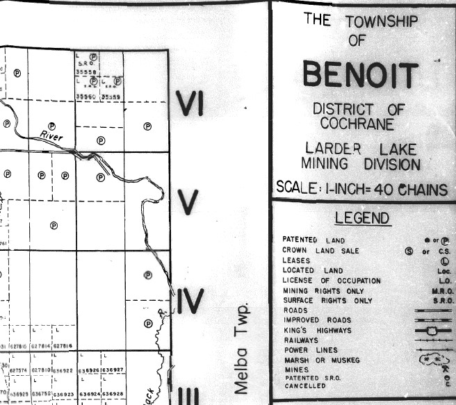
- Benoit |
- Benton |
- Berens Lake |
- Berens River |
- Beresford |
- Bernath Lake |
- Bernhardt |
- Bernier |
- Bernst |
- Berry Lake |
- Berry |
- Bertoia Lake |
- Bertram |
- Bessborough |
- Best |
- Beteau Lake |
- Bethune |
- Beulah |
- Bevin |
- Bickle |
- Bicknell Lake |
- Bicknell |
- Big Island |
- Big North Lake |
- Bigelow |
- Biggs |
- Bigrock Lake |
- Bigsby Island |
- Bigshell Lake |
- Bigstone Bay (Lake of the Woods) |
- Bigwood |
- Bingo Lake |
- Birch Island |
- Birch Lake & Springpole Lake |
- Birch Lake |
- Birch Point |
- Birch |
- Bird |
- Birdsall |
- Birkett |
- Biscotasi |
- Bisley |
- Black Bass Lake |
- Black Bay |
- Black Bear Lake |
- Black River |
- Black Rock |
- Black Sturgeon Lake |
- Black |
- Blackburn |
- Blackstock |
- Blackstone Lake |
- Blackwater Bay (Muskrat Dam Lake) |
- Blackwell |
- Blain |
- Blair Lake |
- Blair |
- Blake Lake |
- Blake |
- Blakelock |
- Blamey |
- Blank |
- Blewett |
- Blezard |
- Bliss Lake |
- Bliss |
- Blithfield |
- Bloch Lake |
- Blood Lake |
- Blount |
- Blue & Worthington |
- Blue Ridge |
- Blue |
- Bluffpoint Lake |
- Bluffy Lake |
- Blyth |
- BMA 517-853 |
- BMA 521-841 |
- BMA 521-842 |
- BMA 521-843 |
- BMA 521-844 |
- BMA 521-852 |
- BMA 521-853 |
- BMA 521-854 |
- BMA 522-841 |
- BMA 522-842 |
- BMA 522-843 |
- BMA 522-844 |
- BMA 522-851 |
- BMA 522-852 |
- BMA 522-853 |
- BMA 522-854 |
- BMA 523-841 |
- BMA 523-842 |
- BMA 523-843 |
- BMA 523-853 |
- BMA 523-854 |
- BMA 524-841 |
- BMA 524-842 |
- BMA 524-843 |
- BMA 524-844 |
- BMA 524-852 |
- BMA 524-853 |
- BMA 524-854 |
- BMA 525-834 |
- BMA 525-841 |
- BMA 525-842 |
- BMA 525-843 |
- BMA 525-844 |
- BMA 525-851 |
- BMA 525-852 |
- BMA 525-853 |
- BMA 525-854 |
- BMA 526-833 |
- BMA 526-834 |
- BMA 526-841 |
- BMA 526-842 |
- BMA 526-843 |
- BMA 526-844 |
- BMA 526-852 |
- BMA 526-853 |
- BMA 526-854 |
- BMA 527-833 |
- BMA 527-834 |
- BMA 527-841 |
- BMA 527-842 |
- BMA 527-843 |
- BMA 527-853 |
- BMA 527-854 |
- BMA 528-834 |
- BMA 528-841 |
- BMA 528-842 |
- BMA 528-843 |
- BMA 528-844 |
- BMA 528-852 |
- BMA 528-853 |
- BMA 528-854 |
- BMA 531-834 |
- BMA 531-841 |
- BMA 531-842 |
- BMA 531-843 |
- BMA 531-844 |
- BMA 531-851 |
- BMA 531-852 |
- BMA 531-853 |
- BMA 531-854 |
- BMA 532-841 |
- BMA 532-842 |
- BMA 532-843 |
- BMA 532-844 |
- BMA 532-851 |
- BMA 532-852 |
- BMA 532-853 |
- BMA 532-854 |
- BMA 532-871 |
- BMA 532-874 |
- BMA 533-843 |
- BMA 533-844 |
- BMA 533-851 |
- BMA 533-852 |
- BMA 533-853 |
- BMA 533-854 |
- BMA 533-871 |
- BMA 533-874 |
- BMA 533-891 |
- BMA 534-824 |
- BMA 534-831 |
- BMA 534-851 |
- BMA 534-852 |
- BMA 534-853 |
- BMA 534-854 |
- BMA 534-871 |
- BMA 534-872 |
- BMA 535-851 |
- BMA 535-852 |
- BMA 535-853 |
- BMA 535-854 |
- BMA 535-871 |
- BMA 535-891 |
- BMA 536-851 |
- BMA 536-852 |
- BMA 536-864 |
- BMA 537-852 |
- BMA 537-853 |
- BMA 537-864 |
- BMA 538-851 |
- BMA 538-852 |
- BMA 538-853 |
- BMA 538-854 |
- BMA 542-853 |
- BMA 548-852 |
- Bolger |
- Bomby |
- Bompas |
- Bonar |
- Bond Lake |
- Bond |
- Bonfield |
- Bonheur River Kame |
- Bonis |
- Bonnell Lake |
- Bonnie Lake |
- Boomerang Lake |
- Boon |
- Boot Bay |
- Booth |
- Bordeleau |
- Borden |
- Borel Lake |
- Borland Lake |
- Boston Lake |
- Boston |
- Bostwick |
- Bosworth Lake |
- Botha |
- Boucha Lake |
- Boucher |
- Bouck |
- Boulter |
- Bound Lake |
- Boundsall |
- Bourassa |
- Bourinot |
- Bouser |
- Bow Lake |
- Bowell |
- Bowerman |
- Bowman Lake |
- Bowman |
- Bowpas |
- Bowser Lake |
- Bowyer |
- Boyce |
- Boyd |
- Boyer Lake |
- Boys & Echo Bay |
- Bracci |
- Brackin |
- Bradburn |
- Bradette |
- Bradley |
- Bradshaw |
- Bragg |
- Brain |
- Braithwaite |
- Brandon Lake |
- Bray |
- Breadner |
- Brebeuf |
- Breckenbridge |
- Breckenridge |
- Breithaupt |
- Bressette Lake |
- Brethour |
- Brewster |
- Brian Lake |
- Bridges |
- Bridgland |
- Briggs |
- Bright Point |
- Bright |
- Brightsand Lake |
- Brigstocke |
- Brimacombe |
- Bristol |
- Britt Creek |
- Britton |
- Broad Lake |
- Brock Lake |
- Broder |
- Broderick |
- Brodeur Island |
- Brokenmouth River |
- Brooks Lake |
- Broome |
- Brothers |
- Brougham |
- Broughton |
- Brower |
- Brown Island |
- Brown |
- Browning |
- Brownridge & Laval |
- Brownridge |
- Brownstone Lake |
- Bruce Lake |
- Brudenell |
- Brule Lake |
- Brule |
- Brundrit Lake |
- Brunel |
- Brunette Lake |
- Brunswick |
- Bruton |
- Brutus |
- Bruyere |
- Bryce |
- Buchan Bay (Eagle Lake) |
- Buchan |
- Buckdeer Lake |
- Bucke |
- Buckett Lake |
- Buckland |
- Buckles |
- Buda Bay |
- Bug Lake |
- Bug River |
- Bugbee Lake |
- Bulging Lake |
- Bullbrook |
- Buller |
- Bullock |
- Bulmer |
- Bunyan Lake |
- Burchell Lake |
- Burden Lake |
- Burditt-Caliper |
- Burgess |
- Burk |
- Burlegih |
- Burling Lake |
- Burma Lake |
- Burnaby |
- Burns |
- Burntrock Lake |
- Burr |
- Burrell |
- Burriss |
- Burritt |
- Burrows |
- Burstall |
- Burt Lake |
- Burt |
- Burton |
- Burwash |
- Busby |
- Bushy Island |
- Butcher |
- Butler |
- Butt |
- Byers |
- Byford Lake |
- Byng |
- Byrnes Lake |
- Byron |
- Byshe & Williams |
- Byshe
- Cabin Bay |
- Cabot |
- Cache Lake |
- Cadeau |
- Caen |
- Cairngorm Lake |
- Cairngorm |
- Cairo Lake |
- Cairo |
- Caithness |
- Calais |
- Calamity Lake |
- Calbert Creek |
- Calder |
- Caldwell |
- Caledon |
- Caley Lake |
- Calvert |
- Calvin |
- Cameron |
- Camp Lake |
- Campfire Lake |
- Camping Lake |
- Campus Lake |
- Candide Lake |
- Candler Lake |
- Cane |
- Canfield |
- Cannard |
- Cannon Creek |
- Cannon Lake |
- Canoe Bay (Lac Seul) |
- Canonto |
- Canton Lake |
- Canton |
- Canuthers |
- Canyon Lake |
- Canyon |
- Caouette |
- Cape Smith |
- Capreol |
- Caramat Lake |
- Carb Lake |
- Carden |
- Cardiff |
- Carew |
- Cargill |
- Caribaldi |
- Caribou Island |
- Caribou Lake |
- Caribou River |
- Carillion Lake |
- Carling Island (Lake St Joseph) |
- Carling Lake |
- Carling |
- Carlow |
- Carlyle |
- Carman |
- Carmeron |
- Carmichael |
- Carnegie |
- Carney |
- Caron Lake |
- Caron |
- Carp Lake |
- Carpenter |
- Carr |
- Carre Lake |
- Carroll Lake |
- Carroll |
- Carrs |
- Carrutheres |
- Carscallen |
- Carss |
- Carter |
- Cartier |
- Carton |
- Cartwright Island |
- Carty |
- Cascaden |
- Case |
- Casey |
- Casgrain |
- Cashel |
- Casimir |
- Casino Lake |
- Cassells |
- Casselman |
- Cassidy |
- Casson |
- Cassummit Lake |
- Castlebar Lake |
- Castlewood Lake |
- Casuette |
- Casummit Lake-Mink Lake |
- Casummit Lake |
- Cat Lake |
- Cat River |
- Catharine |
- Cathcart |
- Cavana |
- Cavell |
- Cavendish |
- Caverley |
- Cawston Lakes |
- Cecil Lake |
- Cecil |
- Cedar Lake |
- CellList Lake |
- Celt Lake |
- Celtis Lake |
- Cemetary Lake |
- Center Part Southbluff Creek |
- Centre Part Kingfisher River |
- Ceylon |
- Chabanel |
- Chabbie Lake |
- Chalet |
- Challener |
- Challies |
- Chamberlain |
- Chambers |
- Champagne |
- Chandos |
- Chapais |
- Chapleau |
- Chaplin |
- Chapman |
- Chappise |
- Charbonneau |
- Chard River |
- Charlotteville |
- Charlton |
- Charters |
- Chartrand |
- Cheepay Island |
- Cheepay River |
- Cheeseman Lake |
- Chellew Lake |
- Chelsea |
- Chemahagan River |
- Chenard |
- Cherriman |
- Cherrington Lake |
- Chesley & Chesley Additional |
- Chesney Bay |
- Chester |
- Chevrier |
- Chewett |
- Chiah Lake |
- Chickney Channel |
- Chief Bay |
- Childerhose |
- Chipai Lake |
- Chipie River |
- Chipie |
- Chipman |
- Chisholm |
- Cholette |
- Chown |
- Christie |
- Christina Lake |
- Church |
- Churchill |
- Circle Lake |
- Cirrus Lake |
- Citellus Lake |
- Clace Lake |
- Clara |
- Clarendon |
- Clarkson |
- Clary |
- Clavet |
- Claw Lake |
- Claxton & Pinus Lake |
- Claxton |
- Clay Lake |
- Clay |
- Clearwater Bay |
- Cleaver |
- Cleland |
- Clement |
- Clendenning River |
- Clergue |
- Cleveland |
- Cliff Lake |
- Clifford |
- Clifton |
- Clist Lake |
- Clive |
- Clouston |
- Clute |
- Clyde |
- Cobden |
- Cobham River |
- Cochram Lake |
- Cochrane |
- Cockeram |
- Cockshutt |
- Code |
- Coderre |
- Cody |
- Coldwell |
- Cole |
- Coleman |
- Colenso |
- Colgrove Lake |
- Coli Lake |
- Collins Inlet |
- Collins Lake |
- Collins |
- Collis Lake |
- Collishaw Lake |
- Collishaw |
- Colpitts Creek |
- Colquhoun |
- Colter |
- Coltham |
- Coltman Island |
- Commanda |
- Common |
- Comox |
- Conacher |
- Conant |
- Concobar |
- Confusion Lake |
- Conger |
- Conifer Lake |
- Conking |
- Conmee |
- Conmee Island |
- Connaught |
- Connett Lake |
- Consens |
- Constance Lake |
- Contact Bay (Wabigoon Lake) |
- Cook |
- Cooper |
- Coott Lake |
- Copenace |
- Coppell |
- Copper Island |
- Copperfield |
- Corallen Lake |
- Corbiere |
- Corboy |
- Cordick Lake |
- Corerley |
- Corie Lake |
- Corkill |
- Corless |
- Corley |
- Corman |
- Corner River |
- Cortez |
- Cosby |
- Cosden |
- Cosgrave Lake |
- Cosgrove |
- Costello |
- Cote |
- Cotte |
- Cotton |
- Coucheemoskog Lake |
- Coughlan Lake |
- Coulson |
- Cowie |
- Cowper |
- Cox |
- Coyle & Desmond |
- Coyle |
- Crabclaw Lake |
- Craig |
- Crawford |
- Crayfish Lake |
- Creamer Lake |
- Creelman |
- Creighton-Davies |
- Creighton |
- Crepieul |
- Crerar Lake |
- Crerar River |
- Crerar |
- Crescent Lake |
- Cristene Lake |
- Critchell Lake |
- Croal Lake |
- Crockett |
- Croft |
- Croll |
- Cromlech |
- Crooked Lake |
- Crooked Mine Lake |
- Crooked Pine Lake |
- Crooked River |
- Crooks |
- Croome |
- Crosby (South) |
- Cross |
- Crothers |
- Crow Lake |
- Crow River-Pickle Lake |
- Crowrock Lake |
- Crozier & Roddick |
- Crozier |
- Crump Lake |
- Cudney |
- Cull |
- Culverson Lake |
- Cumming |
- Cunningham |
- Curie Lake |
- Curran & Atwood |
- Currie |
- Curtain |
- Curtis |
- Cuthbertson |
- Cutis |
- Cutler & Aird Island |
- Cutler |
- Cynthia |
- Cypress Lake
- D'Arcy |
- D'Avaugour |
- D'Orsonnens Lake |
- Dablon |
- Dack |
- Dadson Lake |
- Dagle |
- Dagny Lake |
- Dahl |
- Dainty Lake |
- Dale |
- Daley |
- Dalgas Lake |
- Dalhousie |
- Dalmas |
- Dalton |
- Dambrossio |
- Dana |
- Dance |
- Dane |
- Danford |
- Daniel |
- Daniels Lake |
- Daoust |
- Dargavel |
- Darling |
- Dash Lake |
- Daumont |
- David Lakes |
- Davidson |
- Davieaux |
- Davin |
- Davis |
- Dawn Lake |
- Dawson Lake |
- Dawson Road |
- Day |
- De Celles Island |
- De Gaulle |
- De Lesseps Lake |
- De Morest |
- Deacon Lake & Reddit |
- Deacon |
- Deadfish Lake |
- Deagle |
- Dean Lake |
- Deans |
- Debassige |
- Decarie Lake |
- Dedee Lake |
- Deeds Lake |
- Deer Lake |
- Del Villano |
- Delamere |
- Delaney |
- Delhi |
- Delmage |
- Deloro |
- Dempsay |
- Denbigh |
- Denis Lake |
- Dension |
- Dennie |
- Dennis |
- Dent Lake |
- Dent |
- Denton |
- Denyes |
- Depalma Lake |
- DePencier |
- Derniere Lake |
- Deroche |
- Derry |
- Desbiens |
- Desmond |
- Desolation Lake |
- Desrosiers |
- Devitt |
- Devlin |
- Devon |
- Devonshire |
- Devonshire & MacQuarrie |
- Dewan |
- Dewart |
- Dewy Lake |
- Dibble Lake |
- Dick & Bannings Timber |
- Dickens |
- Dickison Lake |
- Dieppe |
- Digby |
- Dilke & Nelles |
- Dilke |
- Dill |
- Dixie Lake |
- Dobie and Barwick |
- Dobie Lake |
- Docker |
- Dog Lake |
- Doghole Lake |
- Dogpaw Lake |
- Doherty |
- Dokis |
- Dolson |
- Domain Lake |
- Dome |
- Dominion |
- Dona Lake |
- Donald Lake |
- Donnelly Lake |
- Donovan |
- Doon |
- Doran Lake |
- Dore |
- Dorion |
- Doss Lake |
- Doucett |
- Douglas |
- Dowden Lake |
- Dowling |
- Downer |
- Downie Lake |
- Dowsley |
- Doyle |
- Draper |
- Drayton |
- Drea |
- Drew |
- Drift Lake |
- Drope |
- Drowning River |
- Druillettes |
- Drum Lake |
- Drummond |
- Drury |
- Druvy-Nairn |
- Dryberry Lake |
- Dryden |
- Dublin |
- Duckling Lake |
- Duckworth |
- Dudley |
- Duff |
- Duffell Lake |
- Dufferin |
- Dukszta |
- Dulhut |
- Dumas |
- Dumond River |
- Dunbar |
- Duncan |
- Dundee |
- Dundonald |
- Dungannon |
- Dunkirk Lake |
- Dunlop |
- Dunmore |
- Dunne Lake |
- Dunnet |
- Dunphy |
- Dunsmore |
- Dupuis |
- Durban |
- Durer Lake |
- Dusey Lake |
- Dusten Lake |
- Dyer |
- Dymond |
- Dysart
- Eabamet Lake |
- Eager Lake |
- Eagle Island (Lac Seul) |
- Eagle Lake |
- Eagle Rock Lake |
- Eaglehead Lake |
- Eaket |
- Ear Falls |
- Earl |
- Earngey & Uchi Lake |
- Earngey |
- East Bay (Dog Lake) |
- East Burpee |
- East Mills |
- East of Agwasuk River |
- East of Beardy Creek |
- East of Britt Creek |
- East of Carroll |
- East of Carss |
- East of Cheepay Island |
- East of Crawford Lake |
- East of Croal Lake |
- East of De Pencier |
- East of Derniere Lake |
- East of Desolation Lake |
- East of Dusey River |
- East of Ebbitt |
- East of Frog River |
- East of Furry Lake |
- East of Ganong |
- East of Ghost Lake |
- East of Harewood |
- East of Heathcote |
- East of Hendren Lake |
- East of Kesagami Lake |
- East of Lewers |
- East of Little Current River |
- East of Makokibatan Lake |
- East of Martison Lake |
- East of Missisa Lake |
- East of Missisa River |
- East of Mistuskwia River |
- East of Norton Lake |
- East of Partridge River |
- East of Pellatt |
- East of Pembina Island |
- East of Ridge River |
- East of Roseberry River |
- East of Rottenfish Lake |
- East of Rottenfish River |
- East of Sakwaso Lake |
- East of Sandbank Lake |
- East of Sandy Lake |
- East of Seseginagow River |
- East of Sherman River |
- East of Southbluff Creek |
- East of Squirrel River |
- East of Stapells |
- East of Tiffin Lake |
- East of Treloar Lake |
- East of Warchesku River |
- East of Washi Lake |
- East of Winsa Lake |
- East Part Trilsbeck Lake |
- East Part Wataiabei River |
- Eastbend Island |
- Eastern Island |
- Eastern Part of Sandy Lake |
- Eastside Lake |
- Eastwood Island |
- Eaton |
- Eayrs Lake |
- Ebbitt |
- Ebbs |
- Eby |
- Ecclestone |
- Echo Bay & Boys |
- Echo Bay |
- Echo |
- Echum |
- Eddy |
- Eden |
- Edighoffer |
- Edinburgh |
- Edith |
- Edwards Lake |
- Edwards |
- Effingham |
- Egan |
- Eilber |
- Eisenhower |
- Ekwan River |
- Elbow Lake |
- Eldorado |
- Eldridge |
- Eleanor Lake |
- Elgie |
- Elizabeth |
- Ellard Lake |
- Ellard River |
- Elliot |
- Ellis |
- Elmhirst |
- Elmsley |
- Elsbury Lake |
- Eltrut Lake |
- Elzevir |
- Emerald |
- Emerson |
- Emiry |
- Emo |
- Empire Lake |
- Endogoki Lake |
- Endospruce Lake |
- English Bay |
- English Lake |
- English River Post |
- English |
- Engstrom |
- Enid |
- Eric |
- Erichsen Lake |
- Ericson |
- Ermatinger |
- Ermine |
- Errington |
- Esnagami Lake |
- Esnagami |
- Esquega |
- Esten |
- Esther |
- Ethel |
- Eton |
- Etowamami River |
- Eva Lake |
- Evans Lake |
- Evans |
- Evanturel |
- Evelyn |
- Everest Lake |
- Ewart and Indian Bay |
- Ewart |
- Ewen |
- Exploratory Licence |
- Exton |
- Eye Lake |
- Eyes Lake
- Fabbro |
- Factor Lake |
- Fairbairn |
- Fairbank |
- Faircloth Lake |
- Fairlie |
- Falan Lake |
- Falcon Lake |
- Falconbridge |
- Falconer |
- Fallis |
- Fallon |
- Fallscamp Lake |
- Faraday |
- Farewell Bay |
- Farmer Lake |
- Farner Lake |
- Farquhar |
- Farr & Smyth |
- Farr |
- Farrer Lake |
- Farrington & Halkirk |
- Farrington |
- Farrow Lake |
- Fasken |
- Faulkenham Lake |
- Fauquier |
- Faust |
- Fauteux & Poilu Lake |
- Favourable Lake & Sandy Lake |
- Favourable Lake (North) |
- Favourable Lake (South) |
- Favourable Lake |
- Fawcett Lake |
- Fawcett |
- Fawn River |
- Fawn |
- Feagan Lake |
- Fell |
- Felsia Lake & Hurst |
- Felst Lake |
- Fenton |
- Fenwick |
- Ferdinand Lake |
- Fergus |
- Ferguson Lake |
- Ferguson |
- Ferland Station |
- Fernow |
- Ferrie |
- Ferrier |
- Ferris |
- Ficht Lake |
- Fiddler |
- Field |
- Finan |
- Findlay |
- Fingal |
- Finger Lake & Western Part of Sandy Lake |
- Finger Lake (East) |
- Finger Lake (West) |
- Finlayson Lake |
- Finlayson |
- Fintry |
- Firstbrook |
- Firstloon Lake |
- Fisher & Herrick |
- Fisher Lake |
- Fisher |
- Fitzroy |
- Fitzsimmons |
- Flanagan River |
- Flanders Lake |
- Flanders |
- Flash Lake |
- Flatrock Lake |
- Flavelle |
- Fleck |
- Fleming |
- Fletcher |
- Flett |
- Flew Lake |
- Flinch Lake |
- Flint River |
- Floranna |
- Flower Falls |
- Fluor Island |
- Flyingloon Lake |
- Foch Lake |
- Foch |
- Fog Lake & Manion |
- Foley |
- Foleyet |
- Fontaine |
- Foote |
- Forbes |
- Ford |
- Forester Lake |
- Forgie |
- Forgotten Lake |
- Fort Albany |
- Fort Severn |
- Fortune |
- Foster |
- Foucault |
- Foulds |
- Fourbay Lake |
- Fournier |
- Fowler |
- Fox Island |
- Fox Lake |
- Fox River |
- Fox |
- Foxtrap Lake |
- Foy |
- Fraleck |
- Fraleigh |
- Frances |
- Franchere |
- Francois Lake |
- Frank Lake |
- Franklin |
- Franz |
- Fraser |
- Frater |
- Frechette Island |
- Frechette |
- Frecheville |
- Fredart Lake |
- Freeborn |
- Freele |
- Freeman |
- French Lake |
- French |
- Frey |
- Fripp |
- Frog River |
- Frond Lake |
- Frost |
- Fry Lake |
- Fryatt |
- Fulford |
- Fullerton Lake |
- Fulton River |
- Fulton |
- Furlong Lake |
- Furlonge |
- Furniss |
- Furry Lake |
- Fushimi
- Gaby |
- Gaiashk |
- Galbraith |
- Gallagher |
- Galna |
- Galway |
- Gamble |
- Gamey |
- Gammon Lake |
- Gamsby Lake |
- Ganong |
- Gapp |
- Gar Lake |
- Garden Lake |
- Garden River Indian Reserve |
- Garden |
- Gardhouse |
- Gardiner |
- Garibaldi |
- Garineau Lake |
- Garneau Lake |
- Garner Lake |
- Garnet Bay (Eagle Lake) |
- Garnet Bay |
- Garnet |
- Garrison |
- Garrow |
- Garson |
- Garvey |
- Gathering Lake |
- Gaudette |
- Gaudry |
- Gault Lake |
- Gaunt |
- Gauthier |
- Geary |
- Geikie Island (North) |
- Geikie |
- Gemmel |
- Genier |
- Genoa |
- Gentles |
- George Island |
- German |
- Gerow Lake |
- Gerow |
- Gerry Lake |
- Gertrude |
- Gervais |
- Ghost Lake |
- Gibbard |
- Gibbons |
- Gibson Lake |
- Gibson |
- Gidley |
- Gifford Lake |
- Gilbert |
- Gilbertson |
- Giles |
- Gill |
- Gillard Lake |
- Gilleran Lake |
- Gillies Limit (North) |
- Gillies Limit (South) |
- Gillies |
- Gilliland |
- Gillmor |
- Gisborn |
- Gitche River Dobie Lake |
- Gittins Lake |
- Glackmeyer |
- Gladman |
- Gladstone |
- Gladwin |
- Glaister Lake |
- Glamorgan |
- Glasgow & Meath |
- Glasgow |
- Glass |
- Glider Lake |
- Gneiss Rapids |
- Godfrey |
- Godson |
- Gold Pines |
- Golder Lake |
- Goldie |
- Goldpines |
- Goldsborough Lake |
- Goldwin |
- Goodall |
- Gooderham |
- Goodfellow |
- Goods Lake |
- Goodwillie |
- Goodwin |
- Goose Creek |
- Goose River (Southeast) |
- Gooseberry Brook |
- Gordon Lake |
- Gorham |
- Gorman River |
- Goschen |
- Goshawk Lake |
- Gough |
- Gouin |
- Gould Lake |
- Gould |
- Goulet |
- Gour |
- Gourlay |
- Gourlie Creek |
- Gowan |
- Grace Lake |
- Grady Lake |
- Graham |
- Grain |
- Grand Bay (Lake Nipigon) |
- Granite Bay (Sandy Lake) |
- Granite Lake |
- Grant |
- Grasett |
- Grassy Island |
- Grassy Lake |
- Grattan |
- Gravel River |
- Graves |
- Graydon & Innes |
- Graydon Lake |
- Graydon |
- Grebe Lake & McCubbin |
- Green Island |
- Green |
- Greenbush Lake |
- Greenlaw |
- Greenmantle Lake |
- Greensides Lake |
- Greenstone Rapids |
- Greenwater Lake |
- Greenwich Lake |
- Greenwood |
- Greer |
- Greig Lake |
- Gremm Lake |
- Grenfell |
- Grenoble |
- Grenville |
- Greta Lake |
- Greytrout Lake |
- Griesinger |
- Griffin |
- Griffith |
- Grigg |
- Grimsthorpe |
- Grist Lake |
- Grootenboer |
- Groseilliers |
- Gross |
- Grossman |
- Grove Lake |
- Groves |
- Grummett |
- Grzela |
- Guibord |
- Guilford |
- Guilfoyle |
- Guindon |
- Gull Lake & Zionz Lake |
- Gull Lake |
- Gulliver Lake |
- Gummer Lake |
- Gundy |
- Gunterman |
- Gurd |
- Gurney |
- Gzowski
- Habel |
- Haddo |
- Hadley |
- Haentschel |
- Hagar |
- Hagerman |
- Hagey |
- Haggart Lake |
- Haggart |
- Haig |
- Haight |
- Hail Lake |
- Hailstone Lake |
- Haines |
- Halcrow |
- Hale Lake |
- Halifax |
- Halkirk & Farrington |
- Halkirk |
- Hall |
- Hallett |
- Halliday |
- Halsey |
- Halvorsen Lake |
- Hambleton |
- Hambly |
- Hamlet |
- Hammell Lake |
- Hammell |
- Hammond |
- Hancock |
- Handcuff Lake |
- Handleman |
- Haney |
- Hanlan |
- Hanmer |
- Hanna |
- Hannah Bay |
- Hanniwell |
- Hanover Lake |
- Hansen |
- Hanson Lake |
- Hanson River |
- Hanton Lake |
- Harbour lsland (Lake Nipigon) |
- Harburn |
- Harcourt |
- Hardiman |
- Hardy |
- Harewood |
- Harker |
- Harley |
- Harling Creek |
- Harmon Lake |
- Harmon |
- Harper Lake |
- Harris Lake |
- Harris |
- Harrow |
- Harry Lake |
- Hart |
- Hartington |
- Hartle |
- Hartman |
- Harty |
- Harvey Lake |
- Harvey |
- Hassard |
- Haughton |
- Haultain Lake |
- Haultain |
- Haurot |
- Havelock |
- Havilland |
- Havoc Lake |
- Havrot |
- Hawk Lake |
- Hawkins |
- Hawley |
- Hay Lake |
- Haycock |
- Hayward Lake |
- Hayward |
- Hazen |
- Head |
- Hearst |
- Heath |
- Heathcote |
- Heather Lake |
- Heathwalt Lake |
- Heaven Lake |
- Hebert |
- Heckell Lake |
- Hecla |
- Heenan |
- Hefferman Lake |
- Heighington |
- Hele |
- Hellyer |
- Hembruff |
- Henderson Lake |
- Henderson |
- Hendren Lake |
- Hendrie |
- Henley |
- Hennessy |
- Henry |
- Henvey |
- Henwood |
- Hepburn Lake |
- Hepburn |
- Herbert |
- Hergott Lake |
- Herod Lake |
- Heron Lake |
- Heronry Lake |
- Herrick & Fisher |
- Herrick Lake |
- Herrick |
- Herschel |
- Hess |
- Hewitt Lake (North Spirit Lake) |
- Heyson & Baird |
- Heyson |
- Heywood Island |
- Hiawatha |
- Hicks Lake |
- Hicks |
- Highbank Lake |
- Highstone Lake |
- Hill Lake & North Kashaweogama Lake |
- Hill Lake |
- Hill |
- Hillary |
- Hilliard |
- Hillock Lake |
- Hillside Lake |
- Hilltop Lake |
- Himsworth |
- Hinchinbrooke |
- Hincks |
- Hindon |
- Hinz Lake |
- Hislop |
- Hoba Lake |
- Hobbs |
- Hoblitzell |
- Hobson |
- Hodge Lake |
- Hodgetts |
- Hodgins |
- Hodgson |
- Hoey |
- Hoffman |
- Hog Island |
- Hogarth Lake |
- Hogg |
- Holbeck Island |
- Holger Lake |
- Holinshead Lake |
- Hollinger |
- Holloway |
- Holly Lake |
- Holmes |
- Home |
- Homer |
- Homuth |
- Honeywell |
- Hong Kong |
- Hood Lake |
- Hook Lake |
- Hook |
- Hopkins |
- Hopper Lake |
- Hoppins Lake |
- Horden |
- Hornblendite Lake |
- Hornby Lake |
- Horne |
- Hornell |
- Horton |
- Horwood |
- Hoskin |
- Hotte |
- Houck |
- Houghton Lake |
- Howells |
- Howey |
- Hoyle |
- Hubbard |
- Huckell Lake |
- Hudson |
- Huffman |
- Hugel |
- Hughes |
- Hughson |
- Hulse Lake |
- Humboldt Bay (Lake Nipigon) |
- Humboldt |
- Humphrey |
- Hungerford |
- Hunt |
- Huntingdon |
- Huotari |
- Hurdman |
- Hurlburt |
- Hurst & Felsia Lake |
- Hurtubise |
- Hutcheon |
- Hutchinson |
- Hutt |
- Hutton |
- Hyman |
- Hyndman |
- Hynes
- Icarus Lake |
- Idington |
- Igelstrom Lake |
- Ignace |
- Ilsley |
- Indian House Lake |
- Indian Settlement (Sachigo Lake) |
- Ingle Lake |
- Inglis |
- Ingram |
- Innes & Graydon |
- Innes |
- Invergarry |
- Inverness |
- Inwood |
- Ireland |
- Iris |
- Irish |
- Iroquois Point |
- Irving |
- Irwin Lake |
- Irwin |
- Isaac |
- Island Lake |
- Isle St. Ignace |
- Islets Lake |
- Isley |
- Islington Lake |
- Isobel Lake |
- Ivanhoe |
- Ivy
- Jaab Lake |
- Jabez Lake |
- Jack |
- Jackfish Lake |
- Jackman |
- Jackson |
- Jacobs |
- Jacobson |
- Jacques |
- Jadel Lake |
- Jaffray |
- James |
- Jamieson |
- Janes |
- Jannack Lake |
- Jarvey Lake |
- Jarvis |
- Jasper |
- Jean |
- Jeanette Lake |
- Jeep Lake |
- Jeffries |
- Jemar Lake |
- Jenner Creek |
- Jennings |
- Jerry Lake |
- Jessiman Lake |
- Jessiman |
- Jessop |
- Joan |
- Job Lake |
- Jobrin Lake |
- Jocko |
- Joffre |
- Jog Lake |
- Jogues |
- Johns |
- Johnson Tarbutt Tarbutt Additional |
- Johnson |
- Johnston Bay |
- Jollineau |
- Joly |
- Jones |
- Jordan |
- Joselin Lake |
- Joubin |
- Joyce River |
- Joynt |
- Jubilee Lake |
- Juillette |
- Junior Lake |
- Justice Lake |
- Jutten
- Kabamichigama Lake |
- Kabania Lake |
- Kabik Lake & Pickerel |
- Kabinakagami River |
- Kaby Lake |
- Kadota Lake |
- Kagiami Falls |
- Kagianagami Lake |
- Kagiano River |
- Kaiarskons Lake |
- Kaiashk Bay |
- Kaiashk Lake |
- Kakagi Crow Lake |
- Kakagi Lake |
- Kakapitam Lake |
- Kaladar |
- Kalen |
- Kamashegamuk Lake |
- Kamichistit |
- Kamuck River |
- Kane |
- Kapikik Lake |
- Kapikotongwa River |
- Kapiskau Lake |
- Kapiskau River |
- Kapkichi Lake |
- Kaplan |
- Kapuskasing |
- Karas Lake |
- Karl Lake |
- Karns Island |
- Kars |
- Kasabonika Lake |
- Kashabowie Lake |
- Kashishibog Lake |
- Kassagaimini Lake |
- Katatota Island (Lake Nipigon) |
- Katrine |
- Kattawagami Lake |
- Kattawagami River |
- Kavanagh Lake |
- Kawa |
- Kawahe Lake |
- Kawashegamuk Lake |
- Kawataboahegan River |
- Kawinogans Lake |
- Kawitos Lake |
- Kawnipi Lake |
- Keating & Keating Additional |
- Kecheokagan Lake |
- Keefer |
- Keemle Lake |
- Keeper Lake |
- Keesickquayash |
- Keeyask Lake |
- Keezhik Lake (East Arm) |
- Keezhikuns Creek |
- Kehoe |
- Keigat Lake |
- Keikewabik Lake |
- Keith |
- Kelly |
- Kelsey |
- Kelso |
- Kelvin |
- Kemp Lake |
- Kemp |
- Kendall |
- Kendrey |
- Kennebec |
- Kennedy Lake |
- Kennedy |
- Kenning |
- Kenny Point |
- Kenny |
- Kenogami River (Limestone Rapids) |
- Kenogaming |
- Kenora Patricia Portion |
- Kenozhe Lake |
- Kent Lake |
- Kerns |
- Kerrs |
- Kesagami Lake (East) |
- Kesagami Lake (North) |
- Kesagami Lake (South) |
- Kesagami River |
- Key Harbour |
- Kezik Lake |
- Kiasko River |
- Kidd |
- Kilburn Lake |
- Kildare |
- Kilgour Lake |
- Killala Lake |
- Killala |
- Killarney & Rutherford |
- Killarney Peak |
- Killarney Ridge |
- Killarney |
- Killick Lake |
- Killins |
- Killraine |
- Kilmer |
- Kilpatrick |
- Kim Lake |
- Kimberley |
- Kimmewin Lake |
- Kincaid |
- Kineras |
- Kinewan Lake |
- Kingfisher Lake |
- Kingfisher River (Centre) |
- Kingfisher River (East) |
- Kingroy Lake |
- Kingsford |
- Kingsmill |
- Kino Lake |
- Kinsella Bay |
- Kipling |
- Kippen Lake |
- Kirby |
- Kirkland |
- Kirkness Lake |
- Kirkpatrick |
- Kirkup |
- Kirkwall |
- Kirkwood |
- Kitchen Lake |
- Kitchener |
- Kitchenham Lake |
- Kitchie Lake |
- Kitto |
- Kittson |
- Kivinen Lake |
- Klock |
- Klotz Lake |
- Klotz |
- Knicely |
- Knife Lake |
- Knight |
- Knott & Little Bear Lake |
- Knott |
- Knox Lake |
- Knox |
- Kohler |
- Komushikoba River |
- Korah & Awenge |
- Korah |
- Kosny |
- Kowkash
- La Rose Creek |
- La Rose Lake |
- La Salle |
- Labelle |
- Laberge |
- Labonte |
- Lac Des Iles |
- Lacey Creek |
- Lackner |
- Ladysmilth |
- Lafferty Creek |
- LaFleche |
- Laforme |
- Lafortune Lake |
- Lahontan |
- Laidlaw |
- Laird |
- Lake Jean |
- Lake Nipissing |
- Lake of the Woods |
- Lake Superior Provincial Park |
- Lake Superior |
- Lake |
- Lalibert |
- Lamarche |
- Lambert |
- Lamming |
- Lamplugh |
- Lampman |
- Lamport |
- Lanark |
- Landings Lake |
- Landriault |
- Landry |
- Lane |
- Langemarck |
- Langlois |
- Langmuir |
- Langride Lake |
- Langton |
- Langworthy |
- Lansdowne & Rear of Leeds |
- Lansdowne House |
- Lao |
- Lapierre Lake |
- Lapierre |
- Laponen Lake |
- Lard Lake |
- Larkin |
- Laronde & Peterson |
- Laronde |
- Larson |
- Lasalle |
- Lascelles |
- Lash |
- Lastcedar Creek |
- Lastcedar Lake |
- Lastheels |
- Latchford |
- Latreille Lake |
- Lauder |
- Laughren |
- Laughton Lake |
- Laughton |
- Laura |
- Lauri Lake |
- Laurie Lake |
- Laurie |
- Laurier |
- Laval & Brownridge |
- Laval |
- Lavant |
- LaVerendrye |
- Law |
- Lawashi River |
- Lawlor |
- Lawrence Lake |
- Lawson Lake |
- Lawson |
- Laxton |
- Le Caron |
- Le Claire |
- Le May, McMeekin, Code and Work |
- Le May |
- Le Roche |
- Leano Lake |
- Leask |
- Leavitt Lake |
- Lebel |
- Lecaron |
- Leckie Lake |
- Leckie |
- Leclaire |
- Lecours |
- Ledger |
- Leduc |
- Lee |
- Leeson |
- Lefebvre |
- Lefroy |
- Legarde & Legarde Additional |
- Legarde River |
- Legault (South of) |
- Legault |
- Legge |
- Leguerrier |
- Lehman |
- Leinster |
- Leitch |
- Leith |
- Leluk |
- Lemoine |
- Lendrum |
- Lennan Lake |
- Lennox |
- Leo |
- Leonard |
- Leopard Lake |
- Leroche |
- Lerwick |
- Leslie |
- Lessard |
- Levack |
- Levesque |
- Levitt Lake |
- Lewers |
- Lewis Lake |
- Lewis |
- Ley |
- Lilac Lake |
- Lillie |
- Limerick |
- Limestone Rapids |
- Lincoln |
- Lindsley |
- Line Lake |
- Lingman Lake & Seeber Lake |
- Lingman Lake |
- Linklater Lake |
- Linkwater Lake |
- Lippert Lake |
- Lipsett |
- Lipton |
- Lisgar |
- Lismore |
- Little Abitibi River |
- Little Ash River |
- Little Bear Lake & Knott |
- Little Current River |
- Little Detour Lake |
- Little Drowing River |
- Little Gull Lake |
- Little Kesagami Lake |
- Little Ochig Lake |
- Little Shabumeni Lake |
- Little Squaw River |
- Little Sturge |
- Little Trout Lake |
- Little Turtle Lake |
- Little |
- Livingstone |
- Lizar |
- Lloyd |
- Loach |
- Lobstick Bay (Lake of the Woods) |
- Lockeyer |
- Lockhart |
- Loken Lake |
- Lola Lake |
- Lomond |
- Londonderry |
- Lone Lake |
- Loney Lake |
- Long Dog Lake |
- Long Grass Lake |
- Long Lake (Redpine Bay) |
- Long Legged Lake |
- Long Point Island |
- Long |
- Longford |
- Longlac & Oakes |
- Lookout Lake |
- Loon Island |
- Loop Lake |
- Lorna Lake |
- Lorne |
- Lorrain |
- Lost Lake |
- Loudon |
- Louella Falls |
- Loughborough |
- Loughdead |
- Lougheed |
- Loughlan Lake |
- Loughrin |
- Louisa Lake |
- Louise Bay |
- Louise |
- Lount |
- Loveland |
- Low Shoal Island |
- Low |
- Lowakamistic River |
- Lower Aguasabon Lake |
- Lower Detour Lake |
- Lower Manitou Lake |
- Lower Tweed Lake |
- Lower Wabakimi Lake |
- Lowry Lake |
- Lowther |
- Lucas |
- Luckeyer |
- Luhta Lake |
- Luke Lake |
- Lukinto |
- Lumsden |
- Lunch Creek |
- Lundy |
- Lunkie |
- Lutterworth |
- Lybster |
- Lyell |
- Lyman |
- Lynch |
- Lyndoch |
- Lynxpaw Lake |
- Lyon
- Mabee |
- Mabie Lake |
- MacAskill |
- Macbeth |
- MacDiarmid |
- MacDonald |
- MacDowell Lake (North-East) |
- MacDowell Lake (West) |
- MacDowell Lake |
- MacFie & Avery |
- MacFie |
- MacGillivary Lake |
- MacGregor |
- Machar |
- Machin |
- Mack |
- Mackelcan |
- Macklem |
- Macklin Lake |
- MacLennan |
- MacMurchy |
- MacNicol |
- MacPherson |
- MacQuarrie |
- Macvicar |
- Madawau Creek |
- Madoc |
- Maeck |
- Mafeking |
- Mageau |
- Maggotte Lake |
- Magladery |
- Magone |
- Mahaffy |
- Mahamo Lake |
- Maher |
- Mahon Lake |
- Mahoney |
- Maisonville |
- Makawa |
- Makoki Creek |
- Makokibatan Lake |
- Makoop Lake |
- Makoop River |
- Malachi |
- Mallard |
- Mallett Lake |
- Mamakwash Lake |
- Mamchur Lake |
- Mameigwess Lake |
- Mandamin |
- Maness |
- Mang Lake |
- Manion & McLaurin |
- Manion Lake |
- Manitou Lake |
- Manitou Sound |
- Manitoulin Island |
- Manitouwadge Lake |
- Manitush Lake |
- Mann Lake |
- Mann |
- Manning |
- Manross & Whitefish Bay |
- Manross |
- Many Branches Lake |
- Mapledoram |
- Maquatie Lake |
- Marathon |
- Marberg Creek |
- Marceau |
- March |
- Marconi |
- Margaret |
- Margot Lake |
- Maria Lake (North Part) |
- Maria Lake (South Part) |
- Maria |
- Marion |
- Marjorie |
- Mark Lake |
- Marks |
- Marmora |
- Marne |
- Marquette |
- Marquis Lake |
- Marquis |
- Marriott |
- Marsh |
- Marshall |
- Marshay |
- Martel Lake |
- Martel |
- Marter |
- Martin Lake |
- Martin |
- Martinet Lake |
- Martison Lake |
- Martland |
- Marven |
- Mary Point |
- MaryJane Lake |
- Masikesk Lake |
- Maskerine Lake |
- Mason |
- Massey |
- Matapesatakun Bay |
- Matawatchan |
- Matchedash |
- Mather |
- Matheson Island |
- Matheson |
- Mathieu |
- Matier Lake |
- Mattagami |
- Mattawan |
- Matthews Lake |
- Matthews |
- Mattson Lake |
- Maude |
- Maug Lake |
- Maun Lake |
- Maund |
- Max Lake |
- May |
- Mayo |
- McAllister & North of Wiggins |
- McAlpine Lake |
- McAree Lake |
- McAree |
- McArthur |
- McAughey |
- McAuslan |
- McBean Lake |
- McBride |
- McBrien |
- McCallister |
- McCallum |
- McCammon Lake |
- McCann |
- McCart |
- McCarthy |
- McCaul |
- McCausland |
- McClintock |
- McClure |
- McCluskey Lake |
- McCoig |
- McComber |
- McConkey |
- McConnell |
- McCool |
- McCowan |
- McCoy Lake |
- McCoy |
- McCraney |
- McCrea Lake |
- McCrea |
- McCrosson |
- McCuaig |
- McCubbin & Grebe Lake |
- McCubbin North |
- McCubbin |
- McCulley Lake |
- McCusker Lake |
- McDonough |
- McDougall Lake |
- McDougall |
- McDowell Lake |
- McDowell |
- McElroy |
- McEvay |
- McEwing |
- McFadden |
- McFarlan |
- McFerson |
- McGarry |
- McGee |
- McGeorge |
- McGiffin |
- McGillis |
- McGiverin |
- McGowan |
- McGraw Lake |
- McGregor Island |
- McGregor Point |
- McIlraith |
- McIlveen |
- McInnes Lake (South) |
- McInnes Lake |
- McIntosh Bay (Deer Lake) |
- McIntyre Bay |
- McIntyre Lake |
- McIntyre |
- McIrvine |
- McKay |
- McKellar |
- McKelvie |
- McKenzie Bay |
- McKenzie Lake |
- McKenzie |
- McKeough |
- McKeown |
- McKim |
- McKinley Lake |
- McKinnon |
- McKnight Lake |
- McKnight |
- McLaren |
- McLarty |
- McLaurin & Manion |
- McLeister |
- McLeod Lake |
- McLeod |
- McMahon |
- McMeekin |
- McMillan |
- McMurray |
- McMurrich |
- McNamara Lake |
- McNamara |
- McNaught |
- McNaughton |
- McNeil |
- McNevin |
- McNie |
- McNish |
- McOuat Lake |
- McOwen |
- McParlon Creek |
- McParlon Lake |
- McParland |
- McPhail |
- McQuarrie & Devonshire |
- McQuesten & Alfred Lake |
- McQuibban |
- McTavish |
- McVicar Lake |
- McVittie |
- McWilliams |
- Meader |
- Meandrine Lake |
- Meath & Glasgow |
- Meath |
- Mecheegune Lake |
- Mechita Lake |
- Medicine Stone Lake |
- Medina |
- Medora |
- Meen Lake |
- Meen |
- Meggisi Creek |
- Meggisi Lake |
- Melanson Lake |
- Melba |
- Melgund Lake of Avery |
- Melgund Lake |
- Melgund |
- Melick |
- Melin Lake |
- Melrose |
- Memaskwosh |
- Menako Lakes |
- Menapia |
- Menard |
- Menary |
- Mensour Lake |
- Menzies |
- Mercer |
- Meredith |
- Merrick |
- Merritt |
- Metcalfe Lake |
- Methuen |
- Mewhinney |
- Michaud |
- Michel Creek |
- Michel Lake |
- Michie |
- Michikamog Lake |
- Michikan Lake |
- Michikenis Lake |
- Michikenis River |
- Michikenopik Lake |
- Michipicoten Island |
- Mickle |
- Middle Fox Lake |
- Middleboro |
- Midlothian |
- Mikinak Lake |
- Mikwam Lake |
- Mikwawukaw Lake |
- Mildred |
- Miles Bay |
- Miller Lake |
- Miller |
- Millidge-Sundstrum |
- Milligan & Rayner Lake |
- Milligan |
- Mills |
- Milne |
- Milner |
- Miminiska Lake |
- Minaki |
- Minden |
- Miniss Lake |
- Ministik Creek |
- Mink Island |
- Minnipuka |
- Minnitaki Lake |
- Miramichi |
- Miranda Lake |
- Misamikwash Lake |
- Miscampbell |
- Mishamattawa River |
- Mishibishu Lake |
- Misikeyask Lake |
- Misiwaweya Lake |
- Miskokomon |
- Misquamaebin Lake |
- Missinaibi River |
- Missinaibi |
- Missisa Lake |
- Missisa River |
- Mississagi Provincial Forest |
- Mistaken Island |
- Mistuskwia River |
- Mitchell |
- Moberley Lake |
- Moberly |
- Moen |
- Moffat |
- Moggy |
- Mogridge Lake |
- Moher |
- Moir Lake |
- Mojikit Lake (East) |
- Mojikit Lake (West) |
- Molson Lake |
- Monck |
- Moncrieff |
- Mond |
- Monestime |
- Mongowin |
- Monmouth |
- Mons |
- Montbatten |
- Montcalm |
- Monteagle |
- Monteith |
- Montgomery |
- Montrose |
- Monument Bay (Lake of the Woods) |
- Moody |
- Moorehouse |
- Moose |
- Mooseland Lake |
- Moosin Bay (Shoal Lake) |
- Morden Lake |
- Morel |
- Morgan Lake |
- Morgan |
- Morin |
- Morley and Morley Additional |
- Morningstar |
- Morris Lake-Otoskwin River |
- Morris Lake |
- Morrisette |
- Morrison River |
- Morrison |
- Morrow |
- Morse |
- Morson |
- Mortimer |
- Mosambik |
- Moses |
- Moss |
- Moule Lake |
- Mountairy Lake |
- Mountbatten |
- Mountjoy |
- Mouth of Little Drowning River |
- Mouth of Tabasokwia Channel |
- Mouth of Winiskisis Channel |
- Mowat Point |
- Mowat |
- Mowbray |
- Mud Lake |
- Mug Lake |
- Mulcahy |
- Muldrew |
- Mulholland |
- Mulligan |
- Mulloy |
- Mulock |
- Mulvey Lake |
- Mulvey |
- Mundino River |
- Mungo Park Point |
- Munro |
- Munster |
- Murchison Island (North) |
- Murchison |
- Murdock |
- Muriel River |
- Murky Lake |
- Murphy |
- Murray Island |
- Musclow Lake |
- Musgrave Lake |
- Musgrove |
- Muskego |
- Muskoka |
- Muskrat Dam Lake |
- Musquash |
- Mussy Lake |
- Mutrie |
- Muzhikoba Creek (East) |
- Muzhikoba Creek (West)
- Nabish Lake |
- Nadjiwon |
- Nagagami River |
- Nagagami |
- Nahwegezhic |
- Nairn |
- Nakina |
- Namaybin Lake |
- Namaypoke Lake |
- Nameigos |
- Nango Lake |
- Nanos Lake |
- Nansen |
- Naojiwon |
- Napanee Lake |
- Napken Lake (North) |
- Napken Lake (South) |
- Narin |
- Narrow Lake |
- Nash Lake |
- Nassau |
- Natal |
- Natatishee |
- Nattabisha Point |
- Nault Lake |
- Naveau |
- Neawagank Lake |
- Nebonaionquet |
- Nebula Lake |
- Nechigona Lake |
- Neebing |
- Neel |
- Neelands |
- Neelon |
- Neely |
- Negagami River |
- Neill |
- Nekik Lake |
- Nekikamog River |
- Nelles & Dilke |
- Nelles |
- Nelson Lake |
- Nemasa River |
- Nemeigusabins Lake |
- Nesbitt |
- Nesting Lake |
- Nettleton |
- Nettogami Lake |
- Nettogami River |
- Neville |
- Newlands |
- Newman |
- Newmarket |
- Newnham Bay |
- Newnham Creek |
- Nibinamik Lake |
- Nicholas |
- Nickle |
- Nicol |
- Nicolet |
- Nikip Lake |
- Nimitz |
- Nipigon House |
- Nipigon River |
- Nipigon |
- Nipissing |
- Niska Lake |
- Niven |
- Nixon |
- Noble |
- Noganosh |
- Nolin Island |
- Noluskatsi River |
- Nomunheka River |
- Nora Lake |
- Norberg |
- Nordica |
- Nordland Lake |
- Norman |
- Norsey |
- North Abitibi Lake |
- North Algona |
- North Barlow Lake |
- North Bay (Keezhik Lake) |
- North Burntbush Lake |
- North Caribou Lake |
- North Chabbie Lake |
- North East of Big Trout Lake |
- North Feagan Lake |
- North French River |
- North Kashaweogama Lake & Hill Lake |
- North Lingen River |
- North of Akandamo Lakes |
- North of Allan Island |
- North of Atick River |
- North of Crawford Lake |
- North of Deniere Lake |
- North of Dent Lake |
- North of Desolation Lake |
- North of Doulandson |
- North of English River Post |
- North of Favourable Lake |
- North of Feagan Lake |
- North of Fegan River |
- North of Fox River |
- North of French River |
- North of Furry Lake |
- North of Gerow Lake |
- North of Glaister Lake |
- North of Gooseberry Brook |
- North of Habel |
- North of Harvey Lake |
- North of Hendren Lake |
- North of Jog Lake |
- North of Key Harbour |
- North of Kiasko River |
- North of Killick Lake |
- North of Lingen Lake |
- North of Lingman Lake |
- North of Macgregor |
- North of Madawau Creek |
- North of Mahoney |
- North of Many Branches Lake |
- North of Martison Lake |
- North of Masikesk Lake |
- North of McIntosh Bay |
- North of Meggisi Creek |
- North of Missisa Lake |
- North of Moir Lake |
- North of Ogori Trading Post |
- North of Palsen Lake |
- North of Peeagwon Creek |
- North of Pembina Island |
- North of Pikangikum IR 14 |
- North of Pivabiska River |
- North of Purcell Lake |
- North of Purdom |
- North of Rabkin Lake |
- North of Raft Lake |
- North of Redditt |
- North of Ridge Lake |
- North of Rowlandson |
- North of SandyBank Lake |
- North of Schade Lake |
- North of Sourdough Rapids |
- North of Southbluff Creek |
- North of Wapamisk Creek |
- North of Wapikopa Lake |
- North of Wettlaufer Lake |
- North of Wiggins & McAllister |
- North Orillia |
- North Part Corner River |
- North Part Lowakamstic River |
- North Part Severn Lake |
- North Part Southbluff Creek |
- North Peninsula Lake |
- North Sherbrook |
- North Sherbrooke |
- North Trout Lake |
- North Weagamow Lake |
- North Williams |
- North-East of Hendren Lake |
- North-West of Dunsmore |
- North-West of Jaab Lake |
- North-West of Rabkin Lake |
- Northeast Bay |
- Northrup |
- Northwind Lake |
- Norton Lake |
- Norway Lake |
- Norwood Lake |
- Noseworthy |
- Notman |
- Nottik Island |
- Nouvel |
- Nova |
- Noyon |
- Nungesser Lake |
- Nursey |
- Nuttal
- O'Brien |
- O'Connor |
- O'Gorman Lake |
- O'Meara |
- O'Sullivan Lake |
- Oak Lake |
- Oakes & Longlac |
- Oakley |
- Oates |
- Obikoba Lake |
- Obobka Lake |
- Obonga Lake |
- Oboshkegan |
- Obustiga Lake |
- Ochek Lake |
- Odell Lake |
- Odlum |
- Ogden |
- Ogilvie |
- Ogoki Lake |
- Ogoki Reservoir (Centre) |
- Ogoki Reservoir (West) |
- Ogoki River |
- Ogoki Trading Post |
- Oiseau Bay |
- Oke |
- Okikodosik Bay |
- Olden |
- Oldman Lake |
- Olga Lake |
- Olie Lake |
- Olinyk |
- Olive |
- Oliver |
- Olrig |
- Olsen |
- Omdahl Lake |
- Onaman Lake |
- Onaping |
- Oneman Lake |
- Onion Lake |
- Opasatika |
- Opasquia Lake |
- Ophir |
- Opikeigan Lake |
- Opimicon Bay |
- Orbit Lake |
- Oriana Lake |
- Orkney |
- Osaquan |
- Osborne |
- Osbourne Bay (Eagle Lake) |
- Oscar |
- Oshell |
- Oskabukuta Lake |
- Oskawe Lake |
- Oskondaga River |
- Osnaburgh Lake |
- Oso |
- Osprey Lake |
- Ossian |
- Ossin |
- Oswald |
- Osway |
- Otagwahigan River |
- Otatakan Lake |
- Otoonabee Lake |
- Otoskwin Lake |
- Otoskwin River |
- Ottaway |
- Otter Lake |
- Otter |
- Ottertail River |
- Otto |
- Otukamamoan Lake |
- Ouellette |
- Outlet Bay (Horseshoe Lake) |
- Oval Lake |
- Owen Lake |
- Owens |
- Owl Creek |
- Oxtoby Lake |
- Ozhiski Lake
- Pacaud |
- Pagan Lake |
- Paguchi Lake |
- Pagwa River |
- Pagwachuan Lake |
- Painter Lake |
- Paipoogne |
- Pakhoan Lake |
- Pakwan Lake |
- Palanek Lake |
- Palette Lake |
- Palmer |
- Palmerston |
- Palsen Lake (East) |
- Pamplin Lake |
- Panache Lake |
- Panet |
- Pangloss Lake |
- Papineau |
- Papoose Lake |
- Pardee |
- Pardo |
- Parent |
- Parke & Prince |
- Parke |
- Parker |
- Parkin |
- Parkinson |
- Parkman |
- Parks Lake |
- Parliament |
- Parnell |
- Parnes Lake |
- Parr |
- Parrott |
- Partridge Island |
- Partridge Lake |
- Partridge River |
- Pashkokogan Lake |
- Paska |
- Pass Lake |
- Passmore Lake |
- Patenaude |
- Paterson Lake |
- Patrick |
- Patte Lake |
- Patterson |
- Pattinson |
- Pattle Lake |
- Patton |
- Pattullo |
- Paudash |
- Paul |
- Paull Lake |
- Pawis |
- Paxton |
- Payne Lake |
- Pays Plat Lake |
- Pearce |
- Pearkes |
- Pearson |
- Pedley |
- Peeagwon Creek |
- Peeagwon Lake |
- Peekwachana Lake |
- Peever & Rix |
- Peever |
- Pelican |
- Pellatt |
- Pelletier |
- Pembina Island |
- Pembina River |
- Penassi Lake |
- Penhorwood |
- Peninsular Lake |
- Pennefather |
- Pense |
- Percy Lake |
- Perrault Lake |
- Petawanga Lake |
- Peters |
- Peterson & Laronde |
- Peterson |
- Petownikip Lake |
- Petry Station |
- Pettypiece |
- Pharand |
- Phelps |
- Phillips |
- Phyllis |
- Pic Island |
- Pic |
- Piche |
- Pichinamei Lake |
- Pickerel & Kabik Lake |
- Pickerel Arm |
- Pickerel Lake (North) |
- Pickerel Lake (South) |
- Pickett |
- Pie Island |
- Pierce Lake |
- Pifher |
- Pijitawabik Bay |
- Pikangikum IR #14 |
- Pikangikum Lake (West) |
- Pike Lake |
- Pikitigushi Lake |
- Pikotowug Lake |
- Pillar Lake |
- Pilopiko |
- Pilot Harbour |
- Pilot Lake |
- Pinard |
- Pine |
- Pinei Lake |
- Pineimuta Lake |
- Pineimuta River |
- Pinogami |
- Pinus Lake & Claxton |
- Pinus Lake |
- Pipestone Lake |
- Piscapecassy River |
- Pitopiko River |
- Pitt |
- Pitukupi River (North) |
- Pitukupi River (South) |
- Pivabiska River |
- Plant Lake |
- Playfair |
- Pledger Lake (North) |
- Pledger Lake (South) |
- Pliny |
- Plourde |
- Plummer & Plummer Additional |
- Plummer Additional |
- Plummer |
- Poanard |
- Poilu Lake & Fauteux |
- Poilu Lake |
- Point Isacor |
- Point Magnet |
- Poisson |
- Poitras |
- Polly Lake |
- Ponask Lake |
- Ponask River |
- Poncet |
- Ponset |
- Ponsford Lake |
- Ponsford |
- Pontiac |
- Poplar Point |
- Porphyry Island |
- Portage Lake |
- Portal Lake |
- Porter Inlet |
- Porter |
- Portland |
- Post Island (Big Trout Lake) |
- Postelnic Lake |
- Potier |
- Potter |
- Potts |
- Poulin |
- Pout Lake |
- Powell Lake |
- Powell |
- Powis Island |
- Poyoyo Lake |
- Prairie Lake |
- Pratt |
- Prelate Lake |
- Prescott |
- Press Lake |
- Price |
- Prideaux Lake |
- Prime Lake |
- Prince & Parke |
- Pringle |
- Priske |
- Proctor |
- Profit Lake |
- Prosser |
- Proudfoot |
- Puddy Lake |
- Pukaskwa River |
- Purcell Lake |
- Purchase Lake |
- Purdom |
- Purvis |
- Puskuta |
- Pyne |
- Pyramid Lake |
- Pyramid
- Raaflaub |
- Rabazo |
- Rabkin Lake |
- Racine |
- Radcliffe |
- Radisson |
- Raglan |
- Rahill Lake |
- Raimbault |
- Rainfall Lake |
- Rainy Lake-Northwest Bay |
- Raleigh & Stormy Lakes |
- Raleigh Lake |
- Ramsay Lake |
- Ramsay Wright |
- Ramsay |
- Ramsden |
- Ramsey Lake |
- Rand |
- Randall Lake |
- Raney |
- Ranger |
- Rankin |
- Ranry |
- Rapley |
- Rapson Bay |
- Rat Rapids |
- Rathbun & Aylmer |
- Rathbun |
- Rathouse Bay (Sandy Lake) |
- Rathouse Lake |
- Ratte Lake |
- Ratter |
- Rattray |
- Raven |
- Ravine Lake |
- Rawdon |
- Ray |
- Raymond |
- Raynar |
- Rayner Lake & Milligan |
- Rayner Lake |
- Rayside |
- Reaney |
- Rear of Leeds & Lansdowne |
- Reaume |
- Recollet |
- Redden |
- Redditt |
- Redhorse Lake |
- Redsky |
- Redvers |
- Reeb Lake |
- Reed Lake |
- Reeves |
- Regan |
- Reid |
- Reilly |
- Rein Lake |
- Renesig Creek |
- Rennie |
- Renwick |
- Reserve Lake |
- Restoule |
- Return Lake |
- Revell Lake |
- Revell |
- Rex Lake |
- Reynar Lake |
- Reynolds |
- Rhodes |
- Rhue Lake |
- Riach Lake |
- Rice |
- Rich Lake |
- Richards |
- Richardson Arm (Stull Lake) |
- Richardson Lake |
- Richardson |
- Richer Lake |
- Richter Lake |
- Rickaby Lake |
- Rickaby |
- Rickard |
- Riddell |
- Ridge Lake |
- Ridge River |
- Ridgers Lake |
- Ridout |
- Riendeau Lake |
- Riggs |
- Rightangle Lake |
- Riordon Creek |
- Rioux |
- Ritchie Lake |
- Ritchie |
- Ritzer Lake |
- Rix & Peever |
- Rix |
- Roadhouse River |
- Roadhouse |
- Robb |
- Roberta |
- Roberts |
- Robertson |
- Robillard |
- Roblin |
- Robson Lake |
- Robson |
- Roche |
- Roddick & Crozier |
- Roddick |
- Roden Lake |
- Roderick Lake |
- Roebuck |
- Roger Lake |
- Rogers Creek |
- Rogers |
- Rollins |
- Rollo |
- Roosevelt |
- Root Bay |
- Root Lake |
- Root |
- Rope Lake |
- Rorke Lake |
- Rorke |
- Rose |
- Roseberry & Shenston |
- Roseberry River |
- Roseberry |
- Rosnel |
- Rosnett |
- Ross |
- Rossport |
- Rottenfish Lake |
- Rottenfish River (South) |
- Rous Lake |
- Route Lake |
- Rowan Lake |
- Rowat |
- Rowdy Lake |
- Rowe |
- Rowell |
- Rowlandson |
- Rowley Lake |
- Roy |
- Royal |
- Ruby Creek |
- Rudd |
- Ruffo Lake |
- Rugby |
- Runnalls |
- Running |
- Runway Lake |
- Rupert |
- Rushbay Lake |
- Russel Lake |
- Ruston |
- Rutherford & Killarney |
- Rutherford |
- Ruxton Lake |
- Ryan |
- Ryde |
- Ryerson |
- Rykert
- Saarimaki Lake |
- Sabaskosing Bay |
- Sabastopol |
- Sabawi Lake |
- Sabine |
- Sable Island |
- Sabourin Lake |
- Sachigo Hills |
- Sachigo Lake |
- Sachigo River |
- Sackville |
- Saddle Lake |
- Sagamok |
- Saganagons Lake |
- Sagard |
- Sagawitchewan River |
- Sagiminnis Lake |
- Sakwaso Lake |
- Sakwite Lake |
- Sale |
- Salo Lake |
- Salsberg |
- Salter |
- Sampson Lake |
- Sampson |
- Sanborn |
- Sand Lake |
- Sandbank Lake |
- Sandbar Lake |
- Sandbeach Lake |
- Sanderson |
- Sandhill Lake |
- Sandra |
- Sandy Island |
- Sandy Lake & Favourable Lake |
- Sandy Lake |
- Sandy |
- Sandybank Lake |
- Sandybeach Lake |
- Sanford |
- Sangster |
- Sankey |
- Santoy Lake |
- Sarah Lake |
- Sargeant |
- Satterly Lake |
- Satterly |
- Saunders |
- Sauve Lake |
- Savanne |
- Savant |
- Savard |
- Savoff River |
- Sawbill Bay (Marmion Lake) |
- Sayer |
- Scadding |
- Scaler Lake |
- Scallard |
- Scallop Lake |
- Scapa |
- Scarfe |
- Scenic Lake |
- Schade Lake |
- Schembri |
- Schist Lake |
- Schlievert Lake |
- Scholes |
- Scholfield |
- Schryburt Lake |
- Schwenger |
- Scoble |
- Scollard |
- Scotia |
- Scott Island |
- Scout Lake |
- Scovil |
- Scrag Lake |
- Scriven |
- Scrivener |
- Seagram |
- Seagrave Lake |
- Seaton |
- Sebastopol |
- Secord |
- Seeber & Lingman Lakes |
- Seeber Lake |
- Seeber River |
- Seeley Lake |
- Seeseep Lake |
- Seguin |
- Selby |
- Selkirk |
- Selwyn Island |
- Selwyn Lake |
- Selwyn |
- Semple |
- Senga Lake |
- Senn |
- Serpent River IR |
- Servent Lake |
- Servos |
- Seseganaga Lake |
- Seseginagow River |
- Setting Net Creek |
- Setting Net Lake |
- Severn Lake (North) |
- Severn Lake (South) |
- Severn River |
- Sewell |
- Seymour |
- Shabotik River |
- Shabu Lake |
- Shabumeni & Birch Lakes |
- Shabumeni Lake |
- Shabumeni River |
- Shabuskwia Lake |
- Shackelton |
- Shakespeare |
- Shamattawa River |
- Shanly |
- Shannon |
- Sharp Lake |
- Sharpe |
- Sharron Lake |
- Shaver Lake |
- Shaver |
- Shaw |
- Shawanaga |
- Shawkence |
- Sheard |
- Shearer |
- Sheba |
- Shedden |
- Sheffield |
- Shelburne |
- Shelby Lake |
- Sheldon |
- Shelley |
- Shenango |
- Shenston & Roseberry |
- Shenston |
- Sheppard |
- Sheraton |
- Sheridan Lake |
- Sherlock Lake |
- Sherlock |
- Sherman River |
- Sherratt |
- Sherring |
- Sherwood |
- Shetland |
- Shibananing |
- Shibley Lake |
- Shibogama Lake |
- Shields |
- Shikag & Bell |
- Shillabeer Lake |
- Shillington |
- Shinbone Lake |
- Shingwaukonce |
- Shipley |
- Shoal Lake |
- Shonia Lake |
- Shuel |
- Shulman |
- Sibley |
- Sifton |
- Sigal Lake |
- Silcox Lake |
- Silk |
- Silver Peak |
- Silvery Lake |
- Sim Lake |
- Simons Harbour |
- Simons |
- Simpson |
- Sims Lake |
- Sinclair |
- Singapore |
- Singer |
- Singing Lake |
- Sisk |
- Sixmile Lake |
- Skead |
- Skey |
- Skinner Lake |
- Skinner |
- Slack |
- Sladen |
- Slate Islands |
- Slate Lake |
- Slater |
- Slievert |
- Smellie |
- Smiley Lake |
- Smilsky |
- Smock Lake |
- Smoothrock Lake |
- Smuts |
- Smye |
- Smyth & Farr |
- Smyth |
- Snider |
- Snook Lake |
- Snow Lake |
- Snow |
- Snowdon |
- Snowdrift Lake |
- Snowflake Lake |
- Snowshoe Bay (Shoal Lake) |
- Snowshoe Lake |
- Sobeski Lake |
- Solitary Lake |
- Solitude Lake |
- Sollas Lake |
- Solski |
- Somerville |
- Somme |
- Sorel Lake |
- Sothman |
- Sourdough Rapids |
- Sout-West of Sandbank Lake |
- Souter Lake |
- South Bay |
- South Beatty Lake |
- South Charles Island |
- South Crosby |
- South Lorrain |
- South of Abrey |
- South of Allan Island |
- South of Banipatau Creek |
- South of Borland Lake |
- South of Bushy Island |
- South of Byshe & Williams |
- South of Calbert Creek |
- South of Cheepay Island |
- South of Coltman Island |
- South of Elsbury Lake |
- South of English River Post |
- South of Ghost Lake |
- South of Greenstone Rapids |
- South of Hannah Bay |
- South of Jaab Lake |
- South of Kasabonika Lake |
- South of Keezhikuns Creek |
- South of Kiasko River |
- South of Kippen Lake |
- South of Kwataboahegan River |
- South of Lawashi River |
- South of Legault |
- South of Lone Lake |
- South of Low Shoal Island |
- South of Makokibatan Lake |
- South of Martison Lake |
- South of Misikeyask Lake |
- South of Missisa River |
- South of Mistuskwia River |
- South of Mogridge Lake |
- South of Muzhikoba Creek |
- South of Nanos Lake |
- South of Nemeigusabins Lake |
- South of Nettogami River |
- South of Nikip Lake |
- South of Nowashe Lake |
- South of Obonga Lake |
- South of Otter Lake |
- South of Partridge River |
- South of Ponask Lake |
- South of Quantz Lake |
- South of Ridge Lake |
- South of Sandbanit Lake |
- South of Sandbank Lake |
- South of Southbluff Creek |
- South of Spoonbill Lake |
- South of Varveclay Lake |
- South of Wabimeig Lake |
- South Part Again River |
- South Part Corner River |
- South Part Lowakamistic River |
- South Peninsula |
- South Sherbrooke |
- South Weagamow Lake |
- South West Part of Sturgeon Lake |
- South-East Arm of North Caribou Lake |
- South-East of Bernath Lake |
- South-East of Sandbanit Lake |
- South-East of Sandbank Lake |
- South-West of Clendenning River |
- Southbluff Creek |
- Southworth |
- Soweska River |
- Spanish |
- Spar and Victoria Islands |
- Sparkling Lake |
- Specht |
- Speckled Trout Rapids |
- Speight |
- Spence |
- Splitrock Bay |
- Spohn |
- Spoonbill Lake |
- Spooner |
- Spragge |
- Springer Lake |
- Springer |
- Springpole Lake & Birch Lake |
- Sprout Lake & Adamson |
- Sprout Lake |
- Spruce Islands Provincial Nature Reserve |
- Spruce River |
- Squaw Island |
- Squaw Lake |
- Squaw River |
- Squint Lake |
- Squirrel River |
- St Dennis Lake |
- St Germain |
- St Ignace Island |
- St John |
- St Joseph Island |
- St Josephs Lake |
- St Julien |
- St Laurent |
- St Louis |
- St Paul Island |
- St Raphael Lake |
- Stables Lake |
- Stain River |
- Stalin |
- Stanhope |
- Stapells |
- Staples |
- Staunton |
- Stedman |
- Steel Lake |
- Steele |
- Steeprock Lake |
- Stefansson |
- Stetham |
- Stevens Lake |
- Stewart Lake |
- Stewart |
- Stimson |
- Stirland Lake |
- Stirling |
- Stirrett Bay |
- Stisted |
- Stobie |
- Stock |
- Stockman Lake |
- Stoddart |
- Stokes |
- Stone Lake |
- Stone |
- Stonebasket Island |
- Stoney |
- Stooping River |
- Stop Lake |
- Store Lake |
- Storey |
- Stormy Lake & Raleigh lake |
- Storrington |
- Stoughton Lake |
- Stoughton |
- Stover |
- Strachan |
- Strain |
- Stralak |
- Strange |
- Strathcona |
- Strathearn |
- Strathy |
- Strawberry Island |
- Streatfield Lake |
- Street |
- Strey |
- Strickland |
- Striker |
- Stringer Creek |
- Stringer Lake |
- Stringer |
- Strom |
- Struk Lake |
- Struthers |
- Studd Lake |
- Studholm |
- Stull Lake |
- Stull |
- Sturgeon Lake |
- Sturgeon River |
- Sturgeon |
- Sudbury |
- Sudds Lake |
- Suganaqueb |
- Sulman |
- Sulphur Island |
- Sumach Lake |
- Summers |
- Summit Lake |
- Sun Lake |
- Sunday Lake |
- Sundown Lake |
- Suni |
- Sunshine Lake |
- Sup Lake |
- Supawn Lake |
- Surprise Lake |
- Survey Lake |
- Sutcliffe |
- Sutherland |
- Suttak Lake |
- Sutton Narrows |
- Suwala Lake |
- Suzanne Lake |
- Swallow Lake |
- Swallow River |
- Swan Lake |
- Swanson |
- Swartman |
- Swayze |
- Sweatman |
- Sweeny |
- Sweet |
- Sydere |
- Sydney Lake |
- Syer |
- Syine |
- Symington
- Tabasokwia Channel |
- Tabasokwia Lake |
- Tabasokwia River |
- Tabobondung |
- Tabor Lake |
- Tadpole Lake |
- Taillon Lake |
- Tait |
- Talbot Lake |
- Talbott |
- Tamarack Lake |
- Tanase Lake |
- Tannahill |
- Tanner & Bennett |
- Tarbutt |
- Tarentorus |
- Tarp Lake |
- Tarpon Lake |
- Tartan Lake |
- Taylor |
- Teasdale |
- Tease Lake |
- Teck |
- Tedder |
- Teddy Lake |
- Teefy |
- Teetzel |
- Teggau Lake |
- Telescope Lake |
- Telfer |
- Temple |
- Templeton |
- Tennant Lake |
- Tennyson |
- Terrier Lake |
- Terry Island |
- Terry |
- Tetu Lake |
- Thackeray |
- Thaddeus Lake |
- Thessalon |
- Thibodeau Lake |
- Thistle |
- Thomas Lake |
- Thomas |
- Thompson |
- Thorburn |
- Thornben Lake |
- Thorne Lake |
- Thorneloe |
- Thorning |
- Thorp |
- Three Portage Rapids |
- Thunder Bay |
- Thurston Lake |
- Thyret Lake |
- Tib Lake |
- Tide Lake |
- Tiernan Lake |
- Tiernan |
- Tiffin Lake |
- Tillett Lake |
- Tilley |
- Tilly Lake |
- Tilston |
- Tilton |
- Timbrell |
- Timmermans |
- Timmins |
- Tinney Lake |
- Tisdale |
- Titmarsh Lake |
- Todd |
- Tofflemire |
- Togo |
- Tolmie |
- Tolmonen |
- Tolstoi |
- Tomlinson |
- Tomorrow Lake |
- Topham |
- Toronto Lake |
- Torrance |
- Torrington |
- Totten |
- Tovell |
- Township 108 |
- Traill |
- Trapline Lake |
- Travers |
- Treelined Lake |
- Treloar Lake |
- Treptow Lake & Kirby |
- Trethewey |
- Trewartha |
- Triangle Harbour |
- Triangular Lake |
- Trident Lake |
- Trill |
- Trilsbeck Lake (East) |
- Trilsbeck Lake |
- Triquet |
- Trist Lake |
- Tronsen |
- Trout Lake & Joyce River |
- Trout Lake (East) |
- Trout Lake (West) |
- Trout |
- Troutfly Lake |
- Truax |
- Truman |
- Tucker |
- Tudhope |
- Tudor |
- Tullibee Lake |
- Tully |
- Tupper |
- Turley Lake |
- Turnbull |
- Turner |
- Turtle Lake |
- Turtlepond Lake |
- Tustin |
- Tutu River |
- Tuuri |
- Twain Lake |
- Tweddle Lake |
- Tweed |
- Tweedle Lake |
- Tweedsmuir |
- Tyrol Lake |
- Tyrone |
- Tyrrell |
- Tysick Lake
- Valentine |
- Valhalla Lake |
- Valin |
- Valora & Unaka |
- Valora Lake |
- Van Hise |
- Van Horne |
- Van Koughnet |
- Van Nostrand |
- Vance |
- Vanderbrink Lake |
- Varley |
- Varveclay Lake |
- Vasiloff |
- Vaughan Lake |
- Veekay Lake |
- Vein Creek |
- Vein Lake |
- Velos Lake |
- Venton Lake |
- Venturi |
- Verdun |
- Vermilion Additional |
- Vermilion Bay |
- Vermilion |
- Vernon |
- Vert Island |
- Vespra |
- Vibert |
- Victoria |
- Viel |
- Villeneuve |
- Vincent |
- Vista Lake |
- Vivian |
- Vogt |
- Vollett Lake |
- Voltaire Lake |
- Vonderbrink Lake |
- Vondette |
- Vrooman
- Wababimiga Lake |
- Wabakimi Lake (East) |
- Wabakimi Lake (West) |
- Wabigoon Lake |
- Wabigoon |
- Wabikoba Lake |
- Wabikon Lake |
- Wabimeig Creek |
- Wabimeig Lake |
- Wabindon Lake |
- Waboosekon Lake |
- Wabuk Point |
- Wabuska Lake |
- Wachusk Lake |
- Wacousta |
- Wadsworth |
- Wagaming Station |
- Wagg |
- Wagin Lake |
- Wainwright |
- Waito Lake |
- Waitson Lake |
- Wakami |
- Waldie |
- Waldrif Lake |
- Walker |
- Walkover Lake |
- Wallbridge |
- Wallis |
- Walls |
- Walsh |
- Walters |
- Wapageisi Lake |
- Wapamisk Creek |
- Wapesi Lake |
- Wapikaimaski Lake |
- Wapikopa Lake |
- Wapikopa River |
- Wapiskowamik Lake |
- Wapitotem Lake |
- Warchesku River |
- Warden |
- Wardle |
- Wardrope |
- Ware |
- Wark |
- Warnock Lake |
- Warpula |
- Warren |
- Warrington Lake |
- Washi Lake |
- Wastayanipi Lake |
- Waswa |
- Wataiabei River (East) |
- Wataiabei River (West) |
- Wataiabei River |
- Waters |
- Watin Lake |
- Watistiguam River |
- Watson |
- Watt |
- Watten |
- Wauchope |
- Wavell Lake |
- Wawang Lake |
- Wawia |
- Way-White |
- Way |
- Wayner Lake |
- Weaver Lake |
- Weaver |
- Webb |
- Webster Lake |
- Webster |
- Weeks |
- Wegg Lake |
- Weiberg Lake |
- Weichel |
- Weikwabinonaw Lake |
- Welkin Lake |
- Weller Lake |
- Wells Island |
- Wells |
- Welsh |
- Werner Lake |
- Wes Lake |
- Wesley Lake |
- Wesley |
- Wesleyan Lake |
- West Bay to West Arm |
- West Bay |
- West of Agwasuk River |
- West of Atick River |
- West of Banipatau Creek |
- West of Bearskin Lake |
- West of Borland Lake |
- West of Burstall |
- West of Clendenning River |
- West of Colpitts Creek |
- West of Dunsmore |
- West of English River Post |
- West of Fawn River |
- West of Finger Lake |
- West of Forester Lake |
- West of Gentles |
- West of Gifford Lake |
- West of Glaister Lake |
- West of Harvey Lake |
- West of Jaab Lake |
- West of Kapiskau River |
- West of Kennedy Lake |
- West of Kippen Lake |
- West of Kwataboahegan River |
- West of Kwataboahegan |
- West of Madawau Creek |
- West of Melanson Lake |
- West of Misiwaweya Lake |
- West of Missisa Lake |
- West of Missisa River |
- West of Morrison River |
- West of Niska Lake |
- West of Pike Lake |
- West of Pitopiko Lake |
- West of Pitopiko River |
- West of Rabkin Lake |
- West of Ridge Lake |
- West of Riordon Creek |
- West of Sakwaso Lake |
- West of Seeber Lake |
- West of Sunday Lake |
- West of Taillon Lake |
- West of Tomorrow Lake |
- West of Trilsbeck Lake |
- West of Umfreville Lake |
- West of Vanderbrink Lake |
- West of Washi Lake |
- West of Winisk Indian Reserve |
- West of Yesterday Lake |
- West of Zeemel Lake |
- West |
- Westbrook |
- Wettlaufer Lake |
- Whalen Lake |
- Whalen |
- Whalesback |
- Wheeler Lake |
- Whiddon Lake |
- Whipper Lake |
- White Lake (North) |
- White Lake (South) |
- White Otter Lake |
- Whitebirch Lake |
- Whiteclay Lake (East) |
- Whiteclay Lake |
- Whitefin Lake |
- Whitefish Bay & Manross |
- Whitefish Bay |
- Whitefish Falls |
- Whitefish Lake |
- Whitehead |
- Whitemud Lake |
- Whitesides |
- Whitewater Lake |
- Whitman |
- Whitney |
- Whitson |
- Whittle Lake |
- Wicklow |
- Wicksteed |
- Widdifield |
- Wigle |
- Wigwascence Lake |
- Wilbee Lake |
- Wild Potato Lake |
- Wiley Bay (Lake of the Woods) |
- Wilgar Station |
- Wilhelmina |
- Wilkes |
- Wilkie |
- Willans |
- Willet Lake |
- Willet Station |
- Willet |
- Williams & Byshe |
- Williams Bay (Lac Seul) |
- Williams Lake |
- Williamson Lake |
- Williamson |
- Willingdon |
- Willison |
- Wilson Island |
- Wilson |
- Windego |
- Windigo Lake (West) |
- Windigo River |
- Windsor Lake |
- Wine Lake |
- Winget Lake |
- Winget |
- Winisk Indian Reserve |
- Winisk River (East) |
- Winisk River (West) |
- Winkler |
- Winnington |
- Winsa Lake |
- Wintawanan Lake |
- Winters Lake |
- Wiseman |
- Wishart |
- Wisner |
- Witchwood Lake |
- Wlasy |
- Wolf Lake |
- Wollaston |
- Wolseley Lake |
- Wonderland Lake |
- Wood |
- Woodchuck Island |
- Woodhouse |
- Woodpeck Lake |
- Woodyatt |
- Woolrich |
- Work |
- Worthington & Blue |
- Worthington |
- Worthy Lake |
- Worton |
- Wowchuck Lake |
- Wright Lake |
- Wright |
- Wunnummin Lake |
- Wyatt Lake |
- Wyman Lake |
- Wyse
- Yaremko |
- Yarrow |
- Yates |
- Ycliff |
- Yelling Lake |
- Yeo |
- Yesterday Lake |
- Yesterday River |
- Yonde |
- Yoyoy Lake